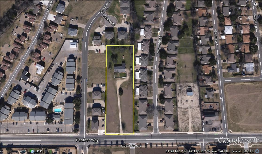
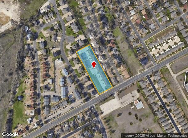
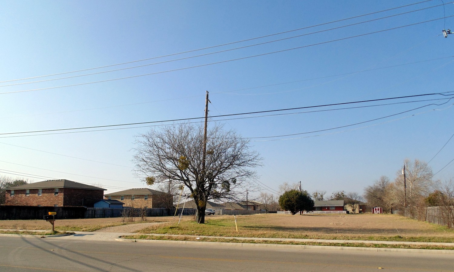
Property Record
10001 Pantherway, Woodway, TX 76712
NEARBY LISTINGS FOR SALE OR LEASE
Property Detail
10001 Pantherway
Waco, TX
Shoal Flats Addition
36-080389-000100-0
SHOAL FLATS ADDITION LOT 1 BLOCK 1 ACRES 1.944
Apartment
Mclennan
X
Texas
48309C0530D
1
2024
1.94 AC
2024
Waco & Killeen
003711
Other Market Areas
33,516 SF
DEMOGRAPHICS near 10001 Pantherway
1 Mile
3 Mile
5 Mile
2024 Total Population
5,708
44,431
112,880
2029 Population
6,033
47,073
120,195
Pop Growth 2024-2029
+ 5.69%
+ 5.95%
+ 6.48%
Average Age
42
37
36
2024 Total Households
2,561
16,884
42,103
HH Growth 2024-2029
+ 5.74%
+ 6.01%
+ 6.88%
Median Household Inc
$51,215
$45,419
$44,909
Avg Household Size
2.10
2.50
2.50
2024 Avg HH Vehicles
2.00
2.00
2.00
Median Home Value
$174,365
$158,983
$157,478
Median Year Built
1971
1964
1971
Nearby Places
- Restaurants
- Banks
- Shops
- Fitness
- Groceries
PUBLIC TRANSPORTATION
AIRPORT
Waco Regional
DRIVE
WALK
Distance
Waco Regional
31 min
14.9 mi
Freight Ports
Port of Houston
DRIVE
WALK
Distance
Port of Houston
226 min
194.2 mi
Nearby Properties
Address
Land Use
TOTAL SIZE
Lot Size
Zoning
Address
Land Use
TOTAL SIZE
Lot Size
Zoning
108,521 SF
70 AC
Address
Land Use
TOTAL SIZE
Lot Size
Zoning
693,933 SF
57.98 AC
M2
Address
Land Use
TOTAL SIZE
Lot Size
Zoning
752,540 SF
96.04 AC
M-2
Address
Land Use
TOTAL SIZE
Lot Size
Zoning
62.09 AC
Address
Land Use
TOTAL SIZE
Lot Size
Zoning
279,135 SF
13 AC
Address
Land Use
TOTAL SIZE
Lot Size
Zoning
222,388 SF
10.68 AC
R-3C
Address
Land Use
TOTAL SIZE
Lot Size
Zoning
405,640 SF
64.46 AC
Address
Land Use
TOTAL SIZE
Lot Size
Zoning
459,747 SF
36.13 AC
M2
Address
Land Use
TOTAL SIZE
Lot Size
Zoning
221,876 SF
12.26 AC
C-2
Address
Land Use
TOTAL SIZE
Lot Size
Zoning
Address
Land Use
TOTAL SIZE
Lot Size
Zoning
65,016 SF
5.08 AC
C-2
Address
Land Use
TOTAL SIZE
Lot Size
Zoning
198,670 SF
10.24 AC
M1
Address
Land Use
TOTAL SIZE
Lot Size
Zoning
23.11 AC
Address
Land Use
TOTAL SIZE
Lot Size
Zoning
60,536 SF
0.93 AC
Address
Land Use
TOTAL SIZE
Lot Size
Zoning
208,902 SF
21.91 AC
C3
Address
Land Use
TOTAL SIZE
Lot Size
Zoning
72,920 SF
11 AC
C-3
Address
Land Use
TOTAL SIZE
Lot Size
Zoning
Address
Land Use
TOTAL SIZE
Lot Size
Zoning
86,014 SF
11.87 AC
R1
Address
Land Use
TOTAL SIZE
Lot Size
Zoning
15 AC
Address
Land Use
TOTAL SIZE
Lot Size
Zoning
111,240 SF
24.73 AC
R-1
Address
Land Use
TOTAL SIZE
Lot Size
Zoning
150,212 SF
16.79 AC
Address
Land Use
TOTAL SIZE
Lot Size
Zoning
174,456 SF
9.04 AC
R3C
Address
Land Use
TOTAL SIZE
Lot Size
Zoning
95,340 SF
5.05 AC
Address
Land Use
TOTAL SIZE
Lot Size
Zoning
160,093 SF
17.63 AC
Address
Land Use
TOTAL SIZE
Lot Size
Zoning
82.98 AC
M-2
Address
Land Use
TOTAL SIZE
Lot Size
Zoning
64,941 SF
5.38 AC
M-2
Address
Land Use
TOTAL SIZE
Lot Size
Zoning
80,437 SF
30.43 AC
C
Address
Land Use
TOTAL SIZE
Lot Size
Zoning
64,455 SF
8.56 AC
Address
Land Use
TOTAL SIZE
Lot Size
Zoning
114,575 SF
4.20 AC
Address
Land Use
TOTAL SIZE
Lot Size
Zoning
50,194 SF
6.40 AC
The World's #1 Commercial Real Estate Marketplace
Connect with us
© 2025 CoStar Group
The information above has been obtained from sources believed reliable. While we do not doubt its accuracy we have not verified it and make no guarantee, warranty or representation about it. It is your responsibility to independently confirm its accuracy and completeness. Any projections, opinions, assumptions, or estimates used are for example only and do not represent the current or future performance of the property. The value of this transaction to you depends on tax and other factors which should be evaluated by your tax, financial, and legal advisors. You and your advisors should conduct a careful, independent investigation of the property to determine to your satisfaction the suitability of the property for your needs.