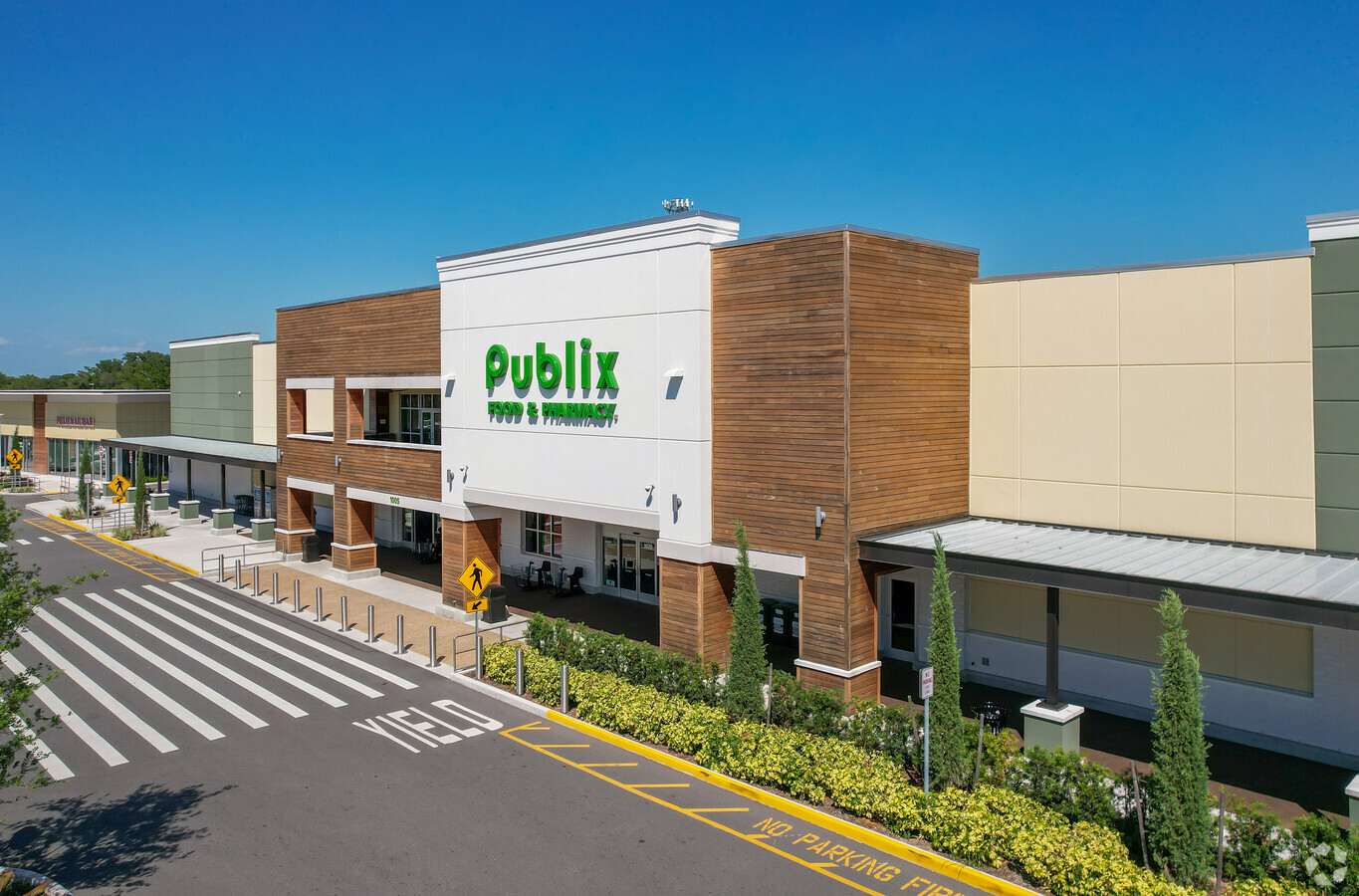
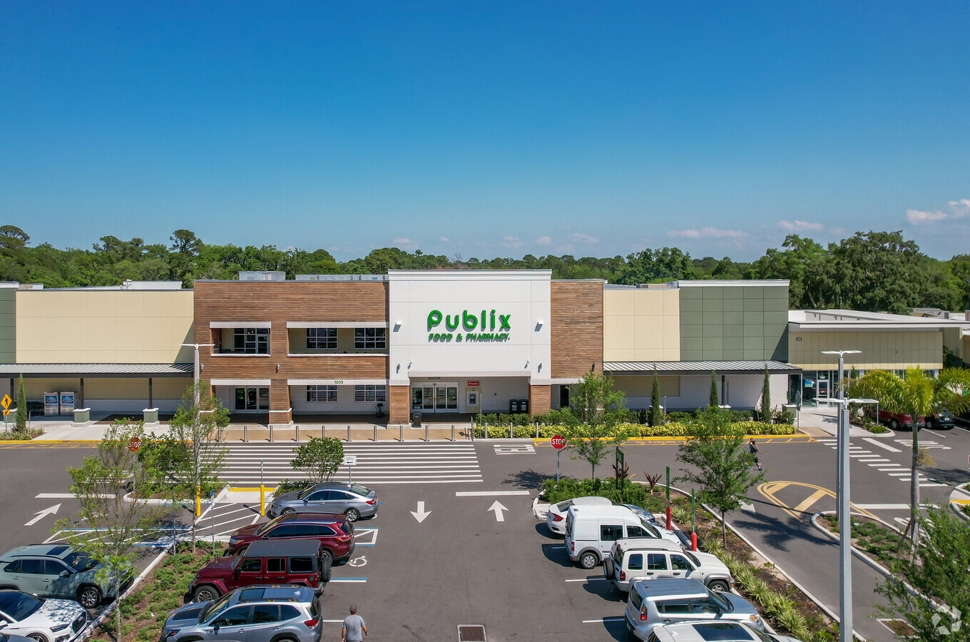
Property Record
1001 N State Road 434, Altamonte Springs, FL 32714
NEARBY LISTINGS FOR SALE OR LEASE
Property Detail
1001 N State Road 434
Orlando-Kissimmee-Sanford, FL
Loehmanns Subdivision
09-21-29-510-0000-0010
LOT 1 ( LESS S 173.28 FT) & ALL LOT 2 & S 1/2 OF VACD ST ADJ ON N LOEHMANNS SUBD PB 27 PGS 40 & 41 & SEC 04 TWP 21S RGE 29E BEG 25 FT N & 116.89 FT E OF S 1/4 COR RUN NELY ALONG SR 434 1036.19 FT S 22 DEG 49 MIN E 740.02 FT S 43 DEG 41 MIN W TO A PT
Storebuilding
Seminole
A
Florida
12095C0145F
1,2
2024
18.63 AC
2024
Altamonte/Douglas
021613
Orlando
26,157 SF
DEMOGRAPHICS near 1001 N State Road 434
1 Mile
3 Mile
5 Mile
2024 Total Population
13,060
89,376
190,061
2029 Population
13,733
93,092
197,352
Pop Growth 2024-2029
+ 5.15%
+ 4.16%
+ 3.84%
Average Age
41
42
41
2024 Total Households
5,380
37,244
76,413
HH Growth 2024-2029
+ 5.45%
+ 4.41%
+ 4.04%
Median Household Inc
$62,871
$67,087
$65,342
Avg Household Size
2.40
2.30
2.40
2024 Avg HH Vehicles
2.00
2.00
2.00
Median Home Value
$316,187
$337,344
$313,510
Median Year Built
1982
1982
1983
Nearby Places
- Restaurants
- Banks
- Shops
- Fitness
- Groceries
PUBLIC TRANSPORTATION
COMMUTER RAIL
Altamonte Springs (SunRail - Florida Department of Transportation)
DRIVE
WALK
Distance
Altamonte Springs (SunRail - Florida Department of Transportation)
10 min
5.0 mi
Longwood (SunRail - Florida Department of Transportation)
DRIVE
WALK
Distance
Longwood (SunRail - Florida Department of Transportation)
10 min
5.2 mi
AIRPORT
Orlando Sanford International
DRIVE
WALK
Distance
Orlando Sanford International
26 min
15.5 mi
Orlando International
DRIVE
WALK
Distance
Orlando International
39 min
24.3 mi
Freight Ports
Port Canaveral
DRIVE
WALK
Distance
Port Canaveral
85 min
66.2 mi
Nearby Properties
Address
Land Use
TOTAL SIZE
Lot Size
Zoning
Address
Land Use
TOTAL SIZE
Lot Size
Zoning
630,861 SF
31.67 AC
PUDMO
Address
Land Use
TOTAL SIZE
Lot Size
Zoning
88,256 SF
39.64 AC
MOC3
Address
Land Use
TOTAL SIZE
Lot Size
Zoning
423,270 SF
3.44 AC
MOC3
Address
Land Use
TOTAL SIZE
Lot Size
Zoning
745,187 SF
18 AC
PUD
Address
Land Use
TOTAL SIZE
Lot Size
Zoning
34,430 SF
19.99 AC
Address
Land Use
TOTAL SIZE
Lot Size
Zoning
1,674 SF
10.53 AC
R3
Address
Land Use
TOTAL SIZE
Lot Size
Zoning
129,745 SF
71.01 AC
PUD
Address
Land Use
TOTAL SIZE
Lot Size
Zoning
357 SF
17.05 AC
Address
Land Use
TOTAL SIZE
Lot Size
Zoning
Address
Land Use
TOTAL SIZE
Lot Size
Zoning
1,416 SF
23.80 AC
Address
Land Use
TOTAL SIZE
Lot Size
Zoning
391,714 SF
42.59 AC
A1
Address
Land Use
TOTAL SIZE
Lot Size
Zoning
400 SF
13.82 AC
R1AA
Address
Land Use
TOTAL SIZE
Lot Size
Zoning
5,256 SF
1.10 AC
PUDRES
Address
Land Use
TOTAL SIZE
Lot Size
Zoning
11,392 SF
8.44 AC
Address
Land Use
TOTAL SIZE
Lot Size
Zoning
1,428 SF
8.56 AC
MOR3
Address
Land Use
TOTAL SIZE
Lot Size
Zoning
1,170 SF
17.75 AC
A1
Address
Land Use
TOTAL SIZE
Lot Size
Zoning
5,913 SF
14.46 AC
Address
Land Use
TOTAL SIZE
Lot Size
Zoning
254,477 SF
13.14 AC
MOR2
Address
Land Use
TOTAL SIZE
Lot Size
Zoning
5,924 SF
17.38 AC
R1A
Address
Land Use
TOTAL SIZE
Lot Size
Zoning
3,658 SF
17.71 AC
PUD
Address
Land Use
TOTAL SIZE
Lot Size
Zoning
249,311 SF
21.11 AC
R3A
Address
Land Use
TOTAL SIZE
Lot Size
Zoning
3,140 SF
15.89 AC
PUD
Address
Land Use
TOTAL SIZE
Lot Size
Zoning
3,370 SF
18.59 AC
PUD
Address
Land Use
TOTAL SIZE
Lot Size
Zoning
228,362 SF
214.60 AC
PUD
Address
Land Use
TOTAL SIZE
Lot Size
Zoning
254,371 SF
15.63 AC
R1A
Address
Land Use
TOTAL SIZE
Lot Size
Zoning
6,466 SF
18.97 AC
MOC3
Address
Land Use
TOTAL SIZE
Lot Size
Zoning
279,457 SF
20.56 AC
R3
Address
Land Use
TOTAL SIZE
Lot Size
Zoning
268,195 SF
50.24 AC
O
Address
Land Use
TOTAL SIZE
Lot Size
Zoning
259,436 SF
11.23 AC
A1
Address
Land Use
TOTAL SIZE
Lot Size
Zoning
3,854 SF
14.33 AC
PUD
The World's #1 Commercial Real Estate Marketplace
Connect with us
© 2025 CoStar Group
The information above has been obtained from sources believed reliable. While we do not doubt its accuracy we have not verified it and make no guarantee, warranty or representation about it. It is your responsibility to independently confirm its accuracy and completeness. Any projections, opinions, assumptions, or estimates used are for example only and do not represent the current or future performance of the property. The value of this transaction to you depends on tax and other factors which should be evaluated by your tax, financial, and legal advisors. You and your advisors should conduct a careful, independent investigation of the property to determine to your satisfaction the suitability of the property for your needs.