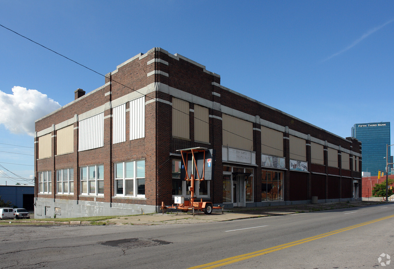
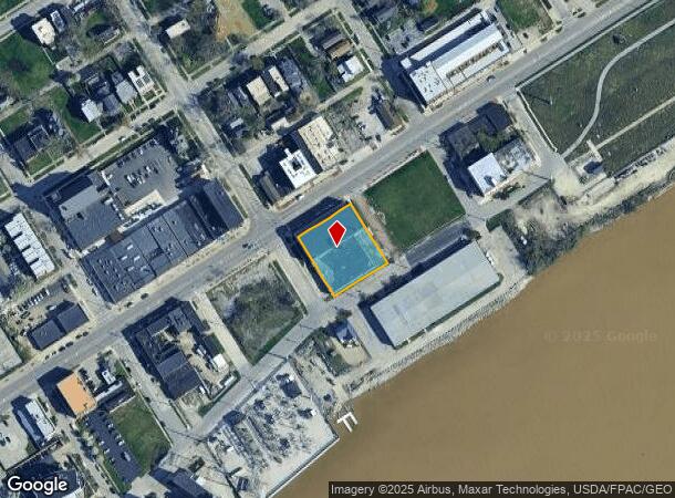
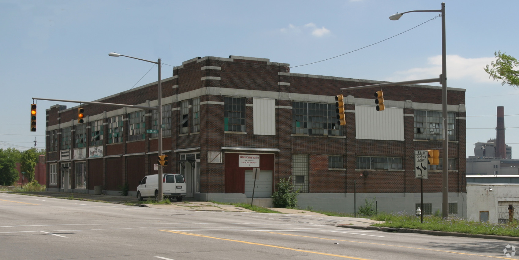
Property Record
1002 N Summit St, Toledo, OH 43604
NEARBY LISTINGS FOR SALE OR LEASE
Property Detail
1002 N Summit St
Toledo, OH
Vistula
15-42851
VISTULA LOT 140 TO 150 EXC ST
Warehouse
Lucas
X
Ohio
39095C0095F
140
2023
0.70 AC
2023
CBD
002800
Toledo
55,207 SF
DEMOGRAPHICS near 1002 N Summit St
1 Mile
3 Mile
5 Mile
2024 Total Population
12,012
93,018
193,233
2029 Population
12,308
94,041
192,825
Pop Growth 2024-2029
+ 2.46%
+ 1.10%
(0.21%)
Average Age
37
38
38
2024 Total Households
5,211
38,590
80,764
HH Growth 2024-2029
+ 2.03%
+ 1.02%
(0.28%)
Median Household Inc
$18,011
$32,141
$39,935
Avg Household Size
2.00
2.20
2.20
2024 Avg HH Vehicles
1.00
1.00
2.00
Median Home Value
$59,774
$71,618
$85,967
Median Year Built
1948
1948
1949
Nearby Places
- Restaurants
- Banks
- Shops
- Fitness
- Groceries
PUBLIC TRANSPORTATION
COMMUTER RAIL
Toledo (Capitol Limited - Amtrak, Lake Shore Limited - Amtrak)
Drive
Walk
Distance
Toledo (Capitol Limited - Amtrak, Lake Shore Limited - Amtrak)
4 min
1.9 mi
AIRPORT
Eugene F Kranz Toledo Express
Drive
Walk
Distance
Eugene F Kranz Toledo Express
35 min
20.0 mi
Freight Ports
Port of Toledo
Drive
Walk
Distance
Port of Toledo
11 min
4.7 mi
Nearby Properties
Address
Land Use
TOTAL SIZE
Lot Size
Zoning
Address
Land Use
TOTAL SIZE
Lot Size
Zoning
1243593
42.25 AC
10-MX
Address
Land Use
TOTAL SIZE
Lot Size
Zoning
1287587
0.41 AC
10-IC
Address
Land Use
TOTAL SIZE
Lot Size
Zoning
277862
3 AC
10-CD
Address
Land Use
TOTAL SIZE
Lot Size
Zoning
605609
9.66 AC
40-C4
Address
Land Use
TOTAL SIZE
Lot Size
Zoning
169.42 AC
10-IG
Address
Land Use
TOTAL SIZE
Lot Size
Zoning
569999
45.25 AC
10-MX
Address
Land Use
TOTAL SIZE
Lot Size
Zoning
314826
10.28 AC
10-CM
Address
Land Use
TOTAL SIZE
Lot Size
Zoning
625485
2 AC
10-MX
Address
Land Use
TOTAL SIZE
Lot Size
Zoning
111471
6.17 AC
10-CD
Address
Land Use
TOTAL SIZE
Lot Size
Zoning
Address
Land Use
TOTAL SIZE
Lot Size
Zoning
171946
0.17 AC
10-IC
Address
Land Use
TOTAL SIZE
Lot Size
Zoning
1.74 AC
10-CD
Address
Land Use
TOTAL SIZE
Lot Size
Zoning
296348
1 AC
10-CO
Address
Land Use
TOTAL SIZE
Lot Size
Zoning
225407
128.05 AC
10-MX
Address
Land Use
TOTAL SIZE
Lot Size
Zoning
328568
16.37 AC
10-CO
Address
Land Use
TOTAL SIZE
Lot Size
Zoning
940263
0.52 AC
10-MX
Address
Land Use
TOTAL SIZE
Lot Size
Zoning
169.42 AC
10-IG
Address
Land Use
TOTAL SIZE
Lot Size
Zoning
375323
10-IC
Address
Land Use
TOTAL SIZE
Lot Size
Zoning
243165
3.63 AC
10-CD
Address
Land Use
TOTAL SIZE
Lot Size
Zoning
68517
1.56 AC
10-RM36
Address
Land Use
TOTAL SIZE
Lot Size
Zoning
390272
5 AC
10-CD
Address
Land Use
TOTAL SIZE
Lot Size
Zoning
172044
12.78 AC
10-MX
Address
Land Use
TOTAL SIZE
Lot Size
Zoning
228692
10.45 AC
10-RM36
Address
Land Use
TOTAL SIZE
Lot Size
Zoning
380316
4 AC
10-CO
Address
Land Use
TOTAL SIZE
Lot Size
Zoning
182983
2 AC
10-CD
Address
Land Use
TOTAL SIZE
Lot Size
Zoning
202118
1.50 AC
10-CD
Address
Land Use
TOTAL SIZE
Lot Size
Zoning
132690
5 AC
10-CO
Address
Land Use
TOTAL SIZE
Lot Size
Zoning
158288
1.22 AC
10-CO
Address
Land Use
TOTAL SIZE
Lot Size
Zoning
77274
4 AC
10-CO
Address
Land Use
TOTAL SIZE
Lot Size
Zoning
232758
2 AC
10-CO
Start a new search to find other properties for sale or lease
Connect with us
© 2024 CoStar Group
The information above has been obtained from sources believed reliable. While we do not doubt its accuracy we have not verified it and make no guarantee, warranty or representation about it. It is your responsibility to independently confirm its accuracy and completeness. Any projections, opinions, assumptions, or estimates used are for example only and do not represent the current or future performance of the property. The value of this transaction to you depends on tax and other factors which should be evaluated by your tax, financial, and legal advisors. You and your advisors should conduct a careful, independent investigation of the property to determine to your satisfaction the suitability of the property for your needs.