Property Record
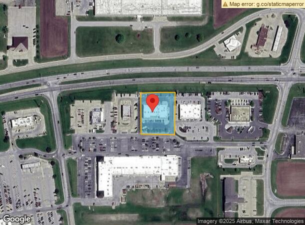
1005 E Charleston Ave E, Mattoon, IL 61938
NEARBY LISTINGS FOR SALE OR LEASE
Property Detail
1005 E Charleston Ave E
Charleston-Mattoon, IL
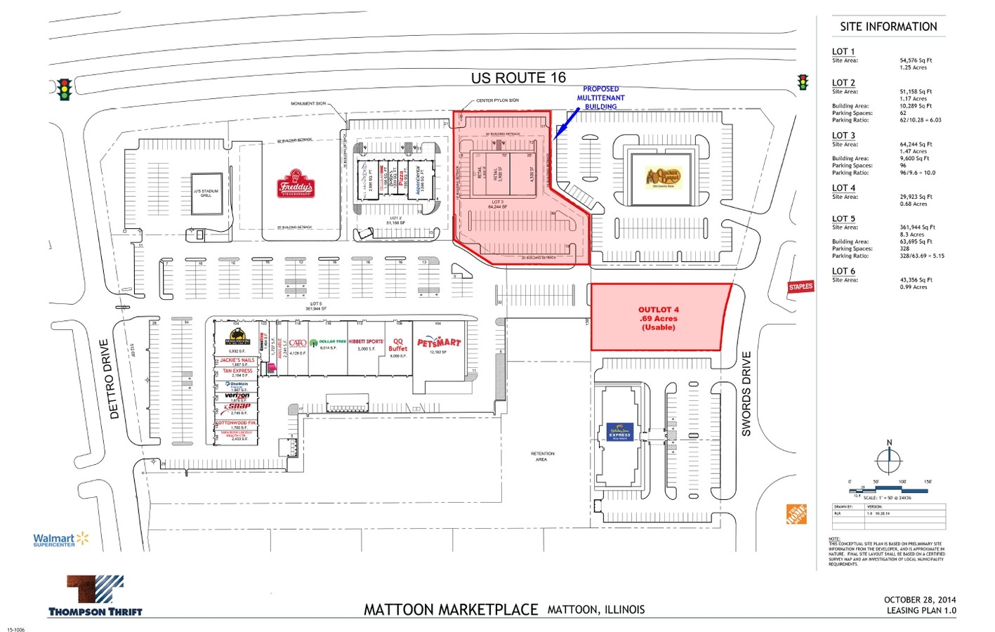
Mattoon Marketplace
06-0-05286-000
MARKETPLACE LOT 02 ALL ABOUT EYES MIRACLE EAR CRICKET WIRELESS LUCKY SLOTS ASPEN DENTAL
Commercialnec
Coles
X
Illinois
17029C0280D
2
2023
1.04 AC
2023
Effingham/Central Illinois Area
001100
Other Market Areas
10,588 SF
DEMOGRAPHICS near 1005 E Charleston Ave E
1 Mile
3 Mile
5 Mile
2024 Total Population
958
13,847
19,299
2029 Population
942
13,576
18,900
Pop Growth 2024-2029
(1.67%)
(1.96%)
(2.07%)
Average Age
49
42
42
2024 Total Households
450
6,231
8,545
HH Growth 2024-2029
(1.78%)
(2.12%)
(2.25%)
Median Household Inc
$43,249
$43,453
$46,111
Avg Household Size
2.00
2.10
2.20
2024 Avg HH Vehicles
2.00
2.00
2.00
Median Home Value
$156,249
$86,921
$91,180
Median Year Built
1969
1958
1959
Nearby Places
- Restaurants
- Banks
- Shops
- Fitness
- Groceries
PUBLIC TRANSPORTATION
COMMUTER RAIL
Mattoon Amtrak Station (City of New Orleans - Amtrak, Illini - Amtrak, Saluki - Amtrak)
DRIVE
WALK
Distance
Mattoon Amtrak Station (City of New Orleans - Amtrak, Illini - Amtrak, Saluki - Amtrak)
6 min
2.5 mi
Freight Ports
Port Milwaukee
DRIVE
WALK
Distance
Port Milwaukee
306 min
266.7 mi
SALE & LEASE HISTORY
LISTING DATE
SALE/LEASE

Oct 03, 2017
For Lease
Aug 20, 2018
For Lease
Nearby Properties
Address
Land Use
TOTAL SIZE
Lot Size
Zoning
Address
Land Use
TOTAL SIZE
Lot Size
Zoning
199,970 SF
24.47 AC
Address
Land Use
TOTAL SIZE
Lot Size
Zoning
75,332 SF
6.48 AC
Address
Land Use
TOTAL SIZE
Lot Size
Zoning
24,943 SF
91.27 AC
Address
Land Use
TOTAL SIZE
Lot Size
Zoning
Address
Land Use
TOTAL SIZE
Lot Size
Zoning
7,500 SF
26.72 AC
Address
Land Use
TOTAL SIZE
Lot Size
Zoning
0.92 AC
Address
Land Use
TOTAL SIZE
Lot Size
Zoning
208,184 SF
30.37 AC
Address
Land Use
TOTAL SIZE
Lot Size
Zoning
39,960 SF
1.95 AC
Address
Land Use
TOTAL SIZE
Lot Size
Zoning
43,613 SF
1.03 AC
Address
Land Use
TOTAL SIZE
Lot Size
Zoning
Address
Land Use
TOTAL SIZE
Lot Size
Zoning
Address
Land Use
TOTAL SIZE
Lot Size
Zoning
95,068 SF
10.13 AC
Address
Land Use
TOTAL SIZE
Lot Size
Zoning
9,644 SF
1.81 AC
Address
Land Use
TOTAL SIZE
Lot Size
Zoning
3,360 SF
5.96 AC
Address
Land Use
TOTAL SIZE
Lot Size
Zoning
9,888 SF
1.17 AC
Address
Land Use
TOTAL SIZE
Lot Size
Zoning
31,026 SF
34.80 AC
Address
Land Use
TOTAL SIZE
Lot Size
Zoning
41,673 SF
5.40 AC
Address
Land Use
TOTAL SIZE
Lot Size
Zoning
Address
Land Use
TOTAL SIZE
Lot Size
Zoning
15,263 SF
2.80 AC
Address
Land Use
TOTAL SIZE
Lot Size
Zoning
2.61 AC
Address
Land Use
TOTAL SIZE
Lot Size
Zoning
230,400 SF
31.34 AC
Address
Land Use
TOTAL SIZE
Lot Size
Zoning
19,320 SF
1.44 AC
Address
Land Use
TOTAL SIZE
Lot Size
Zoning
38,486 SF
4.99 AC
Address
Land Use
TOTAL SIZE
Lot Size
Zoning
68,424 SF
5 AC
Address
Land Use
TOTAL SIZE
Lot Size
Zoning
171,500 SF
11.90 AC
Address
Land Use
TOTAL SIZE
Lot Size
Zoning
25,576 SF
6.60 AC
Address
Land Use
TOTAL SIZE
Lot Size
Zoning
38,414 SF
5.21 AC
Address
Land Use
TOTAL SIZE
Lot Size
Zoning
7.02 AC
Address
Land Use
TOTAL SIZE
Lot Size
Zoning
62,944 SF
0.80 AC
Address
Land Use
TOTAL SIZE
Lot Size
Zoning
27,534 SF
0.32 AC
The World's #1 Commercial Real Estate Marketplace
Connect with us
© 2025 CoStar Group
The information above has been obtained from sources believed reliable. While we do not doubt its accuracy we have not verified it and make no guarantee, warranty or representation about it. It is your responsibility to independently confirm its accuracy and completeness. Any projections, opinions, assumptions, or estimates used are for example only and do not represent the current or future performance of the property. The value of this transaction to you depends on tax and other factors which should be evaluated by your tax, financial, and legal advisors. You and your advisors should conduct a careful, independent investigation of the property to determine to your satisfaction the suitability of the property for your needs.