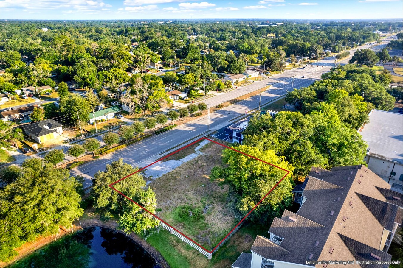
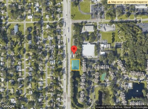
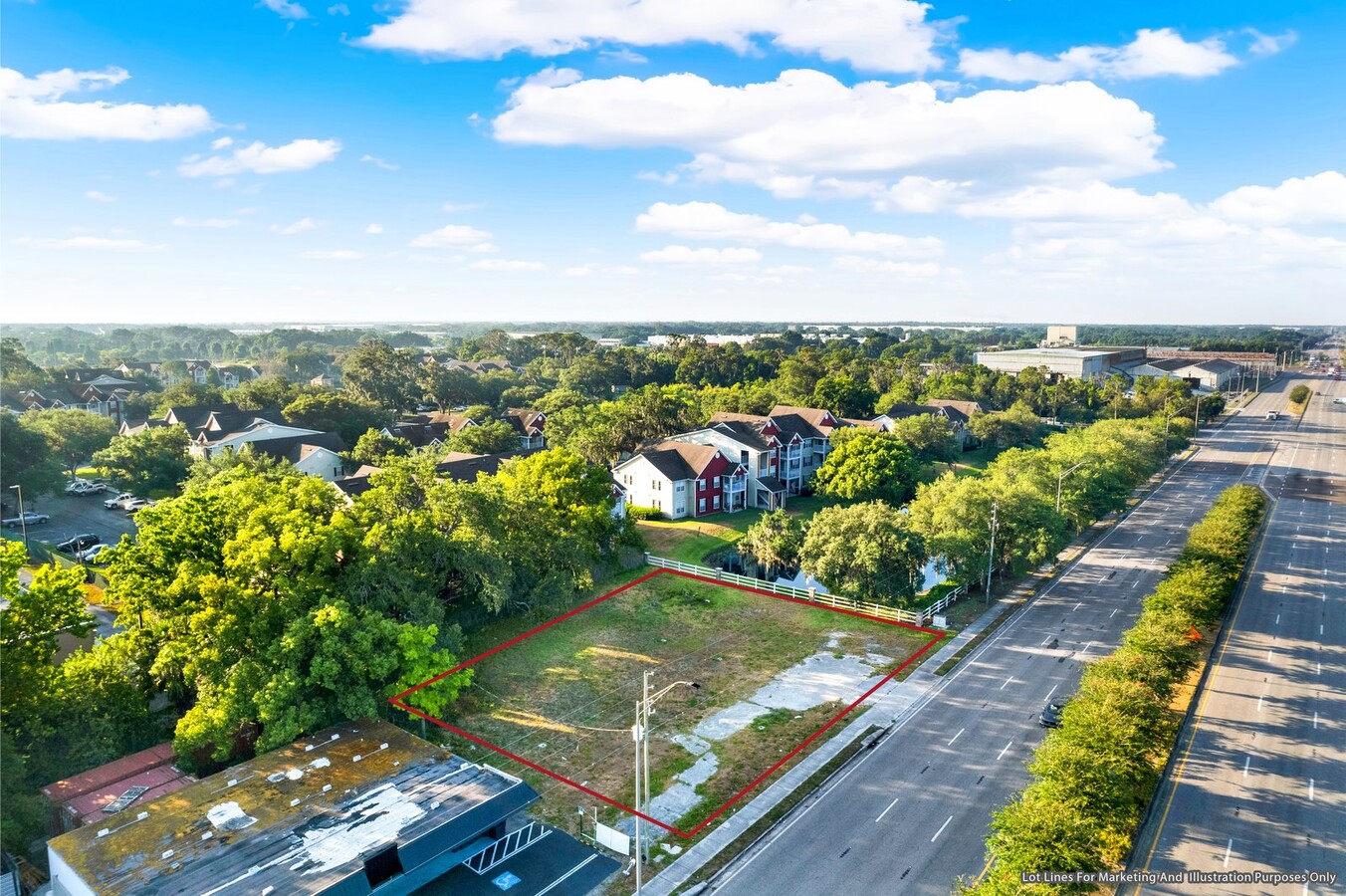
Property Record
1006 N Park Rd, Plant City, FL 33563
NEARBY LISTINGS FOR SALE OR LEASE
Property Detail
1006 N Park Rd
Tampa-St. Petersburg-Clearwater, FL
Unplatted
P-27-28-22-ZZZ-000006-03460.0
W 200 FT OF S 130 FT OF NW 1/4 OF NW 1/4 NW 1/4 ---N 20 FT OF W 200 FT OF SW 1/4 OF NW 1/4 OF NW 1/4 LESS RD R/W
Commercialacreage
Hillsborough
X
Florida
12057C0288H
3460
2023
0.42 AC
2024
Eastern Outlying
013001
Tampa/St Petersburg
DEMOGRAPHICS near 1006 N Park Rd
1 Mile
3 Mile
5 Mile
2024 Total Population
7,012
34,423
64,622
2029 Population
7,634
37,734
70,721
Pop Growth 2024-2029
+ 8.87%
+ 9.62%
+ 9.44%
Average Age
38
39
40
2024 Total Households
2,346
12,498
23,012
HH Growth 2024-2029
+ 9.08%
+ 9.91%
+ 9.77%
Median Household Inc
$59,309
$50,649
$58,496
Avg Household Size
2.90
2.70
2.70
2024 Avg HH Vehicles
2.00
2.00
2.00
Median Home Value
$182,070
$182,831
$240,576
Median Year Built
1975
1985
1987
Nearby Places
- Restaurants
- Banks
- Shops
- Fitness
- Groceries
PUBLIC TRANSPORTATION
AIRPORT
Tampa International
DRIVE
WALK
Distance
Tampa International
41 min
31.9 mi
Freight Ports
Port of Tampa Bay
DRIVE
WALK
Distance
Port of Tampa Bay
34 min
25.4 mi
SALE & LEASE HISTORY
LISTING DATE
SALE/LEASE

Aug 03, 2024
For Sale
Nearby Properties
Address
Land Use
TOTAL SIZE
Lot Size
Zoning
Address
Land Use
TOTAL SIZE
Lot Size
Zoning
1,055,503 SF
112.72 AC
PD
Address
Land Use
TOTAL SIZE
Lot Size
Zoning
723,962 SF
47.49 AC
PD
Address
Land Use
TOTAL SIZE
Lot Size
Zoning
519,942 SF
130.10 AC
PD
Address
Land Use
TOTAL SIZE
Lot Size
Zoning
286,824 SF
43.03 AC
PD
Address
Land Use
TOTAL SIZE
Lot Size
Zoning
605,109 SF
141.96 AC
I
Address
Land Use
TOTAL SIZE
Lot Size
Zoning
505,506 SF
50.60 AC
PD
Address
Land Use
TOTAL SIZE
Lot Size
Zoning
235,102 SF
7.73 AC
C-1B
Address
Land Use
TOTAL SIZE
Lot Size
Zoning
415,389 SF
62.31 AC
PD
Address
Land Use
TOTAL SIZE
Lot Size
Zoning
333,718 SF
28.99 AC
M-1
Address
Land Use
TOTAL SIZE
Lot Size
Zoning
243,294 SF
19.80 AC
R-20
Address
Land Use
TOTAL SIZE
Lot Size
Zoning
220,510 SF
37.15 AC
PD
Address
Land Use
TOTAL SIZE
Lot Size
Zoning
296,496 SF
77.52 AC
R-1A
Address
Land Use
TOTAL SIZE
Lot Size
Zoning
297,907 SF
21.43 AC
I
Address
Land Use
TOTAL SIZE
Lot Size
Zoning
492,180 SF
32.58 AC
PD
Address
Land Use
TOTAL SIZE
Lot Size
Zoning
297,907 SF
22.41 AC
M-1A
Address
Land Use
TOTAL SIZE
Lot Size
Zoning
496,217 SF
35.02 AC
M-AP
Address
Land Use
TOTAL SIZE
Lot Size
Zoning
93,924 SF
3.96 AC
C-1
Address
Land Use
TOTAL SIZE
Lot Size
Zoning
132,285 SF
30.77 AC
PD
Address
Land Use
TOTAL SIZE
Lot Size
Zoning
145,222 SF
36.47 AC
PD
Address
Land Use
TOTAL SIZE
Lot Size
Zoning
177,038 SF
16.95 AC
PD
Address
Land Use
TOTAL SIZE
Lot Size
Zoning
192,911 SF
16.36 AC
PD
Address
Land Use
TOTAL SIZE
Lot Size
Zoning
35,426 SF
39.92 AC
R-1A
Address
Land Use
TOTAL SIZE
Lot Size
Zoning
213,188 SF
16.10 AC
PD
Address
Land Use
TOTAL SIZE
Lot Size
Zoning
187,247 SF
10.19 AC
PD
Address
Land Use
TOTAL SIZE
Lot Size
Zoning
152,518 SF
43.50 AC
C-1A
Address
Land Use
TOTAL SIZE
Lot Size
Zoning
202,712 SF
28.41 AC
PD
Address
Land Use
TOTAL SIZE
Lot Size
Zoning
154,237 SF
17.92 AC
PD
Address
Land Use
TOTAL SIZE
Lot Size
Zoning
139,392 SF
73.31 AC
CC
Address
Land Use
TOTAL SIZE
Lot Size
Zoning
101,815 SF
15.76 AC
PD
Address
Land Use
TOTAL SIZE
Lot Size
Zoning
181,400 SF
17.06 AC
PD
The World's #1 Commercial Real Estate Marketplace
Connect with us
© 2025 CoStar Group
The information above has been obtained from sources believed reliable. While we do not doubt its accuracy we have not verified it and make no guarantee, warranty or representation about it. It is your responsibility to independently confirm its accuracy and completeness. Any projections, opinions, assumptions, or estimates used are for example only and do not represent the current or future performance of the property. The value of this transaction to you depends on tax and other factors which should be evaluated by your tax, financial, and legal advisors. You and your advisors should conduct a careful, independent investigation of the property to determine to your satisfaction the suitability of the property for your needs.