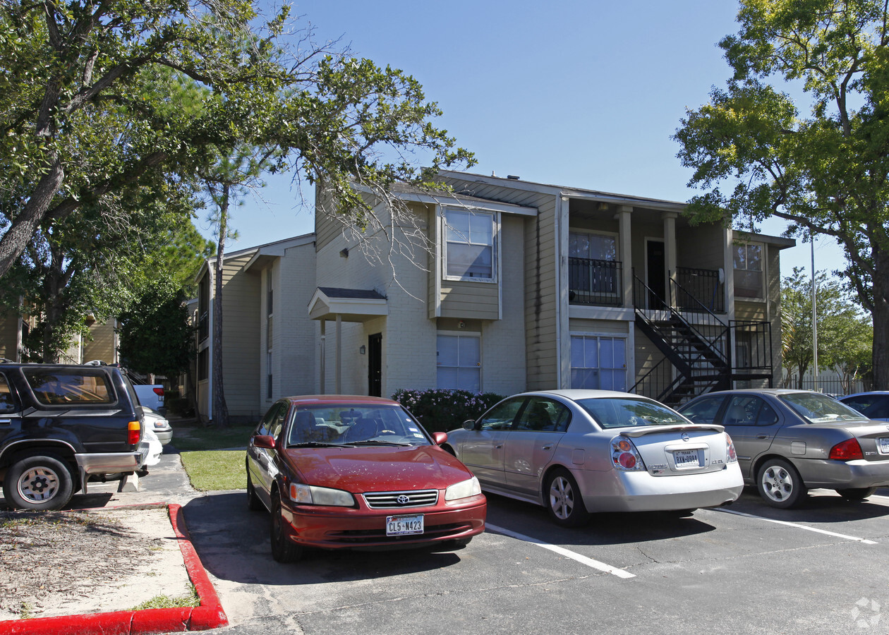
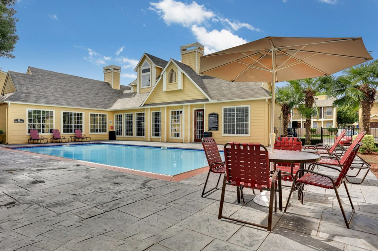
Property Record
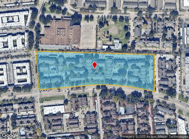
10070 Westpark Dr, Houston, TX 77042

NEARBY LISTINGS FOR SALE OR LEASE
Property Detail
10070 Westpark Dr
Houston-The Woodlands-Sugar Land, TX
Westchase Sec 5
1088570000002
RES L2 BLK 12 WESTCHASE SEC 5
Apartment
Harris
X
Texas
48157C0175L
2
2023
11 AC
2023
Westchase
432401
Houston
275,996 SF
DEMOGRAPHICS near 10070 Westpark Dr
1 Mile
3 Mile
5 Mile
2024 Total Population
34,111
223,854
596,570
2029 Population
34,977
229,298
611,482
Pop Growth 2024-2029
+ 2.54%
+ 2.43%
+ 2.50%
Average Age
34
36
36
2024 Total Households
14,472
90,442
237,028
HH Growth 2024-2029
+ 2.41%
+ 2.41%
+ 2.52%
Median Household Inc
$36,651
$44,042
$48,484
Avg Household Size
2.30
2.40
2.40
2024 Avg HH Vehicles
1.00
1.00
1.00
Median Home Value
$175,999
$256,370
$303,391
Median Year Built
1980
1979
1979
Nearby Places
- Restaurants
- Banks
- Shops
- Fitness
- Groceries
PUBLIC TRANSPORTATION
AIRPORT
William P Hobby
DRIVE
WALK
Distance
William P Hobby
37 min
22.5 mi
George Bush Intcntl/Houston
DRIVE
WALK
Distance
George Bush Intcntl/Houston
39 min
32.1 mi
Freight Ports
Port of Houston
DRIVE
WALK
Distance
Port of Houston
33 min
21.8 mi
Nearby Properties
Address
Land Use
TOTAL SIZE
Lot Size
Zoning
Address
Land Use
TOTAL SIZE
Lot Size
Zoning
2,198,376 SF
14.18 AC
Address
Land Use
TOTAL SIZE
Lot Size
Zoning
1,020,766 SF
3.08 AC
Address
Land Use
TOTAL SIZE
Lot Size
Zoning
1,082,545 SF
7.22 AC
Address
Land Use
TOTAL SIZE
Lot Size
Zoning
1,172,310 SF
8.17 AC
Address
Land Use
TOTAL SIZE
Lot Size
Zoning
1,053,492 SF
9.34 AC
Address
Land Use
TOTAL SIZE
Lot Size
Zoning
967,728 SF
7.40 AC
Address
Land Use
TOTAL SIZE
Lot Size
Zoning
686,506 SF
1.56 AC
Address
Land Use
TOTAL SIZE
Lot Size
Zoning
878,129 SF
11.69 AC
Address
Land Use
TOTAL SIZE
Lot Size
Zoning
794,526 SF
21.25 AC
Address
Land Use
TOTAL SIZE
Lot Size
Zoning
649,992 SF
19.81 AC
Address
Land Use
TOTAL SIZE
Lot Size
Zoning
588,954 SF
7.07 AC
Address
Land Use
TOTAL SIZE
Lot Size
Zoning
972,984 SF
30.18 AC
Address
Land Use
TOTAL SIZE
Lot Size
Zoning
511,262 SF
6.60 AC
Address
Land Use
TOTAL SIZE
Lot Size
Zoning
361,954 SF
14.43 AC
Address
Land Use
TOTAL SIZE
Lot Size
Zoning
526,410 SF
20.43 AC
Address
Land Use
TOTAL SIZE
Lot Size
Zoning
598,127 SF
4.14 AC
Address
Land Use
TOTAL SIZE
Lot Size
Zoning
619,738 SF
8.12 AC
Address
Land Use
TOTAL SIZE
Lot Size
Zoning
771,720 SF
19.28 AC
Address
Land Use
TOTAL SIZE
Lot Size
Zoning
643,125 SF
7.92 AC
Address
Land Use
TOTAL SIZE
Lot Size
Zoning
539,308 SF
21 AC
Address
Land Use
TOTAL SIZE
Lot Size
Zoning
473,207 SF
15.50 AC
Address
Land Use
TOTAL SIZE
Lot Size
Zoning
291,829 SF
4.22 AC
Address
Land Use
TOTAL SIZE
Lot Size
Zoning
997,813 SF
5.25 AC
Address
Land Use
TOTAL SIZE
Lot Size
Zoning
697,180 SF
2.90 AC
Address
Land Use
TOTAL SIZE
Lot Size
Zoning
409,371 SF
8.67 AC
Address
Land Use
TOTAL SIZE
Lot Size
Zoning
367,309 SF
14.72 AC
Address
Land Use
TOTAL SIZE
Lot Size
Zoning
496,395 SF
8.46 AC
Address
Land Use
TOTAL SIZE
Lot Size
Zoning
337,964 SF
9.30 AC
Address
Land Use
TOTAL SIZE
Lot Size
Zoning
344,088 SF
13.77 AC
Address
Land Use
TOTAL SIZE
Lot Size
Zoning
376,860 SF
12.42 AC
The World's #1 Commercial Real Estate Marketplace
Connect with us
© 2025 CoStar Group
The information above has been obtained from sources believed reliable. While we do not doubt its accuracy we have not verified it and make no guarantee, warranty or representation about it. It is your responsibility to independently confirm its accuracy and completeness. Any projections, opinions, assumptions, or estimates used are for example only and do not represent the current or future performance of the property. The value of this transaction to you depends on tax and other factors which should be evaluated by your tax, financial, and legal advisors. You and your advisors should conduct a careful, independent investigation of the property to determine to your satisfaction the suitability of the property for your needs.