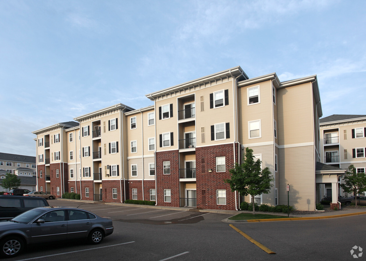
Property Record
101 27Th Ave Se, Minneapolis, MN 55414
NEARBY LISTINGS FOR SALE OR LEASE
Property Detail
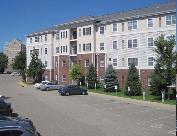
101 27Th Ave Se
Minneapolis-St. Paul-Bloomington, MN-WI
Jefferson Commons
30-029-23-31-0053
Hennepin
Apartment
Minnesota
X
4.24 AC
27053C0376F
Prospect Park
193,392 SF
Minneapolis/St Paul
DEMOGRAPHICS near 101 27Th Ave Se
1 Mile
3 Mile
5 Mile
2024 Total Population
25,442
216,738
500,802
2029 Population
24,971
213,884
491,896
Pop Growth 2024-2029
(1.85%)
(1.32%)
(1.78%)
Average Age
30
36
37
2024 Total Households
9,105
97,366
220,929
HH Growth 2024-2029
(2.28%)
(1.20%)
(1.76%)
Median Household Inc
$44,860
$61,487
$70,057
Avg Household Size
2.10
2.00
2.10
2024 Avg HH Vehicles
1.00
1.00
1.00
Median Home Value
$365,186
$330,031
$330,580
Median Year Built
1989
1966
1954
Nearby Places
- Restaurants
- Banks
- Shops
- Fitness
- Groceries
PUBLIC TRANSPORTATION
TRANSIT/SUBWAY
Stadium Village Station (METRO Green Line - Metro Transit)
DRIVE
WALK
Distance
Stadium Village Station (METRO Green Line - Metro Transit)
2 min
9 min
0.5 mi
Prospect Park Station (METRO Green Line - Metro Transit)
DRIVE
WALK
Distance
Prospect Park Station (METRO Green Line - Metro Transit)
2 min
12 min
0.6 mi
East Bank Station (METRO Green Line - Metro Transit)
DRIVE
WALK
Distance
East Bank Station (METRO Green Line - Metro Transit)
3 min
14 min
0.7 mi
Westgate Station (METRO Green Line - Metro Transit)
DRIVE
WALK
Distance
Westgate Station (METRO Green Line - Metro Transit)
3 min
20 min
1.0 mi
COMMUTER RAIL
Target Field Station (Northstar Corridor - Northstar Commuter Rail)
DRIVE
WALK
Distance
Target Field Station (Northstar Corridor - Northstar Commuter Rail)
10 min
3.8 mi
St. Paul-Minneapolis (Empire Builder - Amtrak)
DRIVE
WALK
Distance
St. Paul-Minneapolis (Empire Builder - Amtrak)
13 min
7.9 mi
AIRPORT
Minneapolis-St Paul International/Wold-Chamberlain
DRIVE
WALK
Distance
Minneapolis-St Paul International/Wold-Chamberlain
21 min
10.7 mi
Freight Ports
Port Milwaukee
DRIVE
WALK
Distance
Port Milwaukee
372 min
336.2 mi
Nearby Properties
Address
Land Use
TOTAL SIZE
Lot Size
Zoning
Address
Land Use
TOTAL SIZE
Lot Size
Zoning
36,300 SF
223.37 AC
Address
Land Use
TOTAL SIZE
Lot Size
Zoning
2,094,377 SF
2.10 AC
B4-2
Address
Land Use
TOTAL SIZE
Lot Size
Zoning
1,934,403 SF
1.67 AC
B4-2
Address
Land Use
TOTAL SIZE
Lot Size
Zoning
141,277 SF
44.78 AC
Address
Land Use
TOTAL SIZE
Lot Size
Zoning
1,462,182 SF
1 AC
B4-2
Address
Land Use
TOTAL SIZE
Lot Size
Zoning
2,282,334 SF
3.25 AC
B4-2
Address
Land Use
TOTAL SIZE
Lot Size
Zoning
1,821,999 SF
2.51 AC
B4-2
Address
Land Use
TOTAL SIZE
Lot Size
Zoning
1,208,190 SF
1.20 AC
B4-2
Address
Land Use
TOTAL SIZE
Lot Size
Zoning
Address
Land Use
TOTAL SIZE
Lot Size
Zoning
1,044,454 SF
1.08 AC
B4-2
Address
Land Use
TOTAL SIZE
Lot Size
Zoning
1,054,492 SF
1.70 AC
B4-1
Address
Land Use
TOTAL SIZE
Lot Size
Zoning
621,608 SF
1.03 AC
B4-2
Address
Land Use
TOTAL SIZE
Lot Size
Zoning
124,932 SF
9.68 AC
Address
Land Use
TOTAL SIZE
Lot Size
Zoning
933,991 SF
0.97 AC
B4S-2
Address
Land Use
TOTAL SIZE
Lot Size
Zoning
722,424 SF
1.33 AC
B4-2
Address
Land Use
TOTAL SIZE
Lot Size
Zoning
1,424,796 SF
1.13 AC
B4-1
Address
Land Use
TOTAL SIZE
Lot Size
Zoning
907,129 SF
1.65 AC
B4-1
Address
Land Use
TOTAL SIZE
Lot Size
Zoning
1,261,574 SF
2.52 AC
B4-2
Address
Land Use
TOTAL SIZE
Lot Size
Zoning
695,624 SF
3.67 AC
C2
Address
Land Use
TOTAL SIZE
Lot Size
Zoning
924,152 SF
2.50 AC
B4-2
Address
Land Use
TOTAL SIZE
Lot Size
Zoning
832,819 SF
0.64 AC
B4-2
Address
Land Use
TOTAL SIZE
Lot Size
Zoning
618,841 SF
1.54 AC
B4S-2
Address
Land Use
TOTAL SIZE
Lot Size
Zoning
618,841 SF
1.53 AC
B4N
Address
Land Use
TOTAL SIZE
Lot Size
Zoning
176,108 SF
27.45 AC
Address
Land Use
TOTAL SIZE
Lot Size
Zoning
795,865 SF
6.49 AC
C3A
Address
Land Use
TOTAL SIZE
Lot Size
Zoning
577,656 SF
2.92 AC
C3A
Address
Land Use
TOTAL SIZE
Lot Size
Zoning
478,616 SF
2.28 AC
C2
Address
Land Use
TOTAL SIZE
Lot Size
Zoning
2.67 AC
C3A
Address
Land Use
TOTAL SIZE
Lot Size
Zoning
711,280 SF
0.50 AC
B4-2
Address
Land Use
TOTAL SIZE
Lot Size
Zoning
557,654 SF
3.15 AC
C2
The World's #1 Commercial Real Estate Marketplace
Connect with us
© 2025 CoStar Group
The information above has been obtained from sources believed reliable. While we do not doubt its accuracy we have not verified it and make no guarantee, warranty or representation about it. It is your responsibility to independently confirm its accuracy and completeness. Any projections, opinions, assumptions, or estimates used are for example only and do not represent the current or future performance of the property. The value of this transaction to you depends on tax and other factors which should be evaluated by your tax, financial, and legal advisors. You and your advisors should conduct a careful, independent investigation of the property to determine to your satisfaction the suitability of the property for your needs.