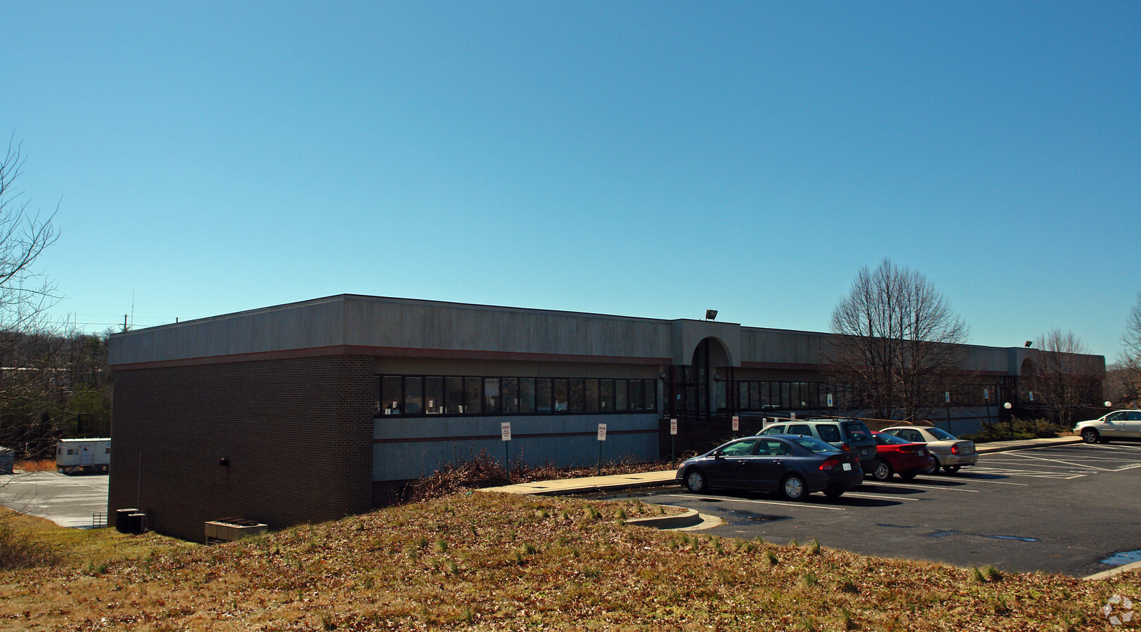
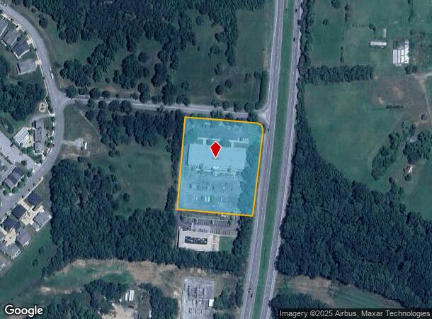
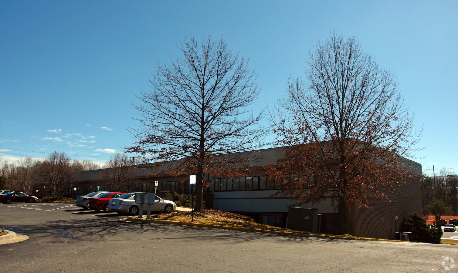
Property Record
101 Catalpa Dr, La Plata, MD 20646
Current Lease Availabilities
NEARBY LISTINGS FOR SALE OR LEASE
Property Detail
101 Catalpa Dr
Washington-Arlington-Alexandria, DC-VA-MD-WV
Town Of La Plata
01-046934
PARCELS 1, 1A & 2A LA PLATA COMMERCE CENTER TOWN OF LA PLATA
Officebuilding
Charles
X
Maryland
24017C0188C
1
2024
5.27 AC
2024
Charles County
851001
Washington, DC
60,244 SF
DEMOGRAPHICS near 101 Catalpa Dr
1 Mile
3 Mile
5 Mile
2024 Total Population
3,670
15,609
27,410
2029 Population
3,878
16,390
28,763
Pop Growth 2024-2029
+ 5.67%
+ 5.00%
+ 4.94%
Average Age
40
41
41
2024 Total Households
1,359
5,640
9,876
HH Growth 2024-2029
+ 5.74%
+ 5.05%
+ 4.95%
Median Household Inc
$98,492
$112,906
$113,357
Avg Household Size
2.60
2.70
2.70
2024 Avg HH Vehicles
2.00
2.00
2.00
Median Home Value
$356,608
$398,981
$406,485
Median Year Built
1996
1989
1993
Nearby Places
- Restaurants
- Banks
- Shops
- Fitness
- Groceries
PUBLIC TRANSPORTATION
AIRPORT
Ronald Reagan Washington Ntl
DRIVE
WALK
Distance
Ronald Reagan Washington Ntl
60 min
36.8 mi
Freight Ports
Port of Baltimore
DRIVE
WALK
Distance
Port of Baltimore
95 min
63.7 mi
Nearby Properties
Address
Land Use
TOTAL SIZE
Lot Size
Zoning
Address
Land Use
TOTAL SIZE
Lot Size
Zoning
315,662 SF
134.30 AC
PL
Address
Land Use
TOTAL SIZE
Lot Size
Zoning
150,480 SF
4.60 AC
CH
Address
Land Use
TOTAL SIZE
Lot Size
Zoning
113,605 SF
20.59 AC
CH
Address
Land Use
TOTAL SIZE
Lot Size
Zoning
6.54 AC
PL
Address
Land Use
TOTAL SIZE
Lot Size
Zoning
80,682 SF
11.35 AC
C-H
Address
Land Use
TOTAL SIZE
Lot Size
Zoning
129,001 SF
11.64 AC
C-H
Address
Land Use
TOTAL SIZE
Lot Size
Zoning
137,862 SF
18.10 AC
CH
Address
Land Use
TOTAL SIZE
Lot Size
Zoning
98,995 SF
2.92 AC
NCX
Address
Land Use
TOTAL SIZE
Lot Size
Zoning
106,711 SF
92.18 AC
PL
Address
Land Use
TOTAL SIZE
Lot Size
Zoning
44,620 SF
9 AC
R-10
Address
Land Use
TOTAL SIZE
Lot Size
Zoning
35,976 SF
3.97 AC
CH
Address
Land Use
TOTAL SIZE
Lot Size
Zoning
65,890 SF
6.70 AC
PL
Address
Land Use
TOTAL SIZE
Lot Size
Zoning
62,127 SF
37.47 AC
PL
Address
Land Use
TOTAL SIZE
Lot Size
Zoning
70,913 SF
6.02 AC
CH
Address
Land Use
TOTAL SIZE
Lot Size
Zoning
140,188 SF
15 AC
CH
Address
Land Use
TOTAL SIZE
Lot Size
Zoning
75,375 SF
4.34 AC
C-B
Address
Land Use
TOTAL SIZE
Lot Size
Zoning
89,000 SF
2.13 AC
CB
Address
Land Use
TOTAL SIZE
Lot Size
Zoning
98,400 SF
1.89 AC
PL
Address
Land Use
TOTAL SIZE
Lot Size
Zoning
39,936 SF
6.24 AC
LI
Address
Land Use
TOTAL SIZE
Lot Size
Zoning
3,696 SF
589.17 AC
MUD-3
Address
Land Use
TOTAL SIZE
Lot Size
Zoning
78,798 SF
5.64 AC
R3
Address
Land Use
TOTAL SIZE
Lot Size
Zoning
60,310 SF
2.99 AC
LI
Address
Land Use
TOTAL SIZE
Lot Size
Zoning
38,228 SF
21.77 AC
PL
Address
Land Use
TOTAL SIZE
Lot Size
Zoning
49,790 SF
8.28 AC
C-H
Address
Land Use
TOTAL SIZE
Lot Size
Zoning
9,908 SF
1.53 AC
C-B
Address
Land Use
TOTAL SIZE
Lot Size
Zoning
39,626 SF
4.07 AC
C-H
Address
Land Use
TOTAL SIZE
Lot Size
Zoning
51,576 SF
2.67 AC
R10
Address
Land Use
TOTAL SIZE
Lot Size
Zoning
31,970 SF
3.88 AC
C-H
Address
Land Use
TOTAL SIZE
Lot Size
Zoning
16,620 SF
2.15 AC
R-21
The World's #1 Commercial Real Estate Marketplace
Connect with us
© 2025 CoStar Group
The information above has been obtained from sources believed reliable. While we do not doubt its accuracy we have not verified it and make no guarantee, warranty or representation about it. It is your responsibility to independently confirm its accuracy and completeness. Any projections, opinions, assumptions, or estimates used are for example only and do not represent the current or future performance of the property. The value of this transaction to you depends on tax and other factors which should be evaluated by your tax, financial, and legal advisors. You and your advisors should conduct a careful, independent investigation of the property to determine to your satisfaction the suitability of the property for your needs.