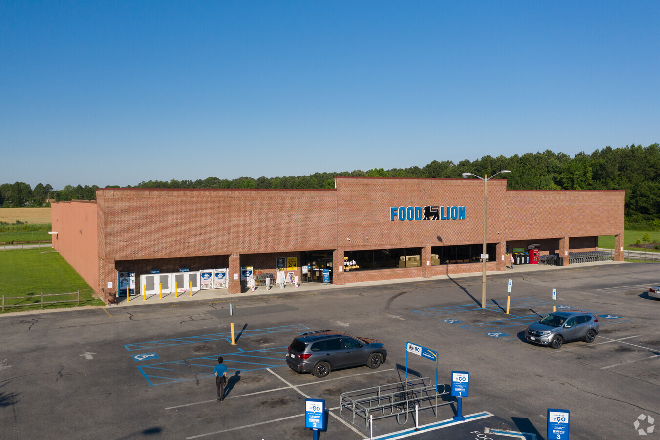
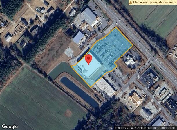
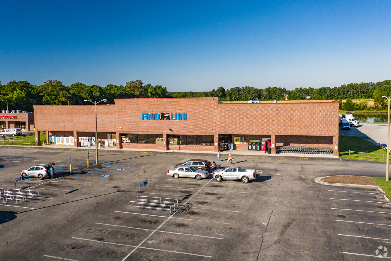
Property Record
101 Lark Dr, Moyock, NC 27958
NEARBY LISTINGS FOR SALE OR LEASE
Property Detail
101 Lark Dr
Virginia Beach-Norfolk-Newport News, VA-NC
Moyock Commons Subdivision Final Plat
0015-000-075D-0000
MOYOCK COMMONS PARCEL 1
Servicestationmarket
Currituck
X
North Carolina
3721803100K
75d
2024
4.40 AC
2024
Currituck County
110201
Hampton Roads
37,903 SF
DEMOGRAPHICS near 101 Lark Dr
1 Mile
3 Mile
5 Mile
2024 Total Population
1,868
7,837
11,965
2029 Population
2,377
9,964
14,831
Pop Growth 2024-2029
+ 27.25%
+ 27.14%
+ 23.95%
Average Age
38
38
39
2024 Total Households
634
2,641
3,794
HH Growth 2024-2029
+ 27.29%
+ 27.30%
+ 25.78%
Median Household Inc
$102,581
$102,188
$100,867
Avg Household Size
2.90
2.90
2.90
2024 Avg HH Vehicles
3.00
3.00
3.00
Median Home Value
$323,248
$321,955
$330,571
Median Year Built
2004
2003
2003
Nearby Places
- Restaurants
- Banks
- Shops
- Fitness
- Groceries
PUBLIC TRANSPORTATION
AIRPORT
Norfolk International
DRIVE
WALK
Distance
Norfolk International
46 min
30.8 mi
Freight Ports
Virginia Port Authority - Portsmouth
DRIVE
WALK
Distance
Virginia Port Authority - Portsmouth
44 min
29.8 mi
Nearby Properties
Address
Land Use
TOTAL SIZE
Lot Size
Zoning
Address
Land Use
TOTAL SIZE
Lot Size
Zoning
89,104 SF
40 AC
AG
Address
Land Use
TOTAL SIZE
Lot Size
Zoning
31,599 SF
6 AC
GB
Address
Land Use
TOTAL SIZE
Lot Size
Zoning
59,355 SF
20.44 AC
GB
Address
Land Use
TOTAL SIZE
Lot Size
Zoning
1,568 SF
202.19 AC
Address
Land Use
TOTAL SIZE
Lot Size
Zoning
19,152 SF
3.60 AC
Address
Land Use
TOTAL SIZE
Lot Size
Zoning
30,330 SF
6.99 AC
GB
Address
Land Use
TOTAL SIZE
Lot Size
Zoning
743 AC
AG
Address
Land Use
TOTAL SIZE
Lot Size
Zoning
349.61 AC
Address
Land Use
TOTAL SIZE
Lot Size
Zoning
573.40 AC
AG
Address
Land Use
TOTAL SIZE
Lot Size
Zoning
299.50 AC
AG
Address
Land Use
TOTAL SIZE
Lot Size
Zoning
131.34 AC
PD-R
Address
Land Use
TOTAL SIZE
Lot Size
Zoning
18,820 SF
2.41 AC
GB
Address
Land Use
TOTAL SIZE
Lot Size
Zoning
10,642 SF
12.15 AC
GB
Address
Land Use
TOTAL SIZE
Lot Size
Zoning
302.50 AC
AG
Address
Land Use
TOTAL SIZE
Lot Size
Zoning
19,680 SF
13.59 AC
A1: AGRICU
Address
Land Use
TOTAL SIZE
Lot Size
Zoning
12,850 SF
1.05 AC
GB
Address
Land Use
TOTAL SIZE
Lot Size
Zoning
5,017 SF
9.58 AC
B1: NEIGHB
Address
Land Use
TOTAL SIZE
Lot Size
Zoning
18,800 SF
3.47 AC
GB
Address
Land Use
TOTAL SIZE
Lot Size
Zoning
4,905 SF
2.95 AC
Address
Land Use
TOTAL SIZE
Lot Size
Zoning
296.34 AC
AG
Address
Land Use
TOTAL SIZE
Lot Size
Zoning
17,015 SF
2.50 AC
GB
Address
Land Use
TOTAL SIZE
Lot Size
Zoning
14,714 SF
1.76 AC
GB
Address
Land Use
TOTAL SIZE
Lot Size
Zoning
24.12 AC
GB
Address
Land Use
TOTAL SIZE
Lot Size
Zoning
12,716 SF
3.07 AC
GB
Address
Land Use
TOTAL SIZE
Lot Size
Zoning
10,170 SF
1.49 AC
GB
Address
Land Use
TOTAL SIZE
Lot Size
Zoning
18,000 SF
2.03 AC
GB
Address
Land Use
TOTAL SIZE
Lot Size
Zoning
10,586 SF
3.08 AC
GB
Address
Land Use
TOTAL SIZE
Lot Size
Zoning
219 AC
AG
The World's #1 Commercial Real Estate Marketplace
Connect with us
© 2025 CoStar Group
The information above has been obtained from sources believed reliable. While we do not doubt its accuracy we have not verified it and make no guarantee, warranty or representation about it. It is your responsibility to independently confirm its accuracy and completeness. Any projections, opinions, assumptions, or estimates used are for example only and do not represent the current or future performance of the property. The value of this transaction to you depends on tax and other factors which should be evaluated by your tax, financial, and legal advisors. You and your advisors should conduct a careful, independent investigation of the property to determine to your satisfaction the suitability of the property for your needs.