Property Record
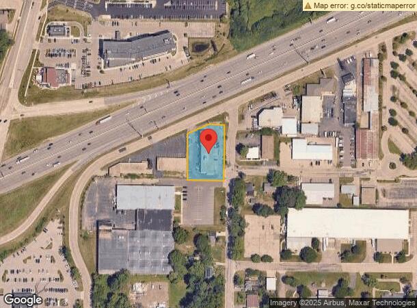
101 Nob Hill Rd, Madison, WI 53713

This Property Is For Sale
Current Lease Availabilities
NEARBY LISTINGS FOR SALE OR LEASE
Property Detail
101 Nob Hill Rd
Madison, WI
Lot 2 Of Certified Survey Map No 2460
0709-362-0094-1
LOT 2 OF CERTIFIED SURVEY MAP NO 2460 RECORDED IN DANE COUNTY REGISTER OF DEEDS IN VOLUME 9 PAGE 377 OF CERTIFIED SURVEYS
Commercialnec
Dane
X
Wisconsin
55025C0436G
2
2023
0.78 AC
2023
Southeast Madison
001502
Milwaukee/Madison
9,203 SF
DEMOGRAPHICS near 101 Nob Hill Rd
1 Mile
3 Mile
5 Mile
2024 Total Population
8,572
92,141
193,128
2029 Population
8,906
94,851
199,316
Pop Growth 2024-2029
+ 3.90%
+ 2.94%
+ 3.20%
Average Age
35
33
36
2024 Total Households
3,874
40,976
86,196
HH Growth 2024-2029
+ 4.03%
+ 3.24%
+ 3.45%
Median Household Inc
$46,405
$48,874
$65,278
Avg Household Size
2.20
2.00
2.10
2024 Avg HH Vehicles
1.00
1.00
1.00
Median Home Value
$235,231
$359,181
$347,275
Median Year Built
1978
1977
1971
Nearby Places
- Restaurants
- Banks
- Shops
- Fitness
- Groceries
PUBLIC TRANSPORTATION
AIRPORT
Dane County Regional/Truax Field
DRIVE
WALK
Distance
Dane County Regional/Truax Field
18 min
8.6 mi
Freight Ports
Port Milwaukee
DRIVE
WALK
Distance
Port Milwaukee
98 min
83.1 mi
Nearby Properties
Address
Land Use
TOTAL SIZE
Lot Size
Zoning
Address
Land Use
TOTAL SIZE
Lot Size
Zoning
484,764 SF
1.62 AC
DC
Address
Land Use
TOTAL SIZE
Lot Size
Zoning
395,505 SF
0.99 AC
UMX
Address
Land Use
TOTAL SIZE
Lot Size
Zoning
466,963 SF
761.23 AC
PD
Address
Land Use
TOTAL SIZE
Lot Size
Zoning
463,006 SF
1.42 AC
UMX
Address
Land Use
TOTAL SIZE
Lot Size
Zoning
169,224 SF
5.49 AC
CC-T
Address
Land Use
TOTAL SIZE
Lot Size
Zoning
208,251 SF
414.76 AC
PD
Address
Land Use
TOTAL SIZE
Lot Size
Zoning
421,021 SF
1.30 AC
DC
Address
Land Use
TOTAL SIZE
Lot Size
Zoning
230,268 SF
0.87 AC
UMX
Address
Land Use
TOTAL SIZE
Lot Size
Zoning
296,708 SF
1 AC
TE
Address
Land Use
TOTAL SIZE
Lot Size
Zoning
269,675 SF
2.25 AC
TR-U2
Address
Land Use
TOTAL SIZE
Lot Size
Zoning
183,407 SF
2.71 AC
PD
Address
Land Use
TOTAL SIZE
Lot Size
Zoning
211,457 SF
329.04 AC
PD
Address
Land Use
TOTAL SIZE
Lot Size
Zoning
230,504 SF
0.76 AC
PD
Address
Land Use
TOTAL SIZE
Lot Size
Zoning
6.30 AC
Address
Land Use
TOTAL SIZE
Lot Size
Zoning
14,229 SF
0.50 AC
DC
Address
Land Use
TOTAL SIZE
Lot Size
Zoning
172,984 SF
1.59 AC
PD
Address
Land Use
TOTAL SIZE
Lot Size
Zoning
182,821 SF
1.19 AC
PD
Address
Land Use
TOTAL SIZE
Lot Size
Zoning
160,531 SF
0.41 AC
UMX
Address
Land Use
TOTAL SIZE
Lot Size
Zoning
42,240 SF
0.98 AC
DC
Address
Land Use
TOTAL SIZE
Lot Size
Zoning
247,984 SF
1 AC
DC
Address
Land Use
TOTAL SIZE
Lot Size
Zoning
24.62 AC
Address
Land Use
TOTAL SIZE
Lot Size
Zoning
404,794 SF
4.86 AC
CC-T
Address
Land Use
TOTAL SIZE
Lot Size
Zoning
207,221 SF
0.60 AC
UMX
Address
Land Use
TOTAL SIZE
Lot Size
Zoning
148,747 SF
0.83 AC
TE
Address
Land Use
TOTAL SIZE
Lot Size
Zoning
2.03 AC
Address
Land Use
TOTAL SIZE
Lot Size
Zoning
3.59 AC
Address
Land Use
TOTAL SIZE
Lot Size
Zoning
169,491 SF
0.79 AC
HIS-L
Address
Land Use
TOTAL SIZE
Lot Size
Zoning
192,840 SF
0.37 AC
DC
Address
Land Use
TOTAL SIZE
Lot Size
Zoning
14.47 AC
Address
Land Use
TOTAL SIZE
Lot Size
Zoning
2,454 SF
0.40 AC
PD
The World's #1 Commercial Real Estate Marketplace
Connect with us
© 2025 CoStar Group
The information above has been obtained from sources believed reliable. While we do not doubt its accuracy we have not verified it and make no guarantee, warranty or representation about it. It is your responsibility to independently confirm its accuracy and completeness. Any projections, opinions, assumptions, or estimates used are for example only and do not represent the current or future performance of the property. The value of this transaction to you depends on tax and other factors which should be evaluated by your tax, financial, and legal advisors. You and your advisors should conduct a careful, independent investigation of the property to determine to your satisfaction the suitability of the property for your needs.