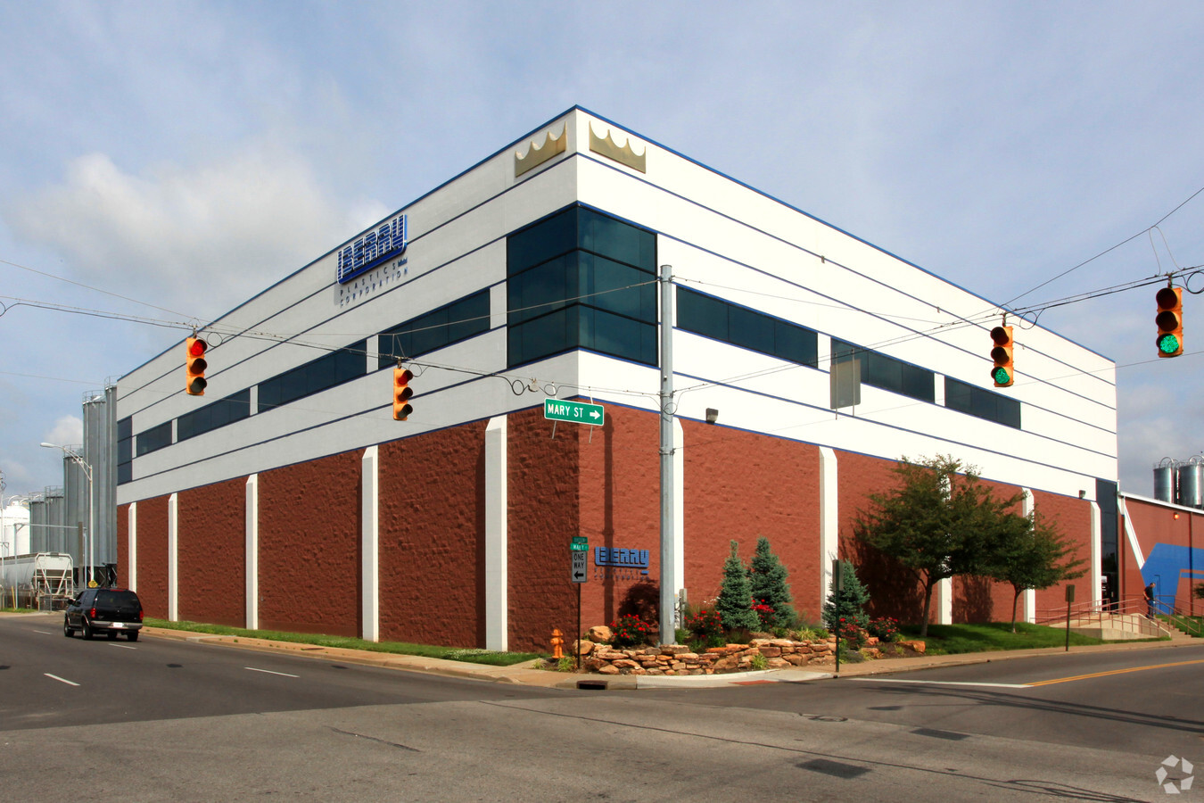
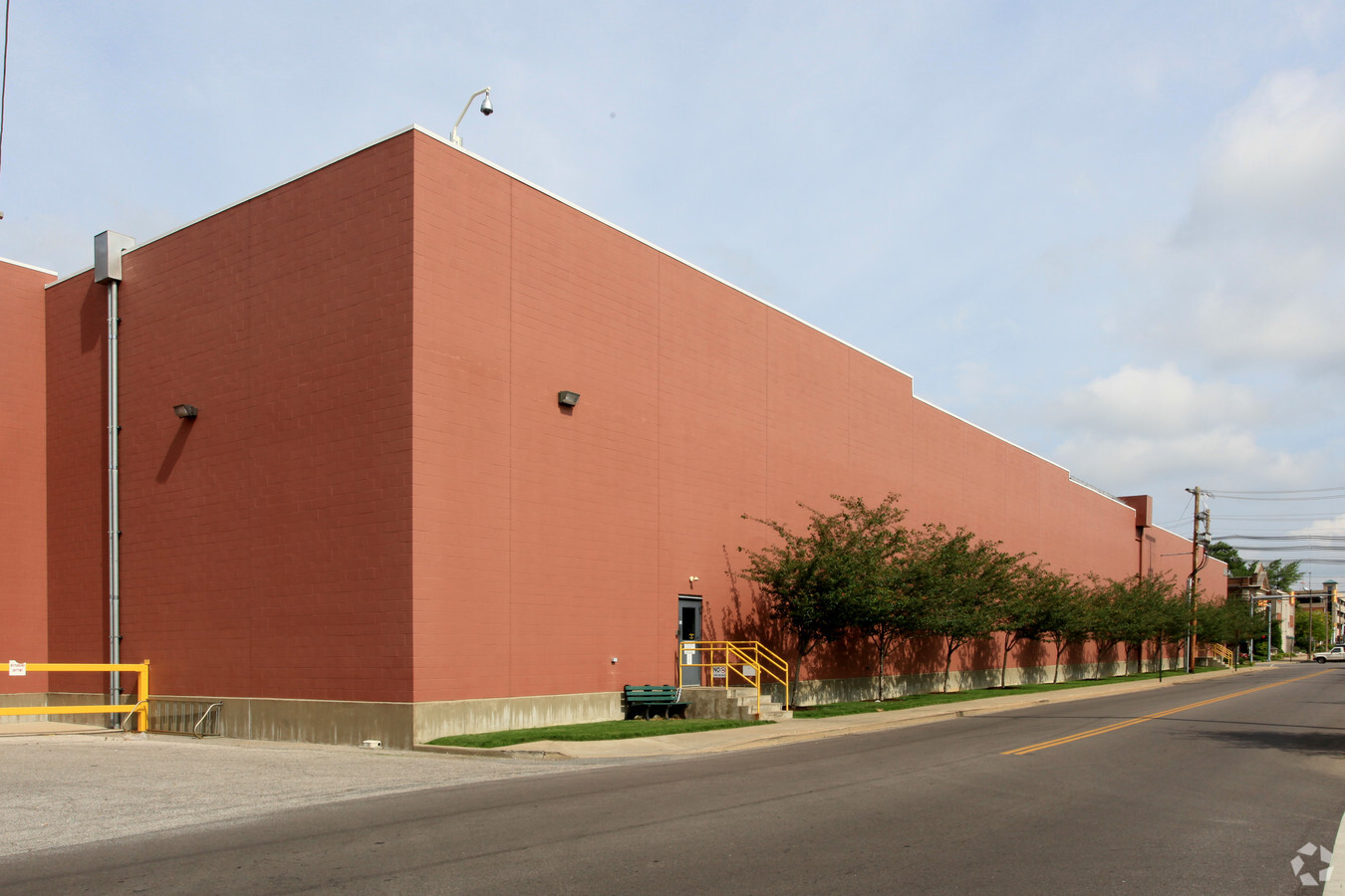
Property Record
101 Oakley St, Evansville, IN 47710
NEARBY LISTINGS FOR SALE OR LEASE
Property Detail
101 Oakley St
Evansville, IN-KY
Sharpes Enlargement
82-06-19-026-002.001-029
E PT CARPENTER FLD LOTS 1-23 BL 1 & LOTS 1-46 BLK 2 SHARPES ENL & PT VAC EDGA R ST, PT ALLEY. PT ILLINOIS ST, PT DIV ST, PT O
Warehouse
Vanderburgh
X
Indiana
21101C0080F
1-23,60
2023
15.37 AC
2023
Downtown Evansville
002000
Evansville
784,971 SF
DEMOGRAPHICS near 101 Oakley St
1 Mile
3 Mile
5 Mile
2024 Total Population
11,504
68,469
125,531
2029 Population
12,018
69,510
126,229
Pop Growth 2024-2029
+ 4.47%
+ 1.52%
+ 0.56%
Average Age
40
39
40
2024 Total Households
4,976
29,589
54,947
HH Growth 2024-2029
+ 4.88%
+ 1.56%
+ 0.56%
Median Household Inc
$34,188
$44,113
$48,127
Avg Household Size
2.10
2.20
2.20
2024 Avg HH Vehicles
1.00
2.00
2.00
Median Home Value
$74,534
$87,146
$118,483
Median Year Built
1948
1949
1960
Nearby Places
- Restaurants
- Banks
- Shops
- Fitness
- Groceries
PUBLIC TRANSPORTATION
AIRPORT
Evansville Regional
DRIVE
WALK
Distance
Evansville Regional
13 min
6.5 mi
Freight Ports
Port of Toledo
DRIVE
WALK
Distance
Port of Toledo
460 min
395.9 mi
Nearby Properties
Address
Land Use
TOTAL SIZE
Lot Size
Zoning
Address
Land Use
TOTAL SIZE
Lot Size
Zoning
84,660 SF
12.95 AC
Address
Land Use
TOTAL SIZE
Lot Size
Zoning
20,964 SF
1.35 AC
Address
Land Use
TOTAL SIZE
Lot Size
Zoning
15,233 SF
3.31 AC
Address
Land Use
TOTAL SIZE
Lot Size
Zoning
117,580 SF
1.74 AC
Address
Land Use
TOTAL SIZE
Lot Size
Zoning
51,342 SF
4.42 AC
Address
Land Use
TOTAL SIZE
Lot Size
Zoning
21,831 SF
3.03 AC
Address
Land Use
TOTAL SIZE
Lot Size
Zoning
165,472 SF
1.38 AC
Address
Land Use
TOTAL SIZE
Lot Size
Zoning
23,108 SF
2.92 AC
Address
Land Use
TOTAL SIZE
Lot Size
Zoning
92,132 SF
1.68 AC
Address
Land Use
TOTAL SIZE
Lot Size
Zoning
223,202 SF
2.28 AC
Address
Land Use
TOTAL SIZE
Lot Size
Zoning
13,182 SF
25.33 AC
Address
Land Use
TOTAL SIZE
Lot Size
Zoning
20,286 SF
4.57 AC
Address
Land Use
TOTAL SIZE
Lot Size
Zoning
87,099 SF
2.28 AC
Address
Land Use
TOTAL SIZE
Lot Size
Zoning
25,595 SF
14.99 AC
Address
Land Use
TOTAL SIZE
Lot Size
Zoning
82,488 SF
1.90 AC
8
Address
Land Use
TOTAL SIZE
Lot Size
Zoning
61,652 SF
15.02 AC
Address
Land Use
TOTAL SIZE
Lot Size
Zoning
331,588 SF
0.96 AC
Address
Land Use
TOTAL SIZE
Lot Size
Zoning
16,292 SF
6.87 AC
Address
Land Use
TOTAL SIZE
Lot Size
Zoning
4,160 SF
9.22 AC
Address
Land Use
TOTAL SIZE
Lot Size
Zoning
8,920 SF
2.62 AC
Address
Land Use
TOTAL SIZE
Lot Size
Zoning
75,109 SF
1.64 AC
Address
Land Use
TOTAL SIZE
Lot Size
Zoning
94,551 SF
6.12 AC
Address
Land Use
TOTAL SIZE
Lot Size
Zoning
39,264 SF
45.28 AC
Address
Land Use
TOTAL SIZE
Lot Size
Zoning
23,796 SF
17.29 AC
Address
Land Use
TOTAL SIZE
Lot Size
Zoning
4,284 SF
13.14 AC
Address
Land Use
TOTAL SIZE
Lot Size
Zoning
229,140 SF
1.03 AC
Address
Land Use
TOTAL SIZE
Lot Size
Zoning
150,102 SF
20.72 AC
Address
Land Use
TOTAL SIZE
Lot Size
Zoning
185,563 SF
12.47 AC
Address
Land Use
TOTAL SIZE
Lot Size
Zoning
1,800 SF
28.13 AC
The World's #1 Commercial Real Estate Marketplace
Connect with us
© 2025 CoStar Group
The information above has been obtained from sources believed reliable. While we do not doubt its accuracy we have not verified it and make no guarantee, warranty or representation about it. It is your responsibility to independently confirm its accuracy and completeness. Any projections, opinions, assumptions, or estimates used are for example only and do not represent the current or future performance of the property. The value of this transaction to you depends on tax and other factors which should be evaluated by your tax, financial, and legal advisors. You and your advisors should conduct a careful, independent investigation of the property to determine to your satisfaction the suitability of the property for your needs.