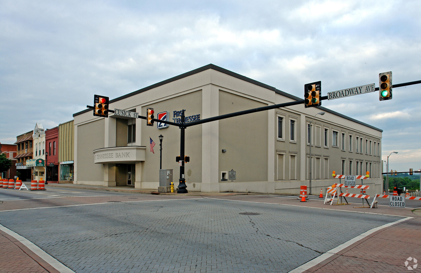
Property Record
101 W Broadway Ave, Maryville, TN 37801
NEARBY LISTINGS FOR SALE OR LEASE
Property Detail
101 W Broadway Ave
Knoxville, TN
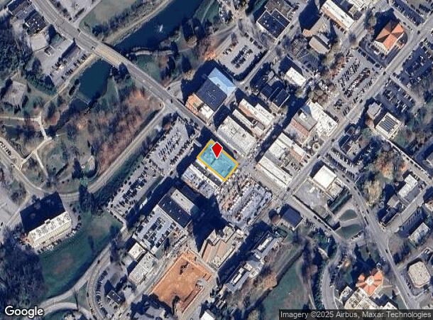
Map Of Maryville Tenn
057D-D-023.00
LOT P61 P61 1ST TN BANK
Officebuilding
Blount
X
Tennessee
47009C0138C
p61 p62
0
0.34 AC
2024
Blount County
010500
Knoxville
43,026 SF
DEMOGRAPHICS near 101 W Broadway Ave
1 Mile
3 Mile
5 Mile
2024 Total Population
7,850
45,404
79,697
2029 Population
8,513
49,319
86,653
Pop Growth 2024-2029
+ 8.45%
+ 8.62%
+ 8.73%
Average Age
39
41
42
2024 Total Households
3,068
18,173
31,898
HH Growth 2024-2029
+ 8.60%
+ 8.70%
+ 8.79%
Median Household Inc
$45,776
$57,492
$61,906
Avg Household Size
2.10
2.40
2.40
2024 Avg HH Vehicles
2.00
2.00
2.00
Median Home Value
$175,144
$221,484
$229,060
Median Year Built
1962
1978
1984
Nearby Places
- Restaurants
- Banks
- Shops
- Fitness
- Groceries
PUBLIC TRANSPORTATION
AIRPORT
McGhee Tyson
DRIVE
WALK
Distance
McGhee Tyson
13 min
7.8 mi
Freight Ports
Georgia Ports - Savannah
DRIVE
WALK
Distance
Georgia Ports - Savannah
489 min
418.5 mi
SALE & LEASE HISTORY
LISTING DATE
SALE/LEASE

Sep 24, 2016
For Sale
Oct 28, 2016
For Sale
Oct 28, 2016
For Sale
Oct 27, 2016
For Sale
Oct 07, 2016
For Sale
Oct 07, 2016
For Lease
Nearby Properties
Address
Land Use
TOTAL SIZE
Lot Size
Zoning
Address
Land Use
TOTAL SIZE
Lot Size
Zoning
325,748 SF
IND
Address
Land Use
TOTAL SIZE
Lot Size
Zoning
194,621 SF
10.13 AC
CC
Address
Land Use
TOTAL SIZE
Lot Size
Zoning
102,661 SF
15.45 AC
BT
Address
Land Use
TOTAL SIZE
Lot Size
Zoning
46.37 AC
AIR
Address
Land Use
TOTAL SIZE
Lot Size
Zoning
144,298 SF
4.51 AC
G
Address
Land Use
TOTAL SIZE
Lot Size
Zoning
558,604 SF
83.49 AC
IND
Address
Land Use
TOTAL SIZE
Lot Size
Zoning
10,061 SF
22.74 AC
SPLIT
Address
Land Use
TOTAL SIZE
Lot Size
Zoning
101,640 SF
7.41 AC
SPLIT
Address
Land Use
TOTAL SIZE
Lot Size
Zoning
88,949 SF
6.83 AC
CBDS
Address
Land Use
TOTAL SIZE
Lot Size
Zoning
194,268 SF
33.99 AC
IND
Address
Land Use
TOTAL SIZE
Lot Size
Zoning
150,532 SF
5.41 AC
G
Address
Land Use
TOTAL SIZE
Lot Size
Zoning
64,033 SF
5.65 AC
O-3
Address
Land Use
TOTAL SIZE
Lot Size
Zoning
23,916 SF
9.94 AC
Address
Land Use
TOTAL SIZE
Lot Size
Zoning
33,912 SF
19.91 AC
HDR
Address
Land Use
TOTAL SIZE
Lot Size
Zoning
74,071 SF
5.19 AC
HIC
Address
Land Use
TOTAL SIZE
Lot Size
Zoning
158,466 SF
14.78 AC
E1
Address
Land Use
TOTAL SIZE
Lot Size
Zoning
41,938 SF
7.42 AC
BT
Address
Land Use
TOTAL SIZE
Lot Size
Zoning
122,648 SF
0.10 AC
CBD
Address
Land Use
TOTAL SIZE
Lot Size
Zoning
323,040 SF
87.30 AC
IND
Address
Land Use
TOTAL SIZE
Lot Size
Zoning
45,913 SF
9.18 AC
RSF
Address
Land Use
TOTAL SIZE
Lot Size
Zoning
55,708 SF
6.95 AC
BT
Address
Land Use
TOTAL SIZE
Lot Size
Zoning
161,251 SF
Address
Land Use
TOTAL SIZE
Lot Size
Zoning
104,327 SF
26.19 AC
CC
Address
Land Use
TOTAL SIZE
Lot Size
Zoning
106,466 SF
2.65 AC
CC
Address
Land Use
TOTAL SIZE
Lot Size
Zoning
172.05 AC
G
Address
Land Use
TOTAL SIZE
Lot Size
Zoning
15,340 SF
5 AC
Address
Land Use
TOTAL SIZE
Lot Size
Zoning
236,656 SF
24.69 AC
E1
Address
Land Use
TOTAL SIZE
Lot Size
Zoning
295,555 SF
IND
Address
Land Use
TOTAL SIZE
Lot Size
Zoning
60,328 SF
4.41 AC
F
Address
Land Use
TOTAL SIZE
Lot Size
Zoning
96,738 SF
23.34 AC
F
The World's #1 Commercial Real Estate Marketplace
Connect with us
© 2025 CoStar Group
The information above has been obtained from sources believed reliable. While we do not doubt its accuracy we have not verified it and make no guarantee, warranty or representation about it. It is your responsibility to independently confirm its accuracy and completeness. Any projections, opinions, assumptions, or estimates used are for example only and do not represent the current or future performance of the property. The value of this transaction to you depends on tax and other factors which should be evaluated by your tax, financial, and legal advisors. You and your advisors should conduct a careful, independent investigation of the property to determine to your satisfaction the suitability of the property for your needs.