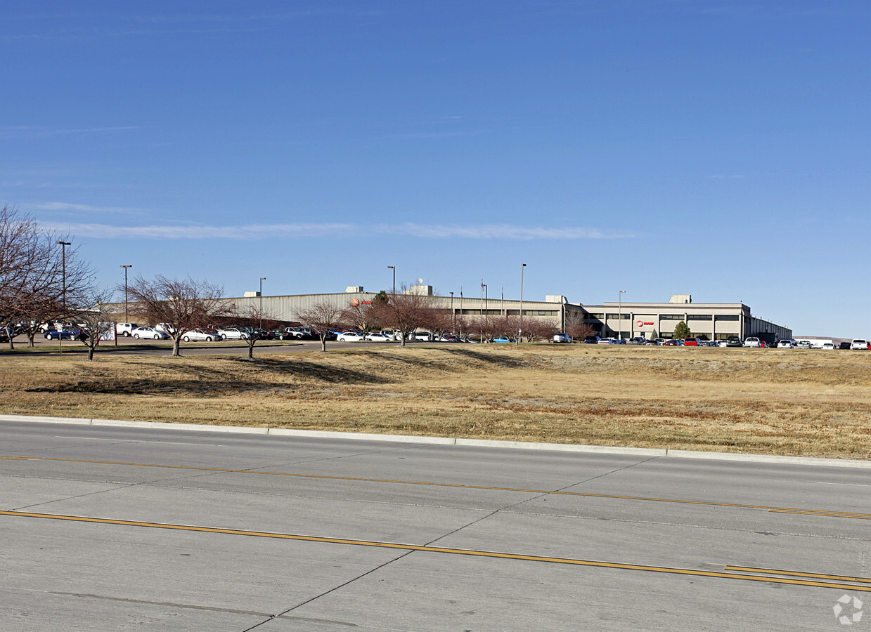
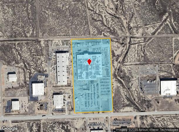
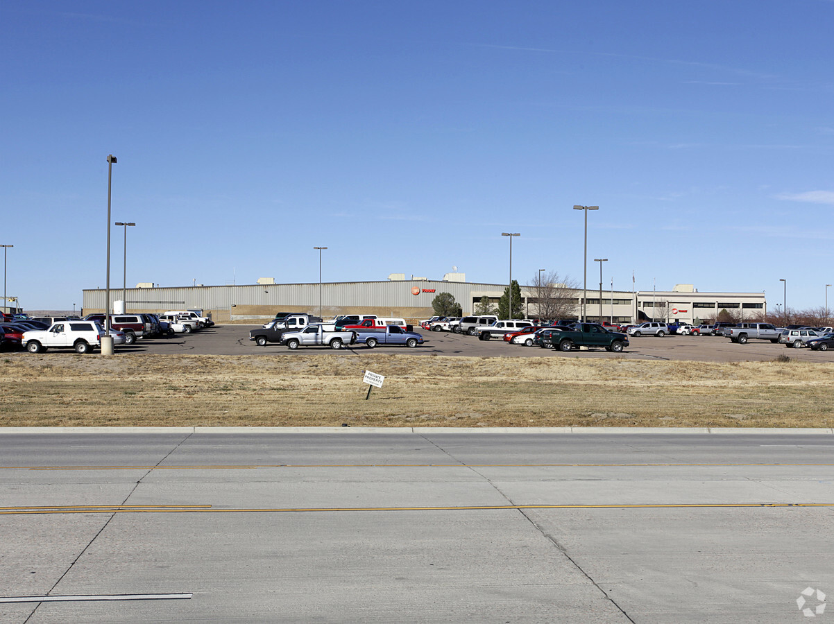
Property Record
101 William White Blvd, Pueblo, CO 81001
NEARBY LISTINGS FOR SALE OR LEASE
Property Detail
101 William White Blvd
Pueblo, CO
Com-Airport Ip
0-4-26-0-05-020
LOT 22 PUEBLO MEMORIAL AIRPORT INDUSTRIAL PARK SUB FORMERLY #04-260-02-001
Industrialgeneral
Pueblo
A
Colorado
08101C0520D
22
2023
27.56 AC
2023
Colorado East Area
003600
Other Market Areas
288,672 SF
DEMOGRAPHICS near 101 William White Blvd
1 Mile
3 Mile
5 Mile
2024 Total Population
84
7,971
42,687
2029 Population
87
8,225
43,754
Pop Growth 2024-2029
+ 3.57%
+ 3.19%
+ 2.50%
Average Age
35
39
40
2024 Total Households
30
2,885
16,929
HH Growth 2024-2029
+ 3.33%
+ 3.19%
+ 2.58%
Median Household Inc
$41,250
$45,214
$45,852
Avg Household Size
2.80
2.70
2.40
2024 Avg HH Vehicles
2.00
2.00
2.00
Median Home Value
$166,666
$265,733
$246,786
Median Year Built
1982
1974
1970
Nearby Places
- Restaurants
- Banks
- Shops
- Fitness
- Groceries
Nearby Properties
Address
Land Use
TOTAL SIZE
Lot Size
Zoning
Address
Land Use
TOTAL SIZE
Lot Size
Zoning
71,345 SF
5.17 AC
Address
Land Use
TOTAL SIZE
Lot Size
Zoning
71,936 SF
3.43 AC
R4:RES/MUL
Address
Land Use
TOTAL SIZE
Lot Size
Zoning
218,600 SF
37.40 AC
I2:IND/MAN
Address
Land Use
TOTAL SIZE
Lot Size
Zoning
1,158,183 SF
84.46 AC
I2:IND/MAN
Address
Land Use
TOTAL SIZE
Lot Size
Zoning
164,092 SF
11.41 AC
I3:IND/HEA
Address
Land Use
TOTAL SIZE
Lot Size
Zoning
59,360 SF
44.62 AC
I1:IND/PAR
Address
Land Use
TOTAL SIZE
Lot Size
Zoning
26,550 SF
3.52 AC
S1:SPC/PUB
Address
Land Use
TOTAL SIZE
Lot Size
Zoning
84,387 SF
0.11 AC
I1:IND/PAR
Address
Land Use
TOTAL SIZE
Lot Size
Zoning
191,905 SF
11.20 AC
I1:IND/PAR
Address
Land Use
TOTAL SIZE
Lot Size
Zoning
148,405 SF
35.67 AC
I1:IND/PAR
Address
Land Use
TOTAL SIZE
Lot Size
Zoning
29,337 SF
6.02 AC
I2:IND/MAN
Address
Land Use
TOTAL SIZE
Lot Size
Zoning
128,100 SF
17.28 AC
I2:IND/MAN
Address
Land Use
TOTAL SIZE
Lot Size
Zoning
140,480 SF
10.03 AC
I2:IND/MAN
Address
Land Use
TOTAL SIZE
Lot Size
Zoning
68,999 SF
4.47 AC
I2:IND/MAN
Address
Land Use
TOTAL SIZE
Lot Size
Zoning
9,903 SF
1.33 AC
R-5
Address
Land Use
TOTAL SIZE
Lot Size
Zoning
155,800 SF
16.46 AC
I1:IND/PAR
Address
Land Use
TOTAL SIZE
Lot Size
Zoning
63,500 SF
3.80 AC
I2:IND/MAN
Address
Land Use
TOTAL SIZE
Lot Size
Zoning
Address
Land Use
TOTAL SIZE
Lot Size
Zoning
7,706 SF
1.80 AC
I2:IND/MAN
Address
Land Use
TOTAL SIZE
Lot Size
Zoning
50,720 SF
6.15 AC
I2:IND/MAN
Address
Land Use
TOTAL SIZE
Lot Size
Zoning
6,384 SF
0.81 AC
R-3
Address
Land Use
TOTAL SIZE
Lot Size
Zoning
80,700 SF
9.89 AC
A2:AG/1&2
Address
Land Use
TOTAL SIZE
Lot Size
Zoning
50,720 SF
6.23 AC
I2:IND/MAN
Address
Land Use
TOTAL SIZE
Lot Size
Zoning
135,019 SF
19.10 AC
I2:IND/MAN
Address
Land Use
TOTAL SIZE
Lot Size
Zoning
26,400 SF
4.87 AC
I2:IND/MAN
Address
Land Use
TOTAL SIZE
Lot Size
Zoning
123,180 SF
2.92 AC
R4:RES/MUL
Address
Land Use
TOTAL SIZE
Lot Size
Zoning
3,805 SF
1.77 AC
A-4
Address
Land Use
TOTAL SIZE
Lot Size
Zoning
29,440 SF
160 AC
A-1
The World's #1 Commercial Real Estate Marketplace
Connect with us
© 2025 CoStar Group
The information above has been obtained from sources believed reliable. While we do not doubt its accuracy we have not verified it and make no guarantee, warranty or representation about it. It is your responsibility to independently confirm its accuracy and completeness. Any projections, opinions, assumptions, or estimates used are for example only and do not represent the current or future performance of the property. The value of this transaction to you depends on tax and other factors which should be evaluated by your tax, financial, and legal advisors. You and your advisors should conduct a careful, independent investigation of the property to determine to your satisfaction the suitability of the property for your needs.