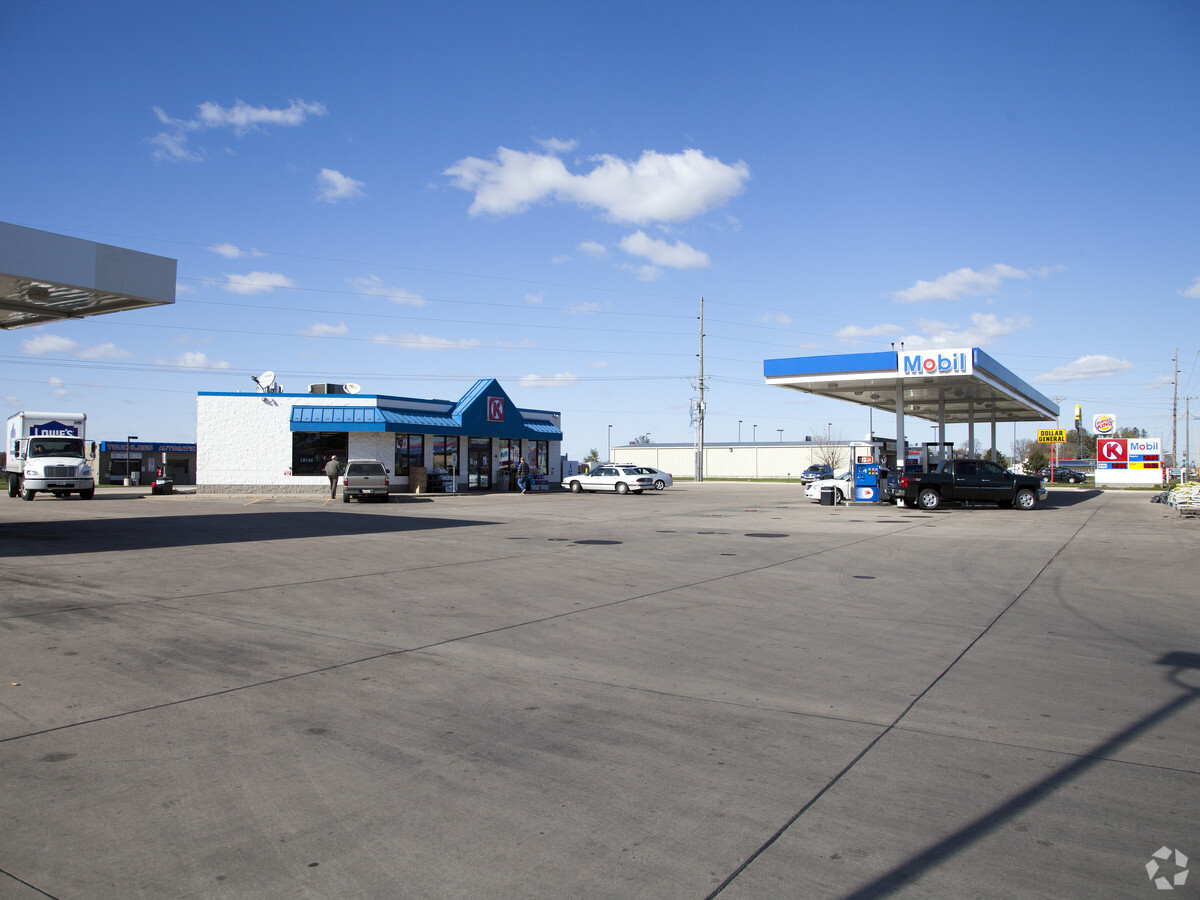
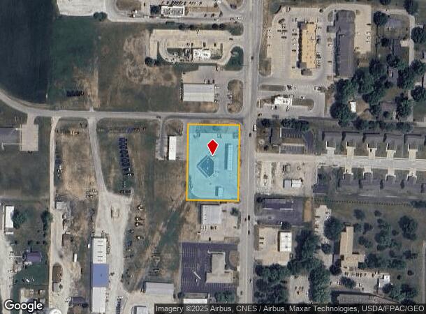
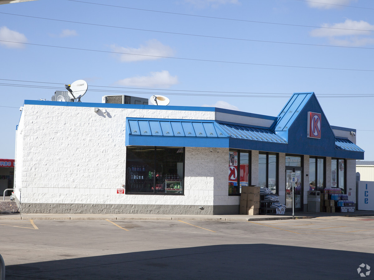
Property Record
1010 N Main St, Monmouth, IL 61462
NEARBY LISTINGS FOR SALE OR LEASE
Property Detail
1010 N Main St
09-044-197-00
Cardinal Subdiv
Commercialnec
S20 T11 R2 LOT 1 CARDINAL SUBDIV PT W PT SW PLAT #491411 LOT SIZE: 1.54 AC
X
Warren
17187C0142D
Illinois
2023
1
2023
1.54 AC
8704004015
Other Market Areas
DEMOGRAPHICS near 1010 N Main St
1 Mile
3 Mile
5 Mile
2024 Total Population
4,893
9,540
9,869
2029 Population
4,840
9,411
9,714
Pop Growth 2024-2029
(1.08%)
(1.35%)
(1.57%)
Average Age
41
41
41
2024 Total Households
2,123
3,937
4,076
HH Growth 2024-2029
(1.18%)
(1.42%)
(1.67%)
Median Household Inc
$57,378
$58,480
$58,484
Avg Household Size
2.20
2.30
2.30
2024 Avg HH Vehicles
2.00
2.00
2.00
Median Home Value
$75,857
$77,240
$79,142
Median Year Built
1952
1951
1952
Nearby Places
- Restaurants
- Banks
- Shops
- Fitness
- Groceries
Nearby Properties
Address
Land Use
TOTAL SIZE
Lot Size
Zoning
Address
Land Use
TOTAL SIZE
Lot Size
Zoning
19.64 AC
Address
Land Use
TOTAL SIZE
Lot Size
Zoning
26.06 AC
Address
Land Use
TOTAL SIZE
Lot Size
Zoning
1.71 AC
Address
Land Use
TOTAL SIZE
Lot Size
Zoning
9.41 AC
Address
Land Use
TOTAL SIZE
Lot Size
Zoning
11.43 AC
Address
Land Use
TOTAL SIZE
Lot Size
Zoning
6.17 AC
Address
Land Use
TOTAL SIZE
Lot Size
Zoning
3.65 AC
Address
Land Use
TOTAL SIZE
Lot Size
Zoning
10.35 AC
Address
Land Use
TOTAL SIZE
Lot Size
Zoning
2.75 AC
Address
Land Use
TOTAL SIZE
Lot Size
Zoning
1.40 AC
Address
Land Use
TOTAL SIZE
Lot Size
Zoning
10.77 AC
Address
Land Use
TOTAL SIZE
Lot Size
Zoning
4.15 AC
Address
Land Use
TOTAL SIZE
Lot Size
Zoning
1.12 AC
Address
Land Use
TOTAL SIZE
Lot Size
Zoning
1.14 AC
Address
Land Use
TOTAL SIZE
Lot Size
Zoning
4.33 AC
Address
Land Use
TOTAL SIZE
Lot Size
Zoning
6.56 AC
Address
Land Use
TOTAL SIZE
Lot Size
Zoning
4.34 AC
Address
Land Use
TOTAL SIZE
Lot Size
Zoning
Address
Land Use
TOTAL SIZE
Lot Size
Zoning
1.40 AC
Address
Land Use
TOTAL SIZE
Lot Size
Zoning
2.05 AC
Address
Land Use
TOTAL SIZE
Lot Size
Zoning
6.97 AC
Address
Land Use
TOTAL SIZE
Lot Size
Zoning
4.86 AC
Address
Land Use
TOTAL SIZE
Lot Size
Zoning
0.64 AC
Address
Land Use
TOTAL SIZE
Lot Size
Zoning
Address
Land Use
TOTAL SIZE
Lot Size
Zoning
1.59 AC
Address
Land Use
TOTAL SIZE
Lot Size
Zoning
6.34 AC
Address
Land Use
TOTAL SIZE
Lot Size
Zoning
320 AC
Address
Land Use
TOTAL SIZE
Lot Size
Zoning
0.70 AC
Address
Land Use
TOTAL SIZE
Lot Size
Zoning
0.15 AC
The World's #1 Commercial Real Estate Marketplace
Connect with us
© 2025 CoStar Group
The information above has been obtained from sources believed reliable. While we do not doubt its accuracy we have not verified it and make no guarantee, warranty or representation about it. It is your responsibility to independently confirm its accuracy and completeness. Any projections, opinions, assumptions, or estimates used are for example only and do not represent the current or future performance of the property. The value of this transaction to you depends on tax and other factors which should be evaluated by your tax, financial, and legal advisors. You and your advisors should conduct a careful, independent investigation of the property to determine to your satisfaction the suitability of the property for your needs.