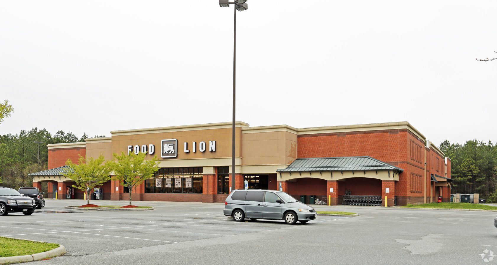
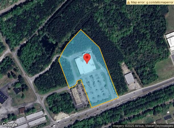
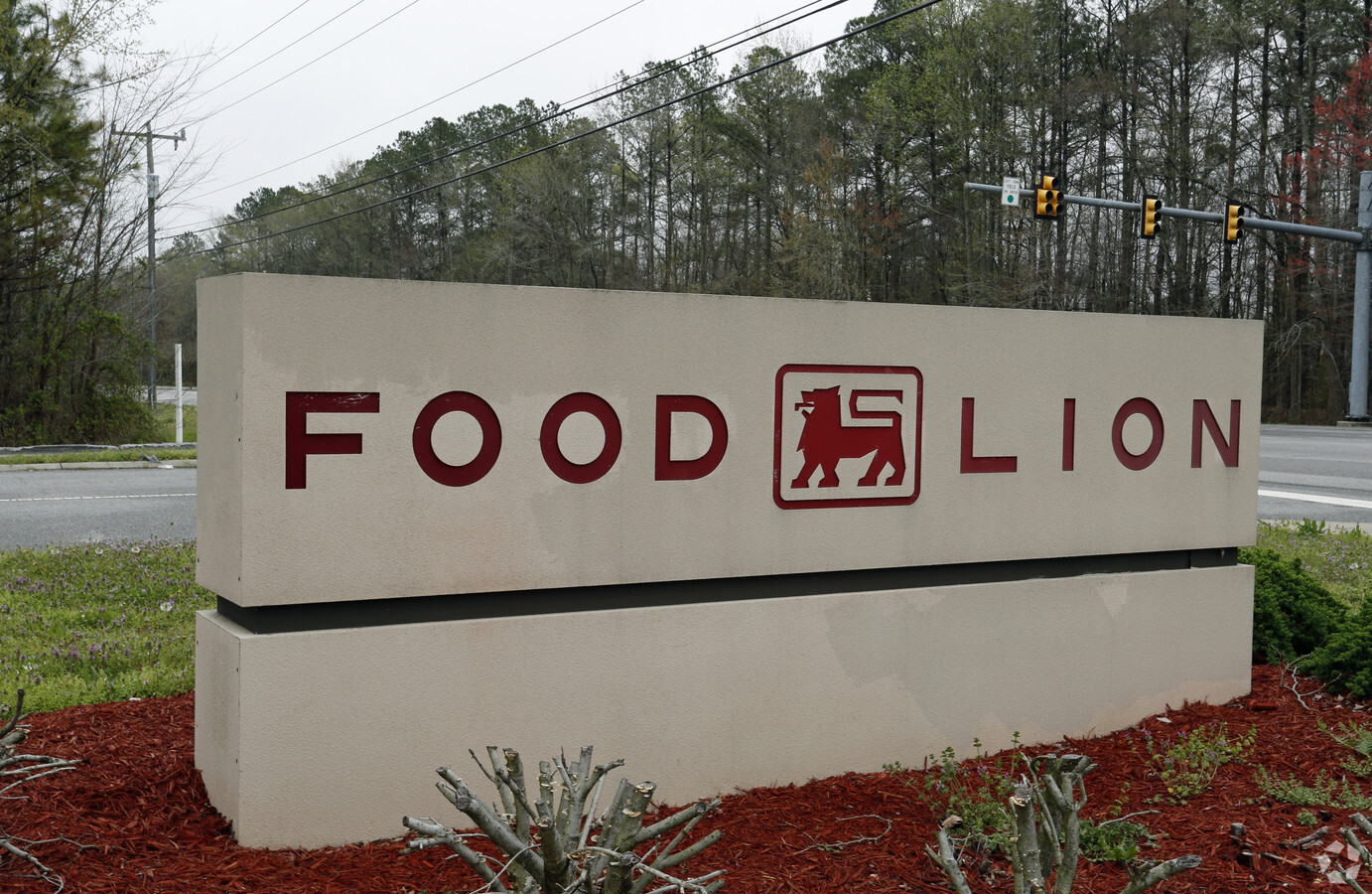
Property Record
1010 Portsmouth Blvd, Suffolk, VA 23434
NEARBY LISTINGS FOR SALE OR LEASE
Property Detail
1010 Portsmouth Blvd
304339300
PARCEL A, U & U ASSOCIATES PLAT
Commercialnec
Suffolk City
X
Virginia
5101560231E
6.89 AC
2024
Suffolk
2024
Hampton Roads
075504
Virginia Beach-Norfolk-Newport News, VA-NC
35,549 SF
DEMOGRAPHICS near 1010 Portsmouth Blvd
1 Mile
3 Mile
5 Mile
2024 Total Population
5,116
35,303
48,543
2029 Population
5,672
39,433
54,272
Pop Growth 2024-2029
+ 10.87%
+ 11.70%
+ 11.80%
Average Age
37
37
38
2024 Total Households
1,927
13,240
18,166
HH Growth 2024-2029
+ 11.05%
+ 12.06%
+ 12.19%
Median Household Inc
$59,199
$62,448
$67,626
Avg Household Size
2.60
2.60
2.60
2024 Avg HH Vehicles
2.00
2.00
2.00
Median Home Value
$218,487
$239,279
$258,809
Median Year Built
1991
1983
1990
Nearby Places
- Restaurants
- Banks
- Shops
- Fitness
- Groceries
PUBLIC TRANSPORTATION
AIRPORT
Norfolk International
DRIVE
WALK
Distance
Norfolk International
39 min
24.3 mi
Newport News/Williamsburg International
DRIVE
WALK
Distance
Newport News/Williamsburg International
53 min
38.7 mi
Freight Ports
Virginia Port Authority - Portsmouth
DRIVE
WALK
Distance
Virginia Port Authority - Portsmouth
28 min
17.2 mi
Nearby Properties
Address
Land Use
TOTAL SIZE
Lot Size
Zoning
Address
Land Use
TOTAL SIZE
Lot Size
Zoning
10,850 SF
51.12 AC
GENERAL CO
Address
Land Use
TOTAL SIZE
Lot Size
Zoning
41,368 SF
58.33 AC
HEAVY INDU
Address
Land Use
TOTAL SIZE
Lot Size
Zoning
24,655 AC
CONSERVATI
Address
Land Use
TOTAL SIZE
Lot Size
Zoning
5,617 SF
16.96 AC
MIXED USE
Address
Land Use
TOTAL SIZE
Lot Size
Zoning
10,255 SF
35.42 AC
HEAVY INDU
Address
Land Use
TOTAL SIZE
Lot Size
Zoning
13.21 AC
OFFICE-INS
Address
Land Use
TOTAL SIZE
Lot Size
Zoning
19.66 AC
RES LOW-ME
Address
Land Use
TOTAL SIZE
Lot Size
Zoning
203,000 SF
31.65 AC
HEAVY INDU
Address
Land Use
TOTAL SIZE
Lot Size
Zoning
4,928 SF
20.79 AC
GENERAL CO
Address
Land Use
TOTAL SIZE
Lot Size
Zoning
19,100 SF
9.84 AC
HEAVY INDU
Address
Land Use
TOTAL SIZE
Lot Size
Zoning
97,713 SF
15.22 AC
PLANNED DE
Address
Land Use
TOTAL SIZE
Lot Size
Zoning
9.02 AC
PLANNED DE
Address
Land Use
TOTAL SIZE
Lot Size
Zoning
91,512 SF
0.35 AC
CENTRAL BU
Address
Land Use
TOTAL SIZE
Lot Size
Zoning
86.84 AC
GENERAL CO
Address
Land Use
TOTAL SIZE
Lot Size
Zoning
12,457 SF
27.01 AC
GENERAL CO
Address
Land Use
TOTAL SIZE
Lot Size
Zoning
91,050 SF
17.06 AC
HEAVY INDU
Address
Land Use
TOTAL SIZE
Lot Size
Zoning
115,088 SF
0.17 AC
CENTRAL BU
Address
Land Use
TOTAL SIZE
Lot Size
Zoning
83,064 SF
26.61 AC
RES LOW-ME
Address
Land Use
TOTAL SIZE
Lot Size
Zoning
73,277 SF
1.94 AC
CENTRAL BU
Address
Land Use
TOTAL SIZE
Lot Size
Zoning
27,857 SF
20.26 AC
HEAVY INDU
Address
Land Use
TOTAL SIZE
Lot Size
Zoning
5,000 SF
5.92 AC
GENERAL CO
Address
Land Use
TOTAL SIZE
Lot Size
Zoning
15,200 SF
12.92 AC
HEAVY INDU
Address
Land Use
TOTAL SIZE
Lot Size
Zoning
4,458 SF
40.56 AC
GENERAL CO
Address
Land Use
TOTAL SIZE
Lot Size
Zoning
10.26 AC
RESIDENTIA
Address
Land Use
TOTAL SIZE
Lot Size
Zoning
4.70 AC
RESIDENTIA
Address
Land Use
TOTAL SIZE
Lot Size
Zoning
149,212 SF
39.20 AC
RES LOW-ME
Address
Land Use
TOTAL SIZE
Lot Size
Zoning
19,388 SF
12.24 AC
GENERAL CO
Address
Land Use
TOTAL SIZE
Lot Size
Zoning
The World's #1 Commercial Real Estate Marketplace
Connect with us
© 2025 CoStar Group
The information above has been obtained from sources believed reliable. While we do not doubt its accuracy we have not verified it and make no guarantee, warranty or representation about it. It is your responsibility to independently confirm its accuracy and completeness. Any projections, opinions, assumptions, or estimates used are for example only and do not represent the current or future performance of the property. The value of this transaction to you depends on tax and other factors which should be evaluated by your tax, financial, and legal advisors. You and your advisors should conduct a careful, independent investigation of the property to determine to your satisfaction the suitability of the property for your needs.