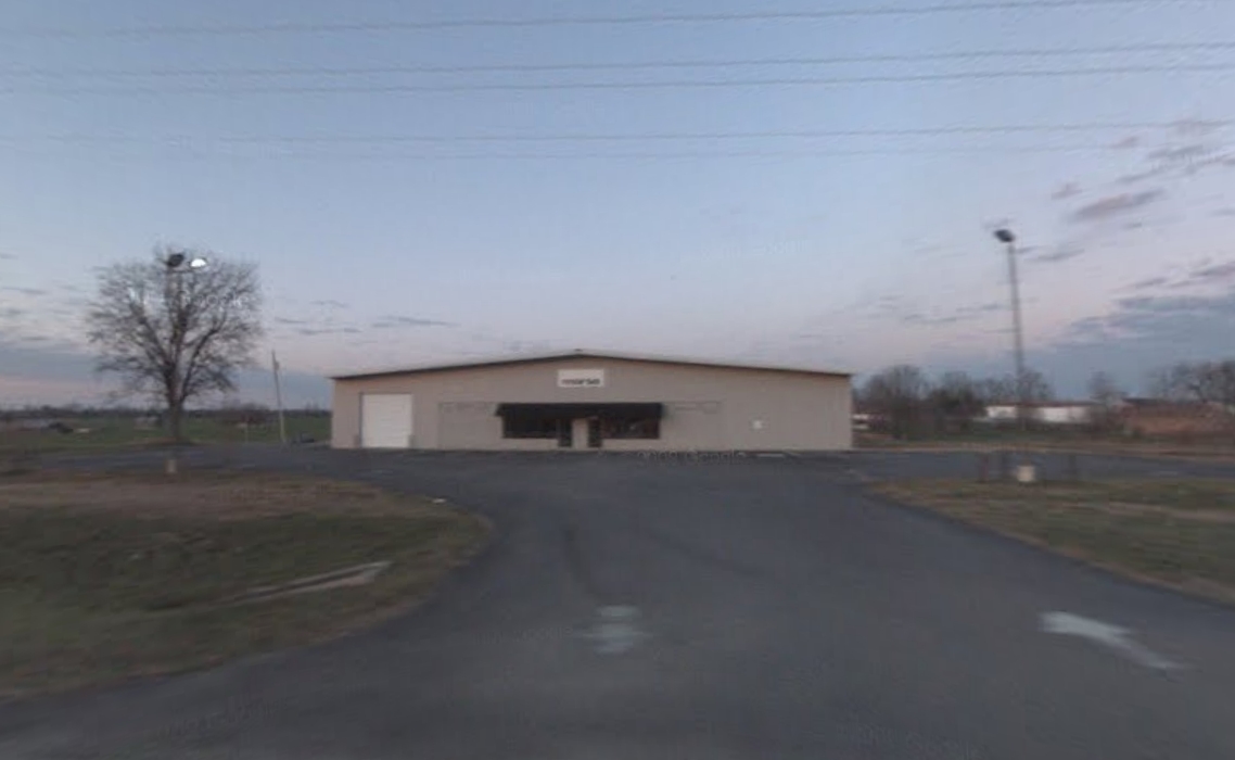
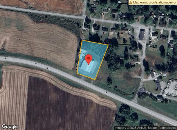
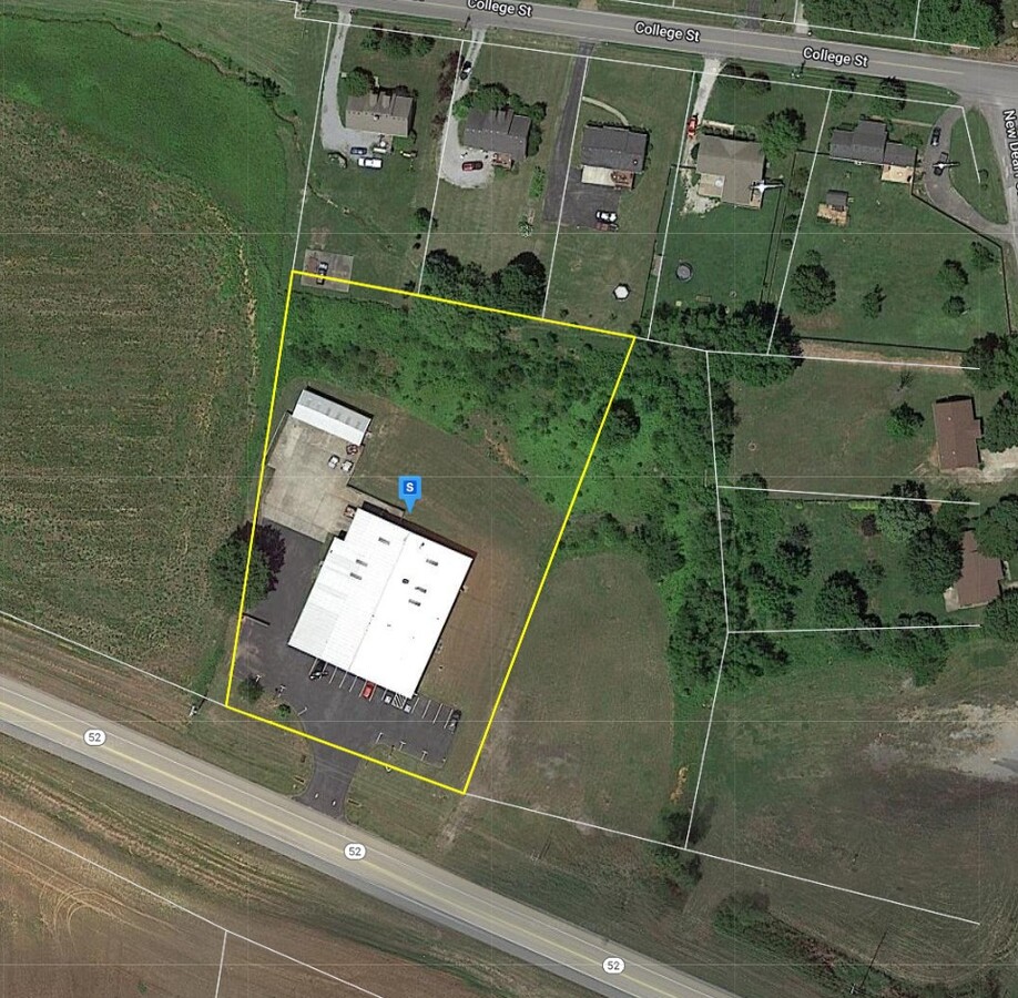
Property Record
1011 Highway 52 W, Portland, TN 37148
NEARBY LISTINGS FOR SALE OR LEASE
Property Detail
1011 Highway 52 W
Nashville-Davidson--Murfreesboro--Franklin, TN
Country Side Est Res
034-065.00
PLAT: 17-16 PAGE: 71-322 BLOCK: LOT: 1-1 SUBD: COUNTRY SIDE EST RESUB
Warehouse
Sumner
X
Tennessee
47165C0130G
1-1
2023
1.85 AC
2023
North
020206
Nashville
12,960 SF
DEMOGRAPHICS near 1011 Highway 52 W
1 Mile
3 Mile
5 Mile
2024 Total Population
2,117
7,367
19,727
2029 Population
2,349
8,191
21,927
Pop Growth 2024-2029
+ 10.96%
+ 11.19%
+ 11.15%
Average Age
37
38
39
2024 Total Households
748
2,660
7,252
HH Growth 2024-2029
+ 11.10%
+ 11.32%
+ 11.31%
Median Household Inc
$62,518
$54,319
$56,638
Avg Household Size
2.80
2.70
2.70
2024 Avg HH Vehicles
2.00
2.00
2.00
Median Home Value
$212,838
$225,914
$239,358
Median Year Built
1994
1993
1993
Nearby Places
- Restaurants
- Banks
- Shops
- Fitness
- Groceries
Nearby Properties
Address
Land Use
TOTAL SIZE
Lot Size
Zoning
Address
Land Use
TOTAL SIZE
Lot Size
Zoning
461,136 SF
27.54 AC
Address
Land Use
TOTAL SIZE
Lot Size
Zoning
19,366 SF
9.30 AC
Address
Land Use
TOTAL SIZE
Lot Size
Zoning
342,042 SF
26.32 AC
Address
Land Use
TOTAL SIZE
Lot Size
Zoning
645,082 SF
47.24 AC
HCD
Address
Land Use
TOTAL SIZE
Lot Size
Zoning
106,600 SF
6.32 AC
Address
Land Use
TOTAL SIZE
Lot Size
Zoning
105,696 SF
25 AC
Address
Land Use
TOTAL SIZE
Lot Size
Zoning
299,042 SF
29.30 AC
Address
Land Use
TOTAL SIZE
Lot Size
Zoning
82,580 SF
36.69 AC
Address
Land Use
TOTAL SIZE
Lot Size
Zoning
310,400 SF
15.69 AC
Address
Land Use
TOTAL SIZE
Lot Size
Zoning
236,884 SF
32.16 AC
Address
Land Use
TOTAL SIZE
Lot Size
Zoning
200,200 SF
9.81 AC
Address
Land Use
TOTAL SIZE
Lot Size
Zoning
25,757 SF
1.25 AC
Address
Land Use
TOTAL SIZE
Lot Size
Zoning
147,526 SF
27.12 AC
Address
Land Use
TOTAL SIZE
Lot Size
Zoning
170,465 SF
19.62 AC
Address
Land Use
TOTAL SIZE
Lot Size
Zoning
27,926 SF
6 AC
Address
Land Use
TOTAL SIZE
Lot Size
Zoning
166,500 SF
11.95 AC
Address
Land Use
TOTAL SIZE
Lot Size
Zoning
161,500 SF
16.14 AC
Address
Land Use
TOTAL SIZE
Lot Size
Zoning
26,360 SF
13.99 AC
Address
Land Use
TOTAL SIZE
Lot Size
Zoning
118,260 SF
10 AC
Address
Land Use
TOTAL SIZE
Lot Size
Zoning
191,404 SF
15.16 AC
Address
Land Use
TOTAL SIZE
Lot Size
Zoning
39,809 SF
3.11 AC
Address
Land Use
TOTAL SIZE
Lot Size
Zoning
70,473 SF
16.95 AC
Address
Land Use
TOTAL SIZE
Lot Size
Zoning
113,268 SF
15 AC
Address
Land Use
TOTAL SIZE
Lot Size
Zoning
117,250 SF
11.80 AC
Address
Land Use
TOTAL SIZE
Lot Size
Zoning
67,000 SF
9.80 AC
Address
Land Use
TOTAL SIZE
Lot Size
Zoning
1,498 SF
5.37 AC
Address
Land Use
TOTAL SIZE
Lot Size
Zoning
4,758 SF
2.62 AC
Address
Land Use
TOTAL SIZE
Lot Size
Zoning
1,344 SF
14.39 AC
Address
Land Use
TOTAL SIZE
Lot Size
Zoning
69,625 SF
14.79 AC
Address
Land Use
TOTAL SIZE
Lot Size
Zoning
3,640 SF
4 AC
The World's #1 Commercial Real Estate Marketplace
Connect with us
© 2025 CoStar Group
The information above has been obtained from sources believed reliable. While we do not doubt its accuracy we have not verified it and make no guarantee, warranty or representation about it. It is your responsibility to independently confirm its accuracy and completeness. Any projections, opinions, assumptions, or estimates used are for example only and do not represent the current or future performance of the property. The value of this transaction to you depends on tax and other factors which should be evaluated by your tax, financial, and legal advisors. You and your advisors should conduct a careful, independent investigation of the property to determine to your satisfaction the suitability of the property for your needs.