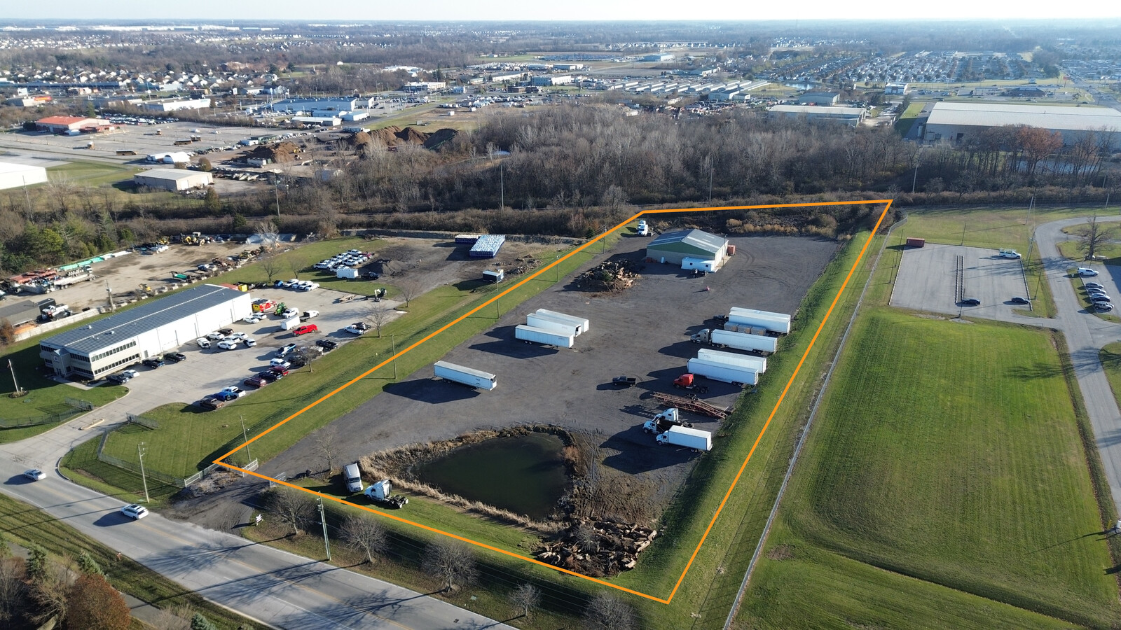
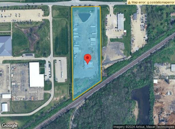
Property Record
10115 E 59Th St, Indianapolis, IN 46236
NEARBY LISTINGS FOR SALE OR LEASE
Property Detail
10115 E 59Th St
49-08-04-124-002.000-407
PT NW1/4 SW1/4 S4 T16 R5 BEG 474.54FT E OF NW CORE 300.7FT S 768.82FT SW 361.54FT N 969.54FT TOBEG 6AC
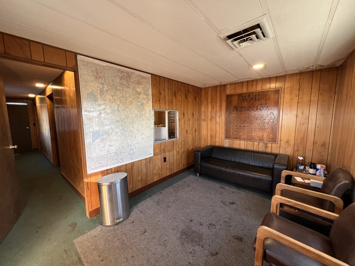
Warehouse
Marion
X
Indiana
18097C0180F
6 AC
2023
Fort Ben
2023
Indianapolis
330213
Indianapolis-Carmel-Anderson, IN
4,800 SF
DEMOGRAPHICS near 10115 E 59Th St
1 Mile
3 Mile
5 Mile
2024 Total Population
7,660
69,222
164,649
2029 Population
7,551
68,513
163,982
Pop Growth 2024-2029
(1.42%)
(1.02%)
(0.41%)
Average Age
40
36
37
2024 Total Households
3,168
26,020
64,121
HH Growth 2024-2029
(0.98%)
(1.04%)
(0.49%)
Median Household Inc
$57,347
$56,432
$62,190
Avg Household Size
2.40
2.60
2.50
2024 Avg HH Vehicles
2.00
2.00
2.00
Median Home Value
$163,105
$173,610
$197,792
Median Year Built
1995
1985
1981
Nearby Places
- Restaurants
- Banks
- Shops
- Fitness
- Groceries
PUBLIC TRANSPORTATION
AIRPORT
Indianapolis International
Drive
Walk
Distance
Indianapolis International
48 min
27.1 mi
Freight Ports
Port of Toledo
Drive
Walk
Distance
Port of Toledo
259 min
213.1 mi
SALE & LEASE HISTORY
LISTING DATE
SALE/LEASE

Feb 10, 2023
For Sale
Dec 05, 2023
For Lease
Nearby Properties
Address
Land Use
TOTAL SIZE
Lot Size
Zoning
Address
Land Use
TOTAL SIZE
Lot Size
Zoning
4217
7.36 AC
ZO01
Address
Land Use
TOTAL SIZE
Lot Size
Zoning
11154
21.99 AC
Address
Land Use
TOTAL SIZE
Lot Size
Zoning
532932
61.88 AC
ZO03
Address
Land Use
TOTAL SIZE
Lot Size
Zoning
129608
54.84 AC
ZO01
Address
Land Use
TOTAL SIZE
Lot Size
Zoning
65095
4.06 AC
ZO01
Address
Land Use
TOTAL SIZE
Lot Size
Zoning
136336
8.74 AC
ZO01
Address
Land Use
TOTAL SIZE
Lot Size
Zoning
293952
12.88 AC
ZO01
Address
Land Use
TOTAL SIZE
Lot Size
Zoning
6770
38.91 AC
Address
Land Use
TOTAL SIZE
Lot Size
Zoning
13087
57.88 AC
Address
Land Use
TOTAL SIZE
Lot Size
Zoning
1066
24.93 AC
Address
Land Use
TOTAL SIZE
Lot Size
Zoning
203720
21.44 AC
Address
Land Use
TOTAL SIZE
Lot Size
Zoning
109200
4.63 AC
ZO01
Address
Land Use
TOTAL SIZE
Lot Size
Zoning
53987
2.39 AC
ZO01
Address
Land Use
TOTAL SIZE
Lot Size
Zoning
206080
12.97 AC
ZO01
Address
Land Use
TOTAL SIZE
Lot Size
Zoning
81928
9.92 AC
ZO01
Address
Land Use
TOTAL SIZE
Lot Size
Zoning
3004
13.79 AC
Address
Land Use
TOTAL SIZE
Lot Size
Zoning
2556
35.56 AC
ZO01
Address
Land Use
TOTAL SIZE
Lot Size
Zoning
109925
9.23 AC
ZO01
Address
Land Use
TOTAL SIZE
Lot Size
Zoning
5430
10.29 AC
ZO01
Address
Land Use
TOTAL SIZE
Lot Size
Zoning
105252
9.96 AC
ZO01
Address
Land Use
TOTAL SIZE
Lot Size
Zoning
52263
4.08 AC
ZO01
Address
Land Use
TOTAL SIZE
Lot Size
Zoning
151107
18.64 AC
Address
Land Use
TOTAL SIZE
Lot Size
Zoning
59900
7.82 AC
ZO01
Address
Land Use
TOTAL SIZE
Lot Size
Zoning
62612
6.96 AC
Address
Land Use
TOTAL SIZE
Lot Size
Zoning
37082
2.53 AC
ZO01
Address
Land Use
TOTAL SIZE
Lot Size
Zoning
52800
5.28 AC
ZO01
Address
Land Use
TOTAL SIZE
Lot Size
Zoning
1.98 AC
ZO01
Address
Land Use
TOTAL SIZE
Lot Size
Zoning
64649
6.95 AC
ZO01
Address
Land Use
TOTAL SIZE
Lot Size
Zoning
201000
14.57 AC
ZO01
Address
Land Use
TOTAL SIZE
Lot Size
Zoning
3244
11.12 AC
ZO01
Start a new search to find other properties for sale or lease
Connect with us
© 2024 CoStar Group
The information above has been obtained from sources believed reliable. While we do not doubt its accuracy we have not verified it and make no guarantee, warranty or representation about it. It is your responsibility to independently confirm its accuracy and completeness. Any projections, opinions, assumptions, or estimates used are for example only and do not represent the current or future performance of the property. The value of this transaction to you depends on tax and other factors which should be evaluated by your tax, financial, and legal advisors. You and your advisors should conduct a careful, independent investigation of the property to determine to your satisfaction the suitability of the property for your needs.