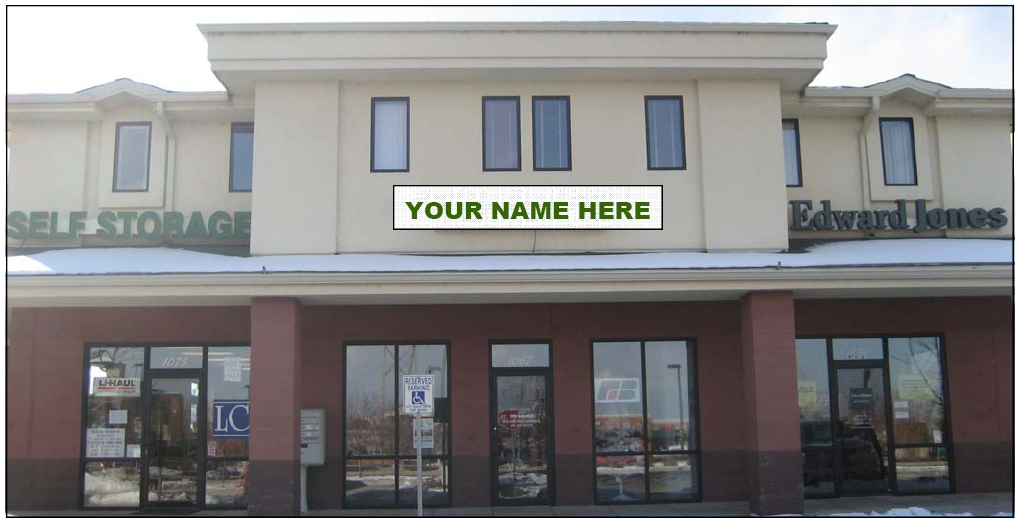
Property Record
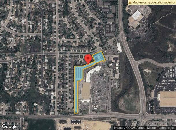
1019 Eagle Dr, Loveland, CO 80537

NEARBY LISTINGS FOR SALE OR LEASE
Property Detail
1019 Eagle Dr
95224-23-006
Thompson Valley 1St, Lov
Warehouse
TRACT F, THOMPSON VALLEY 1ST, LOV
X
Larimer
08069C1188F
Colorado
2023
3.49 AC
2025
Fort Collins/Loveland
002005
Denver
56,352 SF
Fort Collins, CO
DEMOGRAPHICS near 1019 Eagle Dr
1 Mile
3 Mile
5 Mile
2024 Total Population
8,506
45,309
87,925
2029 Population
8,859
47,480
92,649
Pop Growth 2024-2029
+ 4.15%
+ 4.79%
+ 5.37%
Average Age
40
43
43
2024 Total Households
3,422
19,405
36,507
HH Growth 2024-2029
+ 4.41%
+ 5.02%
+ 5.61%
Median Household Inc
$67,330
$72,417
$77,249
Avg Household Size
2.40
2.30
2.40
2024 Avg HH Vehicles
2.00
2.00
2.00
Median Home Value
$330,361
$410,298
$429,517
Median Year Built
1978
1978
1989
Nearby Places
- Restaurants
- Banks
- Shops
- Fitness
- Groceries
SALE & LEASE HISTORY
LISTING DATE
SALE/LEASE

Mar 16, 2017
For Lease
Apr 01, 2024
For Lease
Nearby Properties
Address
Land Use
TOTAL SIZE
Lot Size
Zoning
Address
Land Use
TOTAL SIZE
Lot Size
Zoning
201,500 SF
28.43 AC
R1E
Address
Land Use
TOTAL SIZE
Lot Size
Zoning
200,420 SF
41.52 AC
R1
Address
Land Use
TOTAL SIZE
Lot Size
Zoning
147,663 SF
5.01 AC
R3E
Address
Land Use
TOTAL SIZE
Lot Size
Zoning
96,723 SF
9.16 AC
I
Address
Land Use
TOTAL SIZE
Lot Size
Zoning
115,599 SF
13.15 AC
P38
Address
Land Use
TOTAL SIZE
Lot Size
Zoning
125,566 SF
8.27 AC
R3E
Address
Land Use
TOTAL SIZE
Lot Size
Zoning
137,432 SF
12.89 AC
B
Address
Land Use
TOTAL SIZE
Lot Size
Zoning
196,188 SF
13.26 AC
C
Address
Land Use
TOTAL SIZE
Lot Size
Zoning
296,360 SF
11.88 AC
B
Address
Land Use
TOTAL SIZE
Lot Size
Zoning
165,709 SF
10.52 AC
Address
Land Use
TOTAL SIZE
Lot Size
Zoning
83,954 SF
5.78 AC
FA
Address
Land Use
TOTAL SIZE
Lot Size
Zoning
269,696 SF
1.97 AC
Address
Land Use
TOTAL SIZE
Lot Size
Zoning
93,908 SF
28.86 AC
R1
Address
Land Use
TOTAL SIZE
Lot Size
Zoning
118,788 SF
14.01 AC
B
Address
Land Use
TOTAL SIZE
Lot Size
Zoning
137,950 SF
10.16 AC
Address
Land Use
TOTAL SIZE
Lot Size
Zoning
48,952 SF
6.38 AC
FA
Address
Land Use
TOTAL SIZE
Lot Size
Zoning
101,362 SF
4.80 AC
Address
Land Use
TOTAL SIZE
Lot Size
Zoning
43,646 SF
2.01 AC
Address
Land Use
TOTAL SIZE
Lot Size
Zoning
114,864 SF
0.71 AC
Address
Land Use
TOTAL SIZE
Lot Size
Zoning
62,966 SF
0.83 AC
Address
Land Use
TOTAL SIZE
Lot Size
Zoning
139,289 SF
23.55 AC
I
Address
Land Use
TOTAL SIZE
Lot Size
Zoning
59.21 AC
FA
Address
Land Use
TOTAL SIZE
Lot Size
Zoning
50,715 SF
10.23 AC
R1
Address
Land Use
TOTAL SIZE
Lot Size
Zoning
58,901 SF
3.64 AC
B
Address
Land Use
TOTAL SIZE
Lot Size
Zoning
34,430 SF
2.59 AC
B
Address
Land Use
TOTAL SIZE
Lot Size
Zoning
745,209 SF
63.03 AC
I
Address
Land Use
TOTAL SIZE
Lot Size
Zoning
65,755 SF
2.22 AC
Address
Land Use
TOTAL SIZE
Lot Size
Zoning
65,980 SF
3.04 AC
I
Address
Land Use
TOTAL SIZE
Lot Size
Zoning
37,928 SF
0.72 AC
Address
Land Use
TOTAL SIZE
Lot Size
Zoning
99,341 SF
0.31 AC
The World's #1 Commercial Real Estate Marketplace
Connect with us
© 2025 CoStar Group
The information above has been obtained from sources believed reliable. While we do not doubt its accuracy we have not verified it and make no guarantee, warranty or representation about it. It is your responsibility to independently confirm its accuracy and completeness. Any projections, opinions, assumptions, or estimates used are for example only and do not represent the current or future performance of the property. The value of this transaction to you depends on tax and other factors which should be evaluated by your tax, financial, and legal advisors. You and your advisors should conduct a careful, independent investigation of the property to determine to your satisfaction the suitability of the property for your needs.