Property Record
102 Everitts Rd, Ringoes, NJ 08551

NEARBY LISTINGS FOR SALE OR LEASE
-
-
No Photo
-
View all Ringoes listings for sale on LoopNet.com
Property Detail
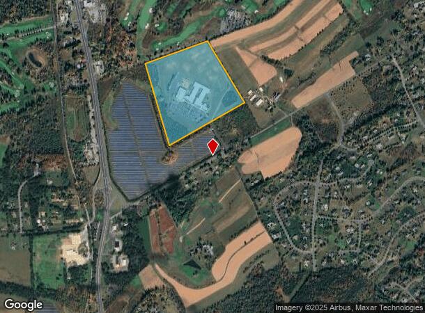
102 Everitts Rd
Newark, NJ-PA
Overall Site Improvement Plan
21-00080-0000-00030
ADDITIONAL LOTS: SOLAR FACILITY
Commercialnec
Hunterdon
X
New Jersey
34019C0353F
30
2023
72.39 AC
2024
Hunterdon
011305
Northern New Jersey
DEMOGRAPHICS near 102 Everitts Rd
1 Mile
3 Mile
5 Mile
2024 Total Population
960
15,478
32,938
2029 Population
974
15,642
33,541
Pop Growth 2024-2029
+ 1.46%
+ 1.06%
+ 1.83%
Average Age
42
44
43
2024 Total Households
300
6,062
12,437
HH Growth 2024-2029
+ 1.67%
+ 1.07%
+ 1.83%
Median Household Inc
$197,114
$108,736
$120,394
Avg Household Size
3.10
2.50
2.60
2024 Avg HH Vehicles
3.00
2.00
2.00
Median Home Value
$703,463
$446,232
$461,415
Median Year Built
1995
1984
1982
Nearby Places
- Restaurants
- Banks
- Shops
- Fitness
- Groceries
PUBLIC TRANSPORTATION
AIRPORT
Trenton Mercer
DRIVE
WALK
Distance
Trenton Mercer
30 min
17.1 mi
Freight Ports
Port of Philadelphia
DRIVE
WALK
Distance
Port of Philadelphia
67 min
39.5 mi
Nearby Properties
Address
Land Use
TOTAL SIZE
Lot Size
Zoning
Address
Land Use
TOTAL SIZE
Lot Size
Zoning
65.10 AC
I-1
Address
Land Use
TOTAL SIZE
Lot Size
Zoning
19.85 AC
B-2
Address
Land Use
TOTAL SIZE
Lot Size
Zoning
11.59 AC
B-2
Address
Land Use
TOTAL SIZE
Lot Size
Zoning
40 AC
AR-2
Address
Land Use
TOTAL SIZE
Lot Size
Zoning
20.89 AC
O/SS
Address
Land Use
TOTAL SIZE
Lot Size
Zoning
7.88 AC
CR
Address
Land Use
TOTAL SIZE
Lot Size
Zoning
12.75 AC
B-2
Address
Land Use
TOTAL SIZE
Lot Size
Zoning
5.47 AC
B-2
Address
Land Use
TOTAL SIZE
Lot Size
Zoning
6.16 AC
B-2
Address
Land Use
TOTAL SIZE
Lot Size
Zoning
7.75 AC
HR
Address
Land Use
TOTAL SIZE
Lot Size
Zoning
15,048 SF
5.61 AC
C-3
Address
Land Use
TOTAL SIZE
Lot Size
Zoning
4.33 AC
B-2
Address
Land Use
TOTAL SIZE
Lot Size
Zoning
12 AC
R-5
Address
Land Use
TOTAL SIZE
Lot Size
Zoning
9.94 AC
B-2
Address
Land Use
TOTAL SIZE
Lot Size
Zoning
2.64 AC
B-2
Address
Land Use
TOTAL SIZE
Lot Size
Zoning
12,160 SF
2.21 AC
GA
Address
Land Use
TOTAL SIZE
Lot Size
Zoning
31.35 AC
VAL
Address
Land Use
TOTAL SIZE
Lot Size
Zoning
6.57 AC
B-2
Address
Land Use
TOTAL SIZE
Lot Size
Zoning
10.40 AC
B-2
Address
Land Use
TOTAL SIZE
Lot Size
Zoning
300.85 AC
VAL
Address
Land Use
TOTAL SIZE
Lot Size
Zoning
1,176 SF
10 AC
VS
Address
Land Use
TOTAL SIZE
Lot Size
Zoning
5,407 SF
3.07 AC
HR
Address
Land Use
TOTAL SIZE
Lot Size
Zoning
5 AC
R-9
Address
Land Use
TOTAL SIZE
Lot Size
Zoning
Address
Land Use
TOTAL SIZE
Lot Size
Zoning
3.18 AC
B-2
Address
Land Use
TOTAL SIZE
Lot Size
Zoning
2.70 AC
B-2
Address
Land Use
TOTAL SIZE
Lot Size
Zoning
10.26 AC
B-2
Address
Land Use
TOTAL SIZE
Lot Size
Zoning
6,560 SF
1.90 AC
HR
Address
Land Use
TOTAL SIZE
Lot Size
Zoning
1.90 AC
VS
Address
Land Use
TOTAL SIZE
Lot Size
Zoning
3.50 AC
B-2
The World's #1 Commercial Real Estate Marketplace
Connect with us
© 2025 CoStar Group
The information above has been obtained from sources believed reliable. While we do not doubt its accuracy we have not verified it and make no guarantee, warranty or representation about it. It is your responsibility to independently confirm its accuracy and completeness. Any projections, opinions, assumptions, or estimates used are for example only and do not represent the current or future performance of the property. The value of this transaction to you depends on tax and other factors which should be evaluated by your tax, financial, and legal advisors. You and your advisors should conduct a careful, independent investigation of the property to determine to your satisfaction the suitability of the property for your needs.