Property Record
102 S Main St, Mansfield, OH 44902
NEARBY LISTINGS FOR SALE OR LEASE
-
-
View all Mansfield listings for sale on LoopNet.com
Property Detail
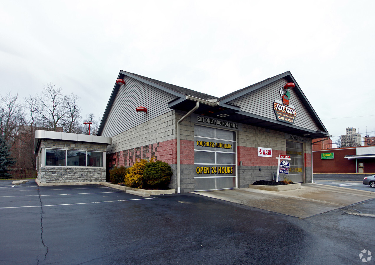
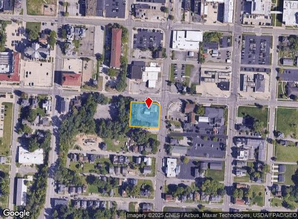
102 S Main St
027-01-025-17-000
City Of Mansfield
Carwashautomated
259 EX NE CORNER, 260 & N PT 261 130X180X150X160X128.28
X
Richland
39139C0144E
Ohio
2023
0.62 AC
2023
Richland County
000500
Cleveland
1,680 SF
Mansfield, OH
DEMOGRAPHICS near 102 S Main St
1 Mile
3 Mile
5 Mile
2024 Total Population
12,030
52,057
74,731
2029 Population
12,251
52,517
75,192
Pop Growth 2024-2029
+ 1.84%
+ 0.88%
+ 0.62%
Average Age
37
40
41
2024 Total Households
5,066
20,810
30,471
HH Growth 2024-2029
+ 1.84%
+ 0.91%
+ 0.62%
Median Household Inc
$26,186
$36,079
$42,968
Avg Household Size
2.20
2.10
2.20
2024 Avg HH Vehicles
1.00
1.00
2.00
Median Home Value
$64,578
$86,065
$119,935
Median Year Built
1948
1956
1961
Nearby Places
- Restaurants
- Banks
- Shops
- Fitness
- Groceries
SALE & LEASE HISTORY
LISTING DATE
SALE/LEASE

May 11, 2023
For Sale
Dec 09, 2022
For Sale
Nearby Properties
Address
Land Use
TOTAL SIZE
Lot Size
Zoning
Address
Land Use
TOTAL SIZE
Lot Size
Zoning
456.50 AC
Address
Land Use
TOTAL SIZE
Lot Size
Zoning
492,672 SF
6.83 AC
Address
Land Use
TOTAL SIZE
Lot Size
Zoning
114,931 SF
17.86 AC
Address
Land Use
TOTAL SIZE
Lot Size
Zoning
139,809 SF
0.99 AC
Address
Land Use
TOTAL SIZE
Lot Size
Zoning
0.06 AC
Address
Land Use
TOTAL SIZE
Lot Size
Zoning
148,135 SF
6.89 AC
Address
Land Use
TOTAL SIZE
Lot Size
Zoning
2.31 AC
Address
Land Use
TOTAL SIZE
Lot Size
Zoning
318,366 SF
26.16 AC
Address
Land Use
TOTAL SIZE
Lot Size
Zoning
92,587 SF
48.78 AC
Address
Land Use
TOTAL SIZE
Lot Size
Zoning
52.67 AC
Address
Land Use
TOTAL SIZE
Lot Size
Zoning
48,602 SF
14.66 AC
Address
Land Use
TOTAL SIZE
Lot Size
Zoning
32,728 SF
56.23 AC
Address
Land Use
TOTAL SIZE
Lot Size
Zoning
66,940 SF
12.40 AC
Address
Land Use
TOTAL SIZE
Lot Size
Zoning
1.69 AC
Address
Land Use
TOTAL SIZE
Lot Size
Zoning
76,069 SF
8 AC
Address
Land Use
TOTAL SIZE
Lot Size
Zoning
47.90 AC
Address
Land Use
TOTAL SIZE
Lot Size
Zoning
44,718 SF
0.47 AC
Address
Land Use
TOTAL SIZE
Lot Size
Zoning
30,306 SF
5.63 AC
Address
Land Use
TOTAL SIZE
Lot Size
Zoning
63,442 SF
5.51 AC
Address
Land Use
TOTAL SIZE
Lot Size
Zoning
161,297 SF
8.12 AC
Address
Land Use
TOTAL SIZE
Lot Size
Zoning
106,361 SF
5.06 AC
Address
Land Use
TOTAL SIZE
Lot Size
Zoning
88,556 SF
12.32 AC
Address
Land Use
TOTAL SIZE
Lot Size
Zoning
2,948 SF
10.62 AC
Address
Land Use
TOTAL SIZE
Lot Size
Zoning
53,034 SF
2.67 AC
Address
Land Use
TOTAL SIZE
Lot Size
Zoning
21,337 SF
11.30 AC
Address
Land Use
TOTAL SIZE
Lot Size
Zoning
82,695 SF
40.16 AC
Address
Land Use
TOTAL SIZE
Lot Size
Zoning
16,578 SF
8.23 AC
Address
Land Use
TOTAL SIZE
Lot Size
Zoning
31,064 SF
9 AC
Address
Land Use
TOTAL SIZE
Lot Size
Zoning
25,061 SF
4.30 AC
Address
Land Use
TOTAL SIZE
Lot Size
Zoning
71,606 SF
9.03 AC
The World's #1 Commercial Real Estate Marketplace
Connect with us
© 2025 CoStar Group
The information above has been obtained from sources believed reliable. While we do not doubt its accuracy we have not verified it and make no guarantee, warranty or representation about it. It is your responsibility to independently confirm its accuracy and completeness. Any projections, opinions, assumptions, or estimates used are for example only and do not represent the current or future performance of the property. The value of this transaction to you depends on tax and other factors which should be evaluated by your tax, financial, and legal advisors. You and your advisors should conduct a careful, independent investigation of the property to determine to your satisfaction the suitability of the property for your needs.