Property Record
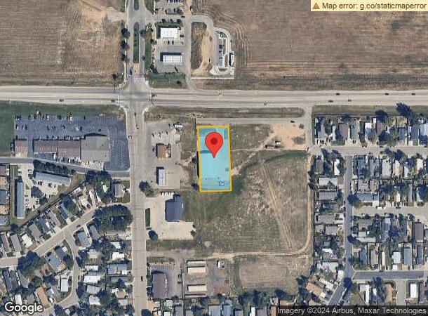
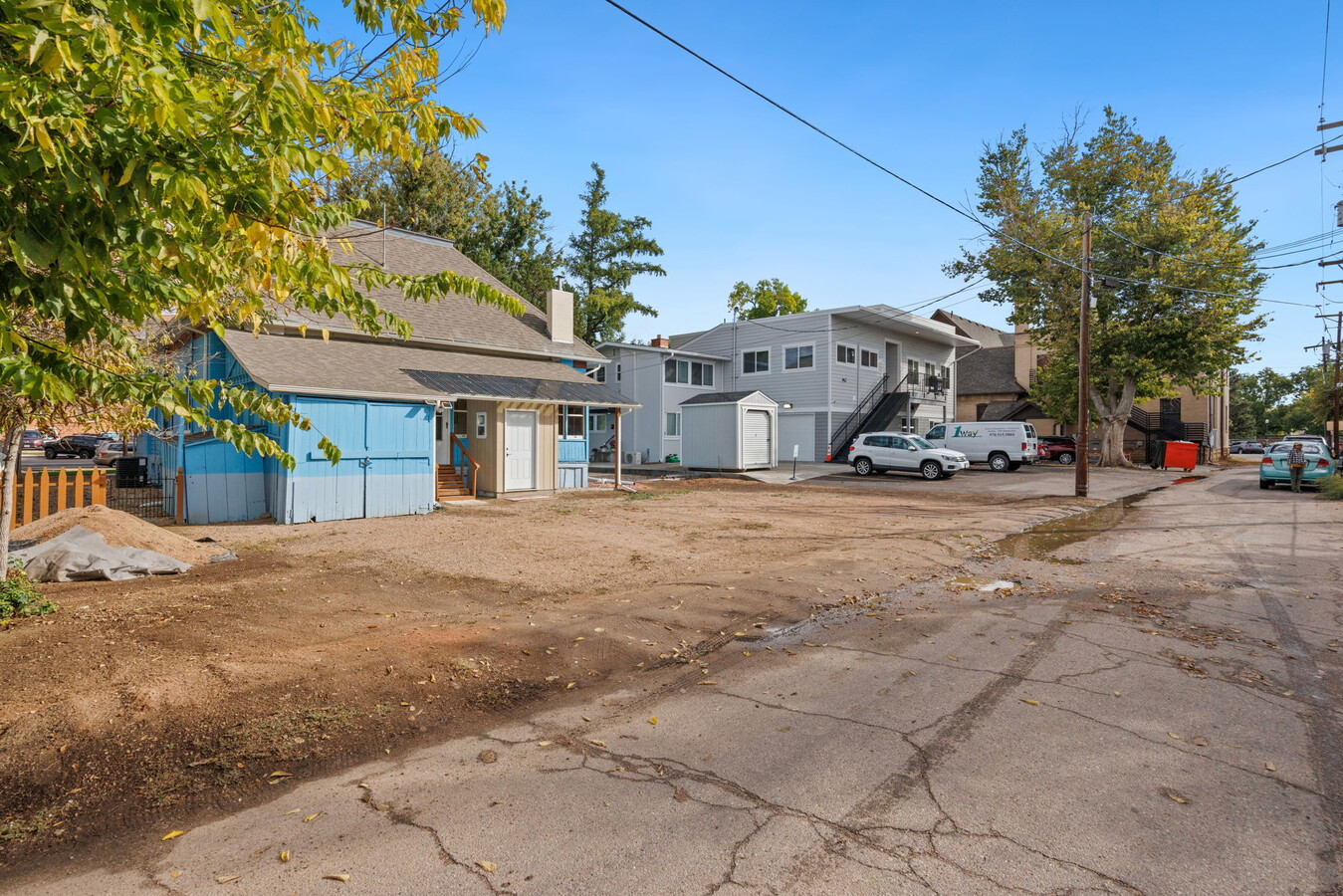
1020 8Th St, Dacono, CO 80514

NEARBY LISTINGS FOR SALE OR LEASE
-
-
View all Dacono listings for sale on LoopNet.com
Property Detail
1020 8Th St
Greeley, CO
H&T Sub Rplt L4
R2565903
DAC HTR L1 H & T RPLT L4
Commercialnec
Weld
X
Colorado
08123C2083E
1
2023
0.88 AC
2024
Weld County
002004
Denver
7,808 SF
DEMOGRAPHICS near 1020 8Th St
1 Mile
3 Mile
5 Mile
2024 Total Population
18,445
85,473
135,548
2029 Population
21,807
100,557
159,759
Pop Growth 2024-2029
+ 18.23%
+ 17.65%
+ 17.86%
Average Age
35
35
36
2024 Total Households
6,766
29,863
48,226
HH Growth 2024-2029
+ 19.05%
+ 18.51%
+ 18.61%
Median Household Inc
$43,595
$50,109
$59,942
Avg Household Size
2.50
2.70
2.70
2024 Avg HH Vehicles
2.00
2.00
2.00
Median Home Value
$288,845
$299,563
$330,058
Median Year Built
1965
1975
1985
Nearby Places
- Restaurants
- Banks
- Shops
- Fitness
- Groceries
PUBLIC TRANSPORTATION
AIRPORT
Denver International
DRIVE
WALK
Distance
Denver International
40 min
30.8 mi
Freight Ports
Tulsa Port Of Catoosa
DRIVE
WALK
Distance
Tulsa Port Of Catoosa
746 min
724.9 mi
SALE & LEASE HISTORY
LISTING DATE
SALE/LEASE

Oct 04, 2022
For Sale
Nearby Properties
Address
Land Use
TOTAL SIZE
Lot Size
Zoning
Address
Land Use
TOTAL SIZE
Lot Size
Zoning
326,357 SF
19.97 AC
Address
Land Use
TOTAL SIZE
Lot Size
Zoning
207,946 SF
28.52 AC
Address
Land Use
TOTAL SIZE
Lot Size
Zoning
69,399 SF
18.43 AC
Address
Land Use
TOTAL SIZE
Lot Size
Zoning
55,378 SF
9.60 AC
Address
Land Use
TOTAL SIZE
Lot Size
Zoning
109,252 SF
8.70 AC
Address
Land Use
TOTAL SIZE
Lot Size
Zoning
45,909 SF
20.52 AC
Address
Land Use
TOTAL SIZE
Lot Size
Zoning
50,046 SF
4.32 AC
Address
Land Use
TOTAL SIZE
Lot Size
Zoning
105,027 SF
86.37 AC
Address
Land Use
TOTAL SIZE
Lot Size
Zoning
81,827 SF
6.27 AC
Address
Land Use
TOTAL SIZE
Lot Size
Zoning
56,766 SF
5.94 AC
Address
Land Use
TOTAL SIZE
Lot Size
Zoning
129,209 SF
19.35 AC
Address
Land Use
TOTAL SIZE
Lot Size
Zoning
42,920 SF
3.24 AC
Address
Land Use
TOTAL SIZE
Lot Size
Zoning
22,204 SF
5.61 AC
Address
Land Use
TOTAL SIZE
Lot Size
Zoning
36,891 SF
4.05 AC
Address
Land Use
TOTAL SIZE
Lot Size
Zoning
38,129 SF
2.73 AC
Address
Land Use
TOTAL SIZE
Lot Size
Zoning
34,670 SF
3.59 AC
Address
Land Use
TOTAL SIZE
Lot Size
Zoning
20,616 SF
4.20 AC
Address
Land Use
TOTAL SIZE
Lot Size
Zoning
39,373 SF
20.52 AC
Address
Land Use
TOTAL SIZE
Lot Size
Zoning
35,656 SF
2.36 AC
Address
Land Use
TOTAL SIZE
Lot Size
Zoning
41,522 SF
6.75 AC
Address
Land Use
TOTAL SIZE
Lot Size
Zoning
17,000 SF
6.61 AC
Address
Land Use
TOTAL SIZE
Lot Size
Zoning
25,236 SF
2.85 AC
Address
Land Use
TOTAL SIZE
Lot Size
Zoning
26,000 SF
2.12 AC
Address
Land Use
TOTAL SIZE
Lot Size
Zoning
34,542 SF
2 AC
Address
Land Use
TOTAL SIZE
Lot Size
Zoning
47,250 SF
2.34 AC
Address
Land Use
TOTAL SIZE
Lot Size
Zoning
25,638 SF
3.01 AC
Address
Land Use
TOTAL SIZE
Lot Size
Zoning
28,204 SF
2 AC
Address
Land Use
TOTAL SIZE
Lot Size
Zoning
16,076 SF
2.03 AC
Address
Land Use
TOTAL SIZE
Lot Size
Zoning
12,316 SF
4.32 AC
Address
Land Use
TOTAL SIZE
Lot Size
Zoning
24,000 SF
2.13 AC
The World's #1 Commercial Real Estate Marketplace
Connect with us
© 2025 CoStar Group
The information above has been obtained from sources believed reliable. While we do not doubt its accuracy we have not verified it and make no guarantee, warranty or representation about it. It is your responsibility to independently confirm its accuracy and completeness. Any projections, opinions, assumptions, or estimates used are for example only and do not represent the current or future performance of the property. The value of this transaction to you depends on tax and other factors which should be evaluated by your tax, financial, and legal advisors. You and your advisors should conduct a careful, independent investigation of the property to determine to your satisfaction the suitability of the property for your needs.