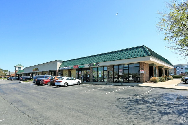
Property Record
1021 Independence Blvd, Virginia Beach, VA 23455


NEARBY LISTINGS FOR SALE OR LEASE
Property Detail
1021 Independence Blvd
Virginia Beach-Norfolk-Newport News, VA-NC
Bayside
1478-46-4114
BAYSIDE 16.840 ACRES
Regionalshoppingcenterormallwithanchorstore
Virginia Beach
X
Virginia
5155310082G
07a00
2024
16.84 AC
2025
Pembroke
040801
Hampton Roads
180,023 SF
DEMOGRAPHICS near 1021 Independence Blvd
1 Mile
3 Mile
5 Mile
2024 Total Population
11,632
105,009
226,204
2029 Population
11,511
104,296
223,994
Pop Growth 2024-2029
(1.04%)
(0.68%)
(0.98%)
Average Age
42
39
40
2024 Total Households
4,712
42,072
91,288
HH Growth 2024-2029
(1.15%)
(0.82%)
(1.11%)
Median Household Inc
$73,014
$71,363
$74,315
Avg Household Size
2.40
2.40
2.40
2024 Avg HH Vehicles
2.00
2.00
2.00
Median Home Value
$336,876
$306,037
$299,436
Median Year Built
1971
1980
1978
Nearby Places
Map Layers
Map Styles
 Street
 Aerial
- Restaurants
- Banks
- Shops
- Fitness
- Groceries
PUBLIC TRANSPORTATION
AIRPORT
Norfolk International
DRIVE
WALK
Distance
Norfolk International
15 min
7.0 mi
Newport News/Williamsburg International
DRIVE
WALK
Distance
Newport News/Williamsburg International
48 min
31.7 mi
Freight Ports
Virginia Port Authority - Portsmouth
DRIVE
WALK
Distance
Virginia Port Authority - Portsmouth
27 min
15.7 mi
SALE & LEASE HISTORY
LISTING DATE
SALE/LEASE

Sep 12, 2024
For Lease
Feb 28, 2017
For Lease
Nearby Properties
Address
Land Use
TOTAL SIZE
Lot Size
Zoning
Address
Land Use
TOTAL SIZE
Lot Size
Zoning
697,880 SF
200.35 AC
R15
Address
Land Use
TOTAL SIZE
Lot Size
Zoning
1 SF
42.35 AC
A18
Address
Land Use
TOTAL SIZE
Lot Size
Zoning
1 SF
24.56 AC
A18
Address
Land Use
TOTAL SIZE
Lot Size
Zoning
1,802 SF
14.40 AC
A24
Address
Land Use
TOTAL SIZE
Lot Size
Zoning
15.92 AC
A18
Address
Land Use
TOTAL SIZE
Lot Size
Zoning
15.12 AC
Address
Land Use
TOTAL SIZE
Lot Size
Zoning
9.62 AC
A36
Address
Land Use
TOTAL SIZE
Lot Size
Zoning
226,775 SF
13.14 AC
B2
Address
Land Use
TOTAL SIZE
Lot Size
Zoning
7.45 AC
B4
Address
Land Use
TOTAL SIZE
Lot Size
Zoning
18.61 AC
PDH2
Address
Land Use
TOTAL SIZE
Lot Size
Zoning
Address
Land Use
TOTAL SIZE
Lot Size
Zoning
301,631 SF
31.91 AC
I1
Address
Land Use
TOTAL SIZE
Lot Size
Zoning
210,872 SF
2.13 AC
B4
Address
Land Use
TOTAL SIZE
Lot Size
Zoning
246,500 SF
B3A
Address
Land Use
TOTAL SIZE
Lot Size
Zoning
1 SF
17.15 AC
A24
Address
Land Use
TOTAL SIZE
Lot Size
Zoning
12.85 AC
A24
Address
Land Use
TOTAL SIZE
Lot Size
Zoning
86,497 SF
1.56 AC
B3A
Address
Land Use
TOTAL SIZE
Lot Size
Zoning
490,047 SF
6.97 AC
A36
Address
Land Use
TOTAL SIZE
Lot Size
Zoning
242,732 SF
12.35 AC
B3
Address
Land Use
TOTAL SIZE
Lot Size
Zoning
210,987 SF
B3A
Address
Land Use
TOTAL SIZE
Lot Size
Zoning
Address
Land Use
TOTAL SIZE
Lot Size
Zoning
318,496 SF
13.79 AC
A18
Address
Land Use
TOTAL SIZE
Lot Size
Zoning
73,244 SF
11.60 AC
B4C
Address
Land Use
TOTAL SIZE
Lot Size
Zoning
1 SF
17.48 AC
A18
Address
Land Use
TOTAL SIZE
Lot Size
Zoning
1 SF
29.60 AC
A12
Address
Land Use
TOTAL SIZE
Lot Size
Zoning
7.46 AC
Address
Land Use
TOTAL SIZE
Lot Size
Zoning
1 SF
5.95 AC
B4
Address
Land Use
TOTAL SIZE
Lot Size
Zoning
194,852 SF
B3A
Address
Land Use
TOTAL SIZE
Lot Size
Zoning
1 SF
14.97 AC
A18
Address
Land Use
TOTAL SIZE
Lot Size
Zoning
1 SF
0.02 AC
A18
The World's #1 Commercial Real Estate Marketplace
Connect with us
© 2026 CoStar Group
The information above has been obtained from sources believed reliable. While we do not doubt its accuracy we have not verified it and make no guarantee, warranty or representation about it. It is your responsibility to independently confirm its accuracy and completeness. Any projections, opinions, assumptions, or estimates used are for example only and do not represent the current or future performance of the property. The value of this transaction to you depends on tax and other factors which should be evaluated by your tax, financial, and legal advisors. You and your advisors should conduct a careful, independent investigation of the property to determine to your satisfaction the suitability of the property for your needs.