Property Record
1025 Monarch St, Lexington, KY 40513
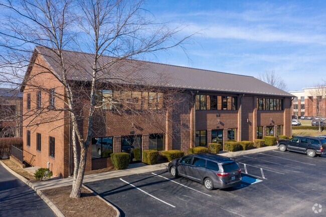

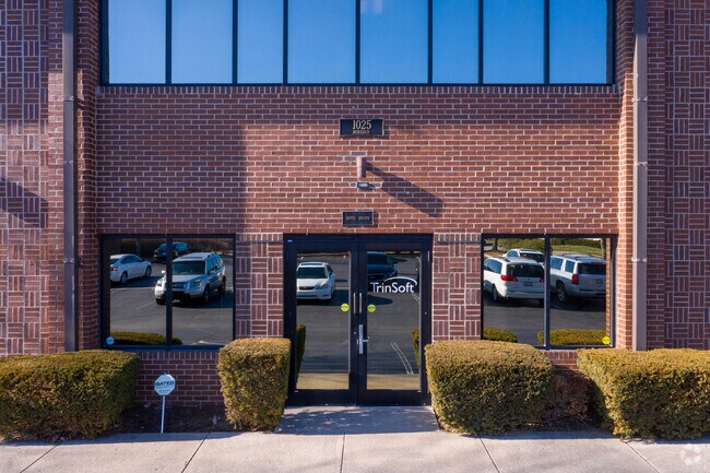
Property Detail
1025 Monarch St
19993070
K-546 LOT 2A; BOOK: 2169 PAGE: 502
Officebuilding
Fayette
P-1
Kentucky
B and X Area of moderate flood hazard, usually the area between the limits of the 100-year and 500-year floods.
2a
2025
0.58 AC
2025
West Lexington/Fayette
004208
Lexington/Fayette
8,000 SF
Lexington-Fayette, KY
NEARBY LISTINGS FOR SALE OR LEASE
DEMOGRAPHICS near 1025 Monarch St
1 mile
3 mile
5 mile
2025 Total Population
12,416
80,241
194,869
2030 Population
12,832
82,720
201,445
Pop Growth 2025-2030
+ 3.35%
+ 3.09%
+ 3.37%
Average Age
41
39
38
2025 Total Households
5,326
33,628
83,229
HH Growth 2025-2030
+ 3.59%
+ 3.34%
+ 3.70%
Median Household Inc
$82,605
$66,423
$64,243
Avg Household Size
2.30
2.30
2.20
2025 Avg HH Vehicles
2.00
2.00
2.00
Median Home Value
$337,914
$314,955
$318,952
Median Year Built
1976
1976
1978
Nearby Places
Map Layers
Map Styles
 Street
 Aerial
Transit
 Traffic
 Biking
Places
Listings with unknown addresses are not visible on the map
- Restaurants
- Banks
- Shops
- Fitness
- Groceries
PUBLIC TRANSPORTATION
AIRPORT
Blue Grass
Drive
Walk
Distance
Blue Grass
13 min
6.2 mi
SALE & LEASE HISTORY
LISTING DATE
SALE/LEASE

Nov 02, 2020
For Lease
Nearby Properties
Address
Land Use
TOTAL SIZE
Lot Size
Zoning
Address
Land Use
TOTAL SIZE
Lot Size
Zoning
635,961 SF
23.52 AC
P-1
Address
Land Use
TOTAL SIZE
Lot Size
Zoning
510,633 SF
15.10 AC
P-1
Address
Land Use
TOTAL SIZE
Lot Size
Zoning
372,139 SF
4.82 AC
R-4
Address
Land Use
TOTAL SIZE
Lot Size
Zoning
82.77 AC
R-4
Address
Land Use
TOTAL SIZE
Lot Size
Zoning
582.34 AC
A-U
Address
Land Use
TOTAL SIZE
Lot Size
Zoning
319,500 SF
0.25 AC
P-1
Address
Land Use
TOTAL SIZE
Lot Size
Zoning
318,370 SF
17.79 AC
B-6P
Address
Land Use
TOTAL SIZE
Lot Size
Zoning
292,730 SF
3.18 AC
R-1C
Address
Land Use
TOTAL SIZE
Lot Size
Zoning
648.54 AC
A-R
Address
Land Use
TOTAL SIZE
Lot Size
Zoning
394,590 SF
14.76 AC
R-4
Address
Land Use
TOTAL SIZE
Lot Size
Zoning
263,090 SF
37.66 AC
A-U
Address
Land Use
TOTAL SIZE
Lot Size
Zoning
144,866 SF
14.83 AC
B-6P
Address
Land Use
TOTAL SIZE
Lot Size
Zoning
238,393 SF
9.83 AC
B-6P
Address
Land Use
TOTAL SIZE
Lot Size
Zoning
134,783 SF
1.36 AC
B-1
Address
Land Use
TOTAL SIZE
Lot Size
Zoning
8,078 SF
10.61 AC
R-5
Address
Land Use
TOTAL SIZE
Lot Size
Zoning
384,037 SF
9.52 AC
P-1
Address
Land Use
TOTAL SIZE
Lot Size
Zoning
2,545 SF
14 AC
R-4
Address
Land Use
TOTAL SIZE
Lot Size
Zoning
9,774 SF
798.32 AC
A-R
Address
Land Use
TOTAL SIZE
Lot Size
Zoning
8,880 SF
7.39 AC
R-4
Address
Land Use
TOTAL SIZE
Lot Size
Zoning
63,509 SF
2.24 AC
B-1
Address
Land Use
TOTAL SIZE
Lot Size
Zoning
46,470 SF
4.91 AC
R-3
Address
Land Use
TOTAL SIZE
Lot Size
Zoning
2,968 SF
14.26 AC
R-3
Address
Land Use
TOTAL SIZE
Lot Size
Zoning
137,905 SF
23.79 AC
B-6P
Address
Land Use
TOTAL SIZE
Lot Size
Zoning
97,729 SF
4.22 AC
P-1
Address
Land Use
TOTAL SIZE
Lot Size
Zoning
10.41 AC
R-3
Address
Land Use
TOTAL SIZE
Lot Size
Zoning
14,292 SF
11.32 AC
R-4
Address
Land Use
TOTAL SIZE
Lot Size
Zoning
2,480 SF
9.12 AC
R-3
Address
Land Use
TOTAL SIZE
Lot Size
Zoning
23,042 SF
8.90 AC
R-4
Address
Land Use
TOTAL SIZE
Lot Size
Zoning
123,221 SF
17.32 AC
R-1B
Address
Land Use
TOTAL SIZE
Lot Size
Zoning
4,214 SF
741.62 AC
A-R
The World's #1 Commercial Real Estate Marketplace
Connect with us
© 2026 CoStar Group
The information above has been obtained from sources believed reliable. While we do not doubt its accuracy we have not verified it and make no guarantee, warranty or representation about it. It is your responsibility to independently confirm its accuracy and completeness. Any projections, opinions, assumptions, or estimates used are for example only and do not represent the current or future performance of the property. The value of this transaction to you depends on tax and other factors which should be evaluated by your tax, financial, and legal advisors. You and your advisors should conduct a careful, independent investigation of the property to determine to your satisfaction the suitability of the property for your needs.