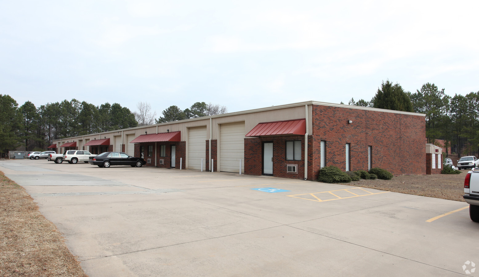
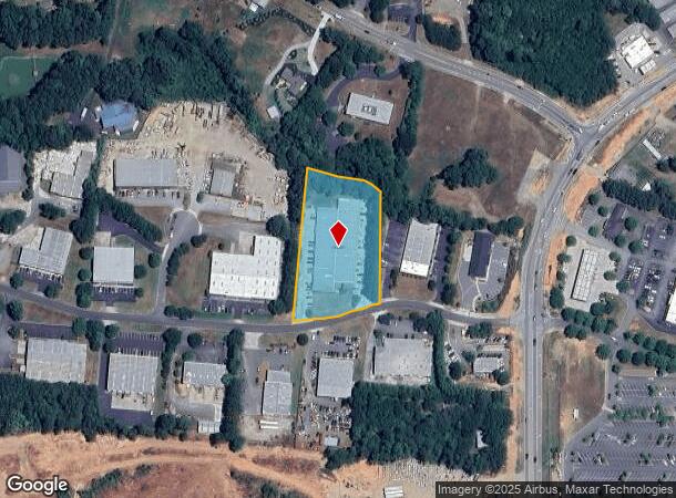
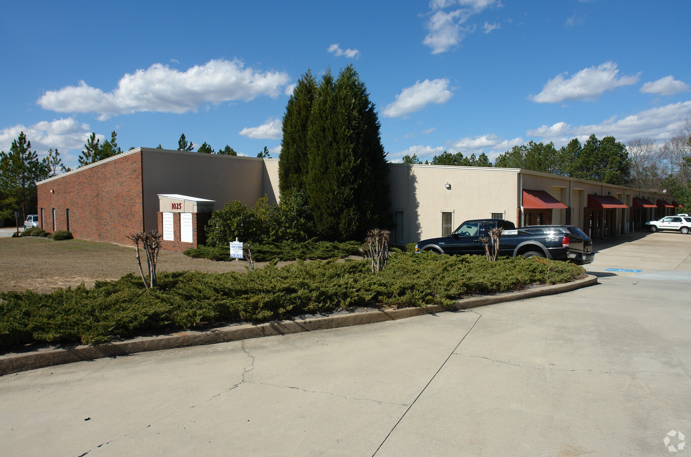
Property Record
1025 Nine North Dr, Alpharetta, GA 30004
NEARBY LISTINGS FOR SALE OR LEASE
Property Detail
1025 Nine North Dr
Atlanta-Sandy Springs-Roswell, GA
Ind Park
017-089
2-1 539 LOT 17 NINE/NORTH IND PARK
Industrialgeneral
Forsyth
X
Georgia
13121C0019G
17
2023
2.20 AC
2024
N Fulton/Forsyth Cnty
130601
Atlanta
24,840 SF
DEMOGRAPHICS near 1025 Nine North Dr
1 Mile
3 Mile
5 Mile
2024 Total Population
2,838
36,851
114,244
2029 Population
3,160
41,248
127,144
Pop Growth 2024-2029
+ 11.35%
+ 11.93%
+ 11.29%
Average Age
38
38
38
2024 Total Households
905
11,878
39,180
HH Growth 2024-2029
+ 11.82%
+ 12.11%
+ 11.17%
Median Household Inc
$163,901
$146,730
$133,158
Avg Household Size
3.10
3.00
2.90
2024 Avg HH Vehicles
2.00
2.00
2.00
Median Home Value
$620,215
$487,021
$484,373
Median Year Built
2003
2002
2003
Nearby Places
- Restaurants
- Banks
- Shops
- Fitness
- Groceries
SALE & LEASE HISTORY
LISTING DATE
SALE/LEASE

Sep 25, 2016
For Lease
May 02, 2018
For Lease
Nearby Properties
Address
Land Use
TOTAL SIZE
Lot Size
Zoning
Address
Land Use
TOTAL SIZE
Lot Size
Zoning
10,908 SF
107.57 AC
RES3
Address
Land Use
TOTAL SIZE
Lot Size
Zoning
119,926 SF
23.23 AC
M1
Address
Land Use
TOTAL SIZE
Lot Size
Zoning
64.48 AC
AG1
Address
Land Use
TOTAL SIZE
Lot Size
Zoning
83,161 SF
277.43 AC
A1
Address
Land Use
TOTAL SIZE
Lot Size
Zoning
207,663 SF
60.62 AC
R2R
Address
Land Use
TOTAL SIZE
Lot Size
Zoning
95,950 SF
14 AC
M1
Address
Land Use
TOTAL SIZE
Lot Size
Zoning
6.07 AC
MP
Address
Land Use
TOTAL SIZE
Lot Size
Zoning
124,700 SF
9.67 AC
M1
Address
Land Use
TOTAL SIZE
Lot Size
Zoning
73,120 SF
1.22 AC
AG1
Address
Land Use
TOTAL SIZE
Lot Size
Zoning
6,298 SF
87.14 AC
A1
Address
Land Use
TOTAL SIZE
Lot Size
Zoning
4,800 SF
28.71 AC
M1
Address
Land Use
TOTAL SIZE
Lot Size
Zoning
138,941 SF
26.40 AC
RES3
Address
Land Use
TOTAL SIZE
Lot Size
Zoning
217,056 SF
24.55 AC
CBD
Address
Land Use
TOTAL SIZE
Lot Size
Zoning
96,999 SF
10.93 AC
CBD
Address
Land Use
TOTAL SIZE
Lot Size
Zoning
97,820 SF
8.39 AC
M1
Address
Land Use
TOTAL SIZE
Lot Size
Zoning
111,102 SF
9.06 AC
M1
Address
Land Use
TOTAL SIZE
Lot Size
Zoning
116,648 SF
16.50 AC
M1
Address
Land Use
TOTAL SIZE
Lot Size
Zoning
66,756 SF
2.02 AC
C1
Address
Land Use
TOTAL SIZE
Lot Size
Zoning
52,173 SF
2.99 AC
CBD
Address
Land Use
TOTAL SIZE
Lot Size
Zoning
96,522 SF
5.80 AC
M1
Address
Land Use
TOTAL SIZE
Lot Size
Zoning
82,035 SF
12.32 AC
C1
Address
Land Use
TOTAL SIZE
Lot Size
Zoning
76,007 SF
6.44 AC
M1
Address
Land Use
TOTAL SIZE
Lot Size
Zoning
450 SF
97.50 AC
M1
Address
Land Use
TOTAL SIZE
Lot Size
Zoning
101,808 SF
2 AC
CBD
Address
Land Use
TOTAL SIZE
Lot Size
Zoning
76,800 SF
6.75 AC
M1
Address
Land Use
TOTAL SIZE
Lot Size
Zoning
81,508 SF
7.20 AC
M1
Address
Land Use
TOTAL SIZE
Lot Size
Zoning
69,380 SF
5 AC
M1
Address
Land Use
TOTAL SIZE
Lot Size
Zoning
151,980 SF
8.77 AC
M1
Address
Land Use
TOTAL SIZE
Lot Size
Zoning
181,540 SF
9.62 AC
M1
Address
Land Use
TOTAL SIZE
Lot Size
Zoning
45,088 SF
1.95 AC
CBD
The World's #1 Commercial Real Estate Marketplace
Connect with us
© 2025 CoStar Group
The information above has been obtained from sources believed reliable. While we do not doubt its accuracy we have not verified it and make no guarantee, warranty or representation about it. It is your responsibility to independently confirm its accuracy and completeness. Any projections, opinions, assumptions, or estimates used are for example only and do not represent the current or future performance of the property. The value of this transaction to you depends on tax and other factors which should be evaluated by your tax, financial, and legal advisors. You and your advisors should conduct a careful, independent investigation of the property to determine to your satisfaction the suitability of the property for your needs.