Property Record
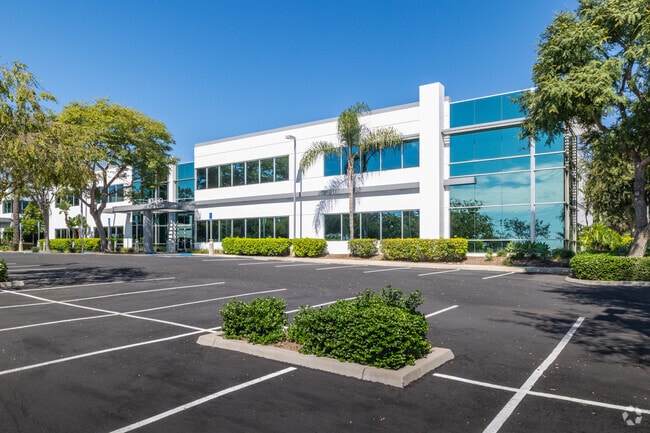
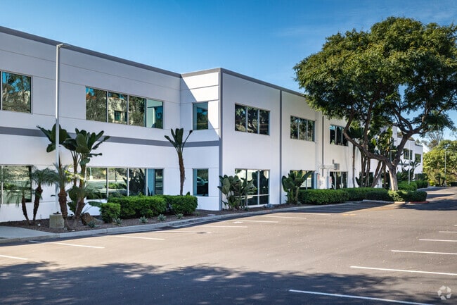
10260 Meanley Dr, San Diego, CA 92131

NEARBY LISTINGS FOR SALE OR LEASE
Property Detail
10260 Meanley Dr
319-170-38
P18964
Storemultistory
PAR 2 TR PM18964
X
San Diego
06073C1361G
California
2024
3.13 AC
2025
Scripps Ranch
017022
San Diego
45,448 SF
San Diego-Carlsbad, CA
DEMOGRAPHICS near 10260 Meanley Dr
1 Mile
3 Mile
5 Mile
2024 Total Population
15,916
112,333
196,116
2029 Population
16,037
111,314
194,285
Pop Growth 2024-2029
+ 0.76%
(0.91%)
(0.93%)
Average Age
38
39
39
2024 Total Households
6,440
36,504
64,964
HH Growth 2024-2029
+ 0.71%
(0.97%)
(1.03%)
Median Household Inc
$104,079
$120,371
$124,585
Avg Household Size
2.50
2.80
2.80
2024 Avg HH Vehicles
2.00
2.00
2.00
Median Home Value
$740,261
$803,072
$811,046
Median Year Built
1986
1986
1986
Nearby Places
Map Layers
Map Styles
 Street
 Aerial
- Restaurants
- Banks
- Shops
- Fitness
- Groceries
PUBLIC TRANSPORTATION
COMMUTER RAIL
Sorrento Valley (Coaster - San Diego North County Transit District (Coaster/Sprinter/Breeze))
DRIVE
WALK
Distance
Sorrento Valley (Coaster - San Diego North County Transit District (Coaster/Sprinter/Breeze))
17 min
9.3 mi
AIRPORT
San Diego International
DRIVE
WALK
Distance
San Diego International
24 min
15.4 mi
SALE & LEASE HISTORY
LISTING DATE
SALE/LEASE

Oct 03, 2016
For Lease
Mar 16, 2021
For Lease
Dec 09, 2024
For Sale
Nearby Properties
Address
Land Use
TOTAL SIZE
Lot Size
Zoning
Address
Land Use
TOTAL SIZE
Lot Size
Zoning
17.60 AC
RM-3-8
Address
Land Use
TOTAL SIZE
Lot Size
Zoning
34.29 AC
C
Address
Land Use
TOTAL SIZE
Lot Size
Zoning
6.96 AC
RM-1-1
Address
Land Use
TOTAL SIZE
Lot Size
Zoning
6.79 AC
IP-2-1
Address
Land Use
TOTAL SIZE
Lot Size
Zoning
16.24 AC
IP-2-1
Address
Land Use
TOTAL SIZE
Lot Size
Zoning
15,774 SF
16.97 AC
CC-1-3
Address
Land Use
TOTAL SIZE
Lot Size
Zoning
7.14 AC
RM-3-8
Address
Land Use
TOTAL SIZE
Lot Size
Zoning
5.98 AC
RM-3-8
Address
Land Use
TOTAL SIZE
Lot Size
Zoning
Address
Land Use
TOTAL SIZE
Lot Size
Zoning
Address
Land Use
TOTAL SIZE
Lot Size
Zoning
4.54 AC
RM-3-8
Address
Land Use
TOTAL SIZE
Lot Size
Zoning
3.01 AC
RM-3-8
Address
Land Use
TOTAL SIZE
Lot Size
Zoning
10.16 AC
CV-1-1
Address
Land Use
TOTAL SIZE
Lot Size
Zoning
5.26 AC
IP-2-1
Address
Land Use
TOTAL SIZE
Lot Size
Zoning
12.78 AC
IP-2-1
Address
Land Use
TOTAL SIZE
Lot Size
Zoning
8.18 AC
IP-2-1
Address
Land Use
TOTAL SIZE
Lot Size
Zoning
1.65 AC
IP-2-1
Address
Land Use
TOTAL SIZE
Lot Size
Zoning
2.18 AC
CC-1-3
Address
Land Use
TOTAL SIZE
Lot Size
Zoning
21.71 AC
RS-1-11
Address
Land Use
TOTAL SIZE
Lot Size
Zoning
8.56 AC
RM-2-5
Address
Land Use
TOTAL SIZE
Lot Size
Zoning
15.09 AC
IL-2-1
Address
Land Use
TOTAL SIZE
Lot Size
Zoning
1,269 SF
5.92 AC
RS-1-11
Address
Land Use
TOTAL SIZE
Lot Size
Zoning
3.04 AC
RM-3-8
Address
Land Use
TOTAL SIZE
Lot Size
Zoning
4.53 AC
IP-2-1
Address
Land Use
TOTAL SIZE
Lot Size
Zoning
81,493 SF
21.13 AC
CC-1-3
Address
Land Use
TOTAL SIZE
Lot Size
Zoning
5.75 AC
RM-3-7
Address
Land Use
TOTAL SIZE
Lot Size
Zoning
93,134 SF
4.54 AC
C
Address
Land Use
TOTAL SIZE
Lot Size
Zoning
5.55 AC
RM-3-7
Address
Land Use
TOTAL SIZE
Lot Size
Zoning
9 AC
IL-2-1
Address
Land Use
TOTAL SIZE
Lot Size
Zoning
87,146 SF
5.30 AC
RM-1-1
The World's #1 Commercial Real Estate Marketplace
Connect with us
© 2025 CoStar Group
The information above has been obtained from sources believed reliable. While we do not doubt its accuracy we have not verified it and make no guarantee, warranty or representation about it. It is your responsibility to independently confirm its accuracy and completeness. Any projections, opinions, assumptions, or estimates used are for example only and do not represent the current or future performance of the property. The value of this transaction to you depends on tax and other factors which should be evaluated by your tax, financial, and legal advisors. You and your advisors should conduct a careful, independent investigation of the property to determine to your satisfaction the suitability of the property for your needs.