Property Record
1029 Se State Road 100, Keystone Heights, FL 32656

NEARBY LISTINGS FOR SALE OR LEASE
-
-
View all Keystone Heights listings for sale on LoopNet.com
Property Detail
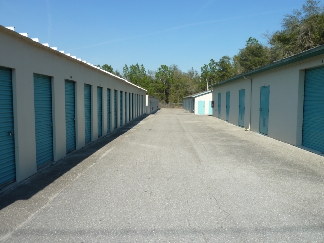
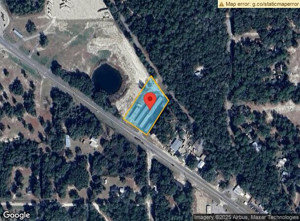
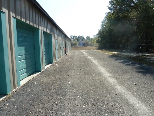
1029 Se State Road 100
05552-0-00000
Mount Pleasant/Silver Lake #8
Warehouse
13 8S 22 COM SE COR TRACT 8. S55*0257E 12.35 TO POB. RUN N55*0257W 115, N34*5703E 310.09 TO S R/W GS&F RR, RUN S36*2244E 121.38, S34*5703W 271.24 TO POB. BEING PARCEL D. ALSO: COM SE COR OF TRACT 8. N55*0257W 102.65, THENCE N55*0257W 90, N34*5703E 34
A
Bradford
12001C0220E
Florida
2024
2.17 AC
2024
Florida Central North Area
000301
Other Market Areas
15,388 SF
DEMOGRAPHICS near 1029 Se State Road 100
1 Mile
3 Mile
5 Mile
2024 Total Population
1,168
7,895
14,243
2029 Population
1,229
8,539
15,509
Pop Growth 2024-2029
+ 5.22%
+ 8.16%
+ 8.89%
Average Age
44
44
44
2024 Total Households
466
3,159
5,748
HH Growth 2024-2029
+ 4.72%
+ 7.82%
+ 8.61%
Median Household Inc
$48,653
$49,564
$57,330
Avg Household Size
2.40
2.50
2.40
2024 Avg HH Vehicles
2.00
2.00
2.00
Median Home Value
$149,629
$193,607
$194,570
Median Year Built
1975
1979
1982
Nearby Places
- Restaurants
- Banks
- Shops
- Fitness
- Groceries
PUBLIC TRANSPORTATION
AIRPORT
Gainesville Regional
DRIVE
WALK
Distance
Gainesville Regional
39 min
23.0 mi
Freight Ports
Jacksonville Port
DRIVE
WALK
Distance
Jacksonville Port
80 min
59.6 mi
Nearby Properties
Address
Land Use
TOTAL SIZE
Lot Size
Zoning
Address
Land Use
TOTAL SIZE
Lot Size
Zoning
23,953 SF
228.32 AC
Address
Land Use
TOTAL SIZE
Lot Size
Zoning
56,278 SF
39.66 AC
Address
Land Use
TOTAL SIZE
Lot Size
Zoning
68,670 SF
10 AC
Address
Land Use
TOTAL SIZE
Lot Size
Zoning
116,370 SF
23.88 AC
PS-5
Address
Land Use
TOTAL SIZE
Lot Size
Zoning
52,626 SF
28.21 AC
Address
Land Use
TOTAL SIZE
Lot Size
Zoning
61,803 SF
18.29 AC
Address
Land Use
TOTAL SIZE
Lot Size
Zoning
60,351 SF
11.58 AC
Address
Land Use
TOTAL SIZE
Lot Size
Zoning
123,219 SF
121 AC
Address
Land Use
TOTAL SIZE
Lot Size
Zoning
42,928 SF
4.69 AC
Address
Land Use
TOTAL SIZE
Lot Size
Zoning
13,346 SF
622.95 AC
Address
Land Use
TOTAL SIZE
Lot Size
Zoning
26,203 SF
0.80 AC
Address
Land Use
TOTAL SIZE
Lot Size
Zoning
43,696 SF
14.90 AC
Address
Land Use
TOTAL SIZE
Lot Size
Zoning
22,485 SF
110 AC
Address
Land Use
TOTAL SIZE
Lot Size
Zoning
36,867 SF
127 AC
Address
Land Use
TOTAL SIZE
Lot Size
Zoning
30,198 SF
140 AC
Address
Land Use
TOTAL SIZE
Lot Size
Zoning
63,693 SF
9.65 AC
Address
Land Use
TOTAL SIZE
Lot Size
Zoning
21,704 SF
8.45 AC
Address
Land Use
TOTAL SIZE
Lot Size
Zoning
14,736 SF
2.12 AC
Address
Land Use
TOTAL SIZE
Lot Size
Zoning
8,266 SF
1.20 AC
Address
Land Use
TOTAL SIZE
Lot Size
Zoning
13,000 SF
2.24 AC
RB
Address
Land Use
TOTAL SIZE
Lot Size
Zoning
33,258 SF
5.34 AC
Address
Land Use
TOTAL SIZE
Lot Size
Zoning
10,115 SF
0.92 AC
PO-1
Address
Land Use
TOTAL SIZE
Lot Size
Zoning
25,442 SF
36.61 AC
Address
Land Use
TOTAL SIZE
Lot Size
Zoning
492.81 AC
Address
Land Use
TOTAL SIZE
Lot Size
Zoning
4,625 SF
1.84 AC
Address
Land Use
TOTAL SIZE
Lot Size
Zoning
7,532 SF
1.06 AC
Address
Land Use
TOTAL SIZE
Lot Size
Zoning
2,485 SF
2.43 AC
Address
Land Use
TOTAL SIZE
Lot Size
Zoning
3,133 SF
1.65 AC
Address
Land Use
TOTAL SIZE
Lot Size
Zoning
15,800 SF
2.47 AC
Address
Land Use
TOTAL SIZE
Lot Size
Zoning
9,146 SF
1.52 AC
The World's #1 Commercial Real Estate Marketplace
Connect with us
© 2025 CoStar Group
The information above has been obtained from sources believed reliable. While we do not doubt its accuracy we have not verified it and make no guarantee, warranty or representation about it. It is your responsibility to independently confirm its accuracy and completeness. Any projections, opinions, assumptions, or estimates used are for example only and do not represent the current or future performance of the property. The value of this transaction to you depends on tax and other factors which should be evaluated by your tax, financial, and legal advisors. You and your advisors should conduct a careful, independent investigation of the property to determine to your satisfaction the suitability of the property for your needs.