Property Record
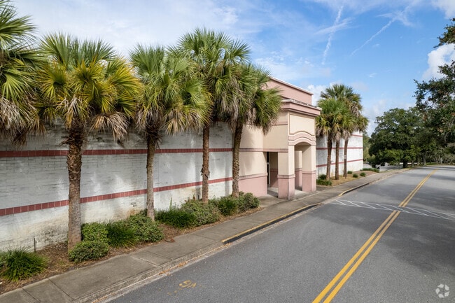
10300 Southside Blvd, Jacksonville, FL 32256


Property Detail
10300 Southside Blvd
155494-1055
01-4S-27E 58.85 PT SW1/4,PT GOVT LOTS 1,2,3,PT 51, 55-4S-27E RECD O/R 7493-806 (EX PT RECD O/R 18551-22)
Regionalshoppingcenterormallwithanchorstore
Duval
PUD
Florida
AE The base floodplain where base flood elevations are provided. AE Zones are now used on new format FIRMs instead of A1-A30 Zones.
1,2,3
2025
58.85 AC
2026
Butler/Baymeadows
015922
Jacksonville (Florida)
810,921 SF
Jacksonville, FL
NEARBY LISTINGS FOR SALE OR LEASE
DEMOGRAPHICS near 10300 Southside Blvd
1 mile
3 mile
5 mile
2025 Total Population
3,546
56,731
167,451
2030 Population
3,766
60,177
177,801
Pop Growth 2025-2030
+ 6.20%
+ 6.07%
+ 6.18%
Average Age
41
39
40
2025 Total Households
1,416
24,055
72,870
HH Growth 2025-2030
+ 6.00%
+ 6.38%
+ 6.42%
Median Household Inc
$95,628
$82,301
$82,527
Avg Household Size
2.30
2.30
2.20
2025 Avg HH Vehicles
2.00
2.00
2.00
Median Home Value
$459,340
$384,064
$371,235
Median Year Built
1996
1992
1996
Nearby Places
Map Layers
Map Styles
 Street
 Aerial
Layers
 Traffic
 Biking
Places
Listings with unknown addresses are not visible on the map
- Restaurants
- Banks
- Shops
- Fitness
- Groceries
PUBLIC TRANSPORTATION
AIRPORT
Jacksonville International
Drive
Walk
Distance
Jacksonville International
40 min
27.9 mi
Freight Ports
Jacksonville Port
Drive
Walk
Distance
Jacksonville Port
25 min
16.4 mi
Nearby Properties
Address
Land Use
TOTAL SIZE
Lot Size
Zoning
Address
Land Use
TOTAL SIZE
Lot Size
Zoning
1,159,855 SF
89.44 AC
RMD-D
Address
Land Use
TOTAL SIZE
Lot Size
Zoning
1,013,318 SF
131.30 AC
PUD
Address
Land Use
TOTAL SIZE
Lot Size
Zoning
733,373 SF
18.30 AC
PUD
Address
Land Use
TOTAL SIZE
Lot Size
Zoning
345,678 SF
30.40 AC
PUD
Address
Land Use
TOTAL SIZE
Lot Size
Zoning
271,074 SF
17.77 AC
PUD
Address
Land Use
TOTAL SIZE
Lot Size
Zoning
358,537 SF
29.16 AC
RMD-C
Address
Land Use
TOTAL SIZE
Lot Size
Zoning
367,197 SF
42.36 AC
RMD-B
Address
Land Use
TOTAL SIZE
Lot Size
Zoning
266,087 SF
35.07 AC
RMD-D
Address
Land Use
TOTAL SIZE
Lot Size
Zoning
215,287 SF
29.59 AC
PUD
Address
Land Use
TOTAL SIZE
Lot Size
Zoning
365,629 SF
23.23 AC
RMD-D
Address
Land Use
TOTAL SIZE
Lot Size
Zoning
584,972 SF
17.76 AC
PUD
Address
Land Use
TOTAL SIZE
Lot Size
Zoning
273,616 SF
34.49 AC
RMD-B
Address
Land Use
TOTAL SIZE
Lot Size
Zoning
307,396 SF
24.45 AC
PUD
Address
Land Use
TOTAL SIZE
Lot Size
Zoning
348,919 SF
18.08 AC
RMD-D
Address
Land Use
TOTAL SIZE
Lot Size
Zoning
330,037 SF
28.33 AC
RMD-C
Address
Land Use
TOTAL SIZE
Lot Size
Zoning
237,625 SF
29.34 AC
RMD-B
Address
Land Use
TOTAL SIZE
Lot Size
Zoning
310,849 SF
16.16 AC
RMD-C
Address
Land Use
TOTAL SIZE
Lot Size
Zoning
485,498 SF
12.25 AC
PUD
Address
Land Use
TOTAL SIZE
Lot Size
Zoning
250,507 SF
26.01 AC
PUD
Address
Land Use
TOTAL SIZE
Lot Size
Zoning
387,425 SF
32.10 AC
IBP
Address
Land Use
TOTAL SIZE
Lot Size
Zoning
236,617 SF
16.38 AC
RMD-D
Address
Land Use
TOTAL SIZE
Lot Size
Zoning
265,806 SF
29.84 AC
RMD-B
Address
Land Use
TOTAL SIZE
Lot Size
Zoning
304,277 SF
25.03 AC
CCG-2
Address
Land Use
TOTAL SIZE
Lot Size
Zoning
279,438 SF
20.25 AC
RMD-B
Address
Land Use
TOTAL SIZE
Lot Size
Zoning
230,730 SF
42.22 AC
PBF-2
Address
Land Use
TOTAL SIZE
Lot Size
Zoning
101,132 SF
4.75 AC
PUD
Address
Land Use
TOTAL SIZE
Lot Size
Zoning
213,374 SF
14.77 AC
PUD
Address
Land Use
TOTAL SIZE
Lot Size
Zoning
195,017 SF
12.66 AC
RMD-D
Address
Land Use
TOTAL SIZE
Lot Size
Zoning
148,931 SF
16.93 AC
RMD-D
The World's #1 Commercial Real Estate Marketplace
Connect with us
© 2026 CoStar Group
The information above has been obtained from sources believed reliable. While we do not doubt its accuracy we have not verified it and make no guarantee, warranty or representation about it. It is your responsibility to independently confirm its accuracy and completeness. Any projections, opinions, assumptions, or estimates used are for example only and do not represent the current or future performance of the property. The value of this transaction to you depends on tax and other factors which should be evaluated by your tax, financial, and legal advisors. You and your advisors should conduct a careful, independent investigation of the property to determine to your satisfaction the suitability of the property for your needs.