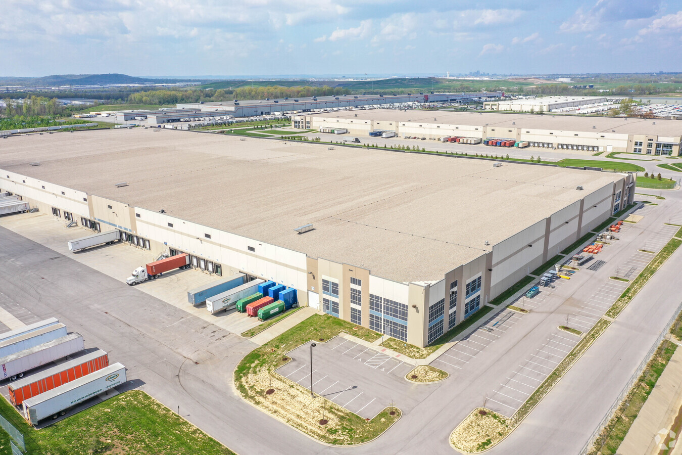
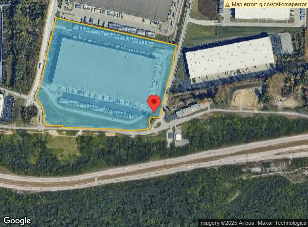
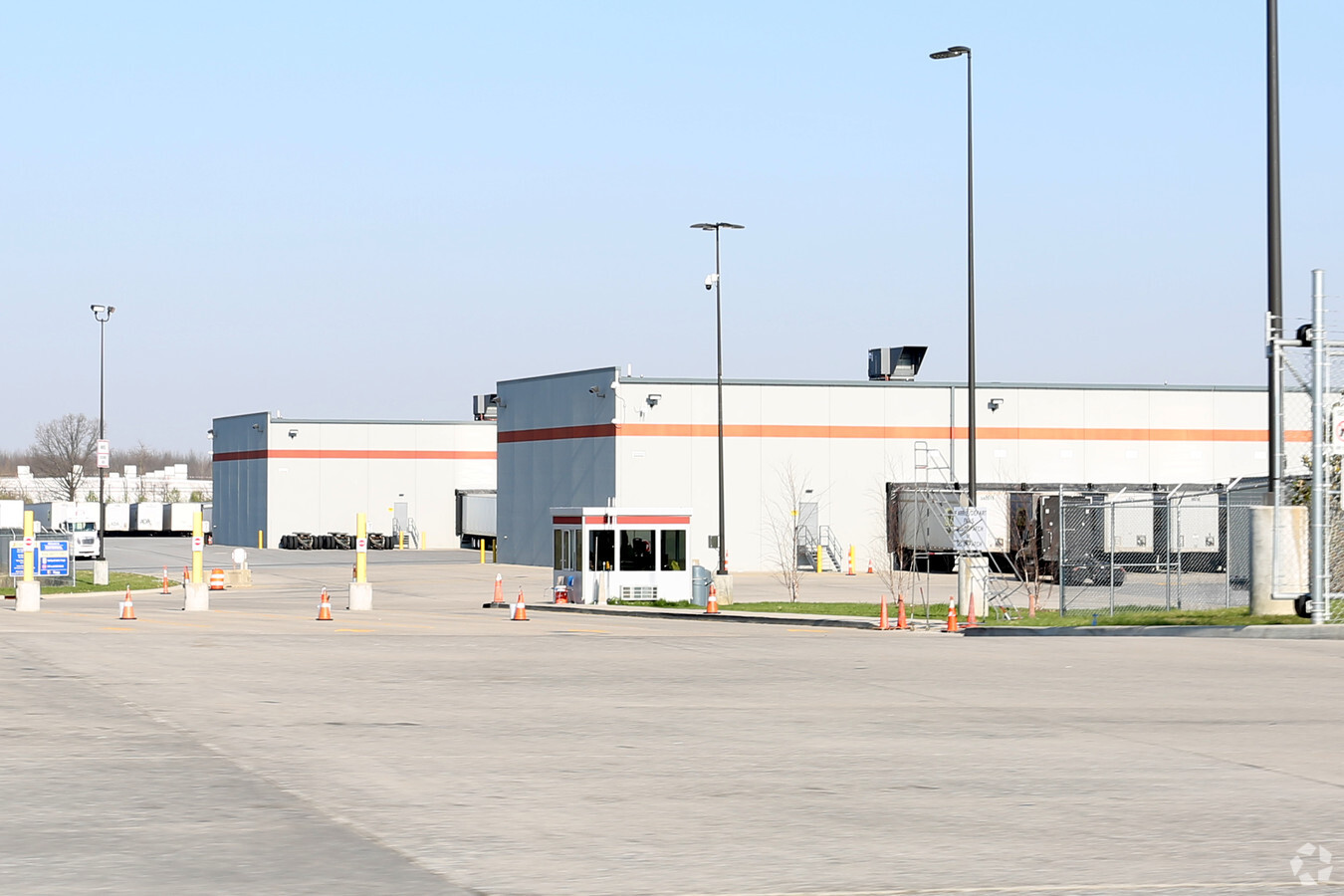
Property Record
10301 Air Commerce Dr, Louisville, KY 40219
NEARBY LISTINGS FOR SALE OR LEASE
Property Detail
10301 Air Commerce Dr
Louisville-Jefferson County, KY-IN
Plat Of Air Commerce Drive Extension
064905480000
40.306 AC TRACT 11 PER PLAT DB 10992 X 33 ES AIR COMMERCE DR & SOUTH PARK RD
Warehouse
Jefferson
X
Kentucky
21111C0109F
30.42 AC
2024
South Central
2024
Louisville
011901
DEMOGRAPHICS near 10301 Air Commerce Dr
1 Mile
3 Mile
5 Mile
2024 Total Population
1,321
41,679
140,728
2029 Population
1,326
41,644
140,265
Pop Growth 2024-2029
+ 0.38%
(0.08%)
(0.33%)
Average Age
31
38
39
2024 Total Households
421
16,664
55,023
HH Growth 2024-2029
+ 0.24%
(0.17%)
(0.40%)
Median Household Inc
$36,532
$53,646
$55,721
Avg Household Size
3.10
2.40
2.50
2024 Avg HH Vehicles
1.00
2.00
2.00
Median Home Value
$57,499
$149,284
$162,679
Median Year Built
1986
1975
1972
Nearby Places
- Restaurants
- Banks
- Shops
- Fitness
- Groceries
PUBLIC TRANSPORTATION
AIRPORT
Louisville Muhammad Ali International
DRIVE
WALK
Distance
Louisville Muhammad Ali International
17 min
6.3 mi
Freight Ports
Port of Toledo
DRIVE
WALK
Distance
Port of Toledo
372 min
314.3 mi
SALE & LEASE HISTORY
LISTING DATE
SALE/LEASE

Sep 19, 2017
For Lease
Nearby Properties
Address
Land Use
TOTAL SIZE
Lot Size
Zoning
Address
Land Use
TOTAL SIZE
Lot Size
Zoning
226,400 SF
150.18 AC
EZ1-ENTERP
Address
Land Use
TOTAL SIZE
Lot Size
Zoning
109.84 AC
R5-RESIDEN
Address
Land Use
TOTAL SIZE
Lot Size
Zoning
257,385 SF
176.30 AC
Address
Land Use
TOTAL SIZE
Lot Size
Zoning
61.37 AC
C2-COMMERC
Address
Land Use
TOTAL SIZE
Lot Size
Zoning
15 AC
C2-COMMERC
Address
Land Use
TOTAL SIZE
Lot Size
Zoning
221,115 SF
97.92 AC
EZ1-ENTERP
Address
Land Use
TOTAL SIZE
Lot Size
Zoning
34.73 AC
Address
Land Use
TOTAL SIZE
Lot Size
Zoning
22.14 AC
EZ1-ENTERP
Address
Land Use
TOTAL SIZE
Lot Size
Zoning
822,500 SF
44.75 AC
EZ1-ENTERP
Address
Land Use
TOTAL SIZE
Lot Size
Zoning
39.61 AC
Address
Land Use
TOTAL SIZE
Lot Size
Zoning
35 AC
C2-COMMERC
Address
Land Use
TOTAL SIZE
Lot Size
Zoning
22.40 AC
Address
Land Use
TOTAL SIZE
Lot Size
Zoning
679,250 SF
35.34 AC
Address
Land Use
TOTAL SIZE
Lot Size
Zoning
102,600 SF
173.89 AC
EZ1-ENTERP
Address
Land Use
TOTAL SIZE
Lot Size
Zoning
321,501 SF
20 AC
M3-INDUSTR
Address
Land Use
TOTAL SIZE
Lot Size
Zoning
1,484 SF
17.11 AC
R4-RESIDEN
Address
Land Use
TOTAL SIZE
Lot Size
Zoning
500,000 SF
33.27 AC
PEC-PLANNE
Address
Land Use
TOTAL SIZE
Lot Size
Zoning
1,411 SF
7.65 AC
OR1-OFFICE
Address
Land Use
TOTAL SIZE
Lot Size
Zoning
2,767 SF
14.38 AC
R7-RESIDEN
Address
Land Use
TOTAL SIZE
Lot Size
Zoning
30.47 AC
R7-RESIDEN
Address
Land Use
TOTAL SIZE
Lot Size
Zoning
500,000 SF
27.89 AC
Address
Land Use
TOTAL SIZE
Lot Size
Zoning
9.44 AC
R5-RESIDEN
Address
Land Use
TOTAL SIZE
Lot Size
Zoning
636,716 SF
33.71 AC
Address
Land Use
TOTAL SIZE
Lot Size
Zoning
517,000 SF
31.95 AC
EZ1-ENTERP
Address
Land Use
TOTAL SIZE
Lot Size
Zoning
402,560 SF
23.70 AC
PEC-PLANNE
Address
Land Use
TOTAL SIZE
Lot Size
Zoning
19.16 AC
Address
Land Use
TOTAL SIZE
Lot Size
Zoning
23.20 AC
EZ1-ENTERP
Address
Land Use
TOTAL SIZE
Lot Size
Zoning
396,422 SF
23.30 AC
PEC-PLANNE
Address
Land Use
TOTAL SIZE
Lot Size
Zoning
201,600 SF
11.43 AC
EZ1-ENTERP
The World's #1 Commercial Real Estate Marketplace
Connect with us
© 2025 CoStar Group
The information above has been obtained from sources believed reliable. While we do not doubt its accuracy we have not verified it and make no guarantee, warranty or representation about it. It is your responsibility to independently confirm its accuracy and completeness. Any projections, opinions, assumptions, or estimates used are for example only and do not represent the current or future performance of the property. The value of this transaction to you depends on tax and other factors which should be evaluated by your tax, financial, and legal advisors. You and your advisors should conduct a careful, independent investigation of the property to determine to your satisfaction the suitability of the property for your needs.