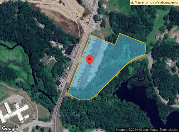
Property Record
1031 Norwich New London Tpke, Uncasville, CT 06382
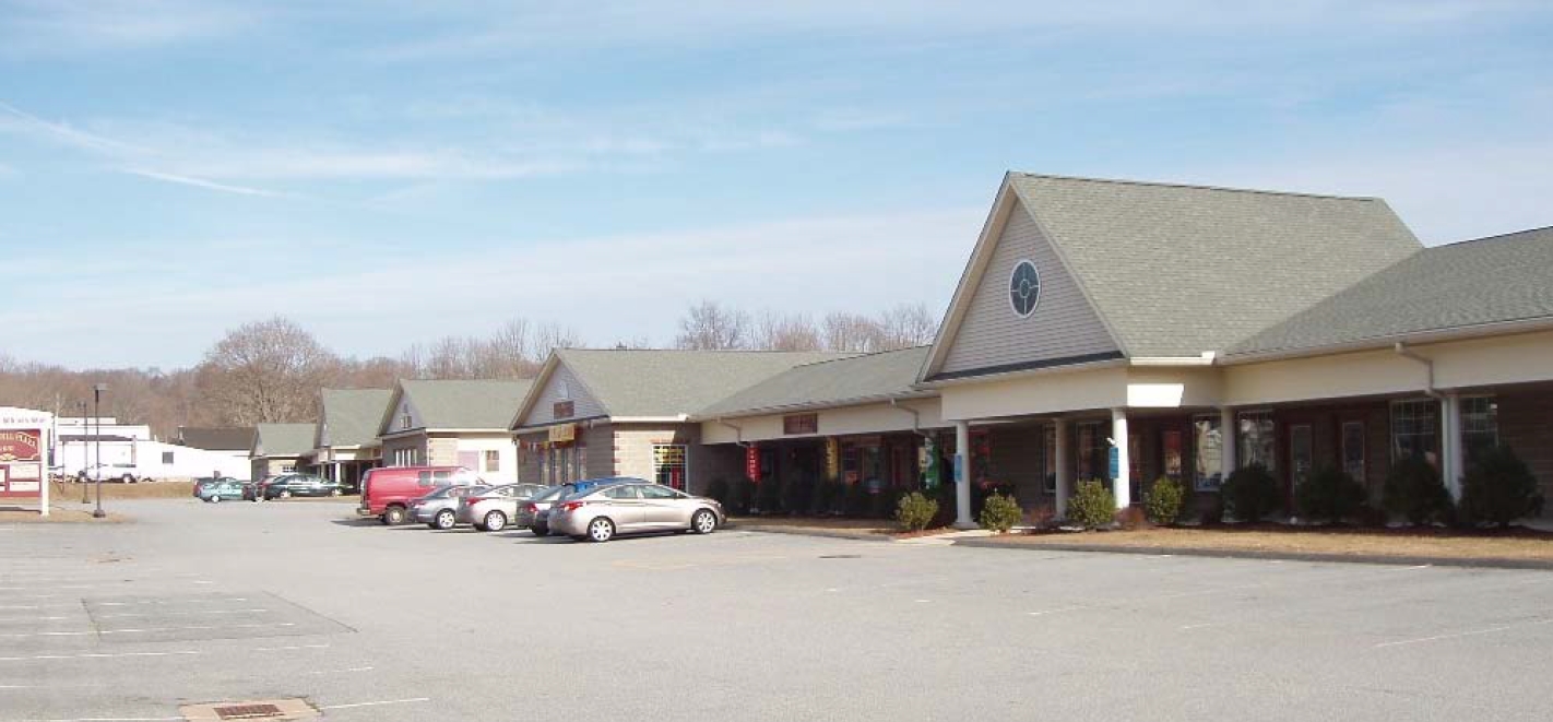
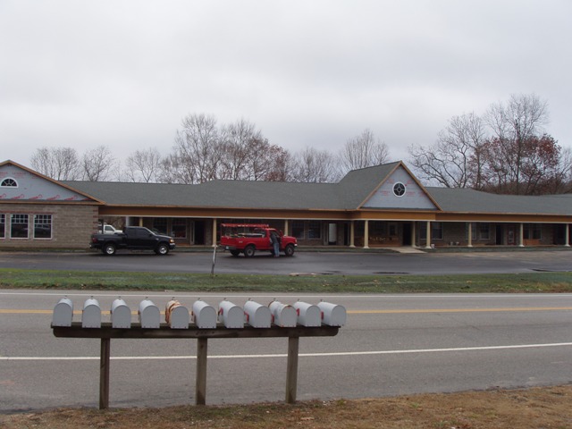
Current Lease Availabilities
General Retail LEASE
$14.25/SF/Yr
800 - 2,400 SF Avail
NEARBY LISTINGS FOR SALE OR LEASE
Property Detail
1031 Norwich New London Tpke
MONT-000086-000013
New London
Commercialnec
Connecticut
AE
6.23 AC
09011C0353G
New London
2024
Hartford
2024
Norwich-New London, CT
870502
DEMOGRAPHICS near 1031 Norwich New London Tpke
1 Mile
3 Mile
5 Mile
2024 Total Population
1,869
16,163
43,192
2029 Population
1,867
16,121
43,178
Pop Growth 2024-2029
(0.11%)
(0.26%)
(0.03%)
Average Age
43
42
41
2024 Total Households
669
5,896
16,603
HH Growth 2024-2029
(0.45%)
(0.66%)
(0.13%)
Median Household Inc
$79,255
$84,638
$83,445
Avg Household Size
2.40
2.40
2.40
2024 Avg HH Vehicles
2.00
2.00
2.00
Median Home Value
$226,680
$236,733
$244,124
Median Year Built
1963
1968
1968
Nearby Places
- Restaurants
- Banks
- Shops
- Fitness
- Groceries
PUBLIC TRANSPORTATION
COMMUTER RAIL
New London (Shore Line East - Shore Line East)
Drive
Walk
Distance
New London (Shore Line East - Shore Line East)
13 min
7.5 mi
Freight Ports
Port of Davisville, RI
Drive
Walk
Distance
Port of Davisville, RI
78 min
57.3 mi
Nearby Properties
Address
Land Use
TOTAL SIZE
Lot Size
Zoning
Address
Land Use
TOTAL SIZE
Lot Size
Zoning
Address
Land Use
TOTAL SIZE
Lot Size
Zoning
242 AC
R20
Address
Land Use
TOTAL SIZE
Lot Size
Zoning
4.59 AC
TRDD
Address
Land Use
TOTAL SIZE
Lot Size
Zoning
113.19 AC
C2/OZ
Address
Land Use
TOTAL SIZE
Lot Size
Zoning
65.90 AC
RSRVT
Address
Land Use
TOTAL SIZE
Lot Size
Zoning
22.87 AC
C-2
Address
Land Use
TOTAL SIZE
Lot Size
Zoning
59.03 AC
RSRVT
Address
Land Use
TOTAL SIZE
Lot Size
Zoning
102477
22.51 AC
C-2
Address
Land Use
TOTAL SIZE
Lot Size
Zoning
38.30 AC
R40
Address
Land Use
TOTAL SIZE
Lot Size
Zoning
4415
128.73 AC
R40
Address
Land Use
TOTAL SIZE
Lot Size
Zoning
106807
5.60 AC
C-2
Address
Land Use
TOTAL SIZE
Lot Size
Zoning
150052
IND
Address
Land Use
TOTAL SIZE
Lot Size
Zoning
35.36 AC
RSRVT
Address
Land Use
TOTAL SIZE
Lot Size
Zoning
58636
2.73 AC
C-2
Address
Land Use
TOTAL SIZE
Lot Size
Zoning
23.24 AC
RSRVT
Address
Land Use
TOTAL SIZE
Lot Size
Zoning
6.54 AC
GOV
Address
Land Use
TOTAL SIZE
Lot Size
Zoning
55562
29.68 AC
GOV
Address
Land Use
TOTAL SIZE
Lot Size
Zoning
34436
19.52 AC
IND
Address
Land Use
TOTAL SIZE
Lot Size
Zoning
12.65 AC
R20
Address
Land Use
TOTAL SIZE
Lot Size
Zoning
18.90 AC
RSRVT
Address
Land Use
TOTAL SIZE
Lot Size
Zoning
18015
17.16 AC
GOV
Address
Land Use
TOTAL SIZE
Lot Size
Zoning
450955
157.97 AC
I
Address
Land Use
TOTAL SIZE
Lot Size
Zoning
46011
4.96 AC
C-2
Address
Land Use
TOTAL SIZE
Lot Size
Zoning
47715
3.41 AC
C-2
Address
Land Use
TOTAL SIZE
Lot Size
Zoning
6 AC
IND
Address
Land Use
TOTAL SIZE
Lot Size
Zoning
13677
1.90 AC
GFDD
Address
Land Use
TOTAL SIZE
Lot Size
Zoning
10.46 AC
RSRVT
Address
Land Use
TOTAL SIZE
Lot Size
Zoning
74.09 AC
TRDD
Address
Land Use
TOTAL SIZE
Lot Size
Zoning
12950
3.30 AC
C-1
Address
Land Use
TOTAL SIZE
Lot Size
Zoning
12.02 AC
R20-M
Start a new search to find other properties for sale or lease
Connect with us
© 2024 CoStar Group
The information above has been obtained from sources believed reliable. While we do not doubt its accuracy we have not verified it and make no guarantee, warranty or representation about it. It is your responsibility to independently confirm its accuracy and completeness. Any projections, opinions, assumptions, or estimates used are for example only and do not represent the current or future performance of the property. The value of this transaction to you depends on tax and other factors which should be evaluated by your tax, financial, and legal advisors. You and your advisors should conduct a careful, independent investigation of the property to determine to your satisfaction the suitability of the property for your needs.