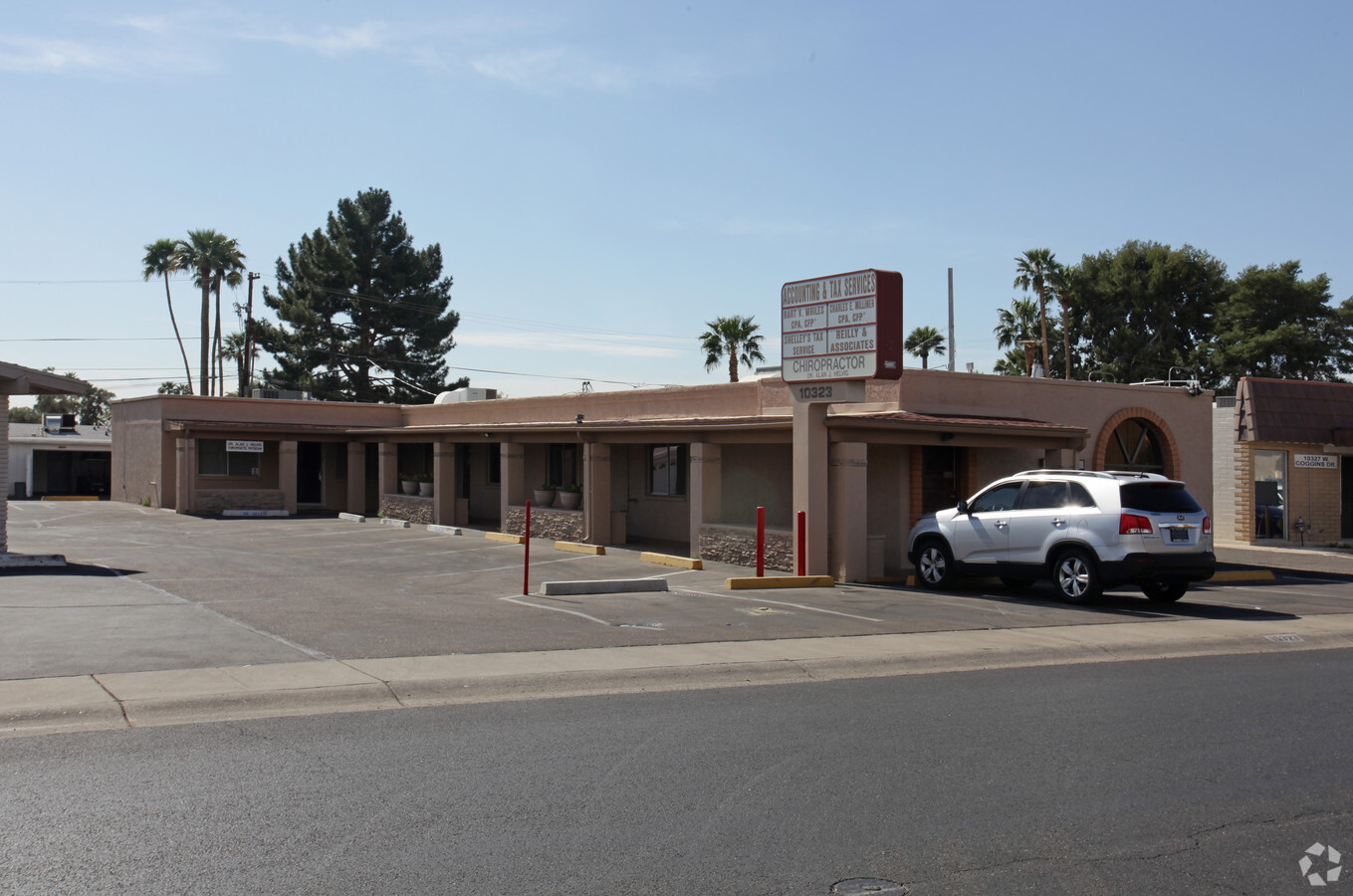
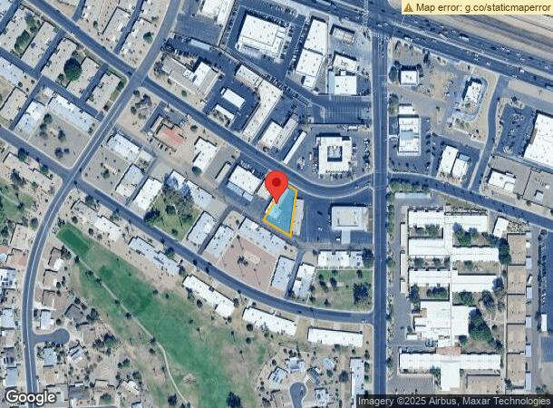
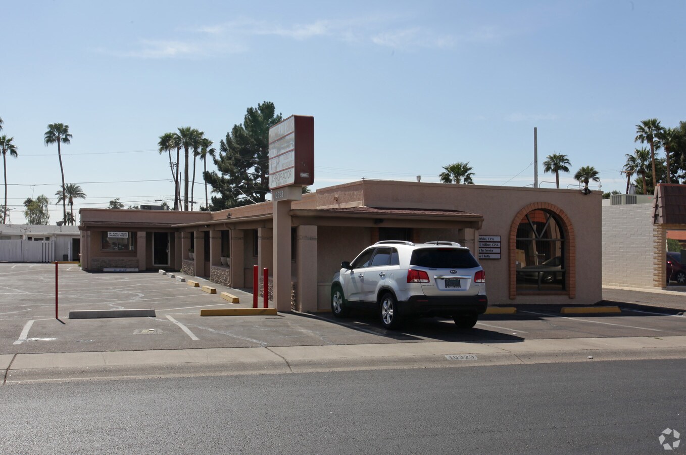
Property Record
10323 W Coggins Dr, Sun City, AZ 85351
NEARBY LISTINGS FOR SALE OR LEASE
Property Detail
10323 W Coggins Dr
200-83-354
Sun City 1A
Officebuilding
SUN CITY 1A
X
Maricopa
04013C1685M
Arizona
2024
0.28 AC
2025
Arrowhead
071801
Phoenix
3,312 SF
Phoenix-Mesa-Scottsdale, AZ
DEMOGRAPHICS near 10323 W Coggins Dr
1 Mile
3 Mile
5 Mile
2024 Total Population
9,904
110,214
255,440
2029 Population
10,861
119,178
277,121
Pop Growth 2024-2029
+ 9.66%
+ 8.13%
+ 8.49%
Average Age
71
48
45
2024 Total Households
6,312
47,695
103,188
HH Growth 2024-2029
+ 9.79%
+ 8.44%
+ 8.66%
Median Household Inc
$42,263
$54,435
$62,911
Avg Household Size
1.50
2.20
2.40
2024 Avg HH Vehicles
1.00
2.00
2.00
Median Home Value
$191,055
$251,784
$283,983
Median Year Built
1970
1979
1989
Nearby Places
- Restaurants
- Banks
- Shops
- Fitness
- Groceries
PUBLIC TRANSPORTATION
AIRPORT
Phoenix Sky Harbor International
DRIVE
WALK
Distance
Phoenix Sky Harbor International
38 min
28.4 mi
Freight Ports
Port of San Diego
DRIVE
WALK
Distance
Port of San Diego
395 min
354.2 mi
SALE & LEASE HISTORY
LISTING DATE
SALE/LEASE

Feb 26, 2024
For Lease
Feb 26, 2024
For Sale
Nearby Properties
Address
Land Use
TOTAL SIZE
Lot Size
Zoning
Address
Land Use
TOTAL SIZE
Lot Size
Zoning
1,010,365 SF
29.94 AC
C2
Address
Land Use
TOTAL SIZE
Lot Size
Zoning
1,113,127 SF
48.24 AC
C2
Address
Land Use
TOTAL SIZE
Lot Size
Zoning
359,639 SF
16.29 AC
PAD
Address
Land Use
TOTAL SIZE
Lot Size
Zoning
303,051 SF
9.11 AC
AG
Address
Land Use
TOTAL SIZE
Lot Size
Zoning
547,083 SF
10.94 AC
C-C
Address
Land Use
TOTAL SIZE
Lot Size
Zoning
353,859 SF
11.71 AC
PAD
Address
Land Use
TOTAL SIZE
Lot Size
Zoning
366,400 SF
19.99 AC
PAD
Address
Land Use
TOTAL SIZE
Lot Size
Zoning
318,282 SF
15.23 AC
PAD
Address
Land Use
TOTAL SIZE
Lot Size
Zoning
327,311 SF
21.14 AC
RM-1
Address
Land Use
TOTAL SIZE
Lot Size
Zoning
106,356 SF
14.16 AC
PAD
Address
Land Use
TOTAL SIZE
Lot Size
Zoning
150,002 SF
10.90 AC
C-C
Address
Land Use
TOTAL SIZE
Lot Size
Zoning
86,343 SF
13.52 AC
M-M
Address
Land Use
TOTAL SIZE
Lot Size
Zoning
210,605 SF
6.76 AC
PAD
Address
Land Use
TOTAL SIZE
Lot Size
Zoning
67,932 SF
14.90 AC
PAD
Address
Land Use
TOTAL SIZE
Lot Size
Zoning
116,323 SF
17.38 AC
R-8
Address
Land Use
TOTAL SIZE
Lot Size
Zoning
262,295 SF
14.79 AC
M-M
Address
Land Use
TOTAL SIZE
Lot Size
Zoning
278,764 SF
15.13 AC
PAD
Address
Land Use
TOTAL SIZE
Lot Size
Zoning
204,607 SF
9.15 AC
PUD
Address
Land Use
TOTAL SIZE
Lot Size
Zoning
156,911 SF
8.06 AC
PAD
Address
Land Use
TOTAL SIZE
Lot Size
Zoning
103,824 SF
15.67 AC
M-M
Address
Land Use
TOTAL SIZE
Lot Size
Zoning
326,301 SF
8.63 AC
M-M
Address
Land Use
TOTAL SIZE
Lot Size
Zoning
66,510 SF
4.36 AC
Address
Land Use
TOTAL SIZE
Lot Size
Zoning
89,511 SF
14.16 AC
R-6
Address
Land Use
TOTAL SIZE
Lot Size
Zoning
123,820 SF
4.53 AC
C-C
Address
Land Use
TOTAL SIZE
Lot Size
Zoning
146,458 SF
16.34 AC
C-C
Address
Land Use
TOTAL SIZE
Lot Size
Zoning
48,664 SF
38.99 AC
R-43
Address
Land Use
TOTAL SIZE
Lot Size
Zoning
228,885 SF
15.91 AC
PAD
Address
Land Use
TOTAL SIZE
Lot Size
Zoning
85,240 SF
13.69 AC
AG
Address
Land Use
TOTAL SIZE
Lot Size
Zoning
50,601 SF
3.71 AC
PUD
Address
Land Use
TOTAL SIZE
Lot Size
Zoning
92,226 SF
7.54 AC
C-C
The World's #1 Commercial Real Estate Marketplace
Connect with us
© 2025 CoStar Group
The information above has been obtained from sources believed reliable. While we do not doubt its accuracy we have not verified it and make no guarantee, warranty or representation about it. It is your responsibility to independently confirm its accuracy and completeness. Any projections, opinions, assumptions, or estimates used are for example only and do not represent the current or future performance of the property. The value of this transaction to you depends on tax and other factors which should be evaluated by your tax, financial, and legal advisors. You and your advisors should conduct a careful, independent investigation of the property to determine to your satisfaction the suitability of the property for your needs.