Property Record
983 Union Grove Rd Se, Adairsville, GA 30103
NEARBY LISTINGS FOR SALE OR LEASE
Property Detail
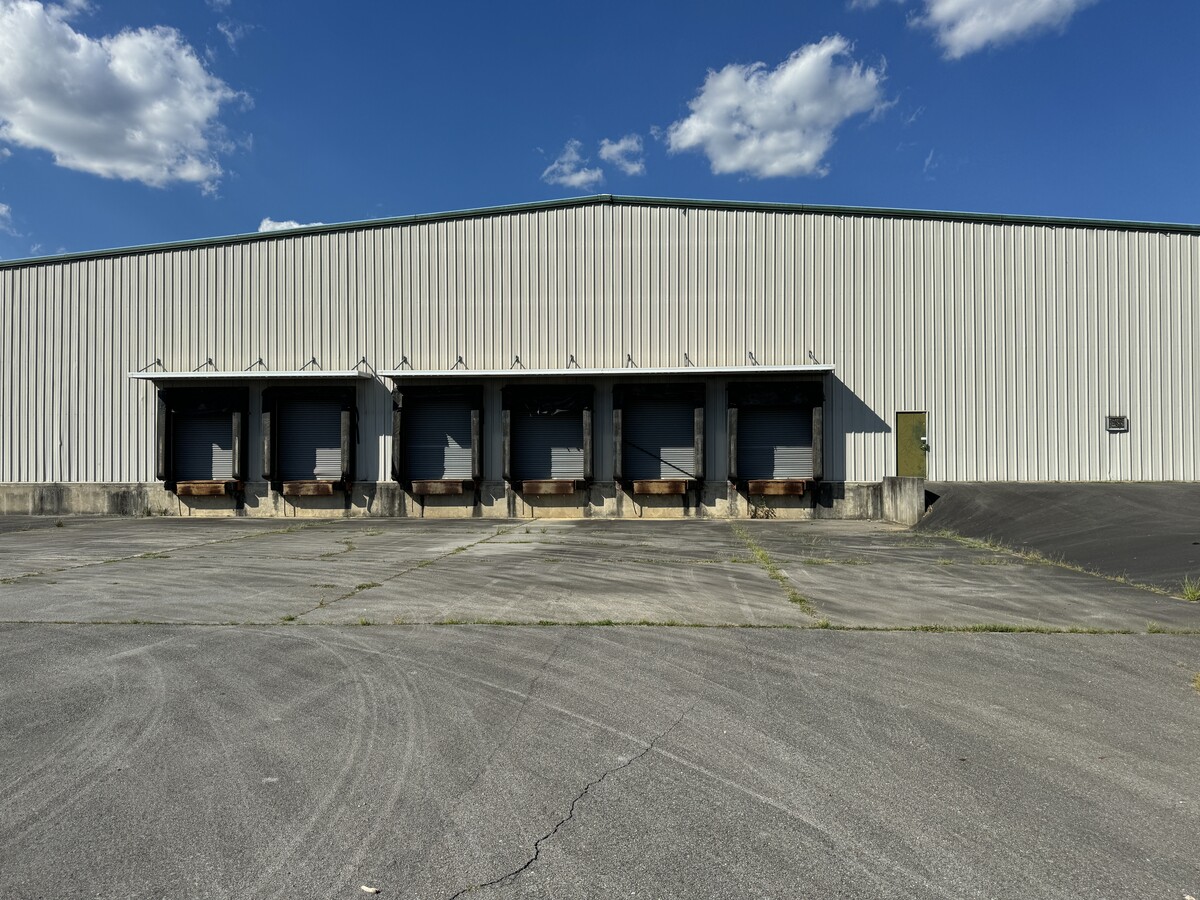
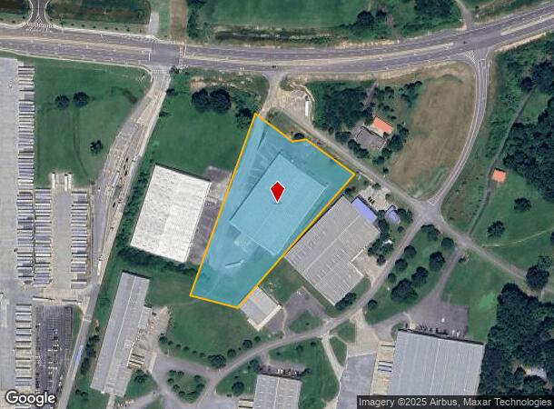
983 Union Grove Rd Se
059-152
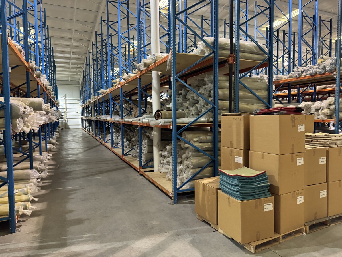
TRACY SHELTON CARPET
Publicstorage
Gordon
X
Georgia
13015C0050H
213
2024
4.16 AC
2024
Georgia Northwest
970802
Other Market Areas
60,000 SF
Calhoun, GA
DEMOGRAPHICS near 983 Union Grove Rd Se
1 Mile
3 Mile
5 Mile
2024 Total Population
574
5,688
25,971
2029 Population
594
6,047
27,822
Pop Growth 2024-2029
+ 3.48%
+ 6.31%
+ 7.13%
Average Age
41
40
39
2024 Total Households
222
2,101
9,515
HH Growth 2024-2029
+ 3.15%
+ 6.14%
+ 6.93%
Median Household Inc
$40,893
$49,123
$56,422
Avg Household Size
2.60
2.70
2.70
2024 Avg HH Vehicles
2.00
2.00
2.00
Median Home Value
$160,294
$170,438
$194,043
Median Year Built
1999
1989
1989
Nearby Places
- Restaurants
- Banks
- Shops
- Fitness
- Groceries
SALE & LEASE HISTORY
LISTING DATE
SALE/LEASE

Jun 26, 2024
For Lease
Jul 03, 2024
For Lease
Nearby Properties
Address
Land Use
TOTAL SIZE
Lot Size
Zoning
Address
Land Use
TOTAL SIZE
Lot Size
Zoning
740,750 SF
19.27 AC
IND-G
Address
Land Use
TOTAL SIZE
Lot Size
Zoning
675,935 SF
63.15 AC
I-2
Address
Land Use
TOTAL SIZE
Lot Size
Zoning
549,997 SF
138.47 AC
IND-G
Address
Land Use
TOTAL SIZE
Lot Size
Zoning
474,748 SF
54.83 AC
IND-G
Address
Land Use
TOTAL SIZE
Lot Size
Zoning
454,680 SF
5.23 AC
IND-G
Address
Land Use
TOTAL SIZE
Lot Size
Zoning
304,308 SF
24.37 AC
I-1
Address
Land Use
TOTAL SIZE
Lot Size
Zoning
89,298 SF
25.68 AC
I-2
Address
Land Use
TOTAL SIZE
Lot Size
Zoning
50,676 SF
19.74 AC
C-2
Address
Land Use
TOTAL SIZE
Lot Size
Zoning
16,424 SF
5.73 AC
MU
Address
Land Use
TOTAL SIZE
Lot Size
Zoning
88,000 SF
8.87 AC
IND-G
Address
Land Use
TOTAL SIZE
Lot Size
Zoning
128,740 SF
42.95 AC
IND-G
Address
Land Use
TOTAL SIZE
Lot Size
Zoning
105,660 SF
22.74 AC
IND-G
Address
Land Use
TOTAL SIZE
Lot Size
Zoning
6,956 SF
7 AC
R-2
Address
Land Use
TOTAL SIZE
Lot Size
Zoning
207,900 SF
13.43 AC
IND-G
Address
Land Use
TOTAL SIZE
Lot Size
Zoning
225,000 SF
14.68 AC
IND-G
Address
Land Use
TOTAL SIZE
Lot Size
Zoning
67,800 SF
10.53 AC
I-1
Address
Land Use
TOTAL SIZE
Lot Size
Zoning
259,964 SF
78.21 AC
IND-G
Address
Land Use
TOTAL SIZE
Lot Size
Zoning
455,554 SF
19.79 AC
IND-G
Address
Land Use
TOTAL SIZE
Lot Size
Zoning
161,958 SF
14.99 AC
C-2
Address
Land Use
TOTAL SIZE
Lot Size
Zoning
15,144 SF
19.26 AC
A-1
Address
Land Use
TOTAL SIZE
Lot Size
Zoning
498,811 SF
60.43 AC
IND-G
Address
Land Use
TOTAL SIZE
Lot Size
Zoning
96,647 SF
35.06 AC
I-2
Address
Land Use
TOTAL SIZE
Lot Size
Zoning
99,360 SF
5.24 AC
IND-G
Address
Land Use
TOTAL SIZE
Lot Size
Zoning
2,899 SF
12 AC
Address
Land Use
TOTAL SIZE
Lot Size
Zoning
188,628 SF
68.91 AC
IND-G
Address
Land Use
TOTAL SIZE
Lot Size
Zoning
160,646 SF
20.92 AC
IND-G
Address
Land Use
TOTAL SIZE
Lot Size
Zoning
13,758 SF
14.81 AC
C-2
Address
Land Use
TOTAL SIZE
Lot Size
Zoning
102,416 SF
14.53 AC
C-2
Address
Land Use
TOTAL SIZE
Lot Size
Zoning
49,500 SF
1.61 AC
C-2
Address
Land Use
TOTAL SIZE
Lot Size
Zoning
121,680 SF
7.71 AC
IND-G
The World's #1 Commercial Real Estate Marketplace
Connect with us
© 2025 CoStar Group
The information above has been obtained from sources believed reliable. While we do not doubt its accuracy we have not verified it and make no guarantee, warranty or representation about it. It is your responsibility to independently confirm its accuracy and completeness. Any projections, opinions, assumptions, or estimates used are for example only and do not represent the current or future performance of the property. The value of this transaction to you depends on tax and other factors which should be evaluated by your tax, financial, and legal advisors. You and your advisors should conduct a careful, independent investigation of the property to determine to your satisfaction the suitability of the property for your needs.