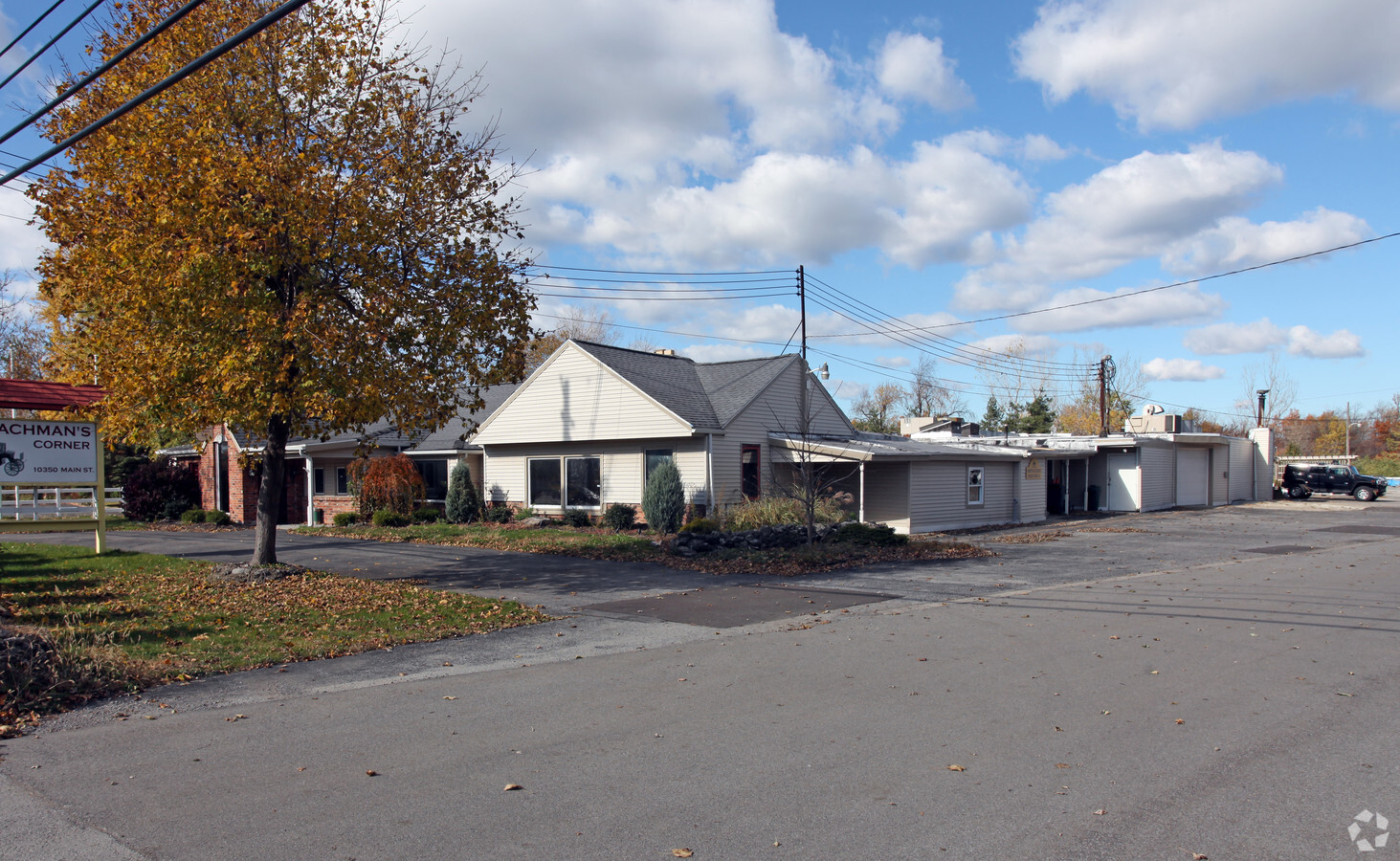
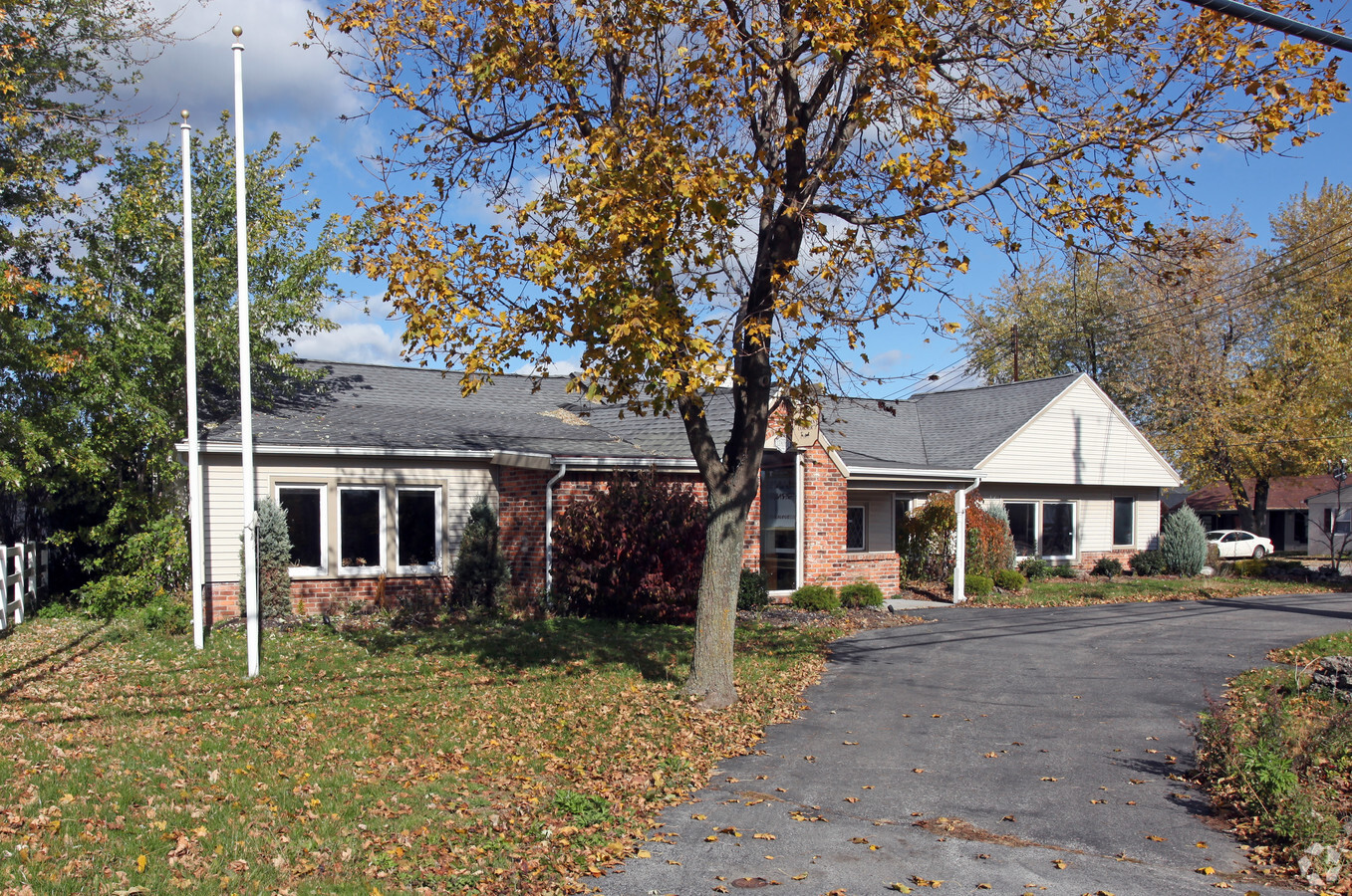
Property Record
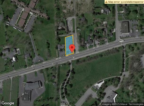
10350 Main St, Clarence, NY 14031
NEARBY LISTINGS FOR SALE OR LEASE
Property Detail
10350 Main St
143200 72.01-4-19
Erie
Storesoffices
New York
X
19.000
36029C0251H
0.51 AC
2023
Outlying Erie County
2023
Buffalo/Niagara Falls
014704
Buffalo-Cheektowaga-Niagara Falls, NY
12,362 SF
DEMOGRAPHICS near 10350 Main St
1 Mile
3 Mile
5 Mile
2024 Total Population
3,407
14,118
41,143
2029 Population
3,406
14,180
41,319
Pop Growth 2024-2029
(0.03%)
+ 0.44%
+ 0.43%
Average Age
50
45
44
2024 Total Households
1,442
5,611
16,064
HH Growth 2024-2029
(0.14%)
+ 0.32%
+ 0.32%
Median Household Inc
$78,046
$102,269
$103,006
Avg Household Size
2.20
2.40
2.50
2024 Avg HH Vehicles
2.00
2.00
2.00
Median Home Value
$276,681
$305,147
$328,447
Median Year Built
1968
1983
1989
Nearby Places
- Restaurants
- Banks
- Shops
- Fitness
- Groceries
PUBLIC TRANSPORTATION
AIRPORT
Buffalo Niagara International
DRIVE
WALK
Distance
Buffalo Niagara International
14 min
8.0 mi
Niagara Falls International
DRIVE
WALK
Distance
Niagara Falls International
39 min
23.3 mi
Freight Ports
Albany, NY Port
DRIVE
WALK
Distance
Albany, NY Port
322 min
273.1 mi
Nearby Properties
Address
Land Use
TOTAL SIZE
Lot Size
Zoning
Address
Land Use
TOTAL SIZE
Lot Size
Zoning
163,016 SF
14.07 AC
Address
Land Use
TOTAL SIZE
Lot Size
Zoning
123,868 SF
25.41 AC
RB
Address
Land Use
TOTAL SIZE
Lot Size
Zoning
84,940 SF
18.58 AC
RB
Address
Land Use
TOTAL SIZE
Lot Size
Zoning
195,246 SF
37.40 AC
Address
Land Use
TOTAL SIZE
Lot Size
Zoning
6,720 SF
56.70 AC
Address
Land Use
TOTAL SIZE
Lot Size
Zoning
106,593 SF
28 AC
Address
Land Use
TOTAL SIZE
Lot Size
Zoning
1,104 SF
50.20 AC
20
Address
Land Use
TOTAL SIZE
Lot Size
Zoning
100 SF
38.45 AC
RB
Address
Land Use
TOTAL SIZE
Lot Size
Zoning
13,685 SF
50.10 AC
Address
Land Use
TOTAL SIZE
Lot Size
Zoning
83,662 SF
11.30 AC
Address
Land Use
TOTAL SIZE
Lot Size
Zoning
480 SF
22.19 AC
Address
Land Use
TOTAL SIZE
Lot Size
Zoning
35,966 SF
120.58 AC
17
Address
Land Use
TOTAL SIZE
Lot Size
Zoning
120,425 SF
15.50 AC
Address
Land Use
TOTAL SIZE
Lot Size
Zoning
50,000 SF
8.98 AC
BUS-IND
Address
Land Use
TOTAL SIZE
Lot Size
Zoning
14,684 SF
3.17 AC
Address
Land Use
TOTAL SIZE
Lot Size
Zoning
38,110 SF
5.67 AC
C
Address
Land Use
TOTAL SIZE
Lot Size
Zoning
64,160 SF
7 AC
Address
Land Use
TOTAL SIZE
Lot Size
Zoning
14,722 SF
13.30 AC
Address
Land Use
TOTAL SIZE
Lot Size
Zoning
17,833 SF
19.49 AC
Address
Land Use
TOTAL SIZE
Lot Size
Zoning
72,323 SF
12.11 AC
Address
Land Use
TOTAL SIZE
Lot Size
Zoning
74,730 SF
5.10 AC
Address
Land Use
TOTAL SIZE
Lot Size
Zoning
34,922 SF
12.80 AC
Address
Land Use
TOTAL SIZE
Lot Size
Zoning
62,704 SF
14 AC
Address
Land Use
TOTAL SIZE
Lot Size
Zoning
8,154 SF
94 AC
17
Address
Land Use
TOTAL SIZE
Lot Size
Zoning
66,208 SF
11.40 AC
Address
Land Use
TOTAL SIZE
Lot Size
Zoning
63,823 SF
20.60 AC
Address
Land Use
TOTAL SIZE
Lot Size
Zoning
27,477 SF
16.60 AC
Address
Land Use
TOTAL SIZE
Lot Size
Zoning
50,176 SF
Address
Land Use
TOTAL SIZE
Lot Size
Zoning
19,676 SF
5.20 AC
Address
Land Use
TOTAL SIZE
Lot Size
Zoning
57,324 SF
0.01 AC
The World's #1 Commercial Real Estate Marketplace
Connect with us
© 2025 CoStar Group
The information above has been obtained from sources believed reliable. While we do not doubt its accuracy we have not verified it and make no guarantee, warranty or representation about it. It is your responsibility to independently confirm its accuracy and completeness. Any projections, opinions, assumptions, or estimates used are for example only and do not represent the current or future performance of the property. The value of this transaction to you depends on tax and other factors which should be evaluated by your tax, financial, and legal advisors. You and your advisors should conduct a careful, independent investigation of the property to determine to your satisfaction the suitability of the property for your needs.