Property Record
10351 Grant Line Rd, Elk Grove, CA 95624
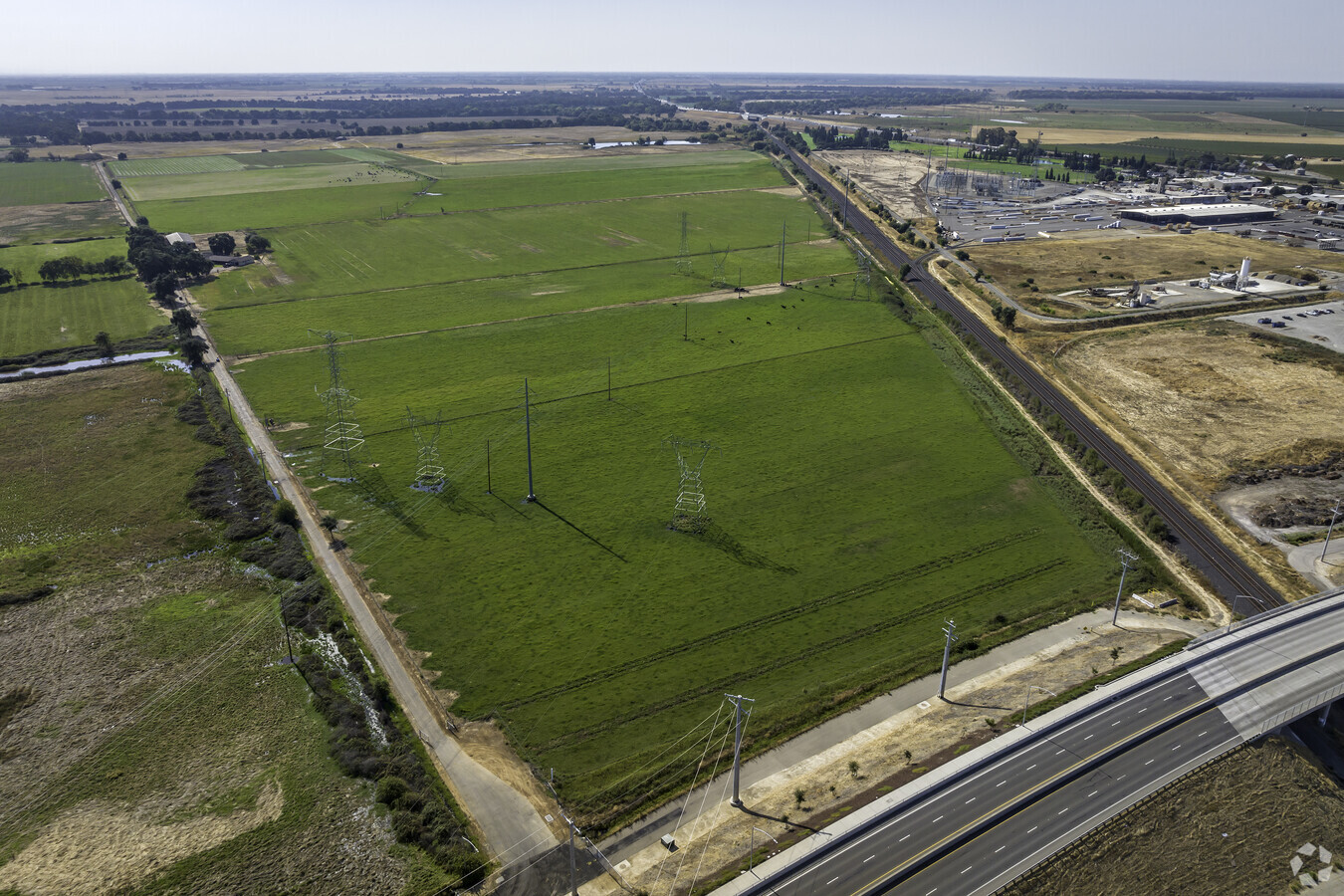
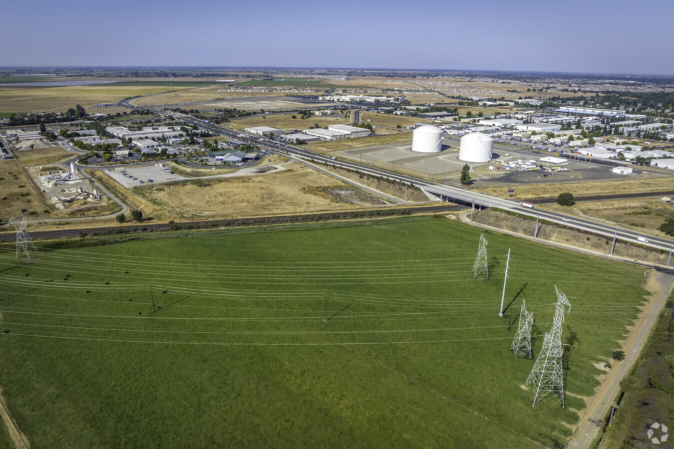
This Property Is For Sale
NEARBY LISTINGS FOR SALE OR LEASE
Property Detail
10351 Grant Line Rd
134-0190-034
Rancho De Los Omoch
Farms
NULL
X
Sacramento
06067C0338H
California
2023
143 AC
2024
Elk Grove
009307
Sacramento
3,108 SF
Sacramento--Roseville--Arden-Arcade, CA
DEMOGRAPHICS near 10351 Grant Line Rd
1 Mile
3 Mile
5 Mile
2024 Total Population
122
31,548
99,298
2029 Population
123
32,150
100,495
Pop Growth 2024-2029
+ 0.82%
+ 1.91%
+ 1.21%
Average Age
37
38
39
2024 Total Households
32
9,634
30,542
HH Growth 2024-2029
+ 3.13%
+ 1.80%
+ 1.17%
Median Household Inc
$162,500
$115,088
$111,611
Avg Household Size
3.40
3.20
3.20
2024 Avg HH Vehicles
3.00
2.00
2.00
Median Home Value
$729,166
$605,632
$597,634
Median Year Built
2005
2000
2001
Nearby Places
- Restaurants
- Banks
- Shops
- Fitness
- Groceries
PUBLIC TRANSPORTATION
AIRPORT
Sacramento International
DRIVE
WALK
Distance
Sacramento International
41 min
29.3 mi
Freight Ports
Port of Stockton
DRIVE
WALK
Distance
Port of Stockton
48 min
37.0 mi
Nearby Properties
Address
Land Use
TOTAL SIZE
Lot Size
Zoning
Address
Land Use
TOTAL SIZE
Lot Size
Zoning
43.54 AC
LI
Address
Land Use
TOTAL SIZE
Lot Size
Zoning
64,579 SF
5.41 AC
LRSPA
Address
Land Use
TOTAL SIZE
Lot Size
Zoning
111,489 SF
4.96 AC
MP
Address
Land Use
TOTAL SIZE
Lot Size
Zoning
221,556 SF
20.10 AC
HI
Address
Land Use
TOTAL SIZE
Lot Size
Zoning
102,526 SF
4.06 AC
MP
Address
Land Use
TOTAL SIZE
Lot Size
Zoning
100 SF
50.85 AC
LRSPA
Address
Land Use
TOTAL SIZE
Lot Size
Zoning
5.38 AC
SC
Address
Land Use
TOTAL SIZE
Lot Size
Zoning
53,949 SF
5.33 AC
AC
Address
Land Use
TOTAL SIZE
Lot Size
Zoning
63,550 SF
5.53 AC
AC
Address
Land Use
TOTAL SIZE
Lot Size
Zoning
21.18 AC
HI
Address
Land Use
TOTAL SIZE
Lot Size
Zoning
150,210 SF
6.25 AC
LI
Address
Land Use
TOTAL SIZE
Lot Size
Zoning
56,892 SF
6.18 AC
AC
Address
Land Use
TOTAL SIZE
Lot Size
Zoning
128,325 SF
9.71 AC
RD-18 O
Address
Land Use
TOTAL SIZE
Lot Size
Zoning
54,977 SF
3.94 AC
LI
Address
Land Use
TOTAL SIZE
Lot Size
Zoning
7,704 SF
17.01 AC
HI
Address
Land Use
TOTAL SIZE
Lot Size
Zoning
123,500 SF
5.94 AC
GC
Address
Land Use
TOTAL SIZE
Lot Size
Zoning
62,963 SF
4.94 AC
LC
Address
Land Use
TOTAL SIZE
Lot Size
Zoning
137,500 SF
7.44 AC
LI
Address
Land Use
TOTAL SIZE
Lot Size
Zoning
42,426 SF
4.20 AC
LI
Address
Land Use
TOTAL SIZE
Lot Size
Zoning
46,753 SF
5.24 AC
AC
Address
Land Use
TOTAL SIZE
Lot Size
Zoning
35,748 SF
9.06 AC
AC
Address
Land Use
TOTAL SIZE
Lot Size
Zoning
25,590 SF
2.37 AC
LC
Address
Land Use
TOTAL SIZE
Lot Size
Zoning
37,550 SF
4.38 AC
HI
Address
Land Use
TOTAL SIZE
Lot Size
Zoning
54,964 SF
5.32 AC
AC
Address
Land Use
TOTAL SIZE
Lot Size
Zoning
330.05 AC
AG-80
Address
Land Use
TOTAL SIZE
Lot Size
Zoning
38,008 SF
3.41 AC
AC
Address
Land Use
TOTAL SIZE
Lot Size
Zoning
69,000 SF
24.48 AC
HI
Address
Land Use
TOTAL SIZE
Lot Size
Zoning
36,121 SF
3.66 AC
AC
Address
Land Use
TOTAL SIZE
Lot Size
Zoning
18,057 SF
1.66 AC
SPA-OT
Address
Land Use
TOTAL SIZE
Lot Size
Zoning
27,060 SF
2.69 AC
GC
The World's #1 Commercial Real Estate Marketplace
Connect with us
© 2025 CoStar Group
The information above has been obtained from sources believed reliable. While we do not doubt its accuracy we have not verified it and make no guarantee, warranty or representation about it. It is your responsibility to independently confirm its accuracy and completeness. Any projections, opinions, assumptions, or estimates used are for example only and do not represent the current or future performance of the property. The value of this transaction to you depends on tax and other factors which should be evaluated by your tax, financial, and legal advisors. You and your advisors should conduct a careful, independent investigation of the property to determine to your satisfaction the suitability of the property for your needs.