Property Record
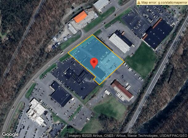
10355 Mount Savage Rd Nw, Cumberland, MD 21502
NEARBY LISTINGS FOR SALE OR LEASE
Property Detail
10355 Mount Savage Rd Nw
Cumberland, MD-WV
Motor City
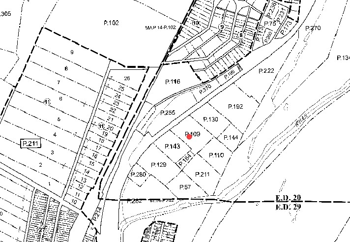
20-007915
2.93A S/E/S RT 36
Autorepair
Allegany
2024
Maryland
2024
2.93 AC
001502
Other Market Areas
12,250 SF
DEMOGRAPHICS near 10355 Mount Savage Rd Nw
1 Mile
3 Mile
5 Mile
2024 Total Population
695
17,912
37,888
2029 Population
643
17,624
37,394
Pop Growth 2024-2029
(7.48%)
(1.61%)
(1.30%)
Average Age
45
43
43
2024 Total Households
291
8,040
15,347
HH Growth 2024-2029
(7.90%)
(1.83%)
(1.53%)
Median Household Inc
$63,187
$54,294
$49,512
Avg Household Size
2.30
2.10
2.20
2024 Avg HH Vehicles
2.00
2.00
2.00
Median Home Value
$153,040
$142,465
$137,963
Median Year Built
1964
1950
1953
Nearby Places
- Restaurants
- Banks
- Shops
- Fitness
- Groceries
PUBLIC TRANSPORTATION
COMMUTER RAIL
Cumberland Amtrak Station (Capitol Limited - Amtrak)
DRIVE
WALK
Distance
Cumberland Amtrak Station (Capitol Limited - Amtrak)
6 min
3.3 mi
Freight Ports
Port of Baltimore
DRIVE
WALK
Distance
Port of Baltimore
163 min
141.7 mi
Nearby Properties
Address
Land Use
TOTAL SIZE
Lot Size
Zoning
Address
Land Use
TOTAL SIZE
Lot Size
Zoning
40,845 SF
26.24 AC
R-O
Address
Land Use
TOTAL SIZE
Lot Size
Zoning
56,963 SF
3.17 AC
Address
Land Use
TOTAL SIZE
Lot Size
Zoning
46,785 SF
6.60 AC
Address
Land Use
TOTAL SIZE
Lot Size
Zoning
67,844 SF
11.25 AC
Address
Land Use
TOTAL SIZE
Lot Size
Zoning
38,489 SF
1.46 AC
B-CBD
Address
Land Use
TOTAL SIZE
Lot Size
Zoning
151,773 SF
4.48 AC
Address
Land Use
TOTAL SIZE
Lot Size
Zoning
48,041 SF
3.62 AC
Address
Land Use
TOTAL SIZE
Lot Size
Zoning
63,412 SF
5.45 AC
R-PUD
Address
Land Use
TOTAL SIZE
Lot Size
Zoning
61,486 SF
5.94 AC
Address
Land Use
TOTAL SIZE
Lot Size
Zoning
50,040 SF
1.52 AC
B-CBD
Address
Land Use
TOTAL SIZE
Lot Size
Zoning
3,136 SF
38.24 AC
R-R
Address
Land Use
TOTAL SIZE
Lot Size
Zoning
56,988 SF
0.34 AC
Address
Land Use
TOTAL SIZE
Lot Size
Zoning
13,014 SF
83.55 AC
R
Address
Land Use
TOTAL SIZE
Lot Size
Zoning
59,849 SF
25 AC
R-PUD
Address
Land Use
TOTAL SIZE
Lot Size
Zoning
109,875 SF
39.52 AC
R-S
Address
Land Use
TOTAL SIZE
Lot Size
Zoning
36,794 SF
3.95 AC
I-C
Address
Land Use
TOTAL SIZE
Lot Size
Zoning
52,402 SF
5.18 AC
Address
Land Use
TOTAL SIZE
Lot Size
Zoning
33,000 SF
4.57 AC
Address
Land Use
TOTAL SIZE
Lot Size
Zoning
26,160 SF
1.70 AC
B-CBD
Address
Land Use
TOTAL SIZE
Lot Size
Zoning
60,354 SF
0.64 AC
B-CBD
Address
Land Use
TOTAL SIZE
Lot Size
Zoning
2,208 SF
4.18 AC
B-CBD
Address
Land Use
TOTAL SIZE
Lot Size
Zoning
17,618 SF
1.84 AC
A
Address
Land Use
TOTAL SIZE
Lot Size
Zoning
71,440 SF
8.11 AC
Address
Land Use
TOTAL SIZE
Lot Size
Zoning
21,078 SF
1.69 AC
B-2
Address
Land Use
TOTAL SIZE
Lot Size
Zoning
100,232 SF
1.23 AC
Address
Land Use
TOTAL SIZE
Lot Size
Zoning
6,070 SF
0.58 AC
B-CBD
Address
Land Use
TOTAL SIZE
Lot Size
Zoning
41,464 SF
4.29 AC
B-2
Address
Land Use
TOTAL SIZE
Lot Size
Zoning
25,668 SF
1.85 AC
R-L
Address
Land Use
TOTAL SIZE
Lot Size
Zoning
29.43 AC
R-A
Address
Land Use
TOTAL SIZE
Lot Size
Zoning
113,950 SF
0.52 AC
B-CBD
The World's #1 Commercial Real Estate Marketplace
Connect with us
© 2025 CoStar Group
The information above has been obtained from sources believed reliable. While we do not doubt its accuracy we have not verified it and make no guarantee, warranty or representation about it. It is your responsibility to independently confirm its accuracy and completeness. Any projections, opinions, assumptions, or estimates used are for example only and do not represent the current or future performance of the property. The value of this transaction to you depends on tax and other factors which should be evaluated by your tax, financial, and legal advisors. You and your advisors should conduct a careful, independent investigation of the property to determine to your satisfaction the suitability of the property for your needs.