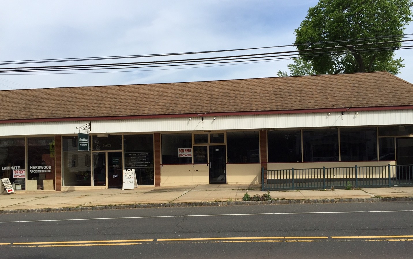
Property Record
140 Main St, Whitehouse Station, NJ 08889
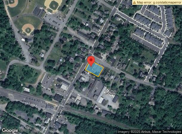
NEARBY LISTINGS FOR SALE OR LEASE
Property Detail
140 Main St
22-00031-0000-00001
Hunterdon
Vacantlandnec
New Jersey
X
1
34019C0257F
0.44 AC
2023
Route 78 West
2024
Northern New Jersey
011203
Newark, NJ-PA
DEMOGRAPHICS near 140 Main St
1 Mile
3 Mile
5 Mile
2024 Total Population
3,970
9,929
28,647
2029 Population
4,061
10,096
28,809
Pop Growth 2024-2029
+ 2.29%
+ 1.68%
+ 0.57%
Average Age
47
46
45
2024 Total Households
1,702
3,990
11,148
HH Growth 2024-2029
+ 2.12%
+ 1.68%
+ 0.56%
Median Household Inc
$101,136
$120,869
$138,785
Avg Household Size
2.30
2.40
2.50
2024 Avg HH Vehicles
2.00
2.00
2.00
Median Home Value
$460,024
$480,688
$521,216
Median Year Built
1989
1980
1981
Nearby Places
- Restaurants
- Banks
- Shops
- Fitness
- Groceries
PUBLIC TRANSPORTATION
COMMUTER RAIL
White House (Raritan Valley Line - NJ Transit Commuter Rail (NJ Transit))
DRIVE
WALK
Distance
White House (Raritan Valley Line - NJ Transit Commuter Rail (NJ Transit))
1 min
3 min
0.1 mi
Lebanon (Raritan Valley Line - NJ Transit Commuter Rail (NJ Transit))
DRIVE
WALK
Distance
Lebanon (Raritan Valley Line - NJ Transit Commuter Rail (NJ Transit))
10 min
3.9 mi
AIRPORT
Newark Liberty International
DRIVE
WALK
Distance
Newark Liberty International
39 min
37.6 mi
Lehigh Valley International
DRIVE
WALK
Distance
Lehigh Valley International
52 min
44.8 mi
SALE & LEASE HISTORY
LISTING DATE
SALE/LEASE

Sep 25, 2016
For Lease
Nearby Properties
Address
Land Use
TOTAL SIZE
Lot Size
Zoning
Address
Land Use
TOTAL SIZE
Lot Size
Zoning
187,596 SF
54.59 AC
RO
Address
Land Use
TOTAL SIZE
Lot Size
Zoning
61.69 AC
RO
Address
Land Use
TOTAL SIZE
Lot Size
Zoning
18.46 AC
I
Address
Land Use
TOTAL SIZE
Lot Size
Zoning
14,182 SF
77.17 AC
ROMX
Address
Land Use
TOTAL SIZE
Lot Size
Zoning
20 AC
AR
Address
Land Use
TOTAL SIZE
Lot Size
Zoning
118.92 AC
R10
Address
Land Use
TOTAL SIZE
Lot Size
Zoning
12.05 AC
I-IP
Address
Land Use
TOTAL SIZE
Lot Size
Zoning
18,288 SF
3.78 AC
I-IP
Address
Land Use
TOTAL SIZE
Lot Size
Zoning
46.18 AC
RR
Address
Land Use
TOTAL SIZE
Lot Size
Zoning
58,471 SF
8.69 AC
B
Address
Land Use
TOTAL SIZE
Lot Size
Zoning
20,048 SF
3 AC
AR
Address
Land Use
TOTAL SIZE
Lot Size
Zoning
4.90 AC
IP
Address
Land Use
TOTAL SIZE
Lot Size
Zoning
4.28 AC
I-IP
Address
Land Use
TOTAL SIZE
Lot Size
Zoning
4.88 AC
I-1
Address
Land Use
TOTAL SIZE
Lot Size
Zoning
127,961 SF
50 AC
B
Address
Land Use
TOTAL SIZE
Lot Size
Zoning
20,764 SF
21.01 AC
ROM1
Address
Land Use
TOTAL SIZE
Lot Size
Zoning
8.40 AC
I&IP
Address
Land Use
TOTAL SIZE
Lot Size
Zoning
4.69 AC
I-IP
Address
Land Use
TOTAL SIZE
Lot Size
Zoning
Address
Land Use
TOTAL SIZE
Lot Size
Zoning
23.40 AC
RR
Address
Land Use
TOTAL SIZE
Lot Size
Zoning
67,200 SF
4.01 AC
I
Address
Land Use
TOTAL SIZE
Lot Size
Zoning
9,348 SF
10.74 AC
B
Address
Land Use
TOTAL SIZE
Lot Size
Zoning
6.80 AC
VR
Address
Land Use
TOTAL SIZE
Lot Size
Zoning
6.52 AC
B
Address
Land Use
TOTAL SIZE
Lot Size
Zoning
11.28 AC
ROM1
Address
Land Use
TOTAL SIZE
Lot Size
Zoning
10.99 AC
ROM1
Address
Land Use
TOTAL SIZE
Lot Size
Zoning
Address
Land Use
TOTAL SIZE
Lot Size
Zoning
66.83 AC
ROM2
Address
Land Use
TOTAL SIZE
Lot Size
Zoning
2.02 AC
I-IP
Address
Land Use
TOTAL SIZE
Lot Size
Zoning
2 AC
I-IP
The World's #1 Commercial Real Estate Marketplace
Connect with us
© 2025 CoStar Group
The information above has been obtained from sources believed reliable. While we do not doubt its accuracy we have not verified it and make no guarantee, warranty or representation about it. It is your responsibility to independently confirm its accuracy and completeness. Any projections, opinions, assumptions, or estimates used are for example only and do not represent the current or future performance of the property. The value of this transaction to you depends on tax and other factors which should be evaluated by your tax, financial, and legal advisors. You and your advisors should conduct a careful, independent investigation of the property to determine to your satisfaction the suitability of the property for your needs.