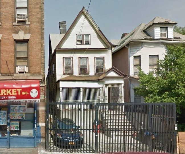
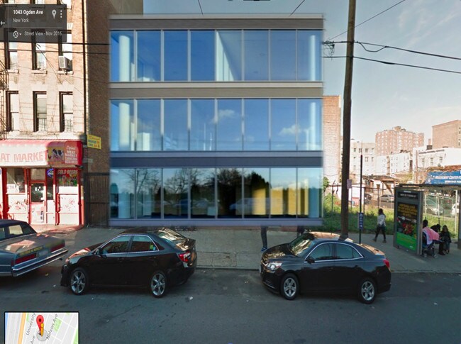
Property Record
1041 Ogden Ave, Bronx, NY 10452

NEARBY LISTINGS FOR SALE OR LEASE
Property Detail
1041 Ogden Ave
02525-0027
Map Land David Mcleod 23Rd Ward
Commercialnec
Bronx
X
New York
3604970083F
27
2024
0.06 AC
2025
Bronx
018900
Westchester/So Connecticut
1,820 SF
New York-Jersey City-White Plains, NY-NJ
DEMOGRAPHICS near 1041 Ogden Ave
1 Mile
3 Mile
5 Mile
2024 Total Population
236,739
1,247,008
2,316,839
2029 Population
220,881
1,166,565
2,158,047
Pop Growth 2024-2029
(6.70%)
(6.45%)
(6.85%)
Average Age
39
38
40
2024 Total Households
86,571
462,323
915,586
HH Growth 2024-2029
(7.25%)
(6.88%)
(7.28%)
Median Household Inc
$40,857
$41,922
$56,399
Avg Household Size
2.60
2.50
2.40
2024 Avg HH Vehicles
.00
.00
.00
Median Home Value
$393,652
$566,480
$718,440
Median Year Built
1948
1952
1952
Nearby Places
Map Layers
Map Styles
 Street
 Aerial
- Restaurants
- Banks
- Shops
- Fitness
- Groceries
PUBLIC TRANSPORTATION
TRANSIT/SUBWAY
167 Street (4 Line) (4 - New York MTA Subway (The Subway))
DRIVE
WALK
Distance
167 Street (4 Line) (4 - New York MTA Subway (The Subway))
3 min
10 min
0.5 mi
161 Street-Yankee Stadium (4 - New York MTA Subway (The Subway), B - New York MTA Subway (The Subway), D - New York MTA Subway (The Subway))
DRIVE
WALK
Distance
161 Street-Yankee Stadium (4 - New York MTA Subway (The Subway), B - New York MTA Subway (The Subway), D - New York MTA Subway (The Subway))
3 min
12 min
0.6 mi
167 Street (B,D Line) (B - New York MTA Subway (The Subway), D - New York MTA Subway (The Subway))
DRIVE
WALK
Distance
167 Street (B,D Line) (B - New York MTA Subway (The Subway), D - New York MTA Subway (The Subway))
4 min
13 min
0.7 mi
155 Street (B,D Line) (B - New York MTA Subway (The Subway), D - New York MTA Subway (The Subway))
DRIVE
WALK
Distance
155 Street (B,D Line) (B - New York MTA Subway (The Subway), D - New York MTA Subway (The Subway))
6 min
19 min
1.0 mi
COMMUTER RAIL
DRIVE
WALK
Distance
2 min
5 min
0.2 mi
Yankees-E 153rd Street Station (Hudson Line - Metro-North Commuter Railroad Company (Metro-North))
DRIVE
WALK
Distance
Yankees-E 153rd Street Station (Hudson Line - Metro-North Commuter Railroad Company (Metro-North))
6 min
13 min
0.7 mi
AIRPORT
LaGuardia
DRIVE
WALK
Distance
LaGuardia
17 min
8.1 mi
John F Kennedy International
DRIVE
WALK
Distance
John F Kennedy International
32 min
19.4 mi
Newark Liberty International
DRIVE
WALK
Distance
Newark Liberty International
28 min
22.4 mi
Freight Ports
NY - Red Hook Container Terminal
DRIVE
WALK
Distance
NY - Red Hook Container Terminal
31 min
16.3 mi
SALE & LEASE HISTORY
LISTING DATE
SALE/LEASE

Oct 11, 2016
For Sale
Jun 02, 2017
For Sale
Apr 03, 2017
For Sale
Nearby Properties
Address
Land Use
TOTAL SIZE
Lot Size
Zoning
Address
Land Use
TOTAL SIZE
Lot Size
Zoning
3,693,539 SF
8.37 AC
R8
Address
Land Use
TOTAL SIZE
Lot Size
Zoning
400,160 SF
10.96 AC
R7-2
Address
Land Use
TOTAL SIZE
Lot Size
Zoning
1,299,700 SF
29.82 AC
R6
Address
Land Use
TOTAL SIZE
Lot Size
Zoning
1,743,584 SF
77.87 AC
R6
Address
Land Use
TOTAL SIZE
Lot Size
Zoning
26.93 AC
R8
Address
Land Use
TOTAL SIZE
Lot Size
Zoning
1,368,870 SF
16.86 AC
R8
Address
Land Use
TOTAL SIZE
Lot Size
Zoning
2,278,432 SF
5.99 AC
R7-2
Address
Land Use
TOTAL SIZE
Lot Size
Zoning
24.08 AC
B2-A
Address
Land Use
TOTAL SIZE
Lot Size
Zoning
4.87 AC
R11
Address
Land Use
TOTAL SIZE
Lot Size
Zoning
873,000 SF
9.95 AC
R7-2
Address
Land Use
TOTAL SIZE
Lot Size
Zoning
0.06 AC
R8
Address
Land Use
TOTAL SIZE
Lot Size
Zoning
1,670,868 SF
9.14 AC
R8
Address
Land Use
TOTAL SIZE
Lot Size
Zoning
1,651,267 SF
1.23 AC
R8
Address
Land Use
TOTAL SIZE
Lot Size
Zoning
7.64 AC
Address
Land Use
TOTAL SIZE
Lot Size
Zoning
Address
Land Use
TOTAL SIZE
Lot Size
Zoning
2.61 AC
D5
Address
Land Use
TOTAL SIZE
Lot Size
Zoning
478,842 SF
3.56 AC
C6-1
Address
Land Use
TOTAL SIZE
Lot Size
Zoning
891,040 SF
5.63 AC
R8
Address
Land Use
TOTAL SIZE
Lot Size
Zoning
0.36 AC
R8
Address
Land Use
TOTAL SIZE
Lot Size
Zoning
1,311,800 SF
9.89 AC
C4-4
Address
Land Use
TOTAL SIZE
Lot Size
Zoning
23.12 AC
PARK
Address
Land Use
TOTAL SIZE
Lot Size
Zoning
698,122 SF
3.47 AC
R8
Address
Land Use
TOTAL SIZE
Lot Size
Zoning
207.09 AC
PARK
Address
Land Use
TOTAL SIZE
Lot Size
Zoning
1,390,324 SF
6.87 AC
R8
Address
Land Use
TOTAL SIZE
Lot Size
Zoning
3.75 AC
Address
Land Use
TOTAL SIZE
Lot Size
Zoning
42.68 AC
P1
Address
Land Use
TOTAL SIZE
Lot Size
Zoning
2 AC
R11
Address
Land Use
TOTAL SIZE
Lot Size
Zoning
2.55 AC
D5
Address
Land Use
TOTAL SIZE
Lot Size
Zoning
807,327 SF
0.60 AC
R8
Address
Land Use
TOTAL SIZE
Lot Size
Zoning
507,265 SF
4.04 AC
C4-4
The World's #1 Commercial Real Estate Marketplace
Connect with us
© 2025 CoStar Group
The information above has been obtained from sources believed reliable. While we do not doubt its accuracy we have not verified it and make no guarantee, warranty or representation about it. It is your responsibility to independently confirm its accuracy and completeness. Any projections, opinions, assumptions, or estimates used are for example only and do not represent the current or future performance of the property. The value of this transaction to you depends on tax and other factors which should be evaluated by your tax, financial, and legal advisors. You and your advisors should conduct a careful, independent investigation of the property to determine to your satisfaction the suitability of the property for your needs.