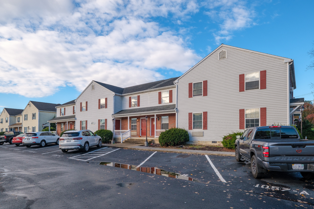
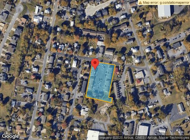
Property Record
1041 Shenandoah St, Harrisonburg, VA 22802
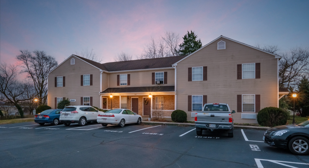
NEARBY LISTINGS FOR SALE OR LEASE
Property Detail
1041 Shenandoah St
048-E-7
QUADRANT 2 SS SHENANDOAH ST
Multifamilydwelling
Harrisonburg
X
Virginia
51165C0384D
44 SF
2024
Staunton & Harrisonburg
2024
Other Market Areas
000402
Harrisonburg, VA
7,168 SF
DEMOGRAPHICS near 1041 Shenandoah St
1 Mile
3 Mile
5 Mile
2024 Total Population
6,505
44,852
68,447
2029 Population
6,366
44,245
68,301
Pop Growth 2024-2029
(2.14%)
(1.35%)
(0.21%)
Average Age
39
33
34
2024 Total Households
2,557
14,575
23,650
HH Growth 2024-2029
(2.54%)
(1.57%)
(0.23%)
Median Household Inc
$52,011
$55,962
$57,556
Avg Household Size
2.40
2.50
2.50
2024 Avg HH Vehicles
2.00
2.00
2.00
Median Home Value
$254,899
$271,300
$270,239
Median Year Built
1981
1984
1989
Nearby Places
- Restaurants
- Banks
- Shops
- Fitness
- Groceries
SALE & LEASE HISTORY
LISTING DATE
SALE/LEASE

Dec 19, 2022
For Sale
Nearby Properties
Address
Land Use
TOTAL SIZE
Lot Size
Zoning
Address
Land Use
TOTAL SIZE
Lot Size
Zoning
143.09 AC
MULTI DWEL
Address
Land Use
TOTAL SIZE
Lot Size
Zoning
68.88 AC
GENERAL IN
Address
Land Use
TOTAL SIZE
Lot Size
Zoning
114.53 AC
MULTI DWEL
Address
Land Use
TOTAL SIZE
Lot Size
Zoning
9.63 AC
MULTI DWEL
Address
Land Use
TOTAL SIZE
Lot Size
Zoning
100,172 SF
0.78 AC
MULTI DWEL
Address
Land Use
TOTAL SIZE
Lot Size
Zoning
219,561 SF
55.38 AC
GENERAL IN
Address
Land Use
TOTAL SIZE
Lot Size
Zoning
45,436 SF
44 SF
MULTI DWEL
Address
Land Use
TOTAL SIZE
Lot Size
Zoning
62.46 AC
SINGLE FAM
Address
Land Use
TOTAL SIZE
Lot Size
Zoning
510,400 SF
36.28 AC
GENERAL IN
Address
Land Use
TOTAL SIZE
Lot Size
Zoning
11.07 AC
RESIDENTIA
Address
Land Use
TOTAL SIZE
Lot Size
Zoning
236,916 SF
3.72 AC
MULTI DWEL
Address
Land Use
TOTAL SIZE
Lot Size
Zoning
4,128 SF
0.65 AC
MULTI DWEL
Address
Land Use
TOTAL SIZE
Lot Size
Zoning
14,490 SF
190 AC
PLANNED UN
Address
Land Use
TOTAL SIZE
Lot Size
Zoning
14,856 SF
168 AC
MULTI DWEL
Address
Land Use
TOTAL SIZE
Lot Size
Zoning
5,000 SF
12.96 AC
GENERAL IN
Address
Land Use
TOTAL SIZE
Lot Size
Zoning
MULTI DWEL
Address
Land Use
TOTAL SIZE
Lot Size
Zoning
99,334 SF
19.46 AC
GENERAL BU
Address
Land Use
TOTAL SIZE
Lot Size
Zoning
55,440 SF
3.41 AC
MULTI DWEL
Address
Land Use
TOTAL SIZE
Lot Size
Zoning
4,630 SF
17.31 AC
R3
Address
Land Use
TOTAL SIZE
Lot Size
Zoning
88 AC
MULTI DWEL
Address
Land Use
TOTAL SIZE
Lot Size
Zoning
53,840 SF
19.68 AC
GENERAL BU
Address
Land Use
TOTAL SIZE
Lot Size
Zoning
119,941 SF
10.82 AC
SINGLE FAM
Address
Land Use
TOTAL SIZE
Lot Size
Zoning
146,940 SF
32.91 AC
SINGLE FAM
Address
Land Use
TOTAL SIZE
Lot Size
Zoning
138.58 AC
GEN INDUST
Address
Land Use
TOTAL SIZE
Lot Size
Zoning
78,833 SF
3.76 AC
GENERAL BU
Address
Land Use
TOTAL SIZE
Lot Size
Zoning
107,978 SF
20.45 AC
MULTI DWEL
Address
Land Use
TOTAL SIZE
Lot Size
Zoning
4,374 SF
17.93 AC
COMMERCIAL
Address
Land Use
TOTAL SIZE
Lot Size
Zoning
236,070 SF
2.40 AC
GENERAL IN
Address
Land Use
TOTAL SIZE
Lot Size
Zoning
16,758 SF
131 SF
MULTI DWEL
Address
Land Use
TOTAL SIZE
Lot Size
Zoning
13,939 SF
98 AC
CENTRAL BU
The World's #1 Commercial Real Estate Marketplace
Connect with us
© 2025 CoStar Group
The information above has been obtained from sources believed reliable. While we do not doubt its accuracy we have not verified it and make no guarantee, warranty or representation about it. It is your responsibility to independently confirm its accuracy and completeness. Any projections, opinions, assumptions, or estimates used are for example only and do not represent the current or future performance of the property. The value of this transaction to you depends on tax and other factors which should be evaluated by your tax, financial, and legal advisors. You and your advisors should conduct a careful, independent investigation of the property to determine to your satisfaction the suitability of the property for your needs.