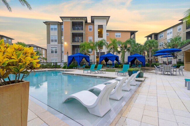
Property Record
10440 Sanderling Shores Dr, Tampa, FL 33619


NEARBY LISTINGS FOR SALE OR LEASE
Property Detail
10440 Sanderling Shores Dr
Tampa-St. Petersburg-Clearwater, FL
Crossroads Town Center A Partial Replat
U-30-29-20-9X3-000000-0002A.0
CROSSROADS TOWN CENTER A PARTIAL REPLAT LOT 2A
Multifamilydwelling
Hillsborough
AE
Florida
12057C0387J
2a
2024
18.06 AC
2024
Brandon
013315
Tampa/St Petersburg
525,026 SF
DEMOGRAPHICS near 10440 Sanderling Shores Dr
1 Mile
3 Mile
5 Mile
2024 Total Population
12,171
101,505
208,375
2029 Population
13,403
111,153
227,771
Pop Growth 2024-2029
+ 10.12%
+ 9.50%
+ 9.31%
Average Age
34
37
38
2024 Total Households
6,022
40,832
79,647
HH Growth 2024-2029
+ 10.43%
+ 9.90%
+ 9.70%
Median Household Inc
$65,990
$60,741
$63,985
Avg Household Size
2.00
2.40
2.50
2024 Avg HH Vehicles
1.00
2.00
2.00
Median Home Value
$218,939
$238,872
$254,486
Median Year Built
2005
1998
1994
Nearby Places
Map Layers
Map Styles
 Street
 Aerial
- Restaurants
- Banks
- Shops
- Fitness
- Groceries
PUBLIC TRANSPORTATION
COMMUTER RAIL
Tampa (Silver Star - Amtrak)
DRIVE
WALK
Distance
Tampa (Silver Star - Amtrak)
13 min
8.9 mi
AIRPORT
Tampa International
DRIVE
WALK
Distance
Tampa International
26 min
17.5 mi
St Pete-Clearwater International
DRIVE
WALK
Distance
St Pete-Clearwater International
44 min
26.7 mi
Freight Ports
Port of Tampa Bay
DRIVE
WALK
Distance
Port of Tampa Bay
15 min
7.8 mi
Nearby Properties
Address
Land Use
TOTAL SIZE
Lot Size
Zoning
Address
Land Use
TOTAL SIZE
Lot Size
Zoning
733,263 SF
72.88 AC
PD
Address
Land Use
TOTAL SIZE
Lot Size
Zoning
1,122,007 SF
181.48 AC
PD
Address
Land Use
TOTAL SIZE
Lot Size
Zoning
868,482 SF
60.83 AC
PD
Address
Land Use
TOTAL SIZE
Lot Size
Zoning
574,867 SF
31.07 AC
PD
Address
Land Use
TOTAL SIZE
Lot Size
Zoning
325,857 SF
16.32 AC
PD
Address
Land Use
TOTAL SIZE
Lot Size
Zoning
606,551 SF
18.23 AC
PD
Address
Land Use
TOTAL SIZE
Lot Size
Zoning
92,431 SF
175.42 AC
PD
Address
Land Use
TOTAL SIZE
Lot Size
Zoning
399,989 SF
25.63 AC
PD
Address
Land Use
TOTAL SIZE
Lot Size
Zoning
406,097 SF
25.82 AC
PD
Address
Land Use
TOTAL SIZE
Lot Size
Zoning
501,085 SF
41.18 AC
PD
Address
Land Use
TOTAL SIZE
Lot Size
Zoning
349,931 SF
19.43 AC
PD
Address
Land Use
TOTAL SIZE
Lot Size
Zoning
366,971 SF
33.26 AC
PD
Address
Land Use
TOTAL SIZE
Lot Size
Zoning
379,023 SF
22.16 AC
PD
Address
Land Use
TOTAL SIZE
Lot Size
Zoning
363,226 SF
27.91 AC
PD
Address
Land Use
TOTAL SIZE
Lot Size
Zoning
317,413 SF
14.60 AC
PD
Address
Land Use
TOTAL SIZE
Lot Size
Zoning
378,206 SF
20.48 AC
PD
Address
Land Use
TOTAL SIZE
Lot Size
Zoning
443,914 SF
80.27 AC
IPD-3
Address
Land Use
TOTAL SIZE
Lot Size
Zoning
427,830 SF
23.95 AC
PD
Address
Land Use
TOTAL SIZE
Lot Size
Zoning
398,440 SF
48.63 AC
IPD-1
Address
Land Use
TOTAL SIZE
Lot Size
Zoning
349,531 SF
17.15 AC
PD
Address
Land Use
TOTAL SIZE
Lot Size
Zoning
343,903 SF
16.71 AC
PD
Address
Land Use
TOTAL SIZE
Lot Size
Zoning
358,987 SF
49.16 AC
PD
Address
Land Use
TOTAL SIZE
Lot Size
Zoning
338,628 SF
14.60 AC
PD
Address
Land Use
TOTAL SIZE
Lot Size
Zoning
402,388 SF
34.49 AC
PD
Address
Land Use
TOTAL SIZE
Lot Size
Zoning
339,482 SF
19.15 AC
PD
Address
Land Use
TOTAL SIZE
Lot Size
Zoning
105,896 SF
38.01 AC
PD
Address
Land Use
TOTAL SIZE
Lot Size
Zoning
426,236 SF
21.09 AC
PD
Address
Land Use
TOTAL SIZE
Lot Size
Zoning
284,156 SF
19.32 AC
PD
Address
Land Use
TOTAL SIZE
Lot Size
Zoning
259,451 SF
13.73 AC
PD
The World's #1 Commercial Real Estate Marketplace
Connect with us
© 2026 CoStar Group
The information above has been obtained from sources believed reliable. While we do not doubt its accuracy we have not verified it and make no guarantee, warranty or representation about it. It is your responsibility to independently confirm its accuracy and completeness. Any projections, opinions, assumptions, or estimates used are for example only and do not represent the current or future performance of the property. The value of this transaction to you depends on tax and other factors which should be evaluated by your tax, financial, and legal advisors. You and your advisors should conduct a careful, independent investigation of the property to determine to your satisfaction the suitability of the property for your needs.