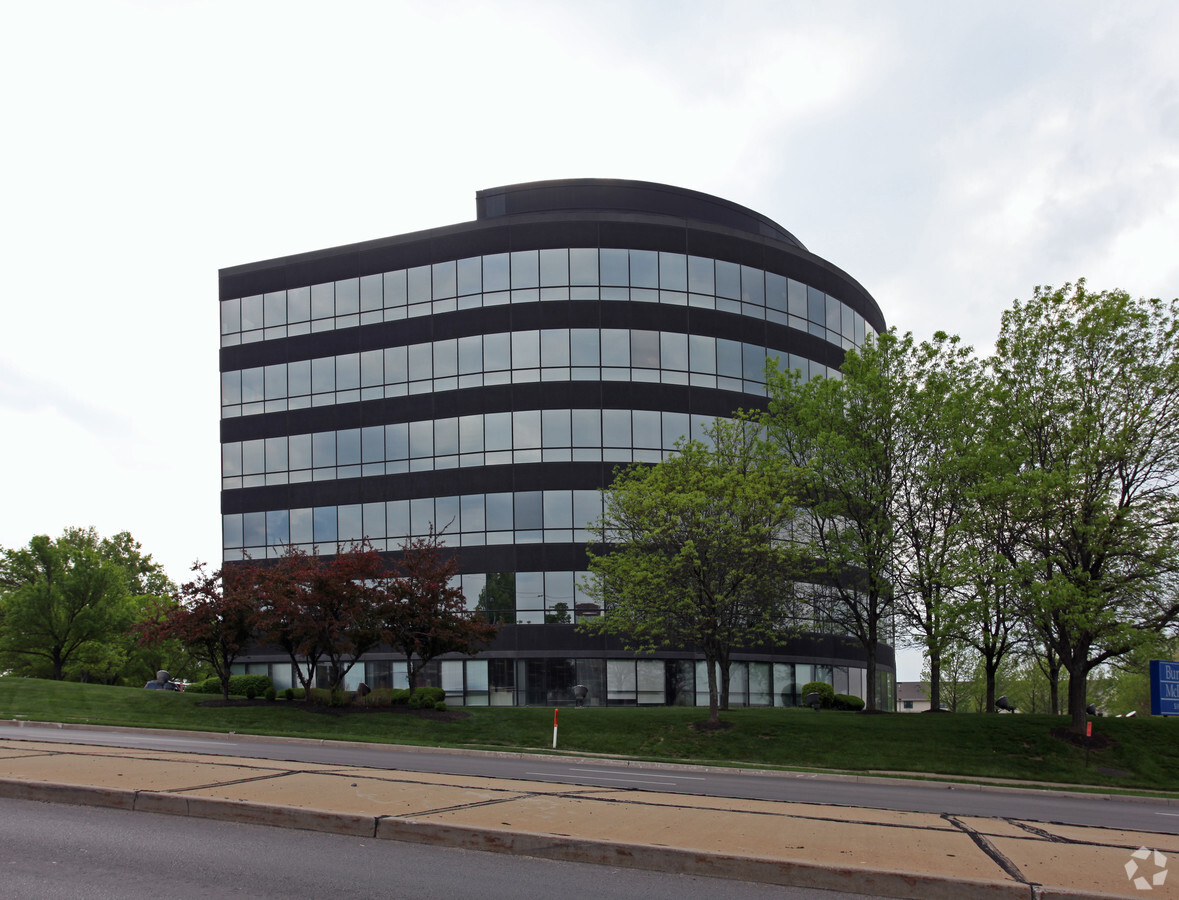
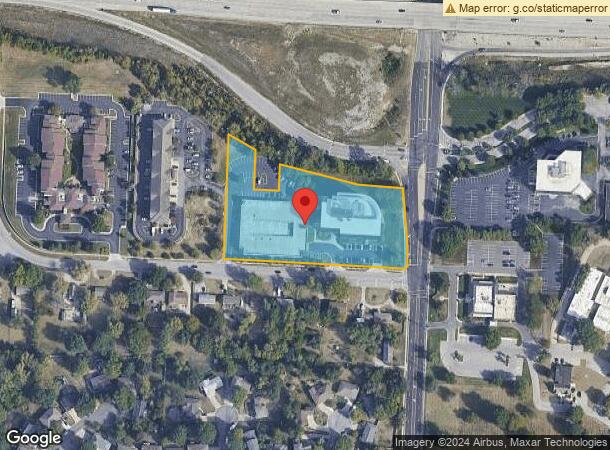
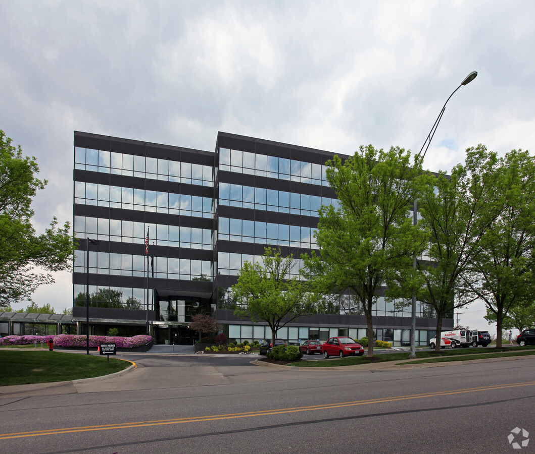
Property Record
10450 Holmes Rd, Kansas City, MO 64131
NEARBY LISTINGS FOR SALE OR LEASE
Property Detail
10450 Holmes Rd
Kansas City, MO-KS
Executive Hills East 2Nd Plat
48-840-09-01-00-0-00-000
EXECUTIVE HILLS EAST 2ND PLAT LOT 2 & S 228 MOL OF E 1/2 VAC 104TH ST LY W OF & ADJ
Officebuilding
Jackson
X
Missouri
29095C0379G
2
2023
3.40 AC
2024
South Kansas City MO
017300
Kansas City
52,818 SF
DEMOGRAPHICS near 10450 Holmes Rd
1 Mile
3 Mile
5 Mile
2024 Total Population
8,547
56,274
185,578
2029 Population
8,695
56,809
188,948
Pop Growth 2024-2029
+ 1.73%
+ 0.95%
+ 1.82%
Average Age
44
42
41
2024 Total Households
4,441
25,209
80,689
HH Growth 2024-2029
+ 1.53%
+ 0.77%
+ 1.81%
Median Household Inc
$68,371
$77,047
$73,083
Avg Household Size
1.90
2.10
2.20
2024 Avg HH Vehicles
2.00
2.00
2.00
Median Home Value
$242,173
$284,387
$300,699
Median Year Built
1974
1968
1967
Nearby Places
- Restaurants
- Banks
- Shops
- Fitness
- Groceries
PUBLIC TRANSPORTATION
AIRPORT
Kansas City International
Drive
Walk
Distance
Kansas City International
48 min
34.9 mi
Freight Ports
Tulsa Port Of Catoosa
Drive
Walk
Distance
Tulsa Port Of Catoosa
256 min
227.6 mi
SALE & LEASE HISTORY
LISTING DATE
SALE/LEASE

Sep 24, 2016
For Lease
Nearby Properties
Address
Land Use
TOTAL SIZE
Lot Size
Zoning
Address
Land Use
TOTAL SIZE
Lot Size
Zoning
616742
13.59 AC
Address
Land Use
TOTAL SIZE
Lot Size
Zoning
73383
9.53 AC
R-1
Address
Land Use
TOTAL SIZE
Lot Size
Zoning
465394
16.63 AC
Address
Land Use
TOTAL SIZE
Lot Size
Zoning
166097
37.29 AC
R-1
Address
Land Use
TOTAL SIZE
Lot Size
Zoning
105110
8.93 AC
AG
Address
Land Use
TOTAL SIZE
Lot Size
Zoning
59570
8.46 AC
SD-O
Address
Land Use
TOTAL SIZE
Lot Size
Zoning
351705
22.71 AC
Address
Land Use
TOTAL SIZE
Lot Size
Zoning
120225
9.13 AC
R-1
Address
Land Use
TOTAL SIZE
Lot Size
Zoning
157280
25.10 AC
Address
Land Use
TOTAL SIZE
Lot Size
Zoning
109553
3.08 AC
Address
Land Use
TOTAL SIZE
Lot Size
Zoning
180281
0.97 AC
Address
Land Use
TOTAL SIZE
Lot Size
Zoning
594789
62.41 AC
Address
Land Use
TOTAL SIZE
Lot Size
Zoning
60960
4.82 AC
SD-NCR
Address
Land Use
TOTAL SIZE
Lot Size
Zoning
85287
2.35 AC
R-1
Address
Land Use
TOTAL SIZE
Lot Size
Zoning
41834
209.03 AC
Address
Land Use
TOTAL SIZE
Lot Size
Zoning
221870
9.76 AC
Address
Land Use
TOTAL SIZE
Lot Size
Zoning
89709
13.43 AC
Address
Land Use
TOTAL SIZE
Lot Size
Zoning
72813
26.68 AC
Address
Land Use
TOTAL SIZE
Lot Size
Zoning
61456
15.15 AC
SD-O
Address
Land Use
TOTAL SIZE
Lot Size
Zoning
25209
3.07 AC
R-1
Address
Land Use
TOTAL SIZE
Lot Size
Zoning
195800
3.21 AC
MXD
Address
Land Use
TOTAL SIZE
Lot Size
Zoning
65128
8.70 AC
Address
Land Use
TOTAL SIZE
Lot Size
Zoning
575809
49.32 AC
Address
Land Use
TOTAL SIZE
Lot Size
Zoning
330705
41.50 AC
Address
Land Use
TOTAL SIZE
Lot Size
Zoning
260629
7.17 AC
Address
Land Use
TOTAL SIZE
Lot Size
Zoning
172350
11.28 AC
SD-CR
Address
Land Use
TOTAL SIZE
Lot Size
Zoning
189920
4.93 AC
MXD
Address
Land Use
TOTAL SIZE
Lot Size
Zoning
334306
16.22 AC
R-3
Address
Land Use
TOTAL SIZE
Lot Size
Zoning
80359
5.84 AC
SD-O
Address
Land Use
TOTAL SIZE
Lot Size
Zoning
128543
6.42 AC
SD-O
Start a new search to find other properties for sale or lease
Connect with us
© 2024 CoStar Group
The information above has been obtained from sources believed reliable. While we do not doubt its accuracy we have not verified it and make no guarantee, warranty or representation about it. It is your responsibility to independently confirm its accuracy and completeness. Any projections, opinions, assumptions, or estimates used are for example only and do not represent the current or future performance of the property. The value of this transaction to you depends on tax and other factors which should be evaluated by your tax, financial, and legal advisors. You and your advisors should conduct a careful, independent investigation of the property to determine to your satisfaction the suitability of the property for your needs.