Property Record
10450 W State Road 84, Davie, FL 33324
NEARBY LISTINGS FOR SALE OR LEASE
Property Detail
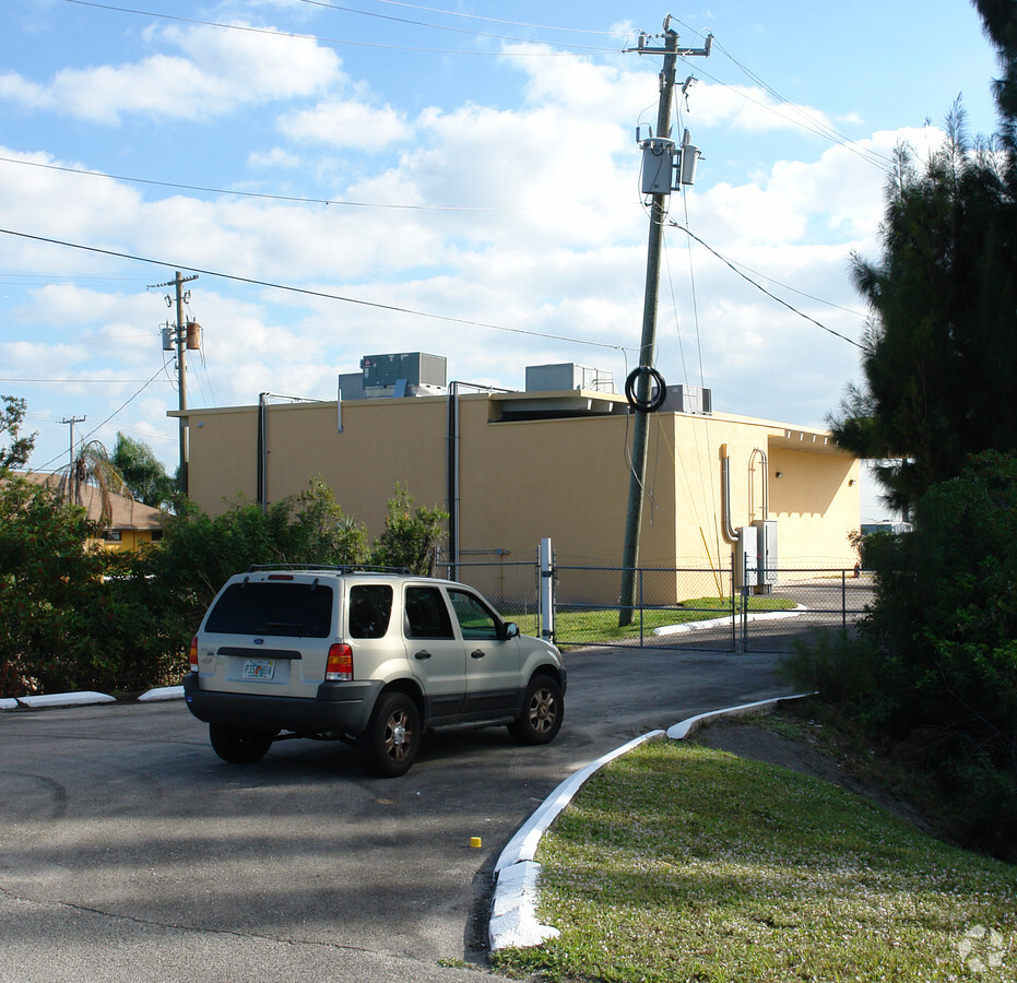
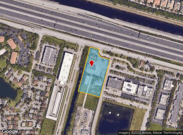
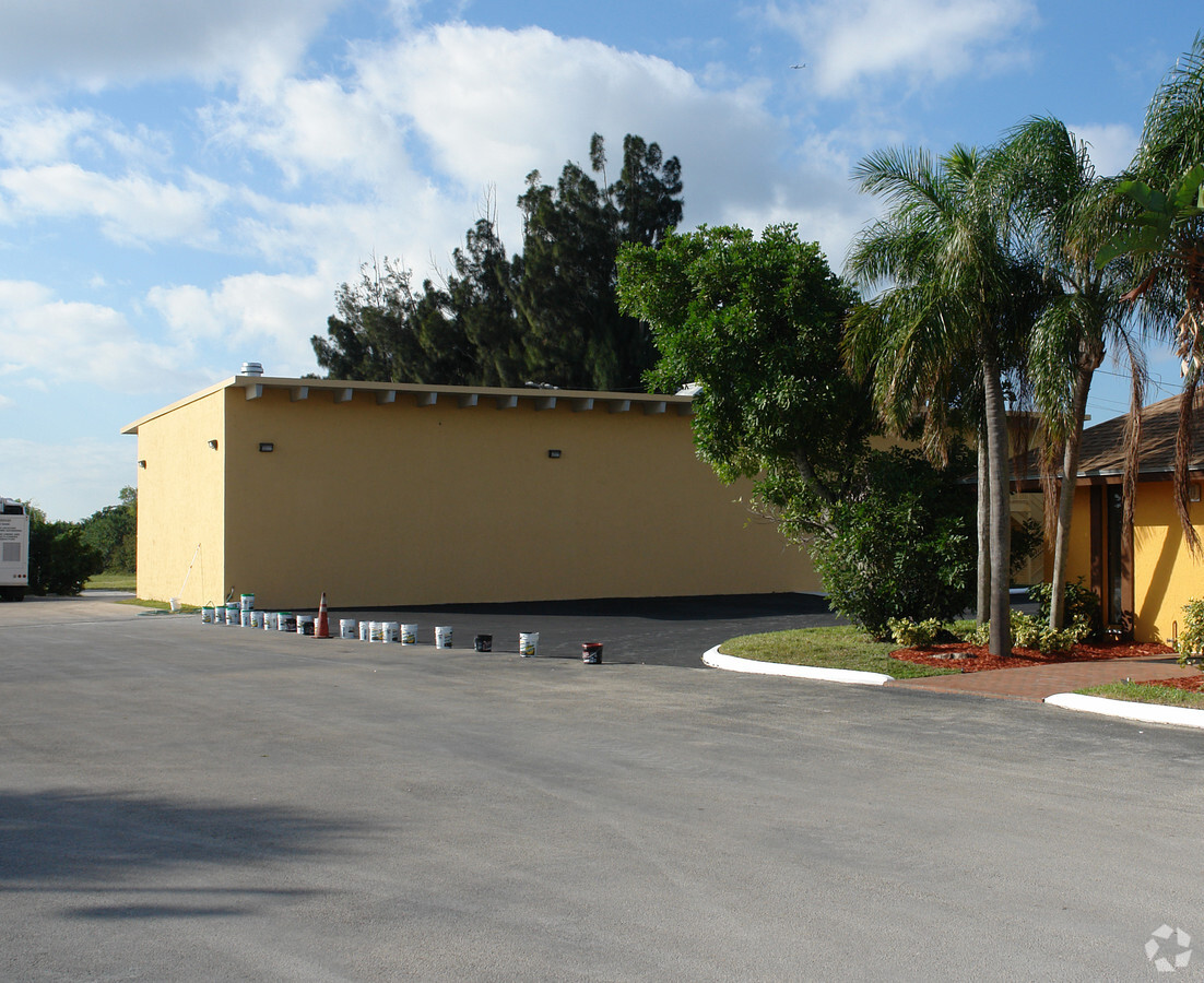
10450 W State Road 84
Fort Lauderdale-Pompano Beach-Deerfield Beach, FL
G.B.C. Properties 144-5 B
50-41-18-07-0040
G.B.C. PROPERTIES 144-5 B A POR OF PARCELS A,B & C DESC AS:BEG AT NE COR SAID PAR C E 115,SW 30,SELY AN ARC DIST OF 78.54,SE 100,SW 456.39,NW 265, NE 536.39 TO POB
Warehouse
Broward
AE
Florida
12011C0535J
a
2024
3 AC
2025
Southwest Broward
070208
South Florida
12,205 SF
DEMOGRAPHICS near 10450 W State Road 84
1 Mile
3 Mile
5 Mile
2024 Total Population
10,575
104,705
283,464
2029 Population
10,526
103,638
280,003
Pop Growth 2024-2029
(0.46%)
(1.02%)
(1.22%)
Average Age
41
40
40
2024 Total Households
3,925
40,273
105,318
HH Growth 2024-2029
(0.94%)
(1.39%)
(1.62%)
Median Household Inc
$95,679
$87,975
$78,568
Avg Household Size
2.60
2.50
2.60
2024 Avg HH Vehicles
2.00
2.00
2.00
Median Home Value
$456,102
$403,660
$365,550
Median Year Built
1991
1986
1983
Nearby Places
- Restaurants
- Banks
- Shops
- Fitness
- Groceries
PUBLIC TRANSPORTATION
COMMUTER RAIL
Fort Lauderdale (Tri-County Commuter - South Florida Regional Transportation Authority (Tri-Rail))
DRIVE
WALK
Distance
Fort Lauderdale (Tri-County Commuter - South Florida Regional Transportation Authority (Tri-Rail))
18 min
9.0 mi
Fort Lauderdale/Hollywood International Airport (Tri-County Commuter - South Florida Regional Transportation Authority (Tri-Rail))
DRIVE
WALK
Distance
Fort Lauderdale/Hollywood International Airport (Tri-County Commuter - South Florida Regional Transportation Authority (Tri-Rail))
15 min
9.8 mi
AIRPORT
Fort Lauderdale/Hollywood International
DRIVE
WALK
Distance
Fort Lauderdale/Hollywood International
17 min
9.7 mi
Miami International
DRIVE
WALK
Distance
Miami International
42 min
31.5 mi
Freight Ports
Port Everglades
DRIVE
WALK
Distance
Port Everglades
16 min
11.7 mi
Nearby Properties
Address
Land Use
TOTAL SIZE
Lot Size
Zoning
Address
Land Use
TOTAL SIZE
Lot Size
Zoning
663,255 SF
3.14 AC
RAC-CC
Address
Land Use
TOTAL SIZE
Lot Size
Zoning
574,019 SF
44.58 AC
RM-10N
Address
Land Use
TOTAL SIZE
Lot Size
Zoning
632,250 SF
34.15 AC
PRD-11.6Q
Address
Land Use
TOTAL SIZE
Lot Size
Zoning
458,854 SF
30.97 AC
PRD-15Q **
Address
Land Use
TOTAL SIZE
Lot Size
Zoning
507,890 SF
39.49 AC
M-PM
Address
Land Use
TOTAL SIZE
Lot Size
Zoning
413,123 SF
63.50 AC
B-3
Address
Land Use
TOTAL SIZE
Lot Size
Zoning
438,123 SF
47.44 AC
RM-22
Address
Land Use
TOTAL SIZE
Lot Size
Zoning
627,368 SF
4.33 AC
PRD-21Q
Address
Land Use
TOTAL SIZE
Lot Size
Zoning
613,363 SF
6.24 AC
B-7Q
Address
Land Use
TOTAL SIZE
Lot Size
Zoning
517,961 SF
3.92 AC
M-PM
Address
Land Use
TOTAL SIZE
Lot Size
Zoning
337,553 SF
39.13 AC
RM-10
Address
Land Use
TOTAL SIZE
Lot Size
Zoning
497,004 SF
4.46 AC
M-PM
Address
Land Use
TOTAL SIZE
Lot Size
Zoning
333,099 SF
9.03 AC
PRD-10Q
Address
Land Use
TOTAL SIZE
Lot Size
Zoning
471,109 SF
5.57 AC
M-PM
Address
Land Use
TOTAL SIZE
Lot Size
Zoning
527,086 SF
2.34 AC
M-PM
Address
Land Use
TOTAL SIZE
Lot Size
Zoning
320,919 SF
27.70 AC
M-PM
Address
Land Use
TOTAL SIZE
Lot Size
Zoning
439,908 SF
13.54 AC
OP-P
Address
Land Use
TOTAL SIZE
Lot Size
Zoning
505,730 SF
18.07 AC
RAC-AV
Address
Land Use
TOTAL SIZE
Lot Size
Zoning
256,568 SF
22.61 AC
PRD-12.15Q
Address
Land Use
TOTAL SIZE
Lot Size
Zoning
312,067 SF
20.94 AC
PRD-15Q
Address
Land Use
TOTAL SIZE
Lot Size
Zoning
445,798 SF
11.80 AC
OP-P
Address
Land Use
TOTAL SIZE
Lot Size
Zoning
321,240 SF
2.16 AC
M-PM
Address
Land Use
TOTAL SIZE
Lot Size
Zoning
234,496 SF
3.07 AC
M-PM
Address
Land Use
TOTAL SIZE
Lot Size
Zoning
231,498 SF
19.56 AC
PRD-12.15Q
Address
Land Use
TOTAL SIZE
Lot Size
Zoning
365,027 SF
38.55 AC
CF
Address
Land Use
TOTAL SIZE
Lot Size
Zoning
405,695 SF
10.08 AC
M-PM
Address
Land Use
TOTAL SIZE
Lot Size
Zoning
242,841 SF
17.21 AC
M-PM
Address
Land Use
TOTAL SIZE
Lot Size
Zoning
264,127 SF
24.02 AC
B-3
Address
Land Use
TOTAL SIZE
Lot Size
Zoning
337,771 SF
20.62 AC
PRD-17Q
Address
Land Use
TOTAL SIZE
Lot Size
Zoning
291,638 SF
15.08 AC
PRD-15Q
The World's #1 Commercial Real Estate Marketplace
Connect with us
© 2025 CoStar Group
The information above has been obtained from sources believed reliable. While we do not doubt its accuracy we have not verified it and make no guarantee, warranty or representation about it. It is your responsibility to independently confirm its accuracy and completeness. Any projections, opinions, assumptions, or estimates used are for example only and do not represent the current or future performance of the property. The value of this transaction to you depends on tax and other factors which should be evaluated by your tax, financial, and legal advisors. You and your advisors should conduct a careful, independent investigation of the property to determine to your satisfaction the suitability of the property for your needs.