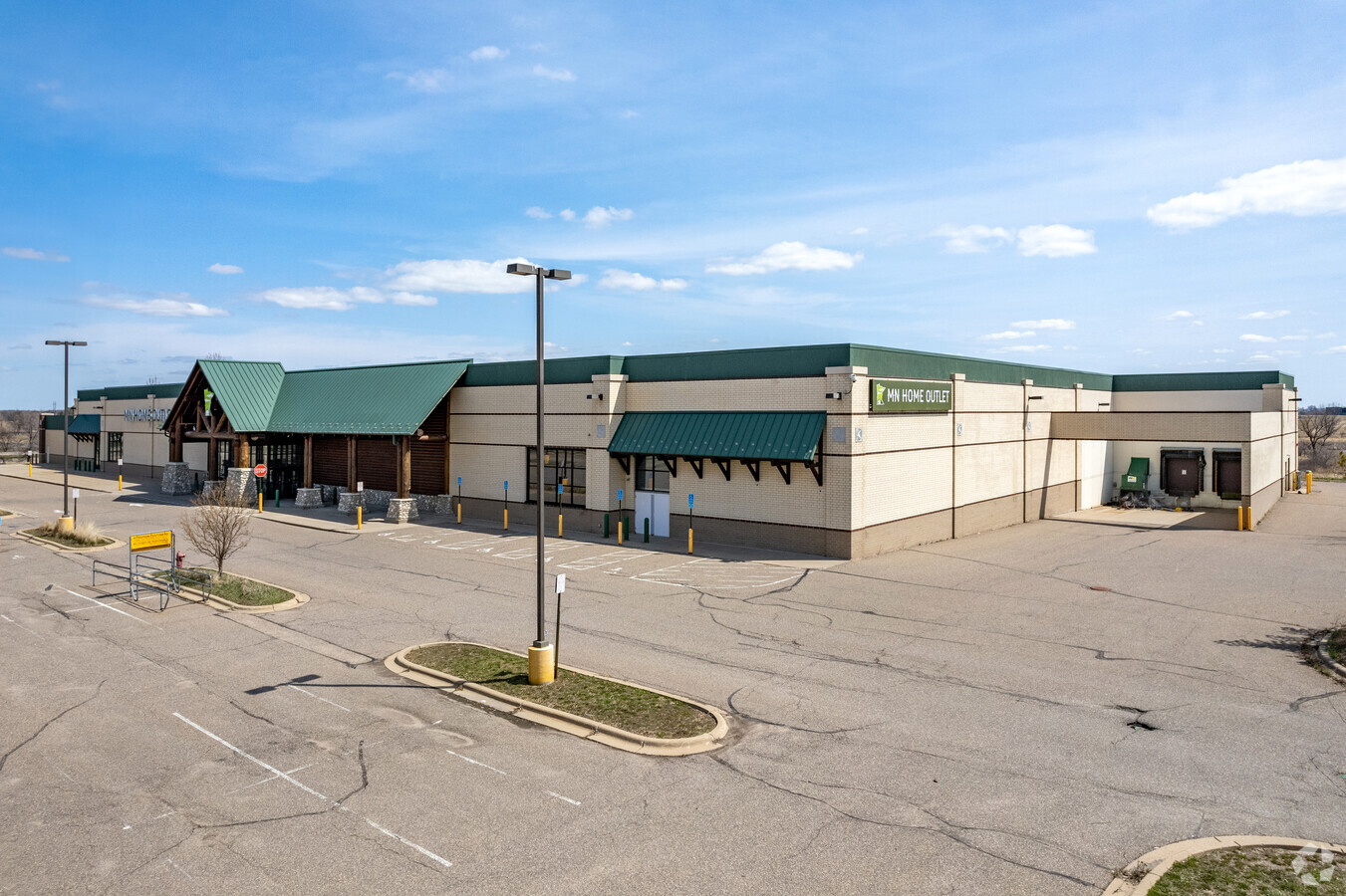
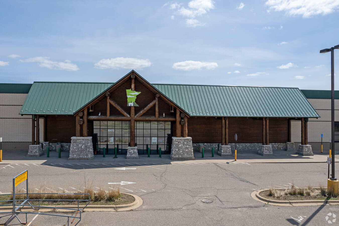
Property Record
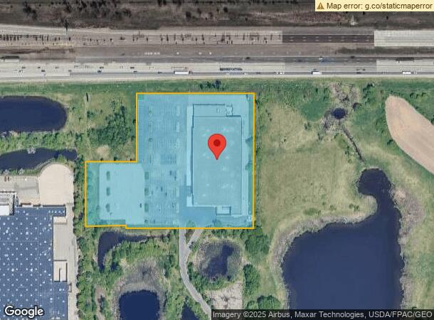
10470 Hudson Rd, Saint Paul, MN 55129
NEARBY LISTINGS FOR SALE OR LEASE
Property Detail
10470 Hudson Rd
Minneapolis-St. Paul-Bloomington, MN-WI
Gander Mountain
02-028-21-21-0011
SUBDIVISIONNAME GANDER MOUNTAIN LOT 1 BLOCK 2 SUBDIVISIONCD 01533 SUBJ TO EASE
Commercialnec
Washington
X
Minnesota
27163C0335E
1
2024
6.66 AC
2023
Woodbury
071021
Minneapolis/St Paul
71,899 SF
DEMOGRAPHICS near 10470 Hudson Rd
1 Mile
3 Mile
5 Mile
2024 Total Population
6,190
41,098
110,429
2029 Population
6,758
44,591
119,509
Pop Growth 2024-2029
+ 9.18%
+ 8.50%
+ 8.22%
Average Age
40
39
39
2024 Total Households
2,646
15,167
40,711
HH Growth 2024-2029
+ 9.22%
+ 8.63%
+ 8.31%
Median Household Inc
$100,691
$134,754
$114,705
Avg Household Size
2.30
2.70
2.60
2024 Avg HH Vehicles
2.00
2.00
2.00
Median Home Value
$428,003
$426,146
$390,810
Median Year Built
2004
1998
1994
Nearby Places
- Restaurants
- Banks
- Shops
- Fitness
- Groceries
PUBLIC TRANSPORTATION
AIRPORT
Minneapolis-St Paul International/Wold-Chamberlain
DRIVE
WALK
Distance
Minneapolis-St Paul International/Wold-Chamberlain
31 min
20.1 mi
Freight Ports
Port Milwaukee
DRIVE
WALK
Distance
Port Milwaukee
352 min
319.5 mi
SALE & LEASE HISTORY
LISTING DATE
SALE/LEASE

May 12, 2017
For Lease
May 12, 2017
For Sale
Mar 25, 2021
For Lease
Nearby Properties
Address
Land Use
TOTAL SIZE
Lot Size
Zoning
Address
Land Use
TOTAL SIZE
Lot Size
Zoning
925,234 SF
37.62 AC
Address
Land Use
TOTAL SIZE
Lot Size
Zoning
Address
Land Use
TOTAL SIZE
Lot Size
Zoning
335,655 SF
Address
Land Use
TOTAL SIZE
Lot Size
Zoning
467,160 SF
5 AC
Address
Land Use
TOTAL SIZE
Lot Size
Zoning
4.81 AC
Address
Land Use
TOTAL SIZE
Lot Size
Zoning
273,222 SF
2.38 AC
Address
Land Use
TOTAL SIZE
Lot Size
Zoning
Address
Land Use
TOTAL SIZE
Lot Size
Zoning
15.10 AC
Address
Land Use
TOTAL SIZE
Lot Size
Zoning
96,046 SF
10.10 AC
Address
Land Use
TOTAL SIZE
Lot Size
Zoning
282,494 SF
9 AC
Address
Land Use
TOTAL SIZE
Lot Size
Zoning
228,036 SF
31.11 AC
Address
Land Use
TOTAL SIZE
Lot Size
Zoning
219,844 SF
Address
Land Use
TOTAL SIZE
Lot Size
Zoning
516,859 SF
Address
Land Use
TOTAL SIZE
Lot Size
Zoning
100,358 SF
24.99 AC
Address
Land Use
TOTAL SIZE
Lot Size
Zoning
85,400 SF
6.43 AC
Address
Land Use
TOTAL SIZE
Lot Size
Zoning
Address
Land Use
TOTAL SIZE
Lot Size
Zoning
124,110 SF
Address
Land Use
TOTAL SIZE
Lot Size
Zoning
86,572 SF
7.92 AC
Address
Land Use
TOTAL SIZE
Lot Size
Zoning
121,705 SF
35 AC
Address
Land Use
TOTAL SIZE
Lot Size
Zoning
79,898 SF
31 AC
Address
Land Use
TOTAL SIZE
Lot Size
Zoning
304,342 SF
24.94 AC
Address
Land Use
TOTAL SIZE
Lot Size
Zoning
75,825 SF
19.49 AC
Address
Land Use
TOTAL SIZE
Lot Size
Zoning
80,019 SF
10.21 AC
Address
Land Use
TOTAL SIZE
Lot Size
Zoning
252,000 SF
16.56 AC
Address
Land Use
TOTAL SIZE
Lot Size
Zoning
53,196 SF
4.48 AC
Address
Land Use
TOTAL SIZE
Lot Size
Zoning
468,264 SF
14.14 AC
Address
Land Use
TOTAL SIZE
Lot Size
Zoning
89,179 SF
16.04 AC
Address
Land Use
TOTAL SIZE
Lot Size
Zoning
122,461 SF
19.98 AC
Address
Land Use
TOTAL SIZE
Lot Size
Zoning
177,239 SF
17.31 AC
The World's #1 Commercial Real Estate Marketplace
Connect with us
© 2025 CoStar Group
The information above has been obtained from sources believed reliable. While we do not doubt its accuracy we have not verified it and make no guarantee, warranty or representation about it. It is your responsibility to independently confirm its accuracy and completeness. Any projections, opinions, assumptions, or estimates used are for example only and do not represent the current or future performance of the property. The value of this transaction to you depends on tax and other factors which should be evaluated by your tax, financial, and legal advisors. You and your advisors should conduct a careful, independent investigation of the property to determine to your satisfaction the suitability of the property for your needs.