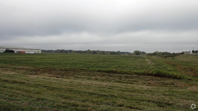
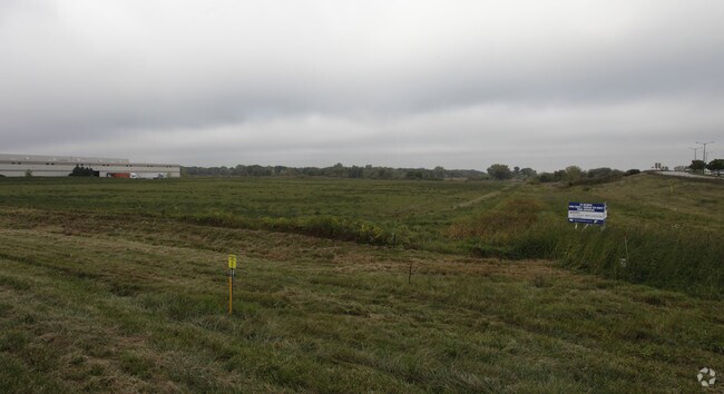
Property Record
10490 88Th Ave, Pleasant Prairie, WI 53158

NEARBY LISTINGS FOR SALE OR LEASE
-
-
-
-
-
-
-
No Photo
-
View all Pleasant Prairie listings for sale on LoopNet.com
Property Detail
10490 88Th Ave
Chicago-Naperville-Elgin, IL-IN-WI
Csm# 2339
92-4-122-291-0111
LOT 99 CSM #2339 DOC#1301442 F/K/A PARCEL 49 CSM #2189 DOC#1182063 F/K/A PARCEL 49 CSM #1635 V1559 P598 PT NE 1/4 OF NE 1/4 S
Commercialnec
Kenosha
X
Wisconsin
55059C0193D
99
2024
12.01 AC
2024
Kenosha East
002605
Chicago
200,637 SF
DEMOGRAPHICS near 10490 88Th Ave
1 Mile
3 Mile
5 Mile
2024 Total Population
0
11,915
69,609
2029 Population
0
11,972
69,184
Pop Growth 2024-2029
0.00%
+ 0.48%
(0.61%)
Average Age
0
42
40
2024 Total Households
0
4,887
26,983
HH Growth 2024-2029
0.00%
+ 0.43%
(0.66%)
Median Household Inc
$0
$96,270
$78,459
Avg Household Size
.00
2.40
2.50
2024 Avg HH Vehicles
.00
2.00
2.00
Median Home Value
$0
$330,574
$243,318
Median Year Built
0
2000
1981
Nearby Places
Map Layers
Map Styles
 Street
 Aerial
- Restaurants
- Banks
- Shops
- Fitness
- Groceries
PUBLIC TRANSPORTATION
COMMUTER RAIL
Winthrop Harbor Station (Union Pacific North Line - Northeast Illinois Regional Commuter Railroad (Metra))
DRIVE
WALK
Distance
Winthrop Harbor Station (Union Pacific North Line - Northeast Illinois Regional Commuter Railroad (Metra))
16 min
8.1 mi
Kenosha Station (Union Pacific North Line - Northeast Illinois Regional Commuter Railroad (Metra))
DRIVE
WALK
Distance
Kenosha Station (Union Pacific North Line - Northeast Illinois Regional Commuter Railroad (Metra))
18 min
9.0 mi
AIRPORT
General Mitchell International
DRIVE
WALK
Distance
General Mitchell International
42 min
33.6 mi
Freight Ports
Port Milwaukee
DRIVE
WALK
Distance
Port Milwaukee
47 min
37.5 mi
Nearby Properties
Address
Land Use
TOTAL SIZE
Lot Size
Zoning
Address
Land Use
TOTAL SIZE
Lot Size
Zoning
1,083,094 SF
230.85 AC
Address
Land Use
TOTAL SIZE
Lot Size
Zoning
159,194 SF
136.60 AC
Address
Land Use
TOTAL SIZE
Lot Size
Zoning
75,755 SF
19.27 AC
Address
Land Use
TOTAL SIZE
Lot Size
Zoning
51,119 SF
63.71 AC
Address
Land Use
TOTAL SIZE
Lot Size
Zoning
271,533 SF
125.41 AC
Address
Land Use
TOTAL SIZE
Lot Size
Zoning
12.53 AC
Address
Land Use
TOTAL SIZE
Lot Size
Zoning
458,709 SF
36.04 AC
Address
Land Use
TOTAL SIZE
Lot Size
Zoning
176,386 SF
58.38 AC
Address
Land Use
TOTAL SIZE
Lot Size
Zoning
603,010 SF
51.30 AC
Address
Land Use
TOTAL SIZE
Lot Size
Zoning
590,185 SF
46.90 AC
Address
Land Use
TOTAL SIZE
Lot Size
Zoning
301,652 SF
43.52 AC
Address
Land Use
TOTAL SIZE
Lot Size
Zoning
519,602 SF
28.36 AC
Address
Land Use
TOTAL SIZE
Lot Size
Zoning
69,139 SF
12.40 AC
Address
Land Use
TOTAL SIZE
Lot Size
Zoning
38,201 SF
16 AC
Address
Land Use
TOTAL SIZE
Lot Size
Zoning
502,033 SF
28.13 AC
Address
Land Use
TOTAL SIZE
Lot Size
Zoning
451,756 SF
30.06 AC
Address
Land Use
TOTAL SIZE
Lot Size
Zoning
534,436 SF
35.50 AC
Address
Land Use
TOTAL SIZE
Lot Size
Zoning
418,133 SF
26.21 AC
Address
Land Use
TOTAL SIZE
Lot Size
Zoning
250,110 SF
17.13 AC
Address
Land Use
TOTAL SIZE
Lot Size
Zoning
424,072 SF
29.14 AC
Address
Land Use
TOTAL SIZE
Lot Size
Zoning
40.09 AC
Address
Land Use
TOTAL SIZE
Lot Size
Zoning
410,694 SF
25.36 AC
Address
Land Use
TOTAL SIZE
Lot Size
Zoning
12,794 SF
16.75 AC
Address
Land Use
TOTAL SIZE
Lot Size
Zoning
77,776 SF
36.16 AC
Address
Land Use
TOTAL SIZE
Lot Size
Zoning
377,582 SF
28.48 AC
Address
Land Use
TOTAL SIZE
Lot Size
Zoning
418,036 SF
25.33 AC
Address
Land Use
TOTAL SIZE
Lot Size
Zoning
47.82 AC
Address
Land Use
TOTAL SIZE
Lot Size
Zoning
447,200 SF
23.50 AC
Address
Land Use
TOTAL SIZE
Lot Size
Zoning
302,500 SF
23.89 AC
Address
Land Use
TOTAL SIZE
Lot Size
Zoning
193,366 SF
11.63 AC
The World's #1 Commercial Real Estate Marketplace
Connect with us
© 2026 CoStar Group
The information above has been obtained from sources believed reliable. While we do not doubt its accuracy we have not verified it and make no guarantee, warranty or representation about it. It is your responsibility to independently confirm its accuracy and completeness. Any projections, opinions, assumptions, or estimates used are for example only and do not represent the current or future performance of the property. The value of this transaction to you depends on tax and other factors which should be evaluated by your tax, financial, and legal advisors. You and your advisors should conduct a careful, independent investigation of the property to determine to your satisfaction the suitability of the property for your needs.