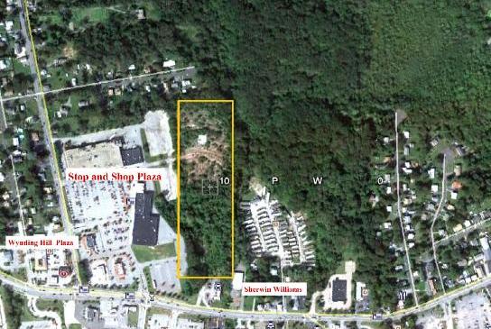
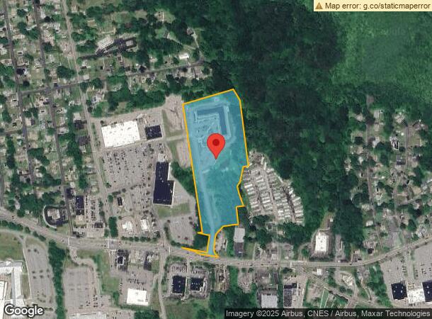
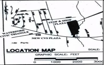
Property Record
105 Boston Post Rd, Waterford, CT 06385
NEARBY LISTINGS FOR SALE OR LEASE
-
-
-
-
-
-
No Photo
-
-
View all Waterford listings for sale on LoopNet.com
Property Detail
105 Boston Post Rd
WATE-000133-000000-000563
New London
Apartmenthouse5plusunits
Connecticut
X
563
09011C0501J
10.78 AC
2024
New London
2024
Hartford
693400
Norwich-New London, CT
82,326 SF
DEMOGRAPHICS near 105 Boston Post Rd
1 Mile
3 Mile
5 Mile
2024 Total Population
8,642
48,892
77,533
2029 Population
8,637
48,790
77,607
Pop Growth 2024-2029
(0.06%)
(0.21%)
+ 0.10%
Average Age
40
40
40
2024 Total Households
3,478
19,895
32,348
HH Growth 2024-2029
(0.03%)
(0.16%)
+ 0.15%
Median Household Inc
$50,409
$65,756
$70,851
Avg Household Size
2.30
2.20
2.20
2024 Avg HH Vehicles
1.00
2.00
2.00
Median Home Value
$186,566
$263,112
$268,086
Median Year Built
1952
1958
1965
Nearby Places
- Restaurants
- Banks
- Shops
- Fitness
- Groceries
PUBLIC TRANSPORTATION
COMMUTER RAIL
New London (Shore Line East - Shore Line East)
DRIVE
WALK
Distance
New London (Shore Line East - Shore Line East)
6 min
1.9 mi
Freight Ports
Port of Davisville, RI
DRIVE
WALK
Distance
Port of Davisville, RI
1 min
41.4 mi
Nearby Properties
Address
Land Use
TOTAL SIZE
Lot Size
Zoning
Address
Land Use
TOTAL SIZE
Lot Size
Zoning
24.41 AC
Address
Land Use
TOTAL SIZE
Lot Size
Zoning
Address
Land Use
TOTAL SIZE
Lot Size
Zoning
45,582 SF
39.40 AC
Address
Land Use
TOTAL SIZE
Lot Size
Zoning
296,000 SF
46.82 AC
C-T
Address
Land Use
TOTAL SIZE
Lot Size
Zoning
35.69 AC
SPD
Address
Land Use
TOTAL SIZE
Lot Size
Zoning
49.32 AC
Address
Land Use
TOTAL SIZE
Lot Size
Zoning
Address
Land Use
TOTAL SIZE
Lot Size
Zoning
59,264 SF
54.53 AC
I/T
Address
Land Use
TOTAL SIZE
Lot Size
Zoning
54.80 AC
Address
Land Use
TOTAL SIZE
Lot Size
Zoning
21.84 AC
Address
Land Use
TOTAL SIZE
Lot Size
Zoning
41.89 AC
SDD
Address
Land Use
TOTAL SIZE
Lot Size
Zoning
Address
Land Use
TOTAL SIZE
Lot Size
Zoning
73,446 SF
69.87 AC
R-12
Address
Land Use
TOTAL SIZE
Lot Size
Zoning
178,385 SF
5.42 AC
Address
Land Use
TOTAL SIZE
Lot Size
Zoning
510,106 SF
30.11 AC
C-R
Address
Land Use
TOTAL SIZE
Lot Size
Zoning
55,766 SF
1.33 AC
Address
Land Use
TOTAL SIZE
Lot Size
Zoning
68,774 SF
53.34 AC
C-T
Address
Land Use
TOTAL SIZE
Lot Size
Zoning
68,331 SF
9.50 AC
R-20
Address
Land Use
TOTAL SIZE
Lot Size
Zoning
79,535 SF
3.03 AC
Address
Land Use
TOTAL SIZE
Lot Size
Zoning
135,113 SF
2.51 AC
Address
Land Use
TOTAL SIZE
Lot Size
Zoning
26.64 AC
C-G
Address
Land Use
TOTAL SIZE
Lot Size
Zoning
9.41 AC
Address
Land Use
TOTAL SIZE
Lot Size
Zoning
129,890 SF
40.95 AC
R-20
Address
Land Use
TOTAL SIZE
Lot Size
Zoning
75,441 SF
40.56 AC
R52
Address
Land Use
TOTAL SIZE
Lot Size
Zoning
5.65 AC
Address
Land Use
TOTAL SIZE
Lot Size
Zoning
4.31 AC
Address
Land Use
TOTAL SIZE
Lot Size
Zoning
56.50 AC
C-R
Address
Land Use
TOTAL SIZE
Lot Size
Zoning
18.95 AC
Address
Land Use
TOTAL SIZE
Lot Size
Zoning
12.55 AC
Address
Land Use
TOTAL SIZE
Lot Size
Zoning
201,755 SF
58.13 AC
C-R
The World's #1 Commercial Real Estate Marketplace
Connect with us
© 2025 CoStar Group
The information above has been obtained from sources believed reliable. While we do not doubt its accuracy we have not verified it and make no guarantee, warranty or representation about it. It is your responsibility to independently confirm its accuracy and completeness. Any projections, opinions, assumptions, or estimates used are for example only and do not represent the current or future performance of the property. The value of this transaction to you depends on tax and other factors which should be evaluated by your tax, financial, and legal advisors. You and your advisors should conduct a careful, independent investigation of the property to determine to your satisfaction the suitability of the property for your needs.