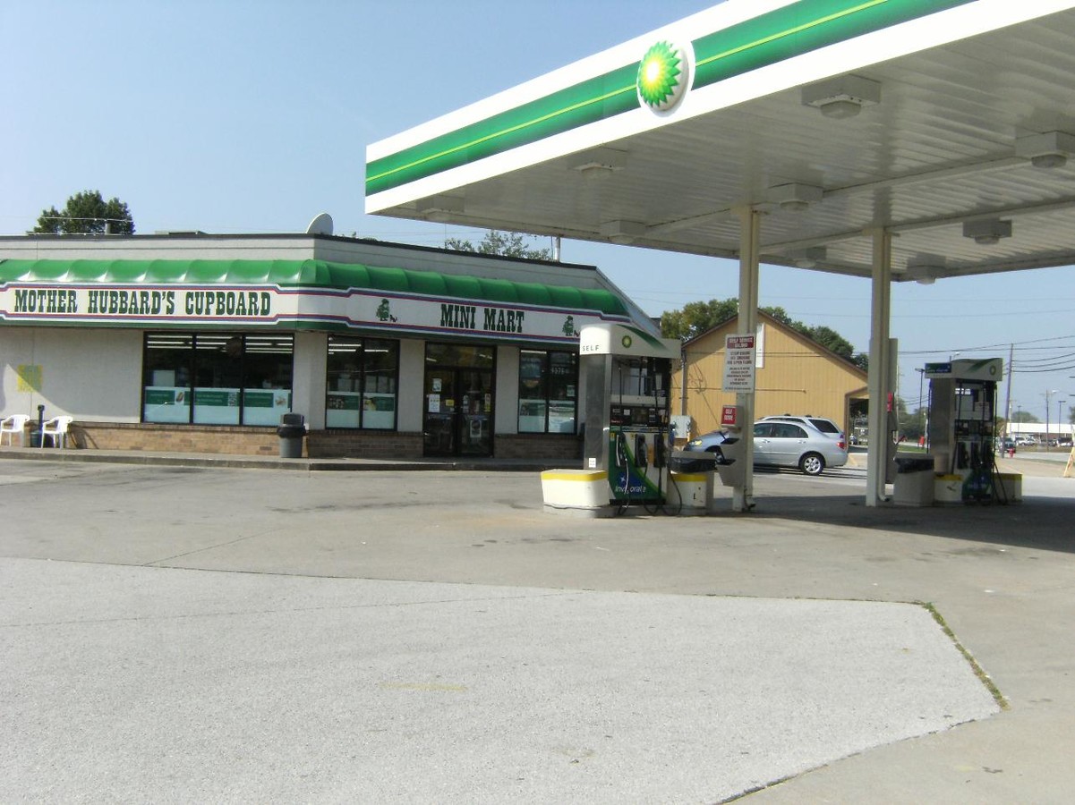
Property Record
105 W 1St Ave, Coal Valley, IL 61240
NEARBY LISTINGS FOR SALE OR LEASE
Property Detail
105 W 1St Ave
Davenport-Moline-Rock Island, IA-IL
Selhost 1St Add
17-23-105-024
LOT 1 SELHOST 1ST ADD SH 8
Commercialnec
Rock Island
X
Illinois
17161C0329F
1
2023
0.68 AC
2023
Outlying Rock Island Cnty
024000
Davenport/Moline/Rock Island
6,558 SF
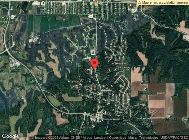
DEMOGRAPHICS near 105 W 1St Ave
1 Mile
3 Mile
5 Mile
2024 Total Population
2,829
24,236
79,541
2029 Population
2,796
23,617
77,482
Pop Growth 2024-2029
(1.17%)
(2.55%)
(2.59%)
Average Age
42
42
42
2024 Total Households
1,166
10,554
34,416
HH Growth 2024-2029
(1.11%)
(2.59%)
(2.62%)
Median Household Inc
$55,954
$67,785
$60,757
Avg Household Size
2.40
2.20
2.30
2024 Avg HH Vehicles
2.00
2.00
2.00
Median Home Value
$157,766
$173,193
$144,416
Median Year Built
1972
1972
1961
Nearby Places
- Restaurants
- Banks
- Shops
- Fitness
- Groceries
PUBLIC TRANSPORTATION
AIRPORT
Quad Cities International
DRIVE
WALK
Distance
Quad Cities International
9 min
3.4 mi
Freight Ports
Port Milwaukee
DRIVE
WALK
Distance
Port Milwaukee
237 min
208.0 mi
Nearby Properties
Address
Land Use
TOTAL SIZE
Lot Size
Zoning
Address
Land Use
TOTAL SIZE
Lot Size
Zoning
132,647 SF
13.76 AC
MOL
Address
Land Use
TOTAL SIZE
Lot Size
Zoning
194,267 SF
23.16 AC
MOL
Address
Land Use
TOTAL SIZE
Lot Size
Zoning
250,875 SF
11.92 AC
MOL
Address
Land Use
TOTAL SIZE
Lot Size
Zoning
19.69 AC
MOL
Address
Land Use
TOTAL SIZE
Lot Size
Zoning
244,440 SF
13.25 AC
MOL
Address
Land Use
TOTAL SIZE
Lot Size
Zoning
10.75 AC
MOL
Address
Land Use
TOTAL SIZE
Lot Size
Zoning
142,836 SF
14.60 AC
MOL
Address
Land Use
TOTAL SIZE
Lot Size
Zoning
203,904 SF
12.75 AC
MOL
Address
Land Use
TOTAL SIZE
Lot Size
Zoning
66.76 AC
MOL
Address
Land Use
TOTAL SIZE
Lot Size
Zoning
9.42 AC
I2
Address
Land Use
TOTAL SIZE
Lot Size
Zoning
53,897 SF
3.13 AC
MOL
Address
Land Use
TOTAL SIZE
Lot Size
Zoning
144,306 SF
16.90 AC
EM
Address
Land Use
TOTAL SIZE
Lot Size
Zoning
162,924 SF
17.18 AC
MOL
Address
Land Use
TOTAL SIZE
Lot Size
Zoning
55.60 AC
CV
Address
Land Use
TOTAL SIZE
Lot Size
Zoning
30,836 SF
4.91 AC
MOL
Address
Land Use
TOTAL SIZE
Lot Size
Zoning
46.02 AC
MOL
Address
Land Use
TOTAL SIZE
Lot Size
Zoning
126,605 SF
20.25 AC
MOL
Address
Land Use
TOTAL SIZE
Lot Size
Zoning
35,631 SF
4.63 AC
MOL
Address
Land Use
TOTAL SIZE
Lot Size
Zoning
63,972 SF
2.66 AC
MOL
Address
Land Use
TOTAL SIZE
Lot Size
Zoning
58,946 SF
2.65 AC
MOL
Address
Land Use
TOTAL SIZE
Lot Size
Zoning
3.07 AC
MOL
Address
Land Use
TOTAL SIZE
Lot Size
Zoning
49,673 SF
3.14 AC
MOL
Address
Land Use
TOTAL SIZE
Lot Size
Zoning
53,611 SF
2.53 AC
MOL
Address
Land Use
TOTAL SIZE
Lot Size
Zoning
62,124 SF
10.33 AC
I2
Address
Land Use
TOTAL SIZE
Lot Size
Zoning
1.91 AC
I2
Address
Land Use
TOTAL SIZE
Lot Size
Zoning
8.42 AC
MOL
Address
Land Use
TOTAL SIZE
Lot Size
Zoning
77,792 SF
6.04 AC
MOL
Address
Land Use
TOTAL SIZE
Lot Size
Zoning
10.17 AC
MOL
Address
Land Use
TOTAL SIZE
Lot Size
Zoning
38,966 SF
4.40 AC
MOL
Address
Land Use
TOTAL SIZE
Lot Size
Zoning
102.38 AC
AG2
The World's #1 Commercial Real Estate Marketplace
Connect with us
© 2025 CoStar Group
The information above has been obtained from sources believed reliable. While we do not doubt its accuracy we have not verified it and make no guarantee, warranty or representation about it. It is your responsibility to independently confirm its accuracy and completeness. Any projections, opinions, assumptions, or estimates used are for example only and do not represent the current or future performance of the property. The value of this transaction to you depends on tax and other factors which should be evaluated by your tax, financial, and legal advisors. You and your advisors should conduct a careful, independent investigation of the property to determine to your satisfaction the suitability of the property for your needs.