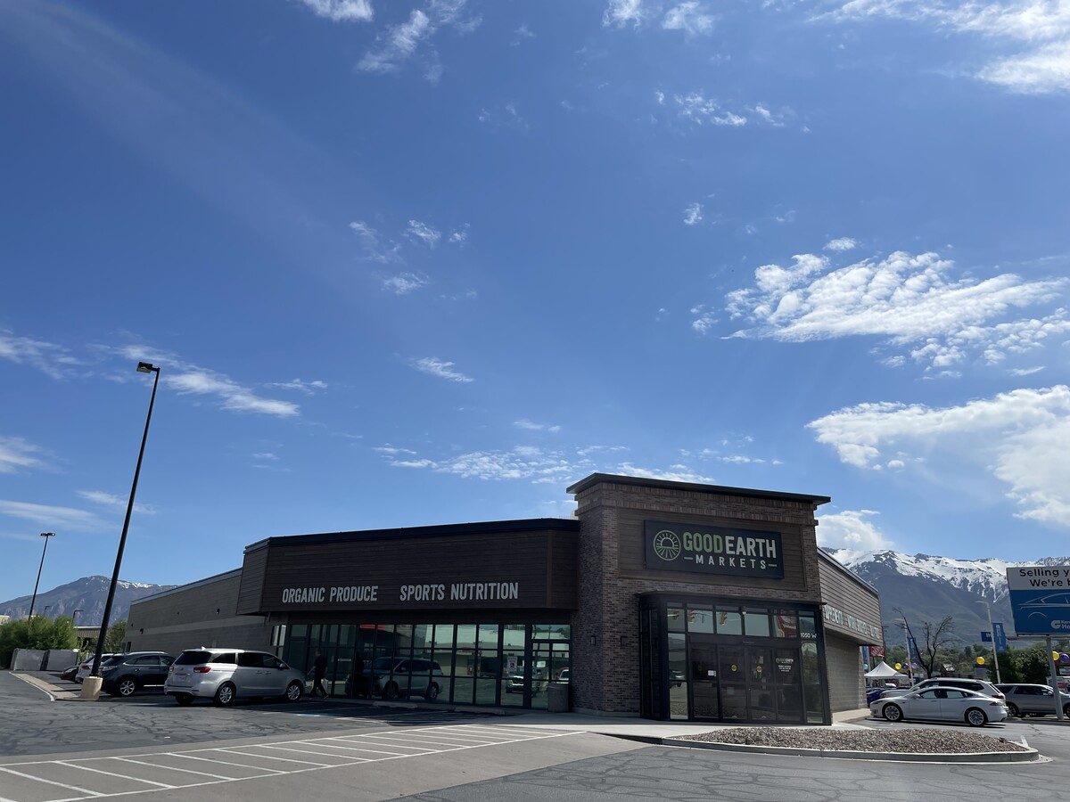
Property Record
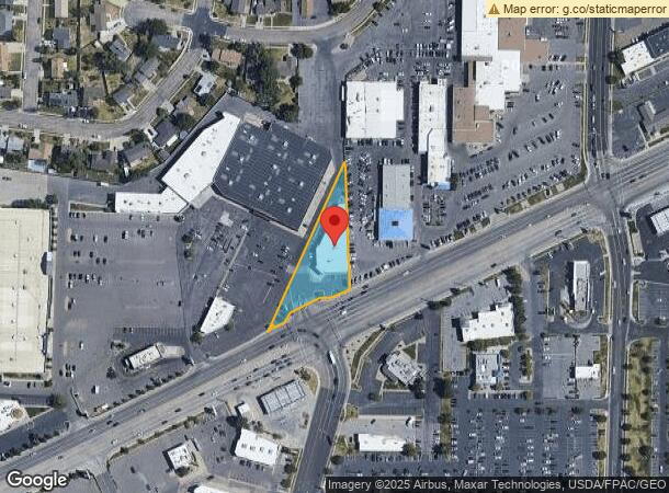
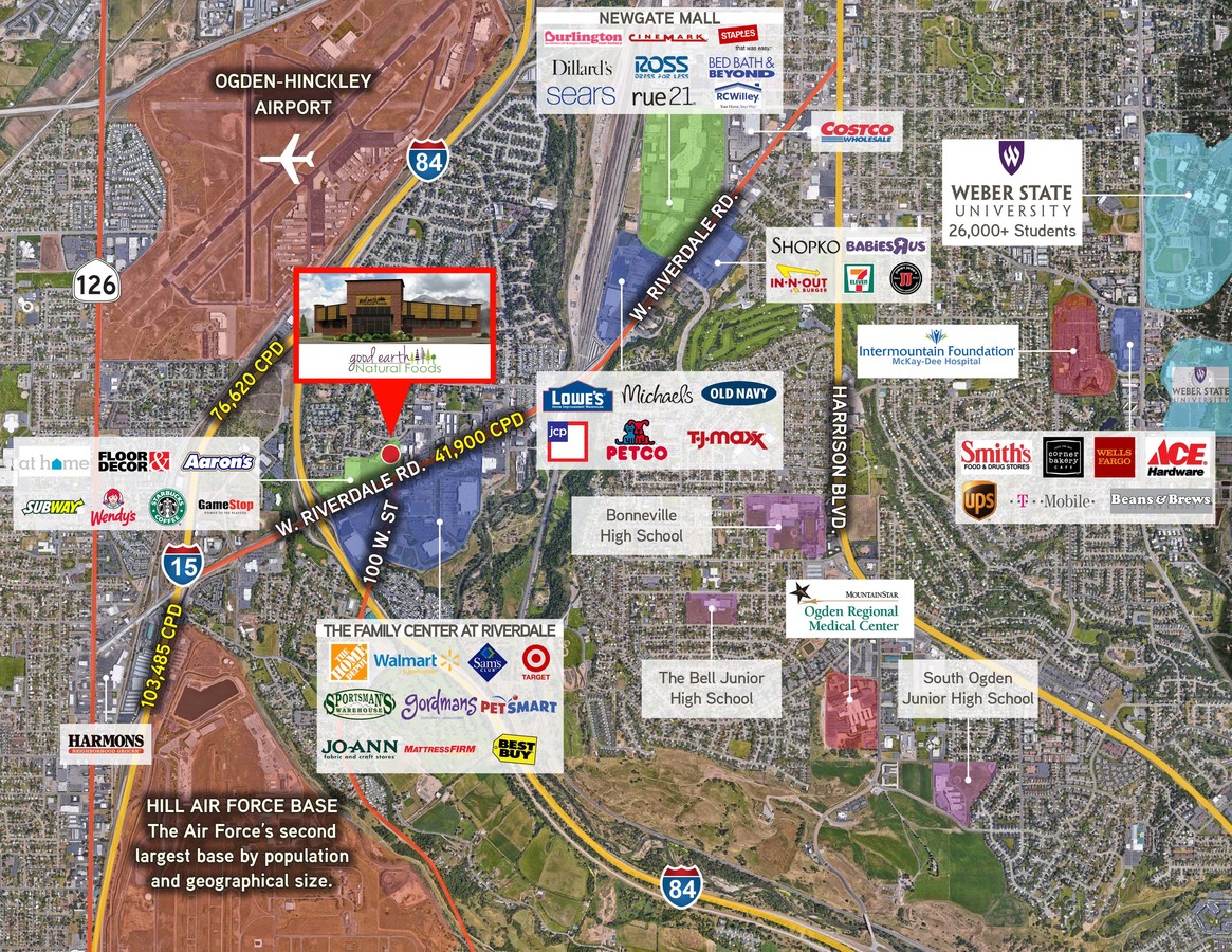
1050 W Riverdale Rd, Ogden, UT 84405

NEARBY LISTINGS FOR SALE OR LEASE
Property Detail
1050 W Riverdale Rd
06-016-0155
PART OF THE SOUTHWEST QUARTER OF SECTION 7, TOWNSHIP 5 NORTH, RANGE 1 WEST, SALT LAKE BASE & MERIDIAN, U S SURVEY, IN
Storebuilding
Weber
X
Utah
49057C0417F
0.88 AC
2024
Davis/Weber Counties
2024
Salt Lake City
210512
Ogden-Clearfield, UT
11,010 SF
DEMOGRAPHICS near 1050 W Riverdale Rd
1 Mile
3 Mile
5 Mile
2024 Total Population
10,094
80,530
204,113
2029 Population
10,897
86,358
218,896
Pop Growth 2024-2029
+ 7.96%
+ 7.24%
+ 7.24%
Average Age
36
36
35
2024 Total Households
3,737
28,033
69,832
HH Growth 2024-2029
+ 8.13%
+ 7.45%
+ 7.44%
Median Household Inc
$57,163
$67,312
$70,380
Avg Household Size
2.70
2.80
2.80
2024 Avg HH Vehicles
2.00
2.00
2.00
Median Home Value
$340,728
$321,870
$350,605
Median Year Built
1981
1976
1982
Nearby Places
- Restaurants
- Banks
- Shops
- Fitness
- Groceries
PUBLIC TRANSPORTATION
COMMUTER RAIL
Roy (FrontRunner North - Utah Transit Authority (UTA))
DRIVE
WALK
Distance
Roy (FrontRunner North - Utah Transit Authority (UTA))
8 min
3.0 mi
Ogden (FrontRunner North - Utah Transit Authority (UTA))
DRIVE
WALK
Distance
Ogden (FrontRunner North - Utah Transit Authority (UTA))
9 min
4.9 mi
AIRPORT
Salt Lake City International
DRIVE
WALK
Distance
Salt Lake City International
43 min
35.7 mi
Freight Ports
Port of Stockton
DRIVE
WALK
Distance
Port of Stockton
744 min
726.1 mi
SALE & LEASE HISTORY
LISTING DATE
SALE/LEASE

Nov 07, 2017
For Sale
May 19, 2023
For Sale
May 03, 2022
For Sale
Nearby Properties
Address
Land Use
TOTAL SIZE
Lot Size
Zoning
Address
Land Use
TOTAL SIZE
Lot Size
Zoning
790,525 SF
57.26 AC
Address
Land Use
TOTAL SIZE
Lot Size
Zoning
11,424 SF
16.26 AC
Address
Land Use
TOTAL SIZE
Lot Size
Zoning
200,509 SF
12.75 AC
Address
Land Use
TOTAL SIZE
Lot Size
Zoning
8,324 SF
8.97 AC
Address
Land Use
TOTAL SIZE
Lot Size
Zoning
83,038 SF
7.54 AC
Address
Land Use
TOTAL SIZE
Lot Size
Zoning
71,940 SF
11 AC
Address
Land Use
TOTAL SIZE
Lot Size
Zoning
98,660 SF
3.18 AC
Address
Land Use
TOTAL SIZE
Lot Size
Zoning
115,094 SF
13.88 AC
Address
Land Use
TOTAL SIZE
Lot Size
Zoning
225,497 SF
20.33 AC
Address
Land Use
TOTAL SIZE
Lot Size
Zoning
23,932 SF
5.53 AC
Address
Land Use
TOTAL SIZE
Lot Size
Zoning
73,942 SF
8.87 AC
Address
Land Use
TOTAL SIZE
Lot Size
Zoning
13,838 SF
4.12 AC
Address
Land Use
TOTAL SIZE
Lot Size
Zoning
7,726 SF
6.19 AC
Address
Land Use
TOTAL SIZE
Lot Size
Zoning
96,690 SF
1.39 AC
Address
Land Use
TOTAL SIZE
Lot Size
Zoning
255,576 SF
24.15 AC
Address
Land Use
TOTAL SIZE
Lot Size
Zoning
202,920 SF
10.16 AC
Address
Land Use
TOTAL SIZE
Lot Size
Zoning
67,248 SF
13.28 AC
Address
Land Use
TOTAL SIZE
Lot Size
Zoning
4,442 SF
7.19 AC
Address
Land Use
TOTAL SIZE
Lot Size
Zoning
112,255 SF
3.36 AC
Address
Land Use
TOTAL SIZE
Lot Size
Zoning
48,290 SF
7.95 AC
The World's #1 Commercial Real Estate Marketplace
Connect with us
© 2025 CoStar Group
The information above has been obtained from sources believed reliable. While we do not doubt its accuracy we have not verified it and make no guarantee, warranty or representation about it. It is your responsibility to independently confirm its accuracy and completeness. Any projections, opinions, assumptions, or estimates used are for example only and do not represent the current or future performance of the property. The value of this transaction to you depends on tax and other factors which should be evaluated by your tax, financial, and legal advisors. You and your advisors should conduct a careful, independent investigation of the property to determine to your satisfaction the suitability of the property for your needs.