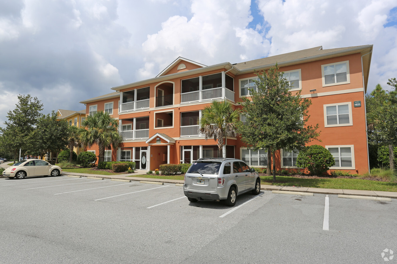
Property Record
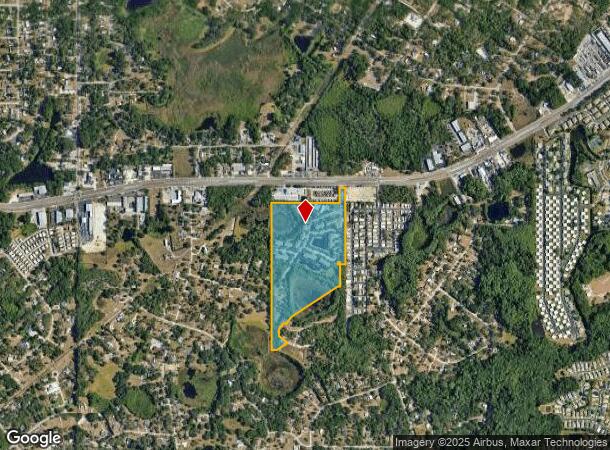
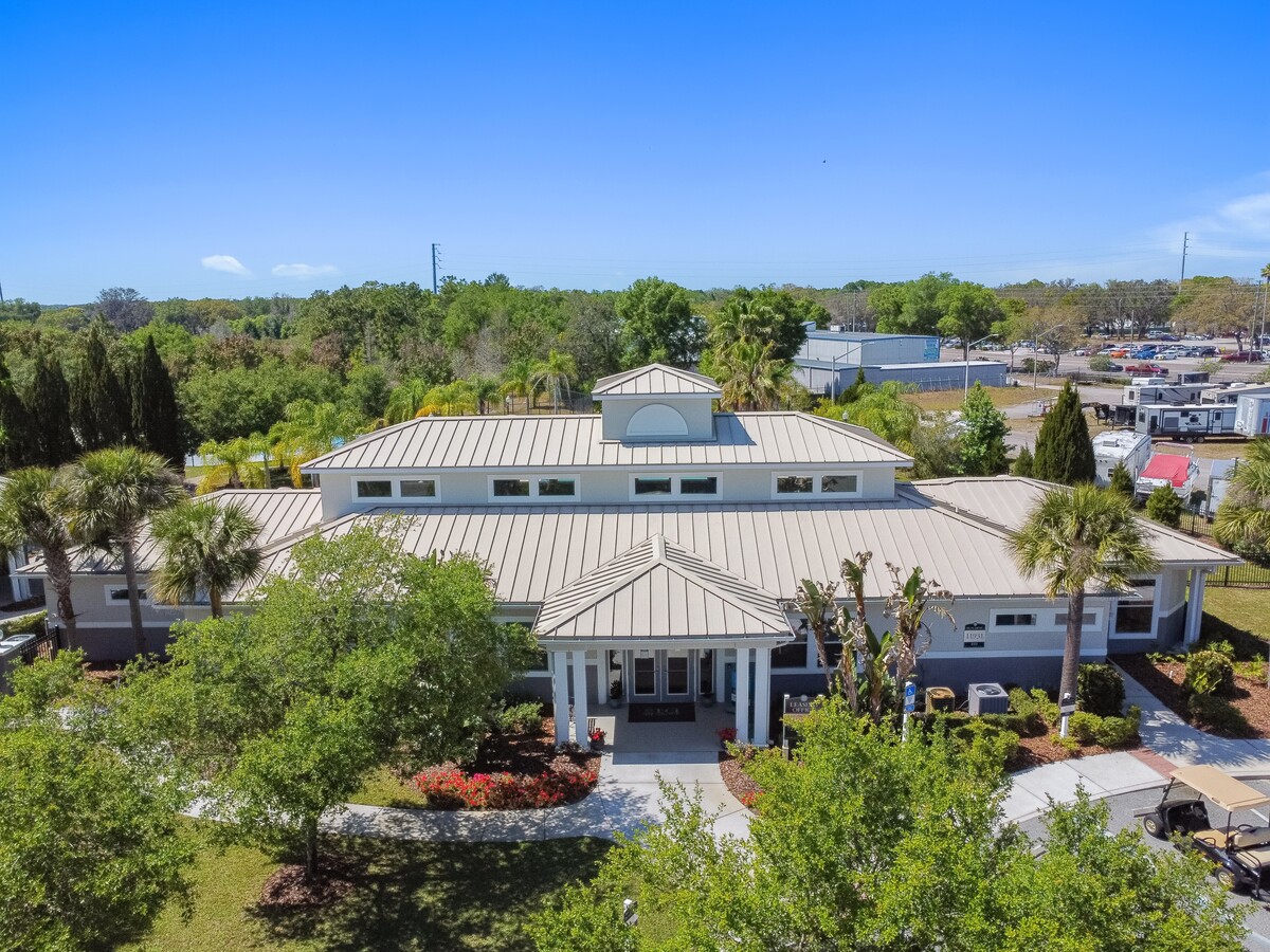
10505 Penelope Pl, New Port Richey, FL 34654
NEARBY LISTINGS FOR SALE OR LEASE
-
-
View all New Port Richey listings for sale on LoopNet.com
Property Detail
10505 Penelope Pl
Tampa-St. Petersburg-Clearwater, FL
Bear Creek
07-25-17-0000-00400-0070
COM AT NE COR OF SEC 7 TH ALG NORTH LINE OF SEC N89DEG5326 W 1633.51 FT TH S0908W 78.64 FT TO SOUTH R/W LINE OF SR 52 FOR POB TH S0908W 1070.12 FT TH N89DEG5052W 75.00 FT TH S0908W 304.17 FT TH N89DEG50 52W 34.20 FT TH S57DEG0305 W 759.65 FT TH S40DE
Multifamilydwelling
Pasco
X
Florida
12101C0184F
7
2024
34.18 AC
2024
Outer Pasco County
031301
Tampa/St Petersburg
233,384 SF
DEMOGRAPHICS near 10505 Penelope Pl
1 Mile
3 Mile
5 Mile
2024 Total Population
4,098
45,517
117,683
2029 Population
4,945
54,701
141,371
Pop Growth 2024-2029
+ 20.67%
+ 20.18%
+ 20.13%
Average Age
50
47
45
2024 Total Households
1,954
19,581
49,942
HH Growth 2024-2029
+ 20.68%
+ 20.07%
+ 20.11%
Median Household Inc
$42,799
$47,015
$48,031
Avg Household Size
2.10
2.30
2.30
2024 Avg HH Vehicles
2.00
2.00
2.00
Median Home Value
$142,384
$160,373
$165,905
Median Year Built
1985
1984
1982
Nearby Places
- Restaurants
- Banks
- Shops
- Fitness
- Groceries
PUBLIC TRANSPORTATION
AIRPORT
Tampa International
DRIVE
WALK
Distance
Tampa International
48 min
35.4 mi
St Pete-Clearwater International
DRIVE
WALK
Distance
St Pete-Clearwater International
65 min
38.2 mi
Freight Ports
Port of Tampa Bay
DRIVE
WALK
Distance
Port of Tampa Bay
61 min
39.0 mi
Nearby Properties
Address
Land Use
TOTAL SIZE
Lot Size
Zoning
Address
Land Use
TOTAL SIZE
Lot Size
Zoning
250,601 SF
38.64 AC
C2
Address
Land Use
TOTAL SIZE
Lot Size
Zoning
218,736 SF
39.17 AC
R1
Address
Land Use
TOTAL SIZE
Lot Size
Zoning
174,876 SF
42.27 AC
MF1
Address
Land Use
TOTAL SIZE
Lot Size
Zoning
124,316 SF
22.91 AC
MF1
Address
Land Use
TOTAL SIZE
Lot Size
Zoning
459,499 SF
100 AC
AR
Address
Land Use
TOTAL SIZE
Lot Size
Zoning
189,166 SF
19.08 AC
C2
Address
Land Use
TOTAL SIZE
Lot Size
Zoning
190,794 SF
10.88 AC
C2
Address
Land Use
TOTAL SIZE
Lot Size
Zoning
106,741 SF
27.67 AC
MF1
Address
Land Use
TOTAL SIZE
Lot Size
Zoning
75,205 SF
12.71 AC
PUD
Address
Land Use
TOTAL SIZE
Lot Size
Zoning
85,003 SF
25 AC
R4
Address
Land Use
TOTAL SIZE
Lot Size
Zoning
48,470 SF
4.19 AC
MPUD
Address
Land Use
TOTAL SIZE
Lot Size
Zoning
85,971 SF
16.58 AC
C2
Address
Land Use
TOTAL SIZE
Lot Size
Zoning
188,871 SF
8.44 AC
C1
Address
Land Use
TOTAL SIZE
Lot Size
Zoning
49,118 SF
7.72 AC
C2
Address
Land Use
TOTAL SIZE
Lot Size
Zoning
51,540 SF
3.07 AC
C2
Address
Land Use
TOTAL SIZE
Lot Size
Zoning
83,135 SF
4.49 AC
MF2
Address
Land Use
TOTAL SIZE
Lot Size
Zoning
64,707 SF
22.64 AC
ER
Address
Land Use
TOTAL SIZE
Lot Size
Zoning
45,594 SF
7.99 AC
ER
Address
Land Use
TOTAL SIZE
Lot Size
Zoning
44,147 SF
2.53 AC
C2
Address
Land Use
TOTAL SIZE
Lot Size
Zoning
13,749 SF
1.94 AC
MPUD
Address
Land Use
TOTAL SIZE
Lot Size
Zoning
50,466 SF
2.75 AC
C2
Address
Land Use
TOTAL SIZE
Lot Size
Zoning
48,597 SF
14.45 AC
R4
Address
Land Use
TOTAL SIZE
Lot Size
Zoning
19,076 SF
3.59 AC
C2
Address
Land Use
TOTAL SIZE
Lot Size
Zoning
15,047 SF
3.23 AC
PUD
Address
Land Use
TOTAL SIZE
Lot Size
Zoning
79.16 AC
MPUD
Address
Land Use
TOTAL SIZE
Lot Size
Zoning
31,500 SF
3.27 AC
C2
Address
Land Use
TOTAL SIZE
Lot Size
Zoning
25,195 SF
11.58 AC
AR
Address
Land Use
TOTAL SIZE
Lot Size
Zoning
50,526 SF
4.50 AC
MF2
Address
Land Use
TOTAL SIZE
Lot Size
Zoning
26,679 SF
3.35 AC
PUD
The World's #1 Commercial Real Estate Marketplace
Connect with us
© 2025 CoStar Group
The information above has been obtained from sources believed reliable. While we do not doubt its accuracy we have not verified it and make no guarantee, warranty or representation about it. It is your responsibility to independently confirm its accuracy and completeness. Any projections, opinions, assumptions, or estimates used are for example only and do not represent the current or future performance of the property. The value of this transaction to you depends on tax and other factors which should be evaluated by your tax, financial, and legal advisors. You and your advisors should conduct a careful, independent investigation of the property to determine to your satisfaction the suitability of the property for your needs.