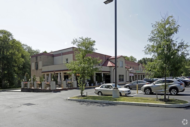
Property Record
1051 County Line Rd, Huntingdon Valley, PA 19006

NEARBY LISTINGS FOR SALE OR LEASE
Property Detail
1051 County Line Rd
Philadelphia-Camden-Wilmington, PA-NJ-DE-MD
Bucks
48-015-024
Pennsylvania
Residentialacreage
0.93 AC
X
Lower Bucks County
42091C0316G
Philadelphia
DEMOGRAPHICS near 1051 County Line Rd
1 Mile
3 Mile
5 Mile
2024 Total Population
6,513
71,598
230,598
2029 Population
6,578
71,468
229,676
Pop Growth 2024-2029
+ 1.00%
(0.18%)
(0.40%)
Average Age
44
44
43
2024 Total Households
2,281
27,304
87,386
HH Growth 2024-2029
+ 0.96%
(0.20%)
(0.41%)
Median Household Inc
$114,402
$87,825
$89,897
Avg Household Size
2.80
2.50
2.50
2024 Avg HH Vehicles
2.00
2.00
2.00
Median Home Value
$424,262
$370,603
$348,371
Median Year Built
1967
1966
1967
Nearby Places
Map Layers
Map Styles
 Street
 Aerial
- Restaurants
- Banks
- Shops
- Fitness
- Groceries
PUBLIC TRANSPORTATION
COMMUTER RAIL
Bethayres (R3 - Southeastern Pennsylvania Transportation Authority Regional Rail (SEPTA Regional Rail))
DRIVE
WALK
Distance
Bethayres (R3 - Southeastern Pennsylvania Transportation Authority Regional Rail (SEPTA Regional Rail))
4 min
1.9 mi
Philmont (R3 - Southeastern Pennsylvania Transportation Authority Regional Rail (SEPTA Regional Rail))
DRIVE
WALK
Distance
Philmont (R3 - Southeastern Pennsylvania Transportation Authority Regional Rail (SEPTA Regional Rail))
5 min
2.0 mi
AIRPORT
Trenton Mercer
DRIVE
WALK
Distance
Trenton Mercer
35 min
20.4 mi
Philadelphia International
DRIVE
WALK
Distance
Philadelphia International
44 min
26.6 mi
Freight Ports
Port of Philadelphia
DRIVE
WALK
Distance
Port of Philadelphia
21 min
12.3 mi
SALE & LEASE HISTORY
LISTING DATE
SALE/LEASE

Dec 05, 2017
For Lease
Nearby Properties
Address
Land Use
TOTAL SIZE
Lot Size
Zoning
Address
Land Use
TOTAL SIZE
Lot Size
Zoning
70,995 SF
5.34 AC
RSD1
Address
Land Use
TOTAL SIZE
Lot Size
Zoning
17,563 SF
1.60 AC
C-O-2.5
Address
Land Use
TOTAL SIZE
Lot Size
Zoning
627,076 SF
36.89 AC
RSA1
Address
Land Use
TOTAL SIZE
Lot Size
Zoning
385,557 SF
5.10 AC
V
Address
Land Use
TOTAL SIZE
Lot Size
Zoning
406,343 SF
6.59 AC
V
Address
Land Use
TOTAL SIZE
Lot Size
Zoning
636,126 SF
43.18 AC
AP
Address
Land Use
TOTAL SIZE
Lot Size
Zoning
184,500 SF
5.40 AC
RSD3
Address
Land Use
TOTAL SIZE
Lot Size
Zoning
166,782 SF
8.45 AC
RSD3
Address
Land Use
TOTAL SIZE
Lot Size
Zoning
498,072 SF
5.39 AC
TC1
Address
Land Use
TOTAL SIZE
Lot Size
Zoning
179,718 SF
6.61 AC
RM2
Address
Land Use
TOTAL SIZE
Lot Size
Zoning
223,170 SF
6.41 AC
RM2
Address
Land Use
TOTAL SIZE
Lot Size
Zoning
282,292 SF
74.30 AC
IN
Address
Land Use
TOTAL SIZE
Lot Size
Zoning
251,655 SF
48.95 AC
SC
Address
Land Use
TOTAL SIZE
Lot Size
Zoning
136.16 AC
I2
Address
Land Use
TOTAL SIZE
Lot Size
Zoning
27.59 AC
SPPOA
Address
Land Use
TOTAL SIZE
Lot Size
Zoning
12,880 SF
1.15 AC
RSD1
Address
Land Use
TOTAL SIZE
Lot Size
Zoning
225,400 SF
7.40 AC
RM2
Address
Land Use
TOTAL SIZE
Lot Size
Zoning
259,505 SF
42.19 AC
V
Address
Land Use
TOTAL SIZE
Lot Size
Zoning
157,400 SF
7.61 AC
RM2
Address
Land Use
TOTAL SIZE
Lot Size
Zoning
189,541 SF
13.58 AC
RM2
Address
Land Use
TOTAL SIZE
Lot Size
Zoning
97,022 SF
9.39 AC
CA2
Address
Land Use
TOTAL SIZE
Lot Size
Zoning
251,935 SF
13.03 AC
TC1
Address
Land Use
TOTAL SIZE
Lot Size
Zoning
257,010 SF
34.12 AC
INST
Address
Land Use
TOTAL SIZE
Lot Size
Zoning
217,560 SF
13.36 AC
I1
Address
Land Use
TOTAL SIZE
Lot Size
Zoning
115,000 SF
12.40 AC
I2
Address
Land Use
TOTAL SIZE
Lot Size
Zoning
112,471 SF
3.31 AC
RSD1
Address
Land Use
TOTAL SIZE
Lot Size
Zoning
66,391 SF
8.25 AC
I2
Address
Land Use
TOTAL SIZE
Lot Size
Zoning
273,531 SF
11.11 AC
INST
Address
Land Use
TOTAL SIZE
Lot Size
Zoning
123,538 SF
12.32 AC
CC
Address
Land Use
TOTAL SIZE
Lot Size
Zoning
66,206 SF
4.64 AC
RSD1
The World's #1 Commercial Real Estate Marketplace
Connect with us
© 2026 CoStar Group
The information above has been obtained from sources believed reliable. While we do not doubt its accuracy we have not verified it and make no guarantee, warranty or representation about it. It is your responsibility to independently confirm its accuracy and completeness. Any projections, opinions, assumptions, or estimates used are for example only and do not represent the current or future performance of the property. The value of this transaction to you depends on tax and other factors which should be evaluated by your tax, financial, and legal advisors. You and your advisors should conduct a careful, independent investigation of the property to determine to your satisfaction the suitability of the property for your needs.