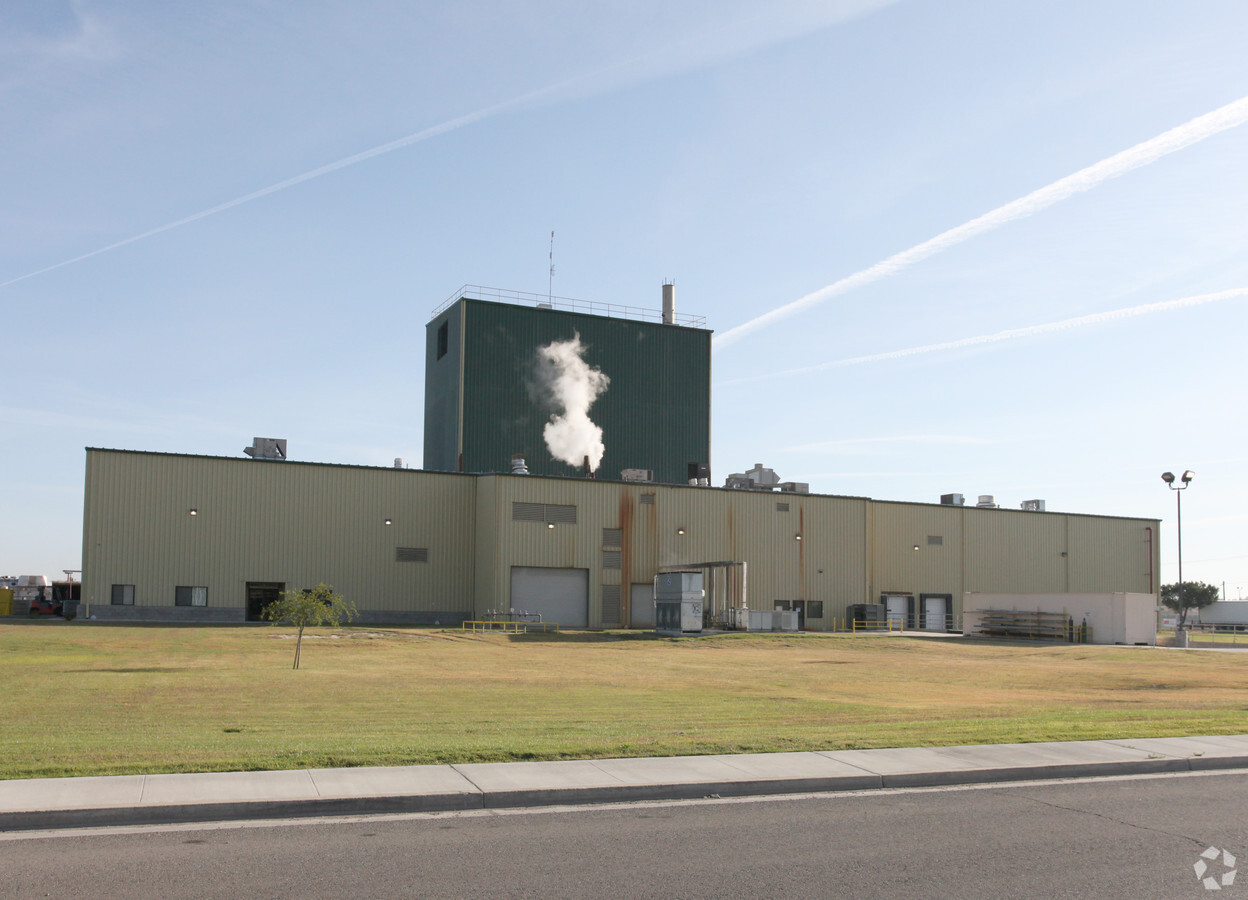
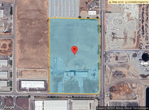
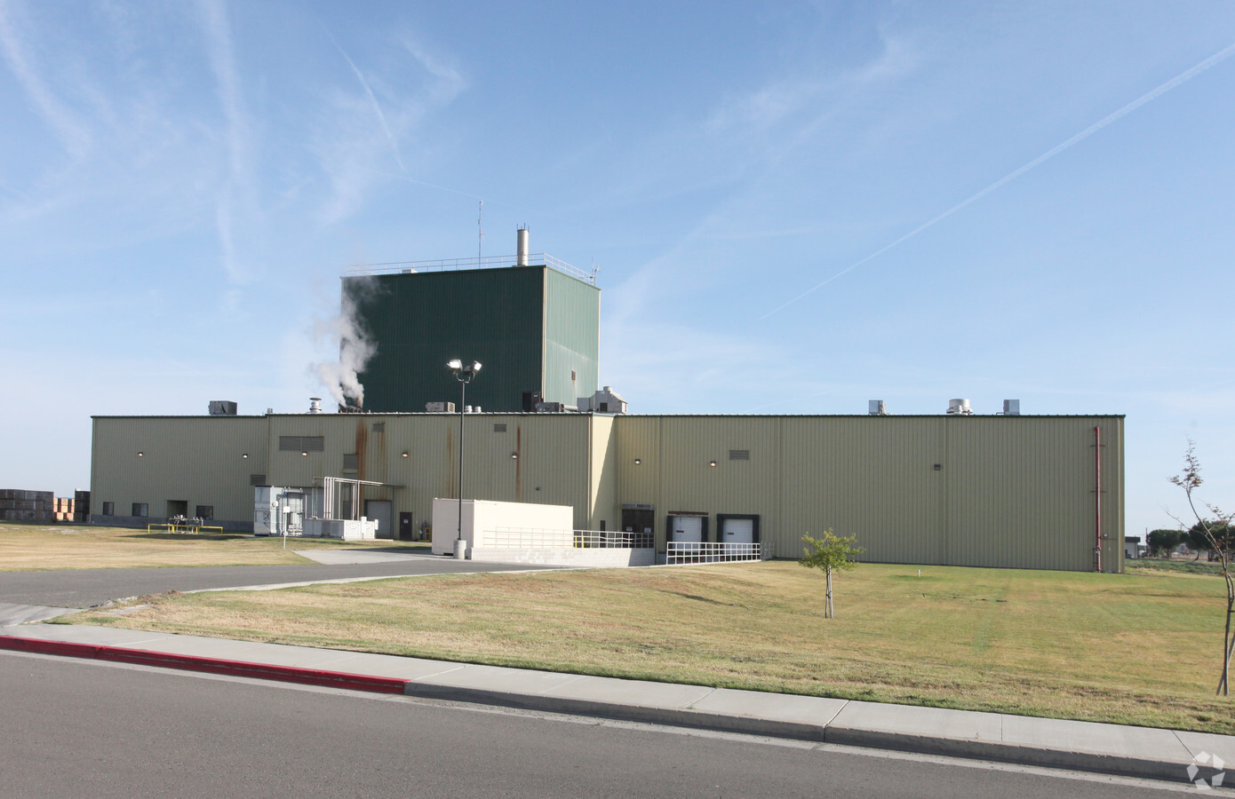
Property Record
1055 S 19Th Ave, Lemoore, CA 93245
NEARBY LISTINGS FOR SALE OR LEASE
Property Detail
1055 S 19Th Ave
Hanford-Corcoran, CA
Lemoore Indust Park #1
024-051-021-000
1055 S 19TH AVE LEM
Foodprocessing
Kings
X
California
06031C0170D
8
2023
14.07 AC
2023
Lemoore
0004022030
Fresno
31,104 SF
DEMOGRAPHICS near 1055 S 19Th Ave
1 Mile
3 Mile
5 Mile
2024 Total Population
4,811
27,442
37,069
2029 Population
4,889
27,904
37,909
Pop Growth 2024-2029
+ 1.62%
+ 1.68%
+ 2.27%
Average Age
35
34
32
2024 Total Households
1,540
9,293
11,946
HH Growth 2024-2029
+ 1.69%
+ 1.71%
+ 2.24%
Median Household Inc
$80,048
$68,605
$66,761
Avg Household Size
3.10
2.90
3.00
2024 Avg HH Vehicles
3.00
2.00
2.00
Median Home Value
$332,273
$292,950
$294,237
Median Year Built
1994
1987
1990
Nearby Places
- Restaurants
- Banks
- Shops
- Fitness
- Groceries
PUBLIC TRANSPORTATION
COMMUTER RAIL
Hanford (San Joaquins - Amtrak)
DRIVE
WALK
Distance
Hanford (San Joaquins - Amtrak)
13 min
9.6 mi
Freight Ports
Port of Stockton
DRIVE
WALK
Distance
Port of Stockton
185 min
166.4 mi
Nearby Properties
Address
Land Use
TOTAL SIZE
Lot Size
Zoning
Address
Land Use
TOTAL SIZE
Lot Size
Zoning
838,078 SF
60.81 AC
ML
Address
Land Use
TOTAL SIZE
Lot Size
Zoning
4.25 AC
ML
Address
Land Use
TOTAL SIZE
Lot Size
Zoning
2,034 SF
134.56 AC
AG20
Address
Land Use
TOTAL SIZE
Lot Size
Zoning
184,792 SF
11.05 AC
RMD
Address
Land Use
TOTAL SIZE
Lot Size
Zoning
10.45 AC
RHD
Address
Land Use
TOTAL SIZE
Lot Size
Zoning
24.96 AC
ML
Address
Land Use
TOTAL SIZE
Lot Size
Zoning
110,190 SF
12.01 AC
RMD
Address
Land Use
TOTAL SIZE
Lot Size
Zoning
3.83 AC
NC
Address
Land Use
TOTAL SIZE
Lot Size
Zoning
2.67 AC
CF
Address
Land Use
TOTAL SIZE
Lot Size
Zoning
194.60 AC
AG20
Address
Land Use
TOTAL SIZE
Lot Size
Zoning
4.70 AC
RHD
Address
Land Use
TOTAL SIZE
Lot Size
Zoning
7.84 AC
RMD
Address
Land Use
TOTAL SIZE
Lot Size
Zoning
Address
Land Use
TOTAL SIZE
Lot Size
Zoning
3.13 AC
RM3
Address
Land Use
TOTAL SIZE
Lot Size
Zoning
139,680 SF
5.95 AC
RMD
Address
Land Use
TOTAL SIZE
Lot Size
Zoning
5.32 AC
RMD
Address
Land Use
TOTAL SIZE
Lot Size
Zoning
0.44 AC
DMX-1
Address
Land Use
TOTAL SIZE
Lot Size
Zoning
7.61 AC
NC
Address
Land Use
TOTAL SIZE
Lot Size
Zoning
19,535 SF
2.42 AC
NC
Address
Land Use
TOTAL SIZE
Lot Size
Zoning
8.82 AC
NC
Address
Land Use
TOTAL SIZE
Lot Size
Zoning
2.20 AC
CH
Address
Land Use
TOTAL SIZE
Lot Size
Zoning
5.43 AC
RMD
Address
Land Use
TOTAL SIZE
Lot Size
Zoning
4,280 SF
1.49 AC
RC
Address
Land Use
TOTAL SIZE
Lot Size
Zoning
150,310 SF
12.44 AC
ML
Address
Land Use
TOTAL SIZE
Lot Size
Zoning
17,161 SF
2.01 AC
NC
Address
Land Use
TOTAL SIZE
Lot Size
Zoning
3,424 SF
1.08 AC
RC
Address
Land Use
TOTAL SIZE
Lot Size
Zoning
5,349 SF
1.94 AC
RC
Address
Land Use
TOTAL SIZE
Lot Size
Zoning
1,500 SF
3 AC
ML
Address
Land Use
TOTAL SIZE
Lot Size
Zoning
54.98 AC
ML
The World's #1 Commercial Real Estate Marketplace
Connect with us
© 2025 CoStar Group
The information above has been obtained from sources believed reliable. While we do not doubt its accuracy we have not verified it and make no guarantee, warranty or representation about it. It is your responsibility to independently confirm its accuracy and completeness. Any projections, opinions, assumptions, or estimates used are for example only and do not represent the current or future performance of the property. The value of this transaction to you depends on tax and other factors which should be evaluated by your tax, financial, and legal advisors. You and your advisors should conduct a careful, independent investigation of the property to determine to your satisfaction the suitability of the property for your needs.