Property Record
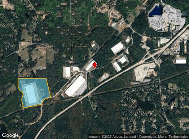
1057 Coweta Industrial Pkwy, Newnan, GA 30265
NEARBY LISTINGS FOR SALE OR LEASE
-
-
View all Newnan listings for lease on LoopNet.com
Property Detail
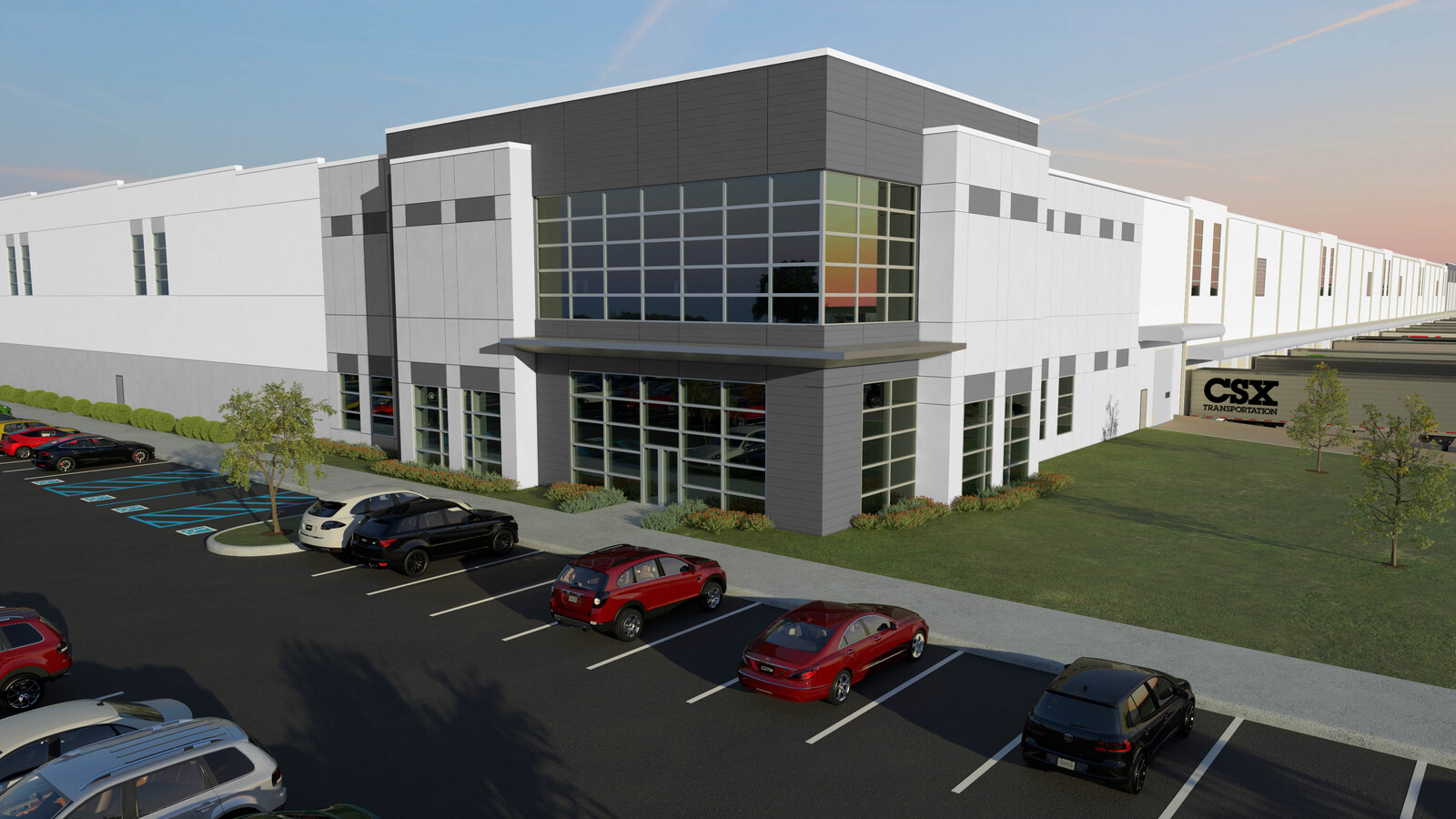
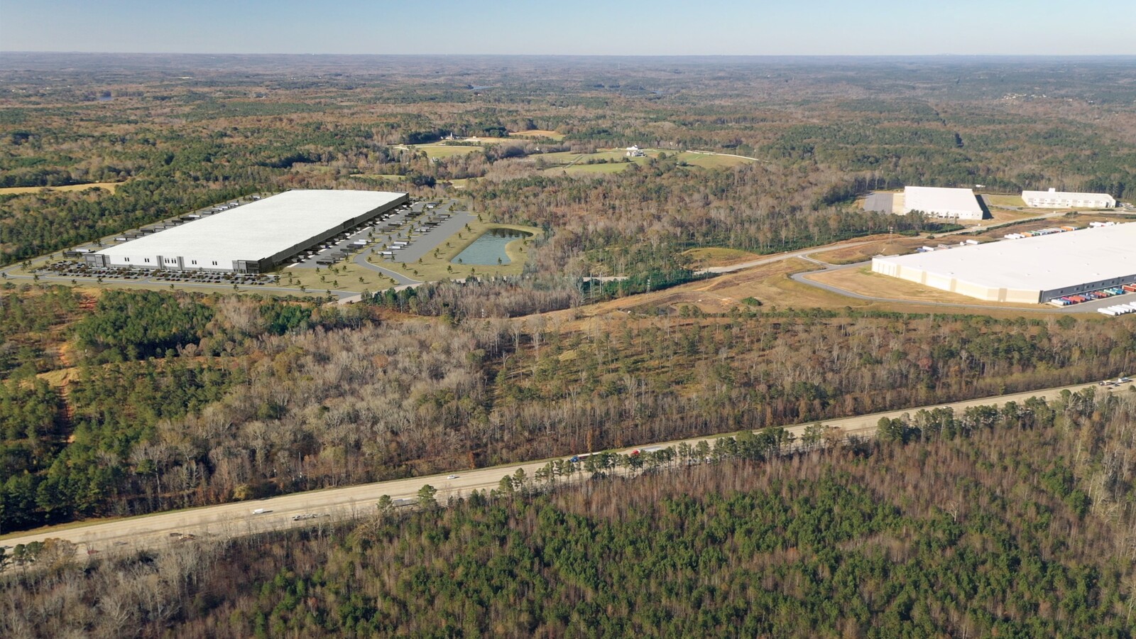
1057 Coweta Industrial Pkwy
096-5143-011
118.5605 AC LOT 1 PH III COWETA IND PARK
Warehouse
Coweta
X
Georgia
13077C0165D
1
2024
118.56 AC
2023
Fayette/Coweta County
170403
Atlanta
1,001,000 SF
Atlanta-Sandy Springs-Roswell, GA
DEMOGRAPHICS near 1057 Coweta Industrial Pkwy
1 Mile
3 Mile
5 Mile
2024 Total Population
223
13,816
66,591
2029 Population
242
15,199
73,912
Pop Growth 2024-2029
+ 8.52%
+ 10.01%
+ 10.99%
Average Age
40
42
40
2024 Total Households
94
5,388
25,107
HH Growth 2024-2029
+ 8.51%
+ 10.04%
+ 11.06%
Median Household Inc
$67,500
$91,780
$92,365
Avg Household Size
2.30
2.50
2.60
2024 Avg HH Vehicles
2.00
2.00
2.00
Median Home Value
$284,615
$307,593
$288,223
Median Year Built
1997
1996
2000
Nearby Places
- Restaurants
- Banks
- Shops
- Fitness
- Groceries
PUBLIC TRANSPORTATION
AIRPORT
Hartsfield - Jackson Atlanta International
DRIVE
WALK
Distance
Hartsfield - Jackson Atlanta International
36 min
25.8 mi
Freight Ports
Georgia Ports - Savannah
DRIVE
WALK
Distance
Georgia Ports - Savannah
298 min
252.4 mi
SALE & LEASE HISTORY
LISTING DATE
SALE/LEASE

Jan 11, 2021
For Lease
Nearby Properties
Address
Land Use
TOTAL SIZE
Lot Size
Zoning
Address
Land Use
TOTAL SIZE
Lot Size
Zoning
1,206,927 SF
109.06 AC
R1
Address
Land Use
TOTAL SIZE
Lot Size
Zoning
1,206,927 SF
109.06 AC
R1
Address
Land Use
TOTAL SIZE
Lot Size
Zoning
1,079,000 SF
73.44 AC
M
Address
Land Use
TOTAL SIZE
Lot Size
Zoning
457,922 SF
45.16 AC
R1
Address
Land Use
TOTAL SIZE
Lot Size
Zoning
766,418 SF
215.23 AC
M
Address
Land Use
TOTAL SIZE
Lot Size
Zoning
102,007 SF
18.92 AC
002
Address
Land Use
TOTAL SIZE
Lot Size
Zoning
215,344 SF
28.12 AC
R1
Address
Land Use
TOTAL SIZE
Lot Size
Zoning
224,314 SF
51.61 AC
R1
Address
Land Use
TOTAL SIZE
Lot Size
Zoning
299,520 SF
32.45 AC
R1
Address
Land Use
TOTAL SIZE
Lot Size
Zoning
108,138 SF
6.36 AC
002
Address
Land Use
TOTAL SIZE
Lot Size
Zoning
76,445 SF
25.34 AC
R1
Address
Land Use
TOTAL SIZE
Lot Size
Zoning
134,417 SF
13.01 AC
R1
Address
Land Use
TOTAL SIZE
Lot Size
Zoning
70,162 SF
12.32 AC
001
Address
Land Use
TOTAL SIZE
Lot Size
Zoning
121,290 SF
11.74 AC
R1
Address
Land Use
TOTAL SIZE
Lot Size
Zoning
186,249 SF
17.99 AC
R1
Address
Land Use
TOTAL SIZE
Lot Size
Zoning
48,000 SF
4.65 AC
M
Address
Land Use
TOTAL SIZE
Lot Size
Zoning
877,500 SF
73.44 AC
M
Address
Land Use
TOTAL SIZE
Lot Size
Zoning
63,876 SF
9.58 AC
ND
Address
Land Use
TOTAL SIZE
Lot Size
Zoning
112,650 SF
5.70 AC
002
Address
Land Use
TOTAL SIZE
Lot Size
Zoning
53,968 SF
3.33 AC
M
Address
Land Use
TOTAL SIZE
Lot Size
Zoning
186,695 SF
29.47 AC
R1
Address
Land Use
TOTAL SIZE
Lot Size
Zoning
117,635 SF
20 AC
001
Address
Land Use
TOTAL SIZE
Lot Size
Zoning
110,964 SF
26.46 AC
R1
Address
Land Use
TOTAL SIZE
Lot Size
Zoning
224,600 SF
13.14 AC
M
Address
Land Use
TOTAL SIZE
Lot Size
Zoning
152.89 AC
R1
Address
Land Use
TOTAL SIZE
Lot Size
Zoning
234,611 SF
17.85 AC
002
Address
Land Use
TOTAL SIZE
Lot Size
Zoning
25,372 SF
2.27 AC
001
Address
Land Use
TOTAL SIZE
Lot Size
Zoning
90,474 SF
12.56 AC
C
Address
Land Use
TOTAL SIZE
Lot Size
Zoning
215,323 SF
29.24 AC
003
The World's #1 Commercial Real Estate Marketplace
Connect with us
© 2025 CoStar Group
The information above has been obtained from sources believed reliable. While we do not doubt its accuracy we have not verified it and make no guarantee, warranty or representation about it. It is your responsibility to independently confirm its accuracy and completeness. Any projections, opinions, assumptions, or estimates used are for example only and do not represent the current or future performance of the property. The value of this transaction to you depends on tax and other factors which should be evaluated by your tax, financial, and legal advisors. You and your advisors should conduct a careful, independent investigation of the property to determine to your satisfaction the suitability of the property for your needs.