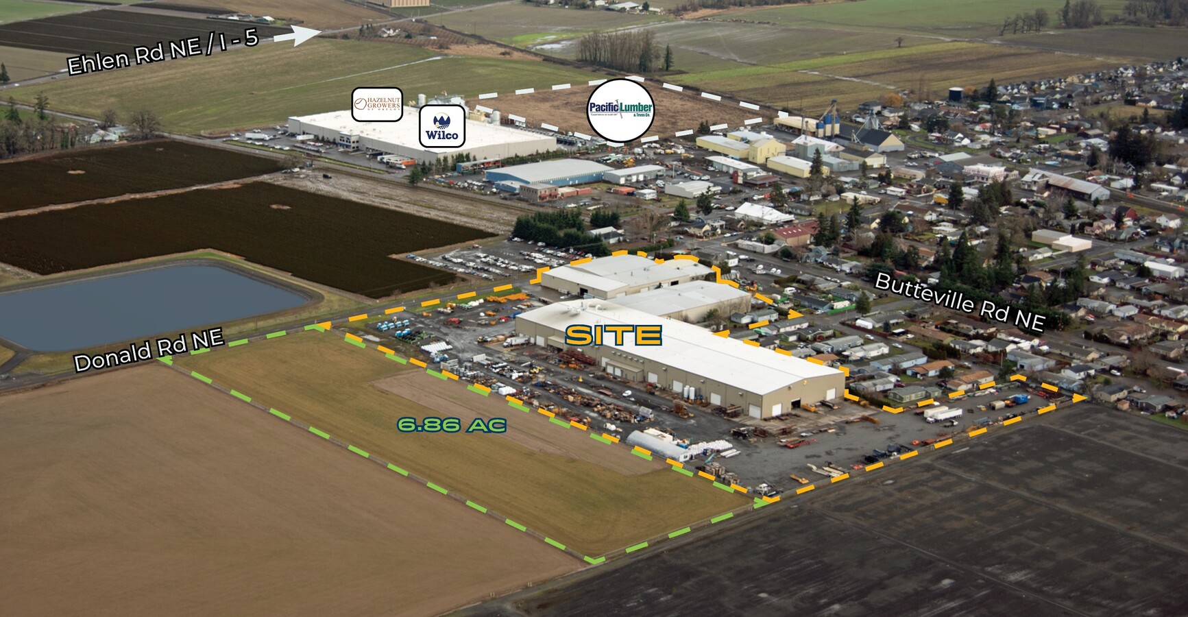
Property Record
10590 Donald Rd Ne, Donald, OR 97020

NEARBY LISTINGS FOR SALE OR LEASE
-
-
View all Donald listings for sale on LoopNet.com
Property Detail
10590 Donald Rd Ne
Portland
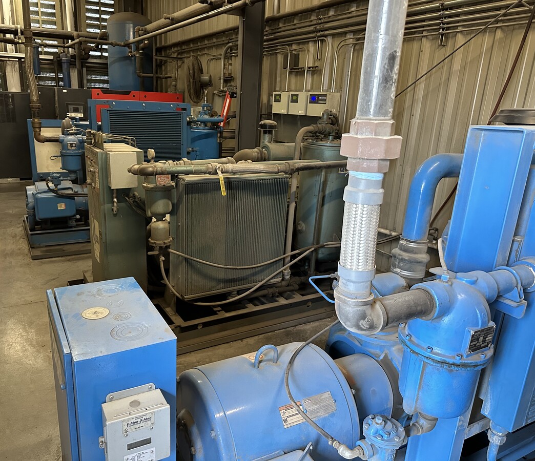
Improvement Only - Machinery & Equipment
Salem, OR
PP 2020-009 LOT 2 ACRES 7.16
344049
Marion
Heavyindustrial
Oregon
2023
2
2024
Marion County
010201
DEMOGRAPHICS near 10590 Donald Rd Ne
1 Mile
3 Mile
5 Mile
2024 Total Population
1,067
3,600
17,030
2029 Population
1,063
3,590
17,117
Pop Growth 2024-2029
(0.37%)
(0.28%)
+ 0.51%
Average Age
42
43
43
2024 Total Households
376
1,286
6,227
HH Growth 2024-2029
(0.27%)
(0.31%)
+ 0.50%
Median Household Inc
$70,454
$73,616
$66,579
Avg Household Size
2.80
2.80
2.70
2024 Avg HH Vehicles
3.00
3.00
2.00
Median Home Value
$318,182
$424,880
$397,726
Median Year Built
1988
1980
1976
Nearby Places
- Restaurants
- Banks
- Shops
- Fitness
- Groceries
PUBLIC TRANSPORTATION
COMMUTER RAIL
Wilsonville (Westside Express Service - Tri-County Metropolitan Transportation District of Oregon Rail (TriMet Rail))
DRIVE
WALK
Distance
Wilsonville (Westside Express Service - Tri-County Metropolitan Transportation District of Oregon Rail (TriMet Rail))
14 min
8.8 mi
AIRPORT
Portland International
DRIVE
WALK
Distance
Portland International
51 min
36.4 mi
Freight Ports
Port of Portland
DRIVE
WALK
Distance
Port of Portland
38 min
27.6 mi
SALE & LEASE HISTORY
LISTING DATE
SALE/LEASE

Mar 18, 2024
For Sale
Jan 31, 2024
For Lease
Nearby Properties
Address
Land Use
TOTAL SIZE
Lot Size
Zoning
Address
Land Use
TOTAL SIZE
Lot Size
Zoning
Address
Land Use
TOTAL SIZE
Lot Size
Zoning
239,072 SF
12.35 AC
EI
Address
Land Use
TOTAL SIZE
Lot Size
Zoning
20.16 AC
EFU; EI; I
Address
Land Use
TOTAL SIZE
Lot Size
Zoning
Address
Land Use
TOTAL SIZE
Lot Size
Zoning
24,734 SF
10.58 AC
ID
Address
Land Use
TOTAL SIZE
Lot Size
Zoning
24,905 SF
19.98 AC
ID
Address
Land Use
TOTAL SIZE
Lot Size
Zoning
9.53 AC
EI
Address
Land Use
TOTAL SIZE
Lot Size
Zoning
42,400 SF
9.71 AC
ID
Address
Land Use
TOTAL SIZE
Lot Size
Zoning
Address
Land Use
TOTAL SIZE
Lot Size
Zoning
7.24 AC
I
Address
Land Use
TOTAL SIZE
Lot Size
Zoning
41,050 SF
23.98 AC
EFU
Address
Land Use
TOTAL SIZE
Lot Size
Zoning
Address
Land Use
TOTAL SIZE
Lot Size
Zoning
22,225 SF
19.49 AC
EFU
Address
Land Use
TOTAL SIZE
Lot Size
Zoning
8,767 SF
10.74 AC
VLDR-2.5
Address
Land Use
TOTAL SIZE
Lot Size
Zoning
Address
Land Use
TOTAL SIZE
Lot Size
Zoning
47,120 SF
3 AC
I
Address
Land Use
TOTAL SIZE
Lot Size
Zoning
Address
Land Use
TOTAL SIZE
Lot Size
Zoning
37,500 SF
1.60 AC
ID
Address
Land Use
TOTAL SIZE
Lot Size
Zoning
15,500 SF
1.96 AC
ID
Address
Land Use
TOTAL SIZE
Lot Size
Zoning
15,400 SF
2.10 AC
ID
Address
Land Use
TOTAL SIZE
Lot Size
Zoning
5.92 AC
I
Address
Land Use
TOTAL SIZE
Lot Size
Zoning
2,473 SF
5.82 AC
ID
Address
Land Use
TOTAL SIZE
Lot Size
Zoning
Address
Land Use
TOTAL SIZE
Lot Size
Zoning
29,425 SF
1.66 AC
ID
Address
Land Use
TOTAL SIZE
Lot Size
Zoning
15,025 SF
0.99 AC
ID
Address
Land Use
TOTAL SIZE
Lot Size
Zoning
24,848 SF
2.17 AC
I
Address
Land Use
TOTAL SIZE
Lot Size
Zoning
13,899 SF
30.06 AC
EFU
Address
Land Use
TOTAL SIZE
Lot Size
Zoning
24,696 SF
156.97 AC
EFU
Address
Land Use
TOTAL SIZE
Lot Size
Zoning
8,214 SF
28.58 AC
EFU
The World's #1 Commercial Real Estate Marketplace
Connect with us
© 2025 CoStar Group
The information above has been obtained from sources believed reliable. While we do not doubt its accuracy we have not verified it and make no guarantee, warranty or representation about it. It is your responsibility to independently confirm its accuracy and completeness. Any projections, opinions, assumptions, or estimates used are for example only and do not represent the current or future performance of the property. The value of this transaction to you depends on tax and other factors which should be evaluated by your tax, financial, and legal advisors. You and your advisors should conduct a careful, independent investigation of the property to determine to your satisfaction the suitability of the property for your needs.